* indicates 24/7 operation
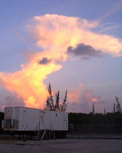
| Fixed PISA #1 (FP1) :: Atmospheric Radiation Measurement (ARM) Central Facility near Lamont, KS |
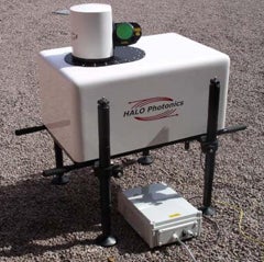
ARM Raman Lidar*
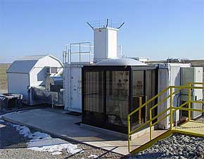 The Raman Lidar (RL) is an active, ground-based laser remote sensing instrument that measures vertical profiles of water-vapor mixing ratio and several cloud- and aerosol-related quantities. Lidar (light detection and ranging) is the optical analog of radar, using pulses of laser radiation to probe the atmosphere. This system is fully computer automated and will run unattended for many days following a brief (~5-minute) startup period.
>> Read more about the Raman Lidar
ARM Atmospheric Emitted Radiance Interferometer (AERI)*
 The AERI is a ground-based instrument that measures the downwelling infrared radiance from the Earth’s atmosphere. These upward-looking surface observations can be used to obtain vertical profiles of tropospheric temperature and water vapor, as well as measurements of trace gases (e.g., ozone, carbon monoxide, and methane) and downwelling infrared spectral signatures of clouds and aerosols.
>> Read more about AERI
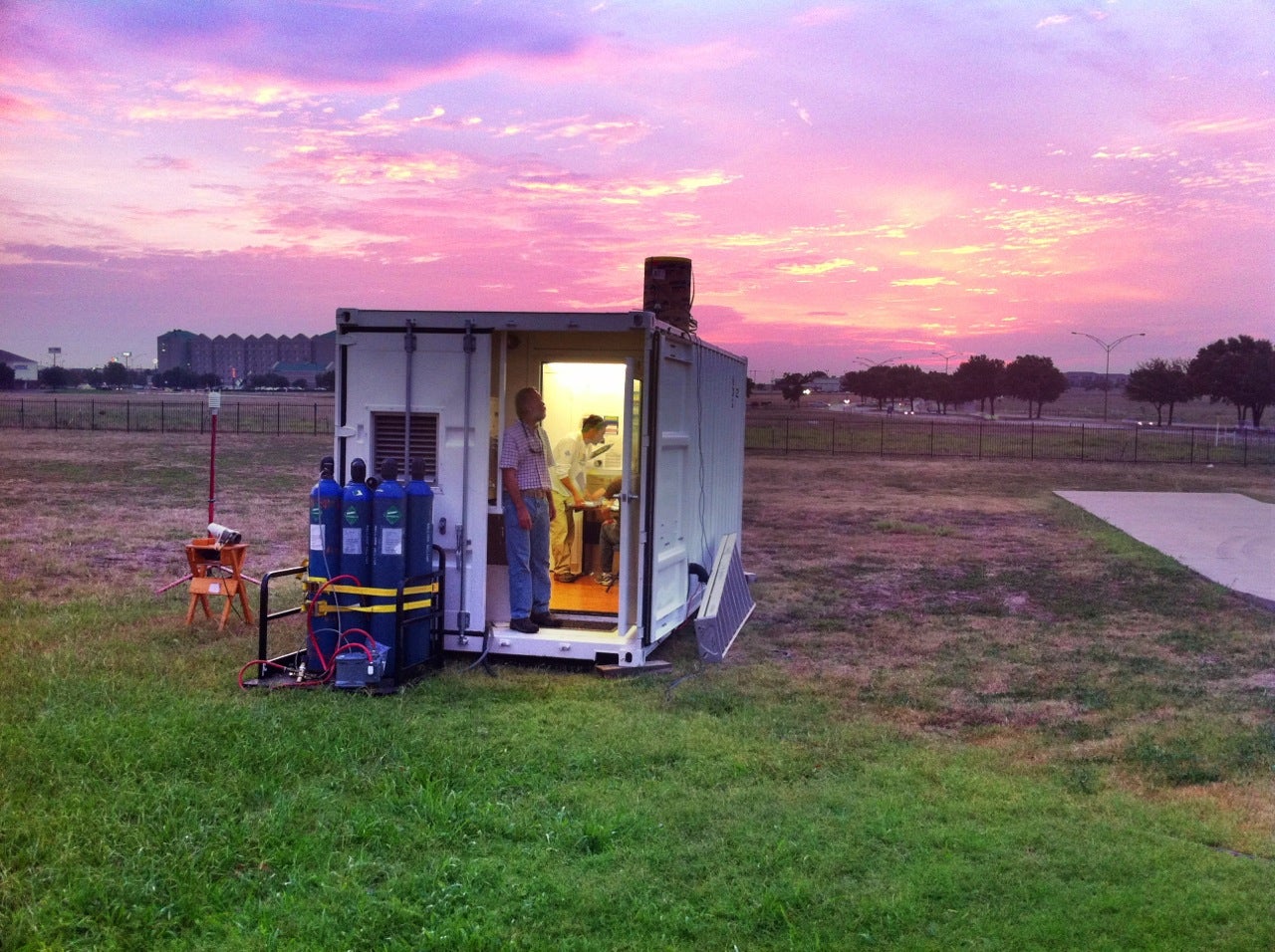
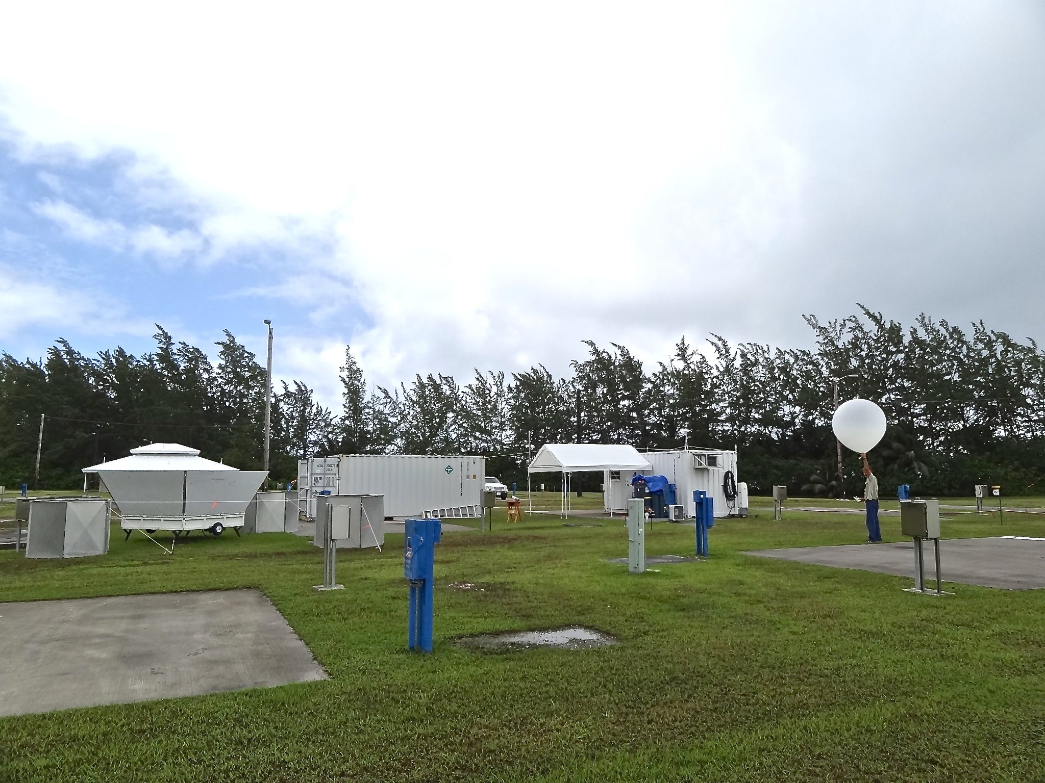
ARM Balloon-borne Sounding System [Radiosonde]
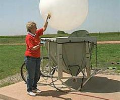 The balloon-borne sounding system provides in situ measurements (vertical profiles) of both the thermodynamic state of the atmosphere and the wind speed and direction. During some field campaigns, sonde operations from multiple stations around a central location with baseline measurements, like a mobile facility, can provide important constraints for model simulations.
>> Read more about the ARM Balloon-borne Sounding Systems
ARM 915 MHz Wind Profiler*
 The 915 MHZ WP is a long-wavelength Doppler radar which detects the backscattered signals from turbulence-induced refractive index variations. The profiler thus tracks the motion of the turbulent eddies which drift with the mean flow, providing a measurement of the mean wind velocity.
ARM Doppler Lidar*
 The Doppler Lidar (DL) is an active remote sensing instrument that provides range- and time-resolved measurements of radial velocity and attenuated backscatter. The principle of operation is similar to radar in that pulses of energy are transmitted into the atmosphere; the energy scattered back to the transceiver is collected and measured as a time-resolved signal. From the time delay between each outgoing transmitted pulse and the backscattered signal, the distance to the scatterer is inferred.
>> Read more about the ARM Doppler Lidar
ARM C-band Radar (C-SPAR)
 The C-SAPR is a C-band dual-polarization Doppler weather radar manufactured by ARC, Inc. The C-SAPR operates in a simultaneous transmit and receive (STAR) mode, meaning that the transmit signal is split so that power is transmitted on both horizontal and vertical polarizations at the same time. The C-SAPR also has the ability to transmit on a single polarization (either horizontal or vertical) and measure linear depolarization ratio (LDR).
>> Read more about the C-SPAR
ARM Aerosol Observing System
 The aerosol observing system (AOS) is the primary Atmospheric Radiation Measurement (ARM) platform for in situ aerosol measurements at the surface. The principal measurements are those of the aerosol absorption and scattering coefficients as a function of the particle size and radiation wavelength. Additional measurements include those of the particle number concentration, size distribution, hygroscopic growth, and inorganic chemical composition.
>> Read more about the AOS
Ka-band Scanning ARM Cloud Radar (KASACR)
 ARM's scanning cloud radars are fully coherent dual-frequency, dual-polarization Doppler radars mounted on a common scanning pedestal. Each pedestal includes a Ka-band radar (2kW peak power) and the deployment location determines whether the second radar is a W-band (1.7 kW peak power) or X-band (20 kW peak power).
>> Read more about KASACR
| Fixed PISA #2 (FP2) :: Greensburg, KS |
Howard University Radiosondes/GPS Atmospheric Upper-Air Sounding System (GAUS)
.jpg) GAUS is a balloon-borne radiosonde sounding system. Through GPS technology, the GAUS measures high vertical resolution of temperature, humidity and winds at locations around the world. Each system includes a meteorological observing station to record thermodynamic data at the surface and the infrastructure to provide local data processing, display and communications. Data from GAUS can be transferred by phone, Internet or the Global Telecommunication System (GTS) to scientists at universities, other research institutions and operational weather centers.
GAUS is a balloon-borne radiosonde sounding system. Through GPS technology, the GAUS measures high vertical resolution of temperature, humidity and winds at locations around the world. Each system includes a meteorological observing station to record thermodynamic data at the surface and the infrastructure to provide local data processing, display and communications. Data from GAUS can be transferred by phone, Internet or the Global Telecommunication System (GTS) to scientists at universities, other research institutions and operational weather centers.
>> Read more about GAUS
NASA ALVICE Mobile Laboratory
 The NASA/Goddard Space Flight Center ALVICE mobile laboratory includes a Raman lidar system, a GPS for total column water, radiosonde and frostpoint hygrometer launch capability and a ventilated surface reference station. For PECAN, Raman lidar and GPS measurements are the focus. The Raman lidar makes use of Raman scattering in the atmosphere to measure various atmospheric properties, in particular water vapor for PECAN. This permits the study and improved understanding of mesoscale dynamics, warm and cold clouds and aerosols.
ARM Atmospheric Emitted Radiance Interferometer (AERI)*
The AERI is a ground-based instrument that measures the downwelling infrared radiance from the Earth’s atmosphere. These upward-looking surface observations can be used to obtain vertical profiles of tropospheric temperature and water vapor, as well as measurements of trace gases (e.g., ozone, carbon monoxide, and methane) and downwelling infrared spectral signatures of clouds and aerosols.
>> Read more about AERI
FP2 will also include:
- NASA Doppler Lidar
- NASA K-band Radar
- Howard University Microwave Radiometer Profiler (MWRP)*
- University of Maryland, Baltimore County Doppler Lidar
- University of Maryland, Baltimore County Micropulse Lidar
- Naval Postgraduate School sodar*
- Naval Postgraduate School surface flux station*
- Naval Postgraduate School ceilometer*
- Naval Postgraduate School surface meteorology*
- Naval Postgraduate School tethersonde
| Fixed PISA #3 (FP3) :: Ellis, KS |
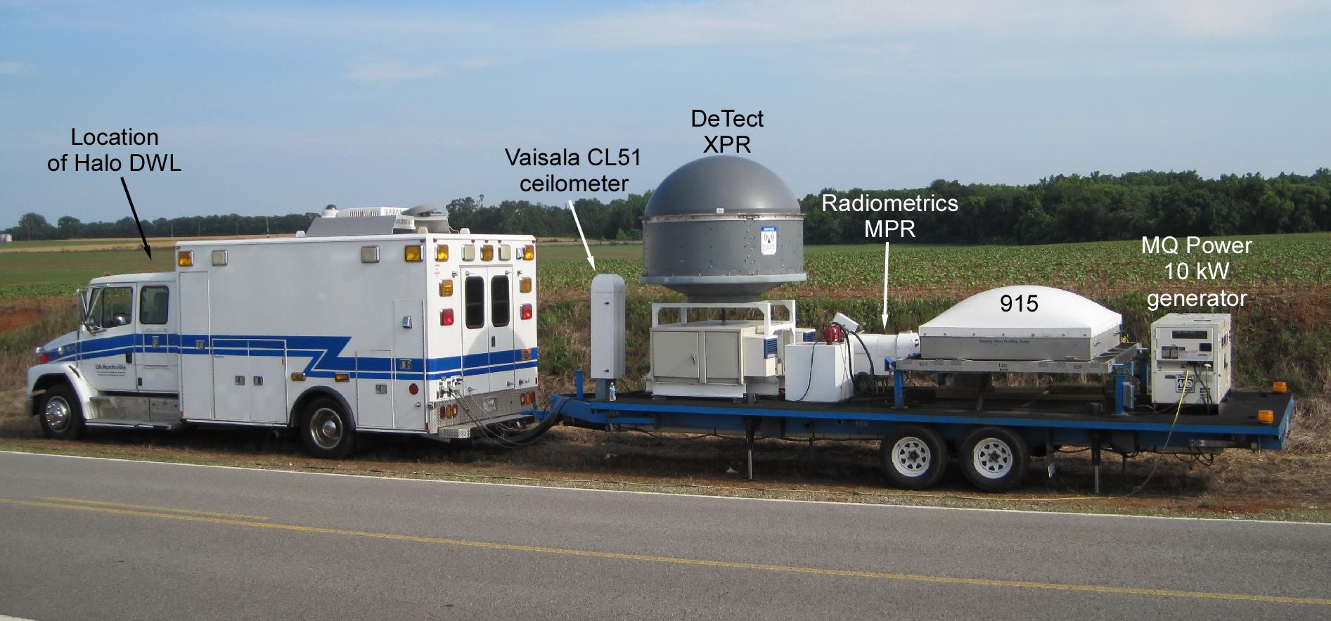
NCAR Modular Profiling Network/449 Wind Profiler*
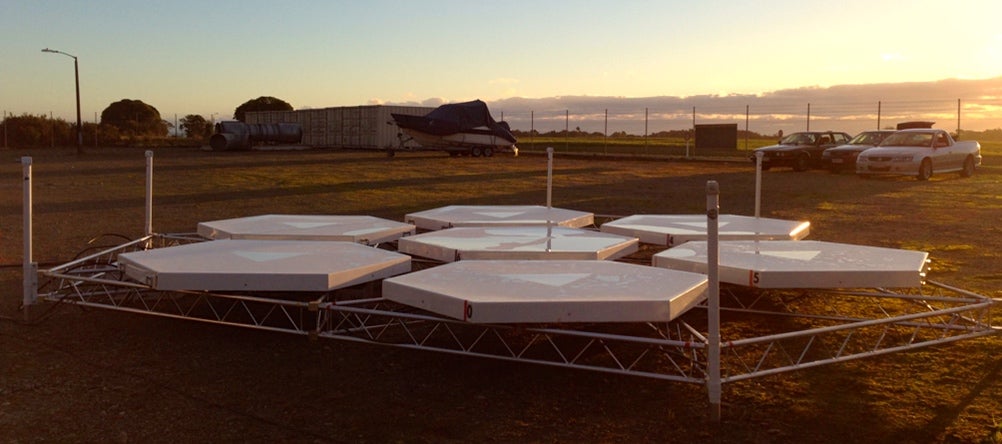 The MPN (Modular Profiling Network) is a new development to extend the capabilities of the Integrated Sounding System (ISS). A center piece of the system in the 449 MHz modular wind profiler, a new scalable radar to profile the wind and structure of the atmospheric boundary layer and troposphere. The radar consists of a set of antenna modules that can be scaled to probe varying depths into the atmosphere. The PECAN deployment will utilize a 7-panel array to probe into the mid-troposphere.
>> Read more about the MPN and access summary plots
NCAR Water Vapor DIAL*
 NCAR/EOL and Montana State University (MSU) have worked together to expand and evaluate the capability of a new technique to remotely measure atmospheric water vapor profiles. The collaboration has resulted in a next-generation instrument – built on the success of previous MSU diode-laser-based prototypes – that advances the technology to provide measurements over a broadened range of atmospheric conditions. The new instrument allows for unattended operations with a completely eye-safe beam.
>> Read more about the WV DIAL
ARM Atmospheric Emitted Radiance Interferometer (AERI)*
The AERI is a ground-based instrument that measures the downwelling infrared radiance from the Earth’s atmosphere. These upward-looking surface observations can be used to obtain vertical profiles of tropospheric temperature and water vapor, as well as measurements of trace gases (e.g., ozone, carbon monoxide, and methane) and downwelling infrared spectral signatures of clouds and aerosols.
>> Read more about AERI
FP3 will also include:
- University of Manitoba Microwave Radiometer Profiler (MWRP)*
- University of Manitoba (DL) zenith only*
- Millersville University sondes
- Millersville University sodar*
- Millersville University Micropulse Lidar (MPL)*
- Millersville University surface flux *
- Millersville University surface meteorology*
- Millersville University tethersonde
- NCAR GPS receiver*
| Fixed PISA #4 (FP4) :: Minden, NE |
NCAR/EOL ISS with 915 MHz Wind Profiler*
 The Integrated Sounding Systems (ISS) is a self contained meteorological observing system at the Earth Observing Laboratory of the National Center for Atmospheric Research. The ISS combines surface, sounding, and remote sensing instrumentation to provide a comprehensive description of lower atmospheric thermodynamics and winds.
>> Read more about the ISS and access summary plots
NCAR/EOL Radiosondes/GPS Atmospheric Upper-Air Sounding System (GAUS)
GAUS is a balloon-borne rawinsonde sounding system. Through GPS technology, the GAUS measures high vertical resolution of temperature, humidity and winds at locations around the world. Each system includes a meteorological observing station to record thermodynamic data at the surface and the infrastructure to provide local data processing, display and communications.
>> Read more about GAUS
ARM Atmospheric Emitted Radiance Interferometer (AERI)*
The AERI is a ground-based instrument that measures the downwelling infrared radiance from the Earth’s atmosphere. These upward-looking surface observations can be used to obtain vertical profiles of tropospheric temperature and water vapor, as well as measurements of trace gases (e.g., ozone, carbon monoxide, and methane) and downwelling infrared spectral signatures of clouds and aerosols.
>> Read more about AERI
FP4 will also include:
- NCAR surface met*
- NCAR surface flux*
- NCAR GPS receiver*
- NCAR ceilometer*
| Fixed PISA #5 (FP5) :: Brewster, KS |
NCAR/EOL ISS with 915 MHz Wind Profiler*
The Integrated Sounding Systems (ISS) is a self contained meteorological observing system at the Earth Observing Laboratory of the National Center for Atmospheric Research. The ISS combines surface, sounding, and remote sensing instrumentation to provide a comprehensive description of lower atmospheric thermodynamics and winds.
>> Read more about the ISS and access summary plots
NCAR/EOL Radiosondes/GPS Atmospheric Upper-Air Sounding System (GAUS)
GAUS is a balloon-borne rawinsonde sounding system. Through GPS technology, the GAUS measures high vertical resolution of temperature, humidity and winds at locations around the world. Each system includes a meteorological observing station to record thermodynamic data at the surface and the infrastructure to provide local data processing, display and communications.
>> Read more about GAUS
ARM Atmospheric Emitted Radiance Interferometer (AERI)*
The AERI is a ground-based instrument that measures the downwelling infrared radiance from the Earth’s atmosphere. These upward-looking surface observations can be used to obtain vertical profiles of tropospheric temperature and water vapor, as well as measurements of trace gases (e.g., ozone, carbon monoxide, and methane) and downwelling infrared spectral signatures of clouds and aerosols.
>> Read more about AERI
FP5 will also include:
- NCAR Surface Meteorology *
- NCAR surface flux*
- NCAR sodar*
- Brookhaven National Laboratory Microwave Radiometer (MWR) [22-31 GHz]*
- Yale University Micropulse Lidar (?)
- NCAR GPS receiver*
| Fixed PISA #6 (FP6) :: Hesston, KS |
University of Manitoba Microwave Radiometer Profiler (MWRP)*
>> Read more about the UM Microwave Radiometer
University of Manitoba Wind Lidar (DLs)*
>> Read more about the UM Wind Lidar
ARM Atmospheric Emitted Radiance Interferometer (AERI)*
The AERI is a ground-based instrument that measures the downwelling infrared radiance from the Earth’s atmosphere. These upward-looking surface observations can be used to obtain vertical profiles of tropospheric temperature and water vapor, as well as measurements of trace gases (e.g., ozone, carbon monoxide, and methane) and downwelling infrared spectral signatures of clouds and aerosols.
>> Read more about AERI
ARM Balloon-borne Sounding System [Radiosonde]
The balloon-borne sounding system (SONDE) provides in situ measurements (vertical profiles) of both the thermodynamic state of the atmosphere, and the wind speed and direction. During some field campaigns, sonde operations from multiple stations around a central location with baseline measurements, like a mobile facility, can provide important constraints for model simulations.
>> Read more about the ARM Balloon-borne Sounding Systems
FP6 will also include:
- University of Alabama, Huntsville Surface Meteorology Instrumentation
| Mobile PISA #1 (MP1) |
University of Oklahoma/NSSL Collaborative Lower Atmospheric Mobile Profiling System (CLAMPS)
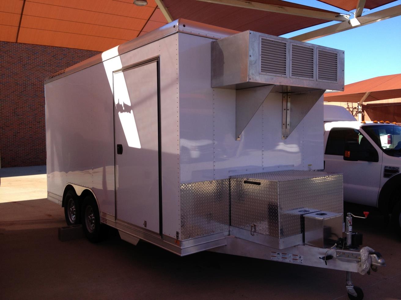 NSSL has a mobile, trailer-based boundary layer profiling facility using commercially available sensors. CLAMPS contains a Doppler lidar, a multi-channel microwave radiometer (MWRP), and an Atmospheric Emitted Radiance Interferometer (AERI). CLAMPS meets a NOAA/NWS operational and research need for profiles of temperature, humidity, and winds near the surface of the earth.
>> Read more about CLAMPS
MP1 will also include:
- Radiosondes
- Surface Meteorology
| Mobile PISA #2 (MP2) :: MIPS |
University of Alabama Mobile Integrated Profiling System (MIPS)
 The Mobile Integrated Profiling System (MIPS) is a unique ground-based remote sensing platform, which is used to study a variety of severe and hazardous weather phenomena by researchers in the Severe Weather Institute – Radar & Lightning Laboratories (SWIRLL) at the University of Alabama in Huntsville. The MIPS routinely participates in studies of land-falling hurricanes, winter cyclones, severe thunderstorms, lake effect snow, and tornadic environments.
>> Read more about MIPS
MP2 will include:
- 915 MHz Wind Profiler
- CL51 ceilometer
- Microwave Radiometer Profiler (MWRP)
- X-band radar (MAX)
- Doppler Lidar
- Surface Meteorology Station
- Radiosondes
| Mobile PISA #3 (MP3) :: SPARC |
University of Wisconsin, Madison SSEC Portable Atmospheric Research Center (SPARC)
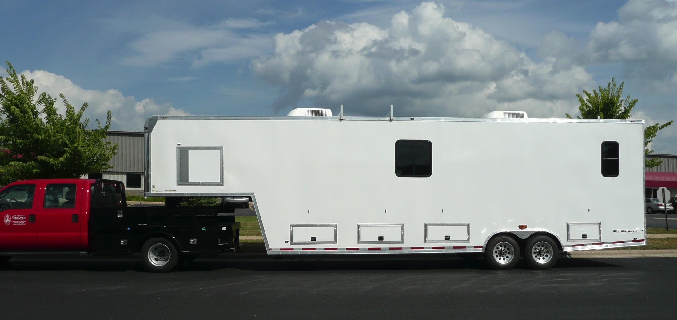 Space Science and Engineering Center (SSEC) scientists are once again taking their research on the road with a new mobile research laboratory. The SSEC Portable Atmospheric Research Center (SPARC) is specially designed to carry instruments to study the atmosphere and make surface emissivity measurements.
>> Read more about SPARC
MP3 will include:
- AERI
- Doppler Lidar
- High-spectral Resolution Lidar (HSRL)
- Surface met
- Radiosondes
| Mobile PISA #4 (MP4) :: MISS |
NCAR Mobile Integrated Sounding System (MISS) with 915 MHz Wind Profiler
 MISS is the mobile version of our Integrated Sounding System (ISS). It is a suite of instruments on a large trailer towed behind a pick-up truck to profile the atmospheric boundary layer and beyond. The instrument suite includes: 915 MHz wind profiler, radiosondes, surface meteorology sensors, and a lab cabin.
>> Read more about the MISS and access sumary plots
NCAR Radiosondes/GPS Atmospheric Upper-Air Sounding System (GAUS)
GAUS is a balloon-borne rawinsonde sounding system. Through GPS technology, the GAUS measures high vertical resolution of temperature, humidity and winds at locations around the world. Each system includes a meteorological observing station to record thermodynamic data at the surface and the infrastructure to provide local data processing, display and communications.
>> Read more about GAUS
MP4 will also include:
-
NCAR/EOL Surface Meteorology Station
| Additional Mobile Instruments |
NPS/CIRPAS Truck-mounted Wind Observing Lidar Facility (TWOLF)
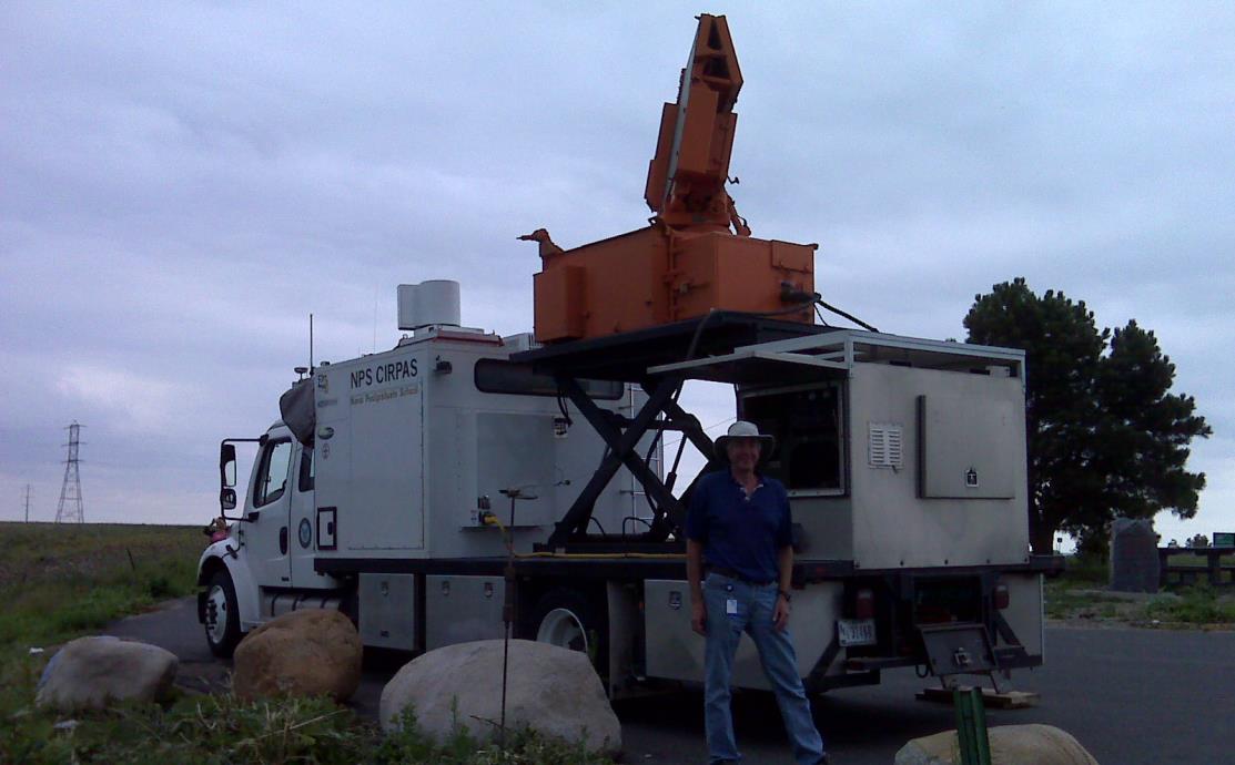 Coming soon!
>> Read more about TWOLF


.jpg")


