| Higher Education Resources :: COMET MetEd [free login required] |
Principles of Convection I: Buoyancy and CAPE
 This module provides a brief overview of Buoyancy and CAPE. Topics covered include the origin of atmospheric buoyancy, estimating buoyancy using the CAPE and Lifted Index, factors that affect buoyancy including entrainment of mid-level air, water loading, convective inhibition, and the origin of convective downdrafts. This module delivers instruction with audio narration, rich graphics, and a companion print version.
>> Go to module
Principles of Convection II: Using Hodographs
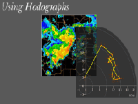 This module provides a basic understanding of how to plot and interpret hodographs, with application to convective environments. Most of the material previously appeared in the CD module, Anticipating Convective Storm Structure and Evolution, developed with Dr. Morris Weisman. Principles of Convection II: Using Hodographs includes a concise summary for quick reference and a final exam to test your knowledge. The module comes with audio narration, rich graphics, and a companion print version.
>> Go to module
Principles of Convection III: Shear and Convective Storms
 This module discusses the role of wind shear in the structure and evolution of convective storms. Using the concept of horizontal vorticity, the module demonstrates how shear enhances uplift, leading to longer-lived supercell and multicell storms. The module also explores the role of shear in the development of mesoscale convective systems, including bow echoes and squall lines. Most of the material in this module previously appeared in the COMET modules developed with Dr. Morris Weisman. This version includes a concise summary for quick reference and a final exam to test your knowledge. The module comes with audio narration, rich graphics, and a companion print version.
>> Go to module
Severe Convection II: Mesoscale Convective Systems
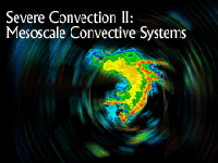 Mesoscale convective systems occur worldwide and year-round and are accompanied by the potential for severe weather and flooding. This module describes typical system evolution by examining squall line, bow echo, and MCC characteristics throughout their life cycles. This module has less emphasis on the physical processes controlling MCS structure and evolution than our previously released module, Mesoscale Convective Systems: Squall Lines and Bow Echoes. Instead, this newly updated module includes more material on tropical squall lines, MCC's, and on NWP’s ability to predict convective systems. The module starts with a forecast scenario and concludes with a final exam. Rich graphics, audio narration, and frequent interactions enhance the learning experience.
>> Go to module
Skywarn Spotter Convective Basics
 The "SKYWARN® Spotter Convective Basics" module will guide users to a basic understanding of convective storms. Through three different scenarios, you will cover reporting and proper communication of local storm reports to the National Weather Service (NWS), personal safety during these events, and field identification of convective storm hazards. After completing the scenarios, you will be given the opportunity to practice identifying storm features from a spectrum of photos.
>> Go to module
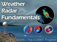
This 2-hour module presents the fundamental principles of Doppler weather radar operation and how to interpret common weather phenomena using radar imagery. This is accomplished via conceptual animations and many interactive radar examples in which the user can practice interpreting both radar reflectivity and radar velocity imagery. Although intended as an accelerated introduction to understanding and using basic Doppler weather radar products, the module can also serve as an excellent refresher for more experienced users.
>> Go to module
Radar Signatures for Severe Convective Weather
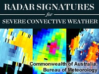
This resource is intended for use as a job aid by operational weather forecasters in live warning situations and as a reference tool to better understand some aspects of severe thunderstorm warning events. Thumbnail images show typical representatives for sixteen radar reflectivity and velocity signatures as well as three primary severe storm types. Each signature links to content describing detection techniques and conceptual and diagnostic information to help determine storm severity. The majority of the examples shown are southern hemisphere storms in Australia; examples from the northern hemisphere are noted.
>> Go to module
Introduction to Electromagnetic and Electro-Optic Propagation

This lesson describes the properties of electromagnetic and electro-optical radiation and how their propagation is affected by the atmosphere and weather. Atmospheric variables that affect EM propagation include temperature, moisture, pressure, and composition. These variables control processes including refraction, absorption, and scattering.
>> Go to module
Precipitation Estimates, Part 1: Measurements
This is part one of a two-module series on estimation of observed precipitation. Through use of rich illustrations, animations, and interactions, this module provides an overview of the science of precipitation estimation using various measuring platforms. First, we define quantitative precipitation estimation (QPE) and examine technologies for remote sensing of QPE, including radar and satellite and the strengths and limitations of each. That is followed by an examination of the use of rain gauges for precipitation estimation and important issues to consider with rain gauge measurement. Finally we provide an introduction to the strengths and limitations of using precipitation climatology for QPE including PRISM.
>> Go to module
Precipitation Estimates, Part 2: Analysis
This is part two of a two-module series on estimation of observed precipitation. Through the use of rich illustrations, animations, and interactions, this module provides an introduction to the science behind successful application of the products and tools available through the NWS Multisensor Precipitation Estimator (MPE) software and related products. An overview is presented of the key fields available in MPE along with illustrations of their use. These include radar, gauge, satellite, bias-adjusted radar, and multisensor fields of precipitation accumulation along with data displays and tables used for evaluating and editing the data. Subsequently, methods for additional data editing with MPE's polygon editing tool are explained, as well as the selection of a best estimate. Finally, a case study section is offered to show how these methods have been applied in the field for a variety of events and locations.
>> Go to module


