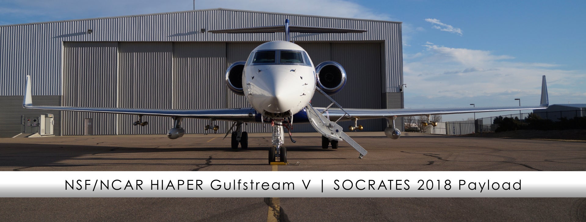
Our research aircraft are essentially "flying laboratories". For each field project a specialized suite of instruments are uploaded to the aircraft to meet the research needs of the study. SOCRATES will quantify how clouds, aerosols, air-sea exchanges interact over the Southern Ocean, therefore the payload consists of a suite of instruments specific to this research project including radar, lidar, radiometers, cloud droplet probes, and dropsondes.
| Instrument Acronym |
Instrument Name |
Measurement |
| AVAPS | Airborne Vertical Atmospheric Profiling System (Dropsonde System) | High resolution vertical profiles of ambient temperature, pressure, humidity, wind speed and wind direction; dropsondes are ejected out of the back right side of the aircraft through a small pressurized port |
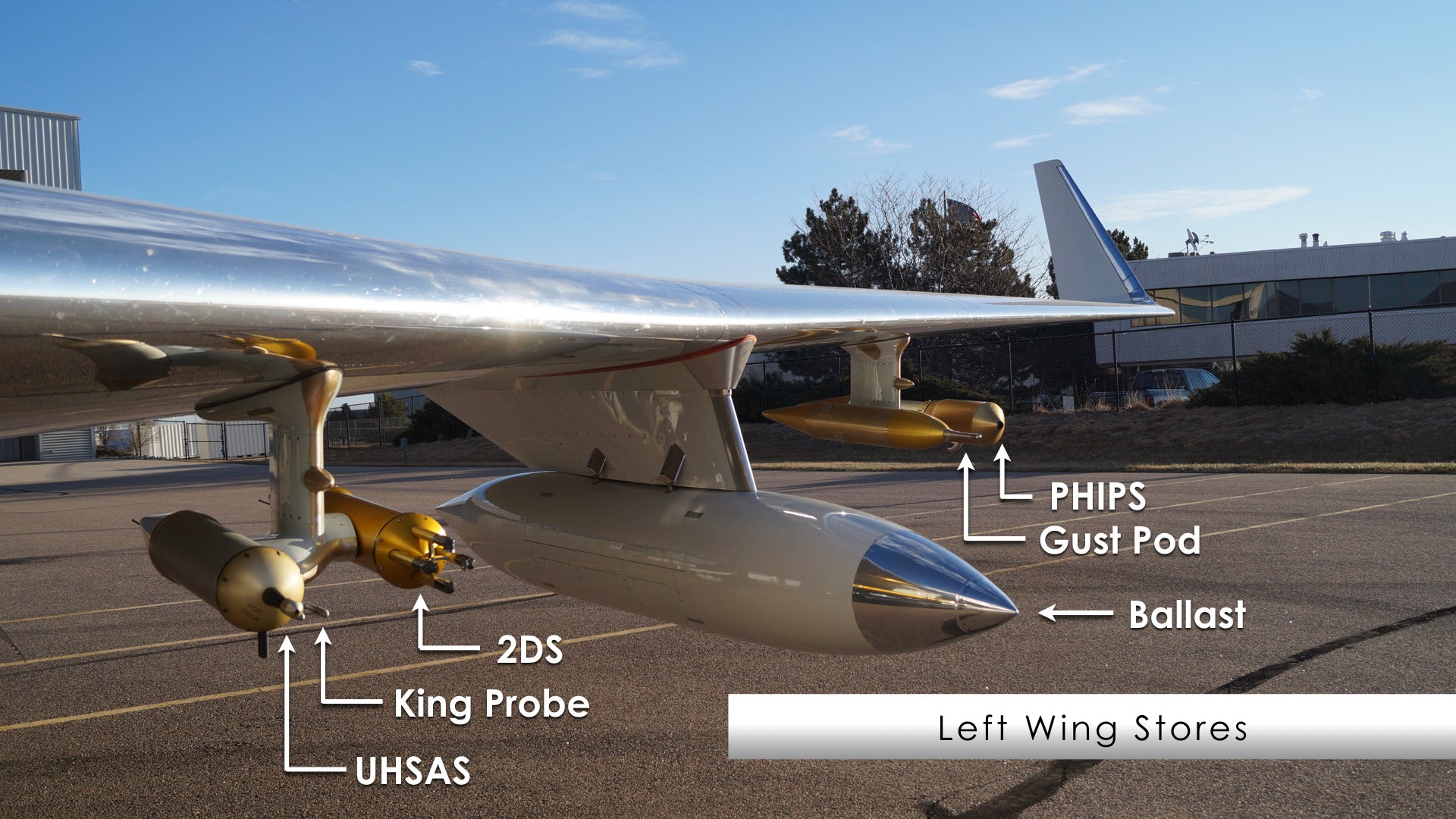
Left Wing Stores
| Instrument Acronym |
Instrument Name |
Measurement |
| 2DS | Two-Dimensional Stereo probe | Two-dimensional images of cloud and precipitation particles from 10-1280 µm |
| Ballast | -- | A non-operational pod that mirrors the weight and aerodynamics properties of the opposite side wing store |
| Gust Pod | All Weather Wind Gust Pod | 3-D wind in all conditions and provides aircraft position, attitude, ground speed, aircraft attack angle (AKRD), Solid State Recording Device (SSRD), and aircraft true air speed (TASX) |
| King Probe | King (CSIRO) Liquid Water Sensor | Cloud liquid water content |
| PHIPS | Particle Habit Imager and Polar Nephelometer | Simultaneously images a cloud particle and measures its angular scattering phase function |
| UHSAS | Ultra-High Sensitivity Aerosol Spectrometer | Concentration and size distribution of aerosol particles having diameters from 0.060 --1.0 µm |
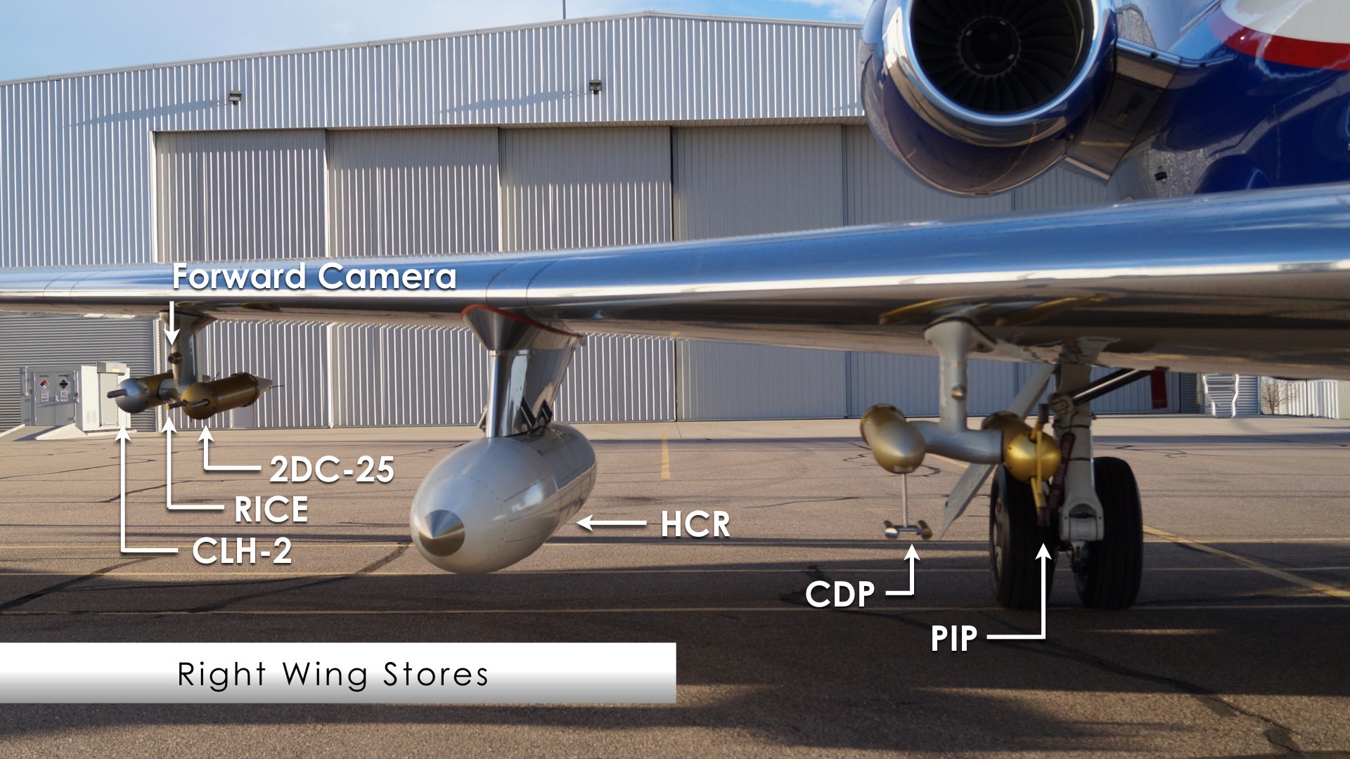
Right Wing Stores
| Instrument Acronym |
Instrument Name |
Measurement |
| 2DC-25 | Two-Dimensional Optical Array Cloud Probe | Two-dimensional images of hydrometeors from 25-1560 µm |
| CDP | Cloud Droplet Probe | Cloud droplet size distribution and various measurements derived from that size distribution from 1-50 µm |
| CLH-2 | University of Colorado Closed-path Laser Hygrometer, v2 | “Total water”, the sum of water vapor and particulate water, water vapor resulting from the evaporation of cloud particles |
| Forward Camera | Forward Camera | Provides imagery of the scene ahead of aircraft. Image resolution is 1024x768, with a 62° (horizontal) x 48° (vertical) field of view |
| HCR | HIAPER Cloud Radar | Radar W-band reflectivity factor and radial velocity of hydrometeors |
| PIP | Precipitation Imaging Probe | Quantity and images of precipitation sized particles from 100 microns to 6.4 mm in size |
| RICE | Rosemount Icing Detector | Presence of supercooled water; also a rough measurement of the quantity |
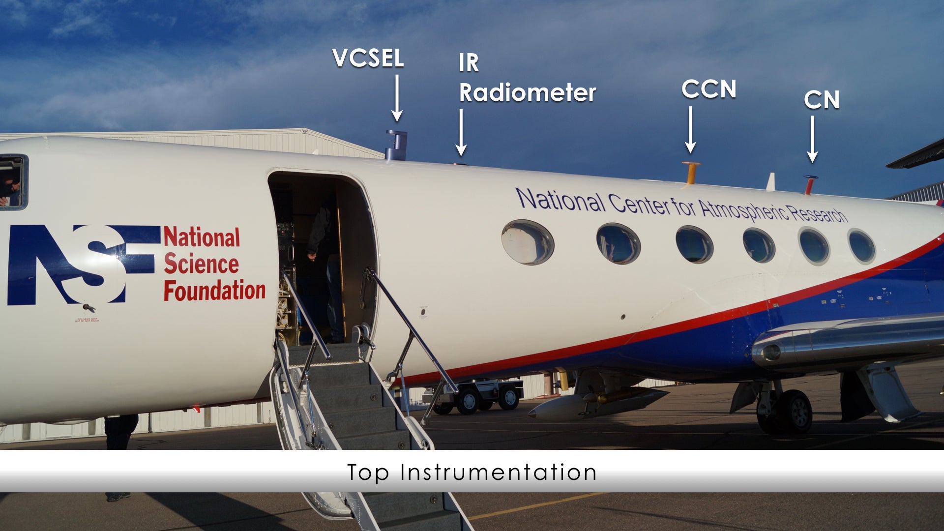
Top Instrumentation
| Instrument Acronym |
Instrument Name |
Measurement |
| CCN | Cloud Condensation Nuclei Counter | Spectrum of cloud condensation nuclei concentration |
| CN | Condensation Nucleus Counter | Total ambient concentration of aerosol particles larger than the threshold size for the instrument, typically about 11 nm diameter (6 nm for the water-based counter); dependent on flight conditions |
| IR radiometer | Infrared radiometer | Infrared radiation |
| VCSEL | Vertical Cavity Surface-Emitting Laser Hygrometer | Water vapor concentration and related derived values (mixing ratio, dew point, etc.) |
Bottom Instrumentation
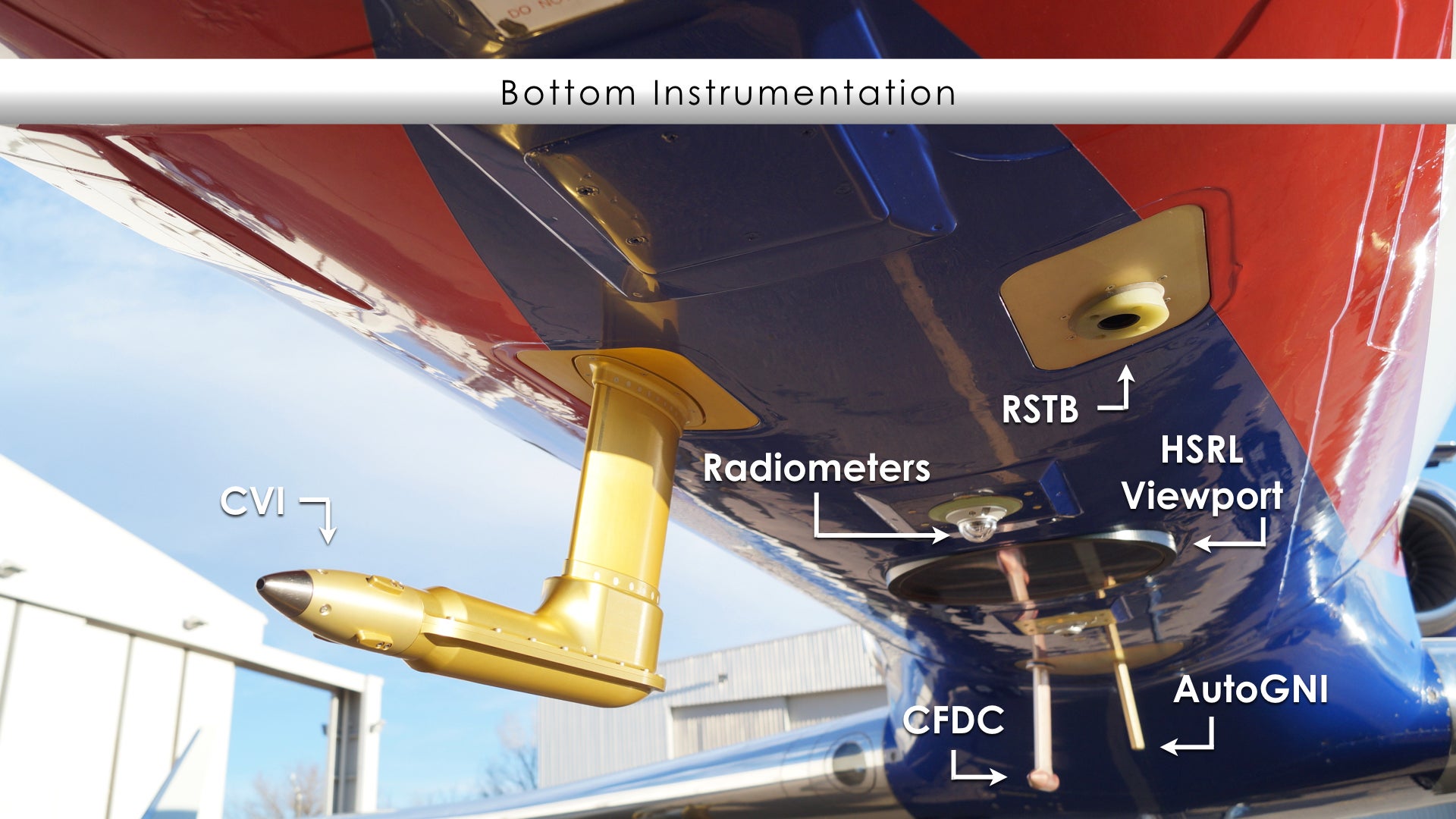
| Instrument Acronym |
Instrument Name |
Measurement |
| CFDC | Continuous Flow Diffusion Chambers | Particle size distribution |
| CVI | Counterflow Virtual Impactor | Cloud particle concentration, condensate mass, water vapor (for isotopic analysis) and aerosol particle residuals |
| AutoGNI | Giant Nuclei Impactor | Giant aerosol particles |
| HSRL (Viewport) | High Spectral Resolution Lidar | Back scatter cross section, extinction and depolarization properties of atmospheric aerosols and clouds |
| Radiometers | Broadband Radiometers | Infrared (IR) and Visiible spectrum |
| RSTB | Radiometric Surface Temperature | Terrestrial radiation |
Images


