Search
Educational Activities
DOW8 was deployed for 11 intensive operation periods (IOPs, Table 1) distributed over five sites (Figure 1). The deployments, described in more detail below, provided educational opportunities to TAMU students enrolled in SOAP and an NSF-funded REU.
Table 1
Summary of DOW8 IOPs
| Date | Time (CDT) | Location | Activity | |
| IOP-1 | 7-14-2018 | 4:00-6:30PM | Research Farm | SOAP |
| IOP-2 | 7-15-2018 | 2:00-5:00PM | Research Farm | SOAP |
| IOP-3 | 7-16-2018 | 2:00-5:00PM | Benchley | SOAP |
| IOP-4 | 7-18-2018 | 2:00-5:00PM | Teichman Road | REU |
| IOP-5 | 7-19-2018 | 6:00-8:30AM | Teichman Road | REU |
| IOP-6 | 7-19-2018 | 1:00-4:00PM | Teichman Road | REU |
| IOP-7 | 7-20-2018 | 6:00-8:30AM | Teichman Road | REU |
| IOP-8 | 7-20-2018 | 1:00-6:00PM | Danbury | REU |
| IOP-9 | 7-21-2018 | 6:00-8:30AM | Teichman Road | REU |
| IOP-10 | 7-22-2018 | 5:30-8:00AM | Pelican Island | REU |
| IOP-11 | 7-23-2018 | 3:00-6:00PM | Research Farm | SOAP |
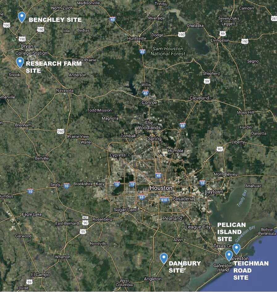
Figure 1. Locations of DOW8 IOP field sites.
SOAP
The first few days of the educational deployment of DOW8 were focused on training and local operations in College Station, TX with TAMU students enrolled in the SOAP course. Students were trained on DOW8 operations by the CSWR technician in groups of three in a parking lot on the TAMU campus. In addition to in-cab training, an hour-long training presentation on radar meteorology and the rapid-scan DOW slotted waveguide technology was given to the students by Drs. Nowotarski and Conlee.
During the following three days (July 14-16), three IOPs were conducted (IOPs 1-3, Table 1) wherein SOAP students participated in an early-afternoon weather discussion and planned deployments to either the research farm field site or a field site near Benchley, TX (Fig. 1) for rapid scanning of convective rain showers and pulse thunderstorms (Fig. 2). Several SOAP students also helped facilitate a local outreach event on the morning of July 15 (Sec. 3a). Another local IOP involving the SOAP students (IOP-11) was conducted at the research farm site on the last day of the educational deployment (July 23).
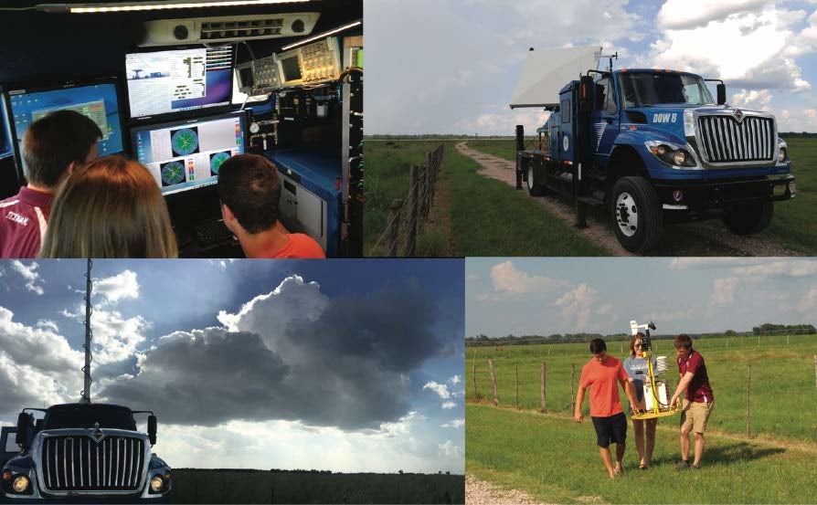
Figure 2. Research Farm SOAP DOW8 deployments.
NSF REU
i. Teichman Road
Five IOPs (IOPs 4-7 and 9, Table 1) occurred at the Teichman Rd site on Galveston Island (Fig. 1). IOP-4 was the students’ first exposure to the Teichman Rd site and we deployed there as an entire group after we arrived at Galveston Island on the afternoon of 18 July. Students were subsequently separated into smaller groups and were put in charge of monitoring the weather conditions for potential next IOPs and providing weather briefings to the rest of the group. From previous years we knew that there was often early morning convection over the water with redevelopment over land in the later afternoon, so morning groups would set their alarm and use the Houston NEXRAD to determine if there was any possible convective activity in the area over the next few hours. Each morning group decided to deploy and we captured a number of developing convective cells over the water (e.g., Fig. 3, top panel) for the three morning IOPs at Teichman Rd (IOPs 5, 7, and 9). The other afternoon IOP at Teichman Rd (IOP-6) observed developing convective cells over land and once again included the whole group and a sounding launch (Fig. 3, bottom panel).
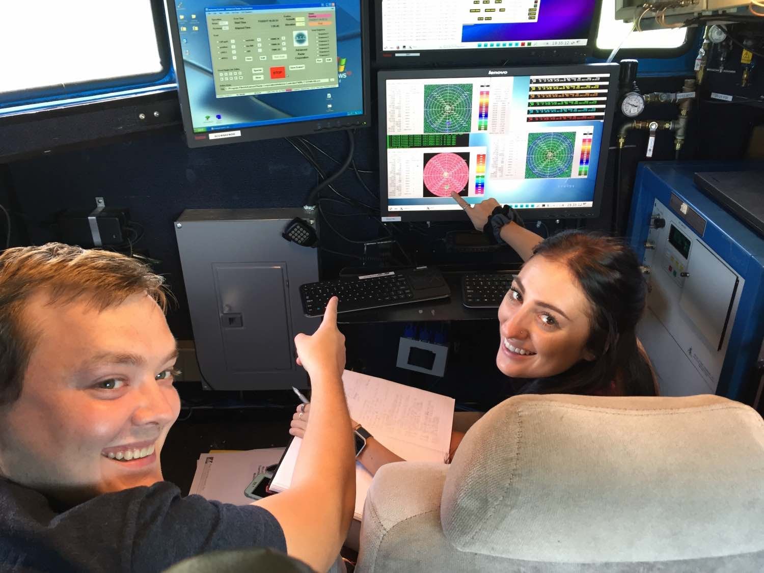
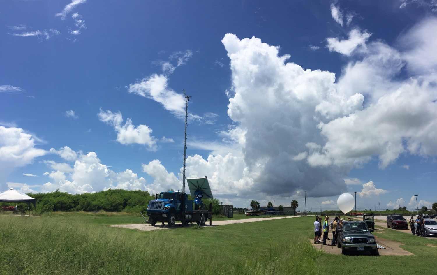
Figure 3. The morning (two left images, IOP-5) and afternoon (two right images, IOP-6) of 19 July 2017.
We had the students think through a variety of scan modes using DOW8, including full-volume PPIs, sector-scan PPIs, RHIs, and a quasi-profiler mode. Their objective was to capture the developing convection in as much temporal and spatial detail as possible. The winds in the ordinary convective cells observed around Galveston Island are typically not very strong so we were not as concerned with velocity folding.
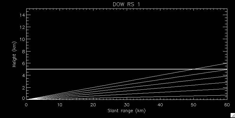
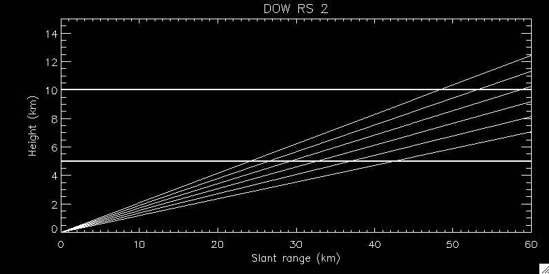
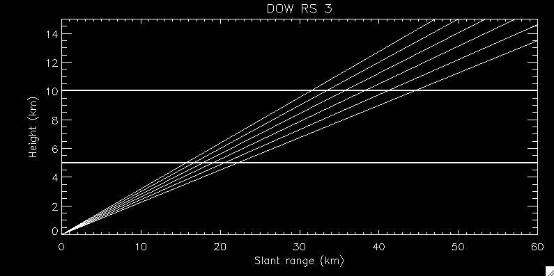
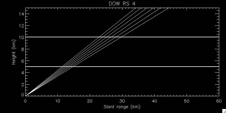
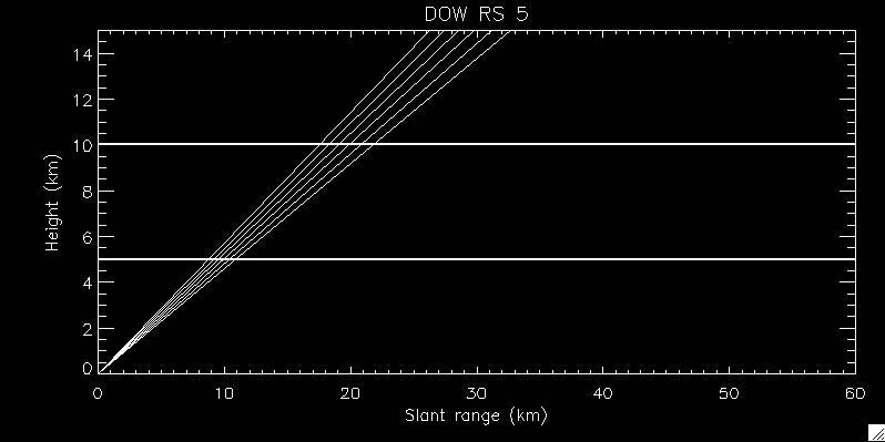
The students started with the scan strategies in Fig. 4 and would do an initial full PPI sweep with RS1 (i.e., 0.5 to 5.5 deg elevation angles) with a low PRF. After that, they would determine the distance and height of the best cell of interest and adapt the number of sweeps (each consisting of 6 elevation angles spaced 1 deg apart) and PRF to maximize the sampling of the cell. They also went through the process of determining appropriate sector scans, but realized that they did not buy one much in terms of sampling with the rapid scan ability of DOW8. When convective cells got close and topping out the storm became more difficult, the students attempted a series of RHIs (both individual and sector RHIs) to observe the tops of the cells. When cells passed over us (which happened twice), the students put DOW8 into a quasi-profiler mode.
While we couldn’t visualize any of these specialized scans in real-time, the process of inquiry and action by the students was unmatchable and the raw data, once processed, has the potential to contribute to our understanding of how things like entrainment and mixed-phase development occurs in ordinary convective cells.
 |
 |
 |
 |
 |
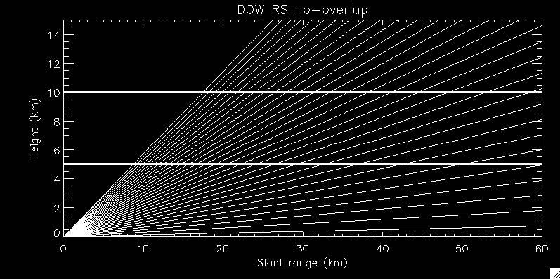 |
Figure 4. Example of five DOW8 scans that provide full-volume coverage (bottom right panel).
ii. Danbury
Because the prevailing weather pattern during the Galveston field trip was characterized by offshore early morning convection with afternoon convection farther inland, the students decided that the afternoon deployment on Thursday, July 20 should occur inland from Galveston Island to maximize data collection opportunities, mimicking how DOW8 might be used during a storm-chasing field experiment. The students developed a strategy to break into two teams with the goal of collecting simultaneous surface and upper air observations on the coast and inland at the radar site to measure horizontal variability in the afternoon convective environment.
During a meeting following the morning deployment on 20 July, students selected several target areas for remote field sites based Google-Earth satellite imagery. DOW8 and a mobile sounding team were deployed in the early afternoon to the target area, and students selected a site on an oil pad with an acceptable radar horizon near Danbury, TX, approximately 50 km west of the Galveston field site (Fig. 1). After obtaining permission from the landowners, students proceeded in setting up a field site suitable for obtaining co-located surface, upper-air, and radar observations (Fig. 5).
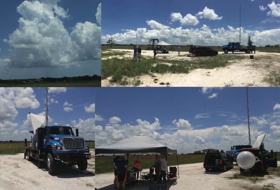
Figure 5. Danbury, TX DOW8 deployment (IOP-8).
During the ~3 hour remote deployment (IOP-8, Table 1), students alternated between radar operations, monitoring surface observations, and conducting a mobile balloon launch. The mobile-site balloon launch was synchronized with a simultaneous launch from the Galveston field site at 1948 UTC using shortwave radio communications. Launch 142 from Danbury (red lines in Fig. 6) was inland and closer to the ordinary convective cells observed by DOW8 (Fig. 7). The soundings are similar above the boundary layer but the marine air cooled and stabilized the lower levels of Launch 143 from Teichman Rd (blue lines in Fig. 6), resulting in a small cap near the ocean and reduced CAPE. The most unstable CAPE version (which is a surface parcel in each sounding) shows a very large value of 4000 J/kg available for the inland cells.
However, shear was weak so ordinary convection resulted.
Students at the Galveston site gained valuable experience in coordinating the DOW8 radar scan strategies based on the proximity, height, and stage of convection, alternating between full volume and sector PPIs with varying waveforms and elevation angles.
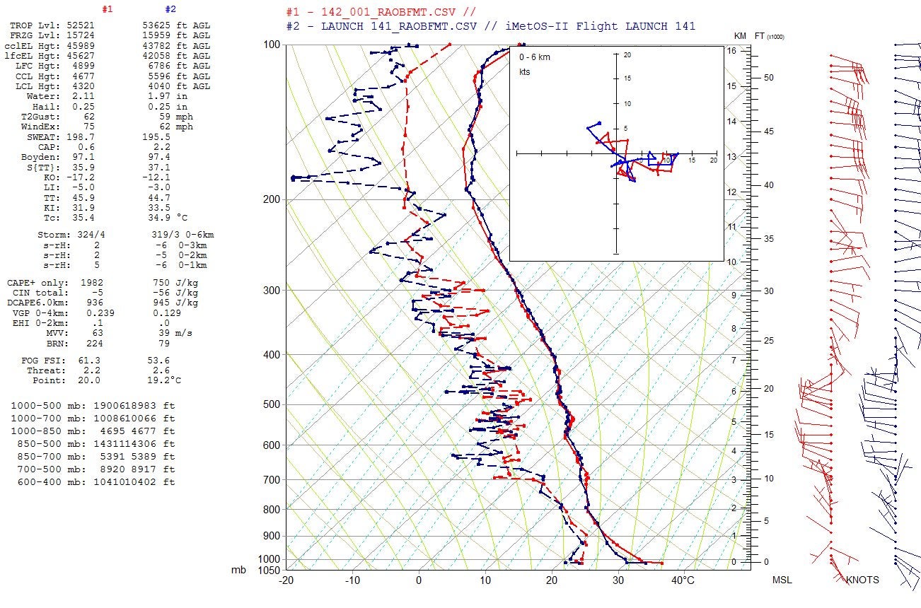
Figure 6. Soundings of inland (red) vs. coastal (blue) conditions during IOP-8.
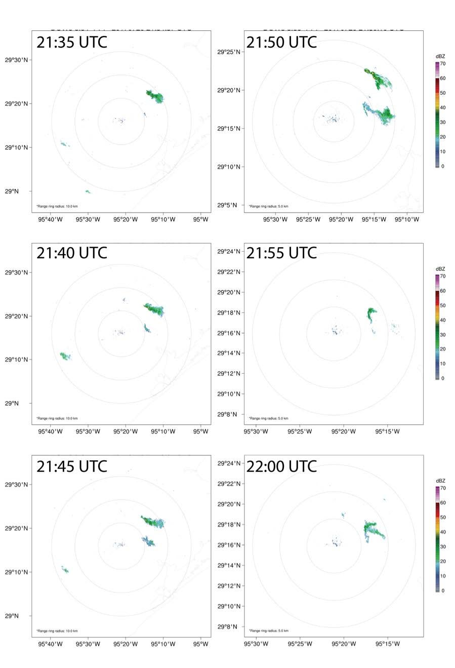
Figure 7. Example of ordinary convective cell evolution every five minutes with DOW8 from IOP-8. Range rings are every 5 km.
iii. Other Galveston locations
On the final day of the Galveston REU field trip, an early morning IOP (IOP-10, Table 1) was conducted at a new field site on Pelican Island (Fig. 1) with good radar visibility towards the west, north, and east where early convection was observed over Galveston Bay. Following this deployment, the REU students helped facilitate an outreach event co-sponsored by the NWS forecast office in League City, TX (Sec. 3b). This also served as a learning and professional development experience for the students who interacted with NWS meteorologists and toured the office.
Outreach
A concerted effort was made to improve the public outreach impact of the DOW8 deployment from the previous TAMU educational deployment in Summer 2015. Two primary events were planned associated with the DOW8 being in the College Station area and later in the Houston/Galveston area during the REU/SOAP field experience.
College Station open-DOW event
A public event was held at an accessible location on campus adjacent to the Kyle Field football stadium on 15 July from 9 am to 12 pm (Fig. 8). Television, radio, and social media advertising were used, as well as signs along the major thoroughfare adjacent to the deployment location. In addition, the local Amateur Radio club, full of trained spotters and other weather technology enthusiasts, were invited to attend in conjunction with their nearby meeting, using it as a program element. A campus-wide visitation program by accomplished prospective students was also in progress, and our event was announced in sessions likely to have interests in the atmospheric sciences.
We were joined at the event by a storm-chasing vehicle, the Weather Edge, from the local CBS affiliate, KBTX. KBTX also provided additional media coverage. We estimate that approximately 70-75 people were able to tour DOW8 and the Weather Edge during the 3-hour event.
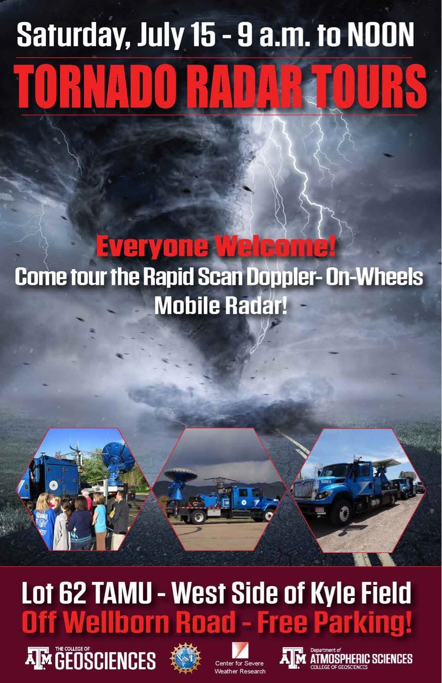
Figure 8. Outreach flyer and visitors to DOW8 during the College Station event.
Houston/Galveston open-DOW event
A public event was held adjacent to the NWS Houston/Galveston Forecast Office in League City, TX (between Galveston and Houston) on 22 July from 10 am to 1 pm (Fig. 9). This event included not only DOW8 demonstrations, but also demonstrations of the CSWR pod and the TAMU in-situ and upper air gear being used in the field experiment. Social media was the main advertisement, as the NWS has a huge Facebook and Twitter following. Again, ham radio volunteers associated with the NWS and Galveston County Emergency Management were targeted as they would be very interested in the radar technology of DOW8. NWS and Galveston County also provided many informative handouts and freebies in addition to those brought by TAMU.
This event had an excellent turnout, even though we had to temporarily suspend demonstrations due to lightning safety for a nearby cell. Many families with young children enjoyed the hands-on activities we prepared (e.g., making a cloud wheel) as well as touring DOW8. Several of the NWS employees came out on their off weekend day and brought family members. We estimate 125-150 people attended this event.