IOP 8: 8-9 December 2001
Time Period of IOP
1200 UTC 8 Dec-0600 UTC 9 Dec
Overview of IOP
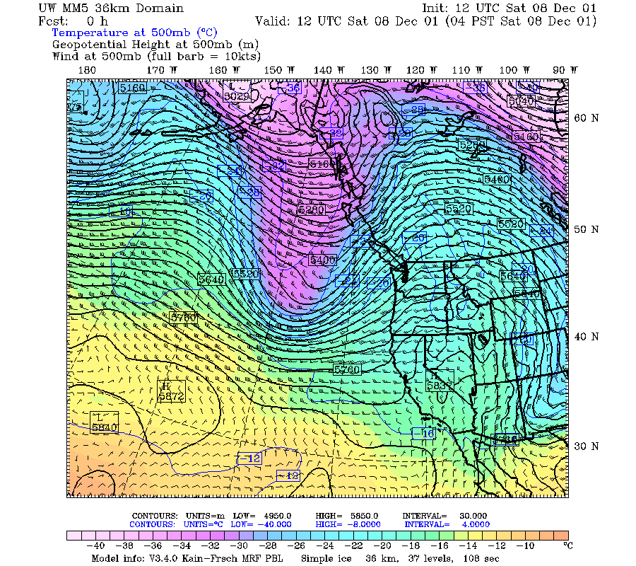
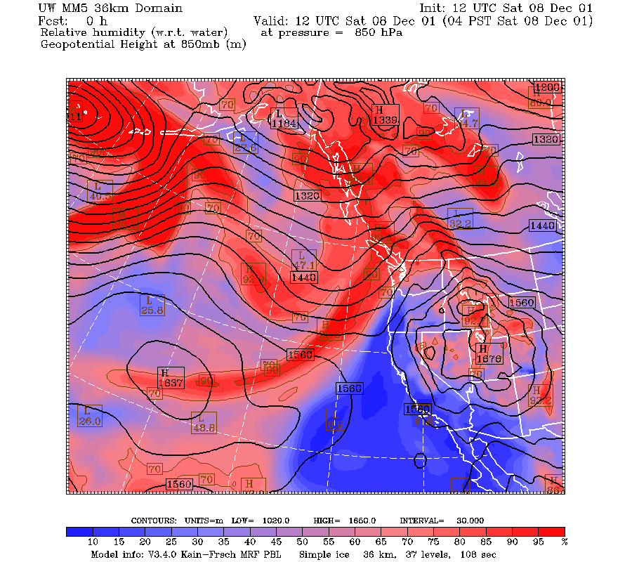
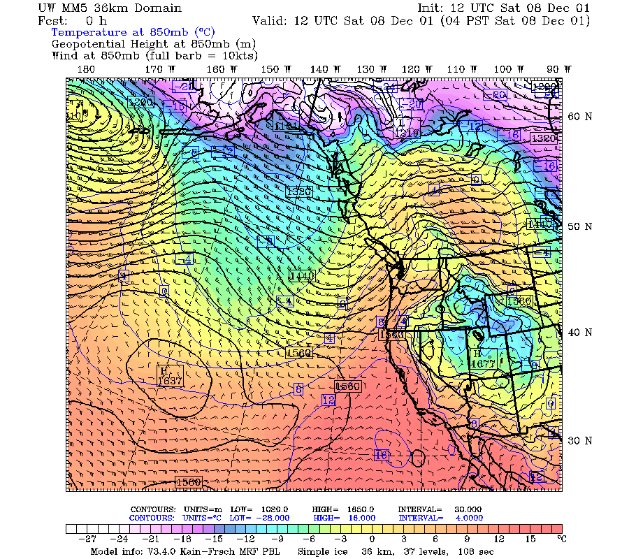
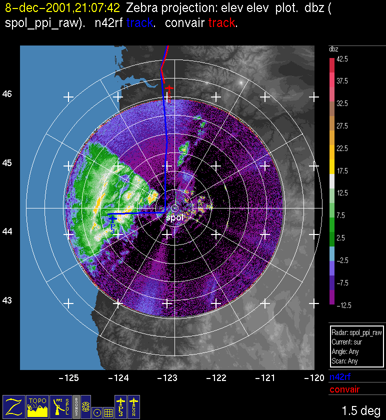
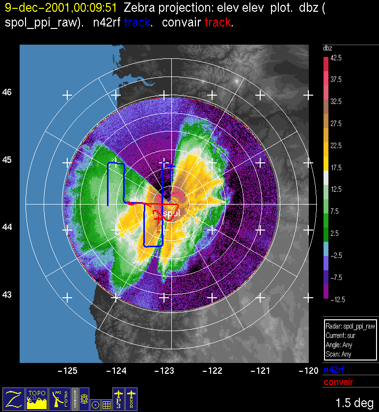
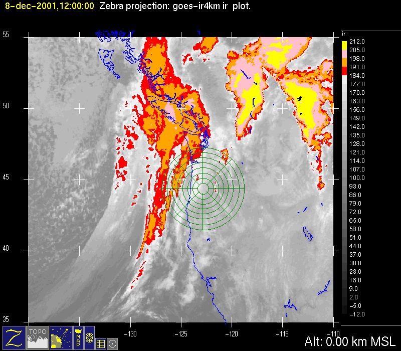
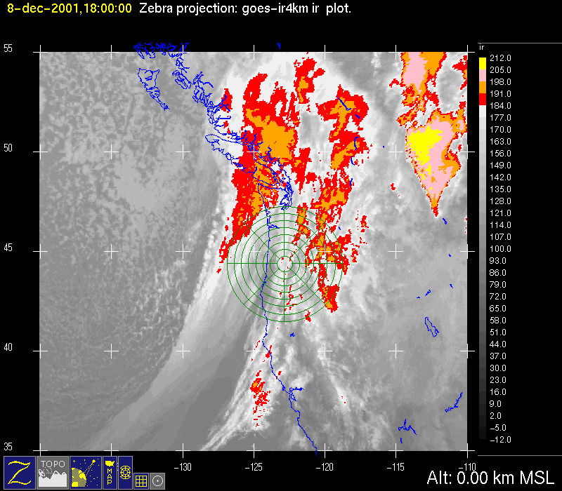
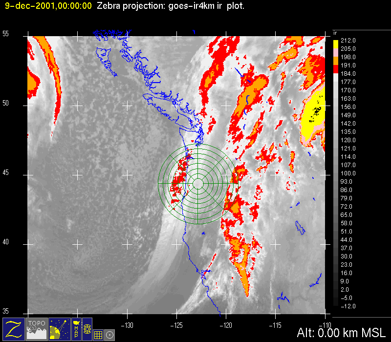
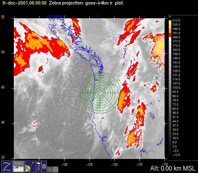
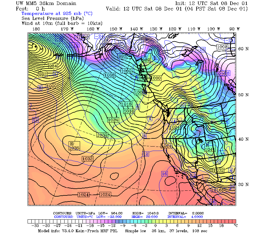
A 500 mb short wave trough was at 137 deg west and approaching Oregon at 1200 UTC 8 December (Fig. 1). At 850 mb, the winds over Oregon were southwesterly ahead of the trough (Fig. 2), and the band of moisture being advected from the southwest at this level extended to 20 deg north (Fig. 3). The surface pressure pattern exhibited a rather weak trough off the coast at this time (Fig. 4). The frontal cloud band was approaching the northwest Oregon coast at 1200 UTC 8 December 2001 (Fig. 5a). By 1800 UTC the main frontal cloud zone was centered over the S-Pol radar (Fig. 5b). By 2100 UTC, S-Pol was seeing echo associated with the frontal cloud band ; it was a contiguous region of weak echo with some embedded cellular elements; the P-3 aircraft was beginning to fly a dual-Doppler pattern in this echo (Fig. 6a). The surface front was reportedly near the leading edge of this cloud band. The rear portion of the frontal cloud region had a more intense appearance with a sharp back edge and patches of colder cloud top that looked wavelike in some enhancements. Possibly these are another example of wavelike rainbands. This cloud band was moving across the northwestern portion of the S-Pol area by 0000 UTC 9 December (Fig. 5c). The radar echo was a contiguous region of diffuse snow echo of moderate intensity with a bright band surrounding the radar location in the 1.5 deg elevation PPI, and the two aircraft were flying a coordinated pattern, with the P-3 continuing the dual-Doppler pattern and the Convair flying a microphysics vertical profile (Fig. 6b, Fig. 6c).
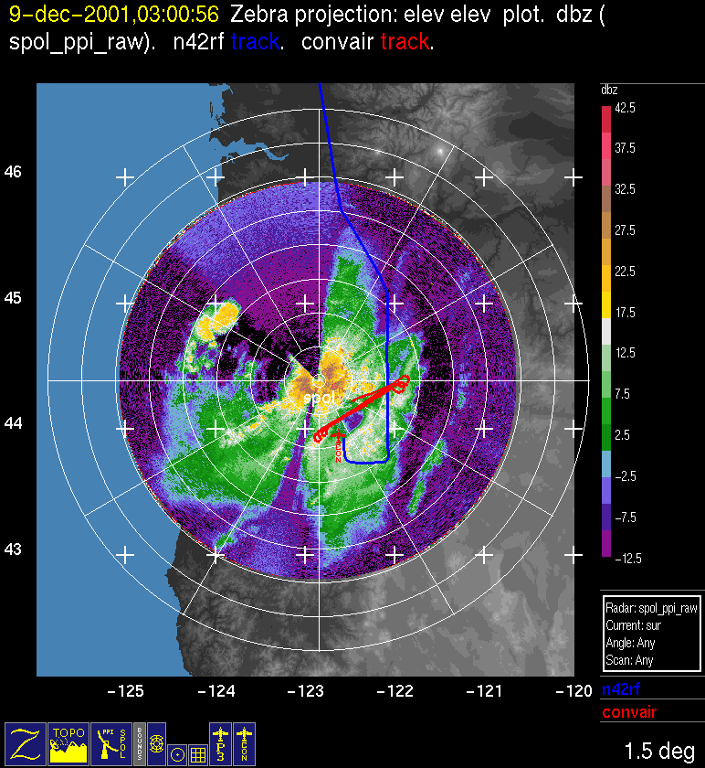
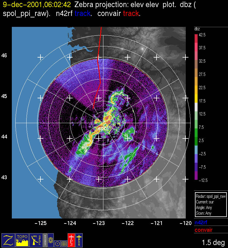
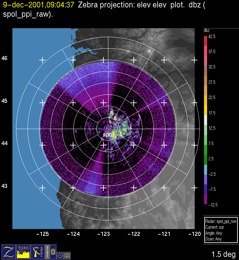
The back edge of the radar echo associated with the frontal cloud band had a wavy continuous pattern of narrow intense echo when it passed the radar at 0300 UTC (Fig. 6d). It looked like a narrow cold frontal rain band but apparently was not, as the front was reportedly in the leading edge of the cloud band, as noted above. By 0600 UTC the frontal cloud region had passed the radar area (Fig. 5d), and the radar showed only weak postfrontal cells over the mountains to the east of S-Pol (Fig. 6e).
Convair-580 Summary
UW Flight Number:
1897
Period of Flight:
2018-2351 UTC, 8 December 2001
Main Accomplishment of Flight:
Profile from 7,000 to 17,000 ft through postfrontal rainband on Oregon coast (P-3 flew below Convair-580). Landed in Eugene.
Instrument Problems:
Counts in clear air on PMS 1-D cloud probe.
Flight Scientist:
Peter V. Hobbs
Approximate UTC Timeline (Local time= UTC-8 hours) Activity for UW Flight 1897:
2028 |
Takeoff. |
2028-2151 |
Transit. |
2151-2206 |
East à west through front at 7,000 ft. |
2209- |
2219 West à east climb 7,000 ft à 9,000 ft. |
2223-2232 |
East à west at 9,000 ft. |
2235-2244 . |
West à east at 11,000 ft |
2244-2255 |
East à west at 11,000 ft. |
2257-2310 . |
West à east climb to 13,000 ft |
2310-2317 |
East à west at 13,000 ft. |
2318 |
West à east climb to 17,000 ft. |
UW Flight Number:
1898
Period of Flight:
0024-0600 UTC, 9 December 2001
Main Accomplishment of Flight:
Takeoff from Eugene, Oregon. Profile from 19,000 ft down to minimum allowable altitude over Santiam Pass in postfrontal conditions (possibly same rainband in which measurements were obtained on UW Flight 1897).
Instrument Problems:
Counts in clear air on PMS 1-D cloud probe.
Flight Scientist:
Peter V. Hobbs
Approximate UTC Timeline (Local time= UTC-8 hours) Activity for UW Flight 1898:
0032 |
Takeoff. |
0032-0056 |
Transit to start point southwest at 17,000 ft. |
0056-0130 |
Southwest à northeast at 17,000 ft. |
0130 à 0151 |
Northeast à southwest climb to 19,000 ft. |
0151 à 0206 |
Southwest à northeast at 19,000 ft. |
0211 à 0225 |
Southwest ß northeast descent to 15,000 ft. |
0230 à 0240 |
Southwest à northeast at 15,000 ft. |
0243 à 0258 |
Southwest ß northeast descent. to 13,000 ft. |
0300 à 0312 |
Southwest à northeast at 13,000 ft. |
0318 à 0337 |
Southwest ß northeast descent to 11,000 ft. |
0341 à 0400 |
Southwest à northeast at 11,000 ft. |
0400-0430 |
From northeast to southwest at minimum altitude above terrain. (Little icing picked up—rainband?) |
0430-0447 |
CCN spectra measurements below cloud base just south of Eugene in in-flow air to orographic clouds. |
P-3 Summary
P-3 Flight Number:
011208H, Improve 04
Period of Flight:
1930 UTC 8 December-0324 UTC 9 December 2001
Main Accomplishment of Flight:
The P-3 flew a mixture of east-west legs through the rainband, and north-south box pattern legs.
Instrument Problems:
-
Flight Scientist:
Nick Bond
Approximate UTC Timeline (Local time= UTC-8 hours) Activity for P-3 Flight 04:
193042 UTC (47.0024, -122.28056) 348.466°, 990.1 mb, 9.0 m Engine Start
193746 UTC (47.90020, -122.28056) 178.822°, 989.9 mb, 9.0 m Block Out
194929 UTC (47.91655, -122.28580) 178.704°, 991.2 mb, 8.0 m Takeoff temp 8.2 oC, wind 185o/12 kts
195119 UTC (47.85594, -122.33766) 235.451°, 915.1 mb, 826.0 m at 700 m, wind 190o/43kts temp 4.3 oC; cloud base 1000 m; 210/40kts at 1500 m, temp 2.6 oC/0.4
195928 UTC (47.55371, -122.66574) 195.373°, 654.2 mb, 3474.0 m radar up, wind 217o/55kts at 3600 m; winds at 700 mb 10-20deg more southerly than progged by models.
200853 UTC (47.07281, -122.91345) 180.152°, 570.6 mb, 4545.0 m FSSP has been in zero bin (default) (not much except for top bin). Wind 220o/65Kts and temp -15.5 oC/-15.8, flying through mid-level ice, see precip 60 km to west over coastal mts.
202002 UTC (46.41760, -123.12372) 194.735°, 573.5 mb, 4103.0 m switched FSSP to bin 3 (seeing 4-5 bins) at 570 mb. Wind 216o/56kts
203052 UTC (45.76229, -123.04787) 174.400°, 585.2 mb, 3930.0 m start decent down to 6 kft.
203913 UTC (45.24809, -123.01306) 184.851°, 813.5 mb, 1780.0 m reached 6kft at point A; switched FSSP back to 1 bin as we descend into precip. Temp –8 oC at 3500m plan to head west to the coast at 44 23".
205349 UTC (44.34367, -123.03656) 187.153°, 813.8 mb, 1727.0 m turning towards west, will track along lat to 124.5o at 7kt ft, temp at 7kft is -2.2 oC, well defined precip band 25 km west of coast
210051 UTC (44.31748, -123.62224) 268.013°, 756.2 mb, 2252.0 m temp dropped to -4.8 oC at 7kft. Entering the leading edge of band.
210424 UTC (44.31105, -123.92717) 269.664°, 756.3 mb, 2044.0 m encountered some mod turbulence over coastal range. Well defined ne-SW band 20 nmi from coast. Near the coast, there is cyclonic shear, wind reduction to 226o/12kts
211219 UTC (44.29455, -124.59361) 266.523°, 754.2 mb, 2422.0 m penetrating band at 7kft. Winds slowly coming up to 240o/33kts. Temp at -5.0 oC. going to 125 oW then turning back to east.
212711 UTC (44.30285, -124.21559) 88.861°, 622.4 mb, 3915.0 m at the coast heading west at 13kft, temp -10.5 oC, precip band not as well defined near coast. FSSP set to level 1 a few minutes ago.
213240 UTC (44.30750, -123.61615) 90.302°, 629.5 mb, 3571.0 m started decent down to 7kft. A lot of SCW at –8 oC, not much ice.
213612 UTC (44.35722, -123.29138) .689°, 745.9 mb, 2428.0 m started turn to the northwest. Not much precip just to the east of coastal mountains.
214020 UTC (44.59759, -123.48404) 326.896°, 784.3 mb, 1740.0 m getting a lot of needles here at –4 oC. Heading to 123 50" to start first north-south leg.
214720 UTC (44.94147, -123.80867) 325.684°, 784.5 mb, 1636.0 m entering band. Mod turb. Winds came around to 280/20kts. Descending down to 6kft.
215032 UTC (45.03992, -123.79863) 153.784°, 815.6 mb, 1629.0 m heading south for Doppler leg at 6kft. Lots of nice dendrites at -3 oC.
215655 UTC (44.62613, -123.84238) 180.432°, 815.8 mb, 1552.0 m back in the needles. At -3 oC. Winds 280o/38kts. A nice sloping echo of leading edge of precip 20 nm east of plane
220607 UTC (44.03448, -123.84196) 177.844°, 815.3 mb, 1722.0 m winds have decreased 300o/11kts. More SCW and some needles
221023 UTC (43.75362, -123.83566) 219.179°, 815.4 mb, 1453.0 m stared turn to west at 6fkt.
221447 UTC (43.74487, -124.17946) 329.985°, 815.1 mb, 1790.0 m heading north along band at 6kft. Right along precip band (to 25 dbZ), which has broadened as it made landfall. Temp -3.5 oC, wind 283o/35kts
221832 UTC (43.97832, -124.17075) 359.193°, 815.7 mb, 1806.0 m right in frontal band, nice dendrites, wind 280o/43kts. Some mod bumps. Winds down to 304o/12kts 8 minutes later.
222950 UTC (44.65799, -124.16823) 359.817°, 816.8 mb, 1783.0 m precip is quite stratiform (no defined band anymore). Very little or no enhancement of precip over coastal range even though winds 280o/12kts.
223518 UTC (44.99809, -124.15778) 42.150°, 816.8 mb, 1782.0 m started turn to east. Wind 293o/21Kts at 6kft. Temp -3.5 oC; nice dendrite-like particles.
223837 UTC (44.98188, -123.84419) 147.255°, 816.9 mb, 1500.0 m turn to south. Retracing previously done southbound leg. Wind 300o/23kts. Precip enhancement more evident over coastal range.
225430 UTC (43.91177, -123.82748) 185.301°, 816.6 mb, 1534.0 m winds increasing again to 290o/35kts
225603 UTC (43.81120, -123.83583) 195.913°, 816.2 mb, 1463.0 m turn to head west back to coast for another box. Winds 288o/37kts temp -3.8C. Within a broad straitform band to 30 dBZ near surface.
225852 UTC (43.76714, -124.04846) 258.232°, 816.4 mb, 1635.0 m radar taken down (LF was frozen). Winds up to 280o/43kts at 6kft
230227 UTC (43.90622, -124.16901) 1.529°, 816.8 mb, 1791.0 m made turn to north a few minutes ago. Radar back up.
232009 UTC (44.99059, -124.15999) 27.526°, 816.3 mb, 1790.0 m start turn to east at 6kft. Temp -4.0 oC. 262o/14kts.
232849 UTC (44.64435, -123.83098) 179.288°, 816.7 mb, 1682.0 m aircraft turned to south ~10 min ago along same southbound leg.
233214 UTC (44.41893, -123.81813) 124.741°, 816.8 mb, 1571.0 m turn to east half way through track. Report of fropa at S-pol and precip is at the Casacade foothills. Still in widespread stratiform echo to25 dBUTC.
233643 UTC (44.38310, -123.40706) 164.631°, 816.6 mb, 1459.0 m turn to south to finish leg in the lee of the coastal range. Temp -2.6 oC, wind 290o/27kts
234650 UTC (43.76064, -123.32285) 84.884°, 816.4 mb, 1436.0 m turn east to head towards point to start lawnmower patterns. Wind 266o/17Kts some needles and SWC drops.
234953 UTC (43.78027, -123.03145) 34.979°, 816.7 mb, 1569.0 m heading north at point F. Wimd 264o/10Kts. Broader precip band orientated NNE-SSW.
000518 UTC (44.74072, -123.03261) 357.737°, 816.8 mb, 1723.0 m nice overhanging echo in the lee of the coastal range to the west of track. Wind 270o/14Kts. Temp -3.0 oC
000859 UTC (44.98566, -123.03218) 15.608°, 816.0 mb, 1750.0 m started east turn at point A. Ascending up to 8kt ft. At 8kft, temp -6.3 oC, wind 275o/39kts.
001259 UTC (45.01235, -122.60570) 107.345°, 756.6 mb, 2016.0 m At point B, heading south at 8kft. Wind 274o/33Kts temp -6.2 oC, plate like ice particles. Good radar coverage on either side of plane.
001546 UTC (44.83629, -122.56950) 180.569°, 757.2 mb, 1641.0 m radar down at 00:15:00, back up at 00:18:22UTC
003042 UTC (43.88220, -122.56665) 179.995°, 757.1 mb, 1632.0 m penetrated through front at 8kft 10 min ago. Winds now 235o/24kts. Downward sloping echo over windward slope (front?)
003208 UTC (43.79451, -122.56262) 151.953°, 755.1 mb, 1889.0 m At point G, heading east. Ascended up through shear layer. Wind 218o/47Kts at 11kft temp -9.0
003726 UTC (43.80333, -122.05820) 8.581°, 674.0 mb, 1853.0 m At point H, heading north. Echo very weak (5DBUTC) under plane, but some enhancement (to 25 dBZ) over windward slopes
005308 UTC (44.97742, -122.08389) 353.379°, 674.2 mb, 2660.0 m At point C, heading west back to point B. At 11kft, temp -11.3 oC, wind 242o/30kts. Start decent to 8kft at 00:56:00UTC
005849 UTC (45.00520, -122.53674) 245.799°, 747.5 mb, 1932.0 m At point B, heading south at 8kft. Temp -7.0 oC, wind 286o/30kts
011735 UTC (43.79920, -122.56389) 152.371°, 756.3 mb, 1947.0 m At point G, heading east to point H, climbing to 11 kft. At 11kft, winds 222o/43kts, temp -10.5 oC
012206 UTC (43.77466, -122.12546) 75.845°, 675.4 mb, 1608.0 m At point H, heading north to point C. Start of echo 20 nmi to the east of plane (which is near the crest),. Some spillover evident.
014008 UTC (45.00423, -122.17944) 272.472°, 706.2 mb, 1664.0 m At point C, heading west to point B. Descending down to 8kft.
014412 UTC (45.00835, -122.50406) 261.594°, 756.5 mb, 1869.0 m At point B, heading south to point G at 8 kft., wind 285o/17Kts, temp -7.1 oC
020310 UTC (43.78083, -122.55771) At point G, heading to point H, ascending to 11 kft. At 11kft, wind 245o/27kts.
020834 UTC (43.78786, -122.07257) 358.298°, 674.1 mb, 1863.0 m At point H, heading north. Wind 238o/35Kts. Temp -11.8 oC. echo extends to crest, but fairly weak to 24 dBZ, tops to 17 kft.
021406 UTC (44.18874, -122.08324) .261°, 674.0 mb, 2815.0 m winds slowly veering to 255o/23kts. Temp -12.0 oC. Echo tops becoming more shallow. Some enhancement over ridges.
022708 UTC (45.11547, -122.10173) 336.687°, 648.0 mb, 2305.0 m At C, heading home. Interesting case, great documentation of microphysical/precip evolution of a landfalling front.
025645 UTC (47.23756, -122.78838) 15.834°, 856.3 mb, 1344.0 m radar taken down. Freezing level 1200 m.
032022 UTC (47.91183, -122.28566) 179.097°, 991.3 mb, 9.0 m landed. Penetrated nice Puget Sound convergence zone to the north of Paine. +- 3-4 m/s vertical motion. Nice shear layer from 270o/20 kts at 900 m to 220o/12kts at 200 m
032440 UTC (47.90025, -122.28049) 260.359°, 250.6 mb, 9.0 m block in
S-Pol Radar Summary
The S-Pol radar was run continuously in the same mode of operation for the entire length of the field project.
Summary of Mobile Upstream Sonde Launches
Launch times at: Creswell, OR, Lat: 43.9200, Lon: -123.0250, Elev: 165 m
1816 UTC 8 Dec
2118 UTC 8 Dec
0021 UTC 9 Dec
Summary of Leeside Sonde Launches
Launch times at: Black Butte Ranch, OR (a.k.a. ISS-3), Lat: 44.379, Lon: -121.679, Elev: 1027 m
1600 UTC 8 Dec
1800 UTC 8 Dec
2100 UTC 8 Dec
0000 UTC 9 Dec
0300 UTC 9 Dec
0600 UTC 9 Dec
Summary of NWS Sonde Launches from Salem (SLE)
Launch times:
1200 UTC 8 Dec (standard)
1500 UTC 8 Dec (special)
1800 UTC 8 Dec (special)
2100 UTC 8 Dec (special)
0000 UTC 9 Dec (standard)
0300 UTC 9 Dec (special)
Summary of Snow Crystal Ground Measurements
Measurement times:Every 15 minutes from
1800 UTC 8 Dec-0500 UTC 9 Dec (at Santiam Pass, Corbett, and Tombstone Sno Park)
