IOP 15: 19-20 December 2001
Time Period of IOP
2100 UTC 19 Dec-0609 UTC 20 Dec
Overview of IOP
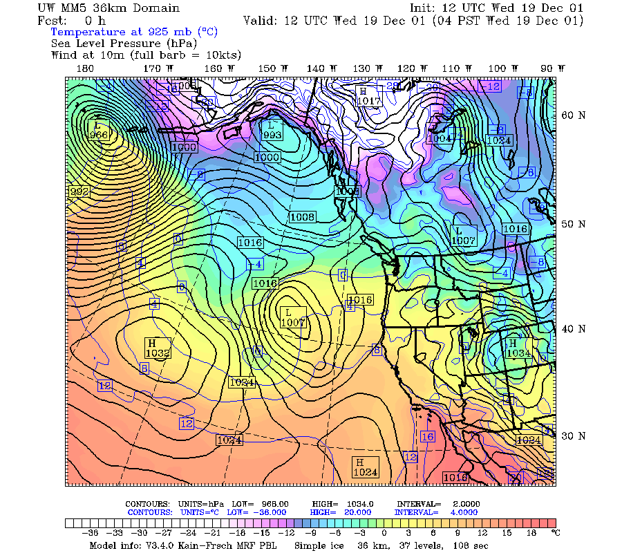
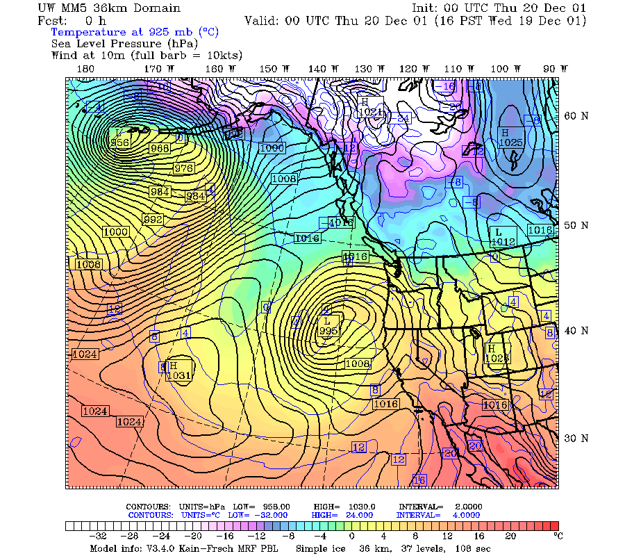
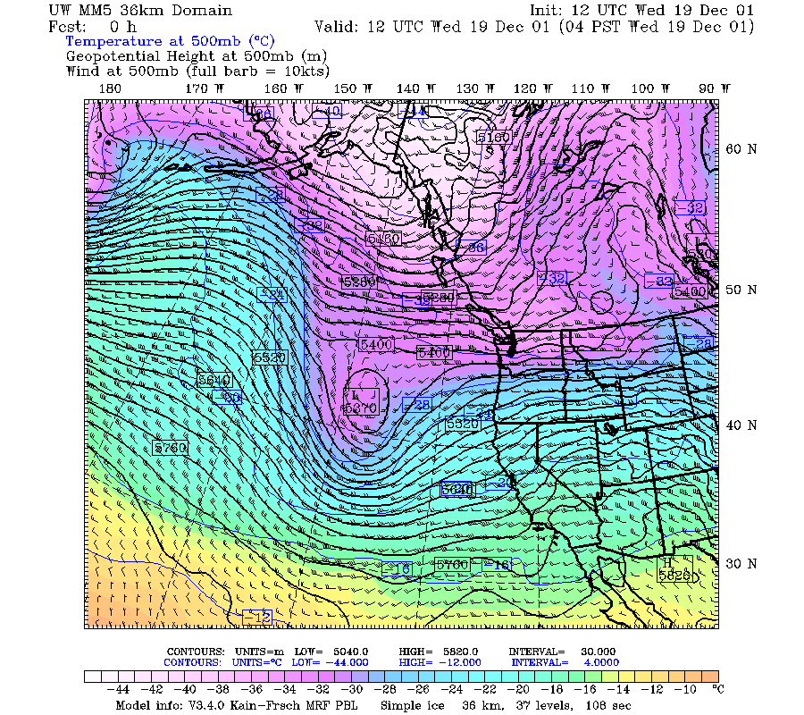
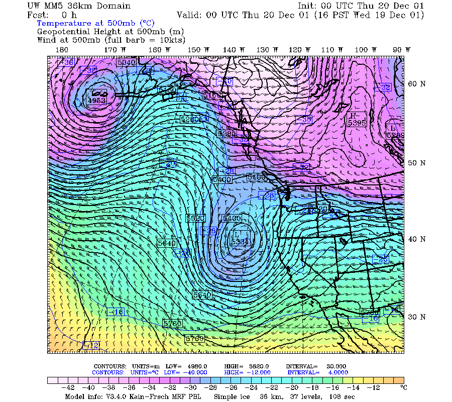
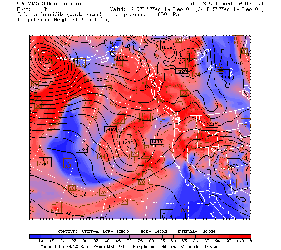
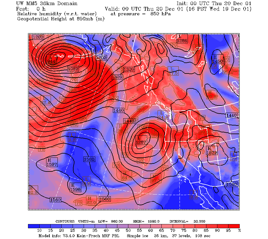
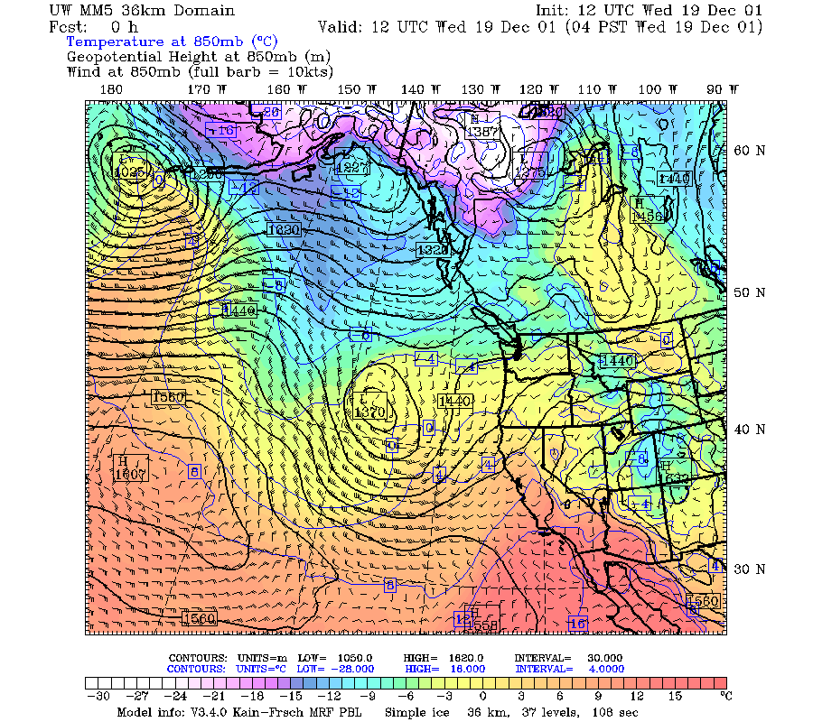
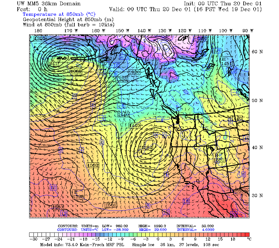
This case differed from all the previous IMPROVE II cases in that a low to the southwest of Oregon produce easterly flow over the study area, so that the eastern slopes of the Cascades became the windward slope of the terrain. Thus, the orographic enhancement occurred on the eastern rather than the western slopes when the easterly flow became predominant. At 500 mb, a well defined short wave trough was moving eastward, intensifying, deepening, and beginning to cut off between 19 December 1200 UTC and 20 December 0000 UTC ( Fig. 1a, Fig. 1b). As the intensifying low moved eastward, the 850 mb flow changed from weak southerly to strong east-southeasterly (Fig. 2a, Fig. 2b). The tongue of high relative humidity at 850 mb reached into the storm from 15 deg south (Fig. 3a, Fig. 3b). The sea-level pressure and temperature pattern showed a warm front moving over the study area during this time period (Fig. 4a, Fig. 4b).
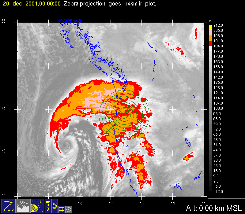
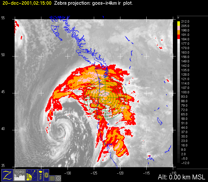
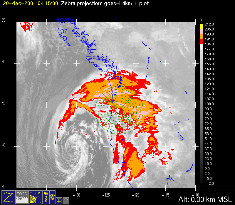
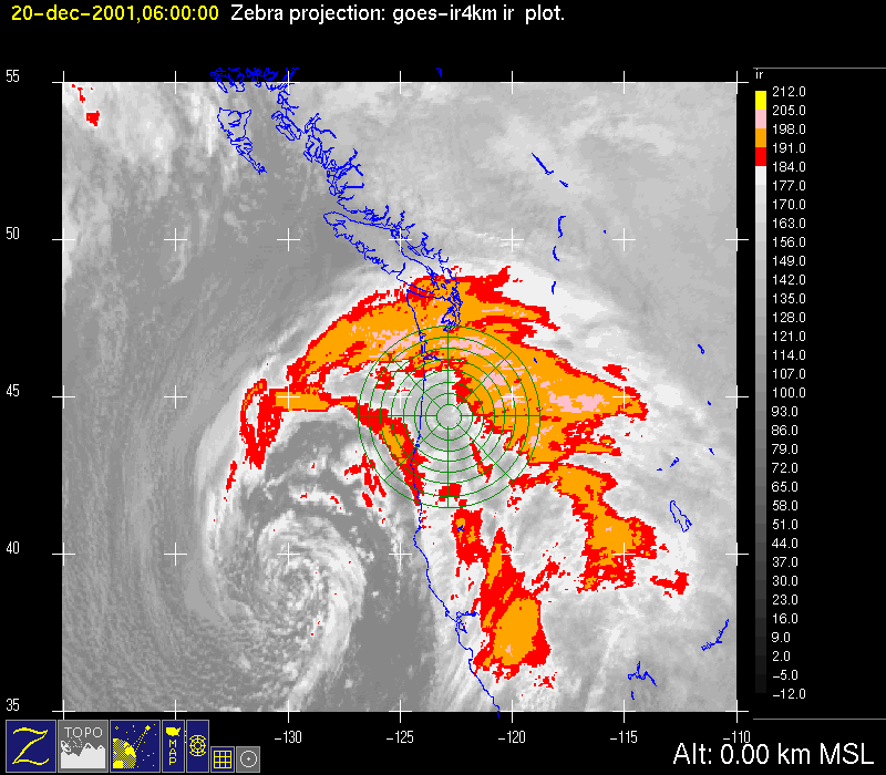
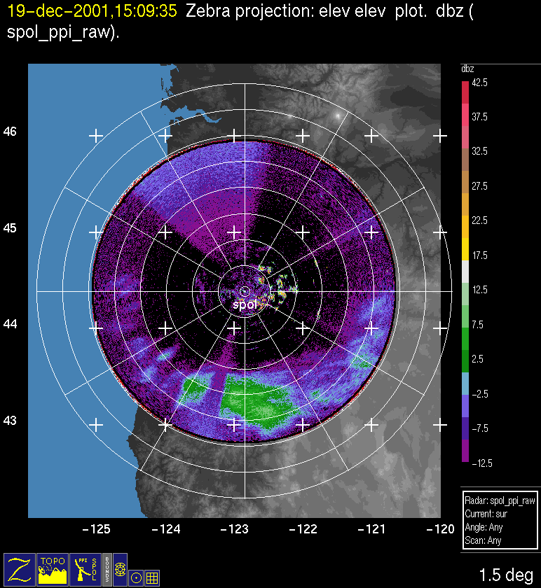
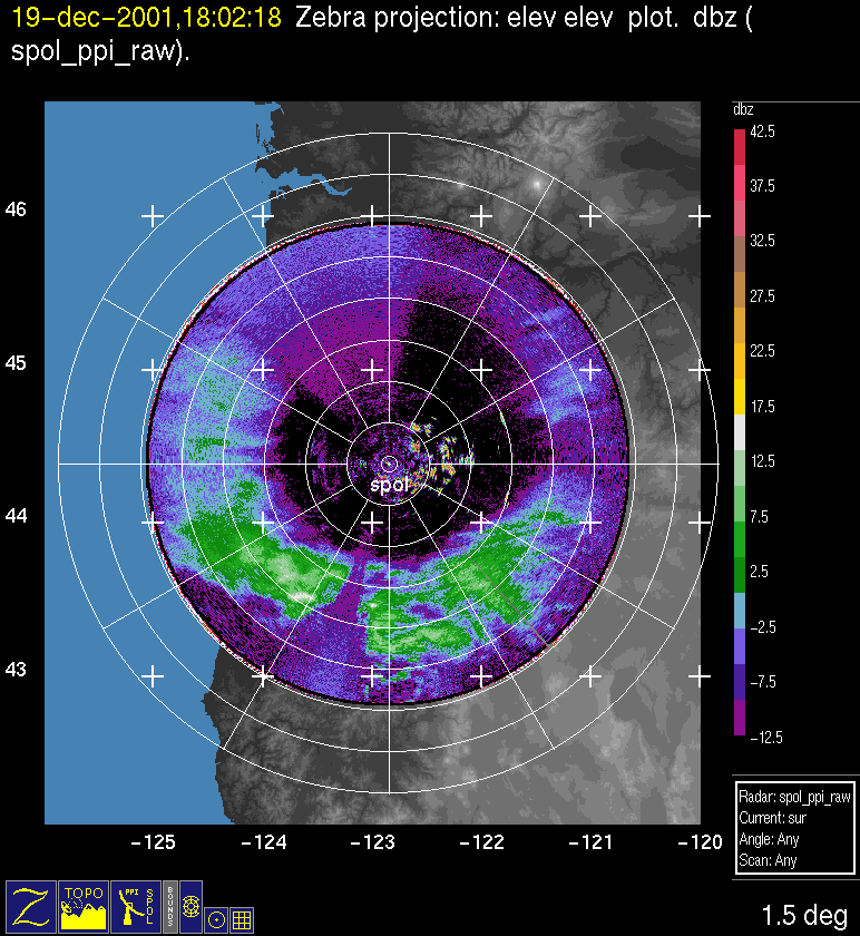
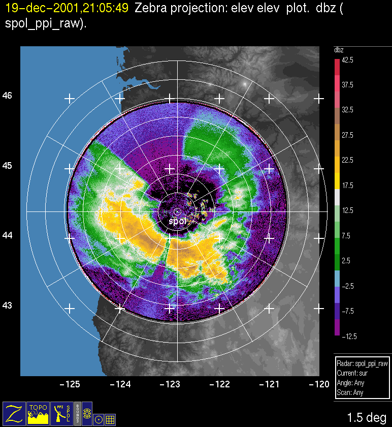
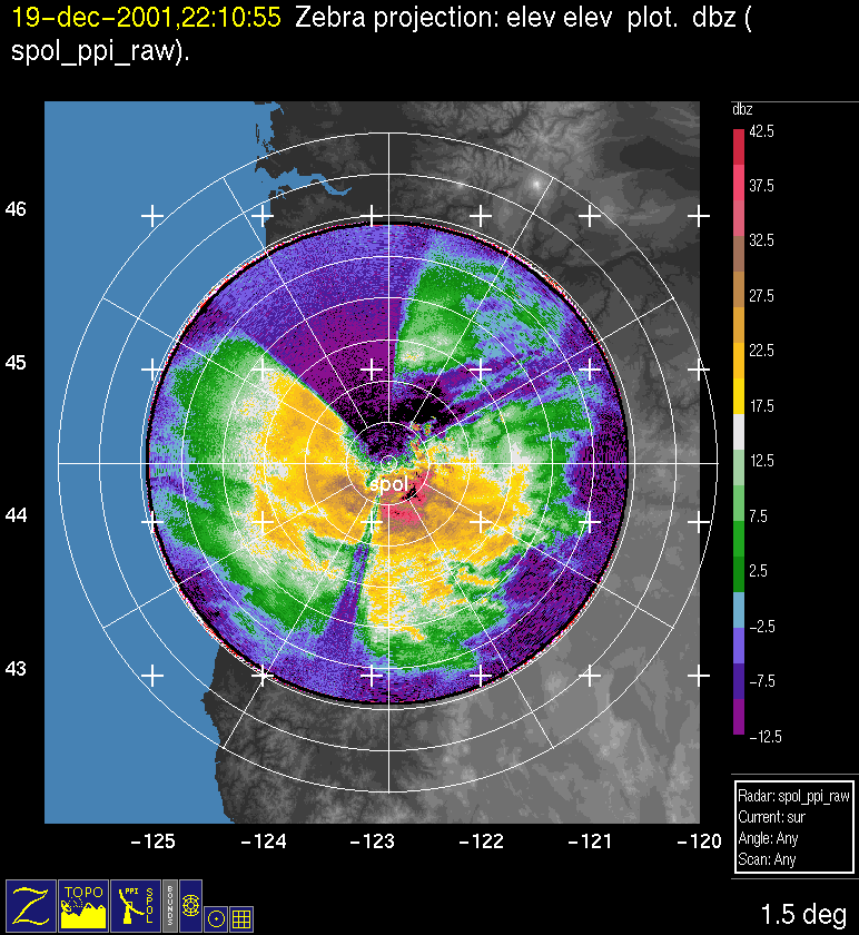
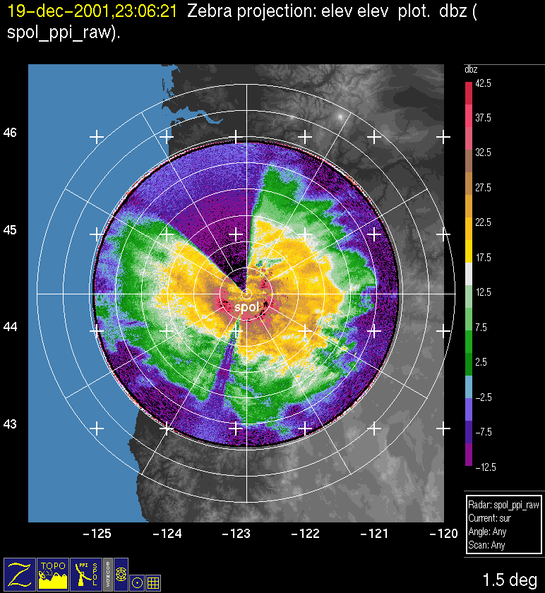
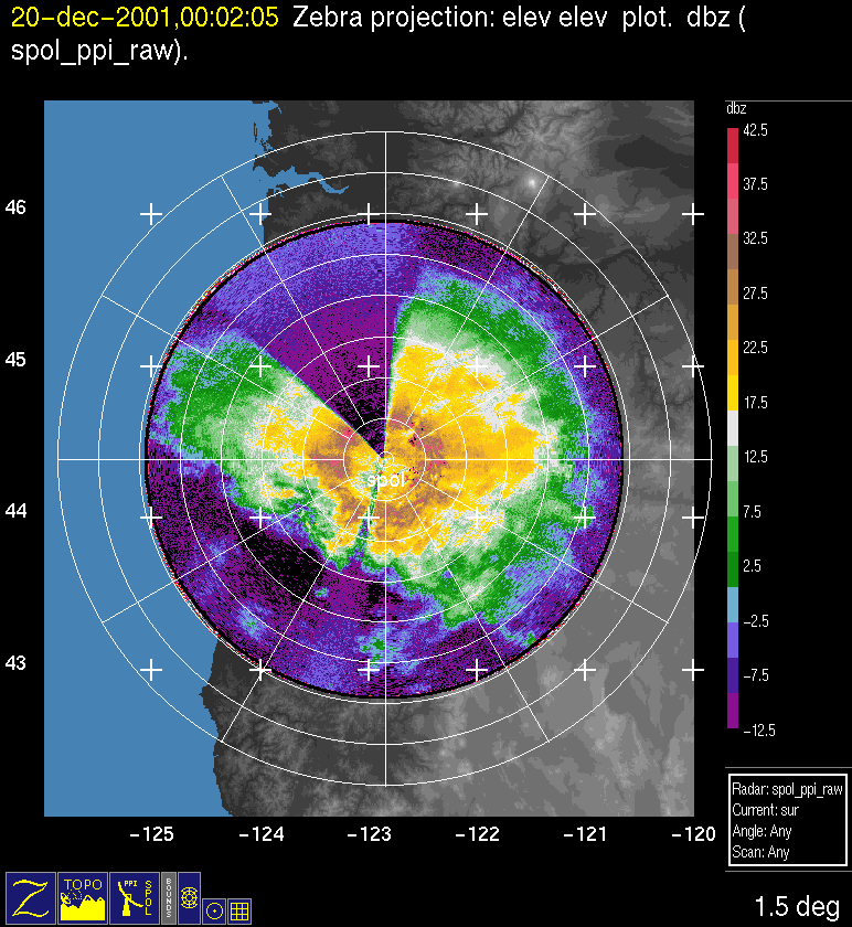
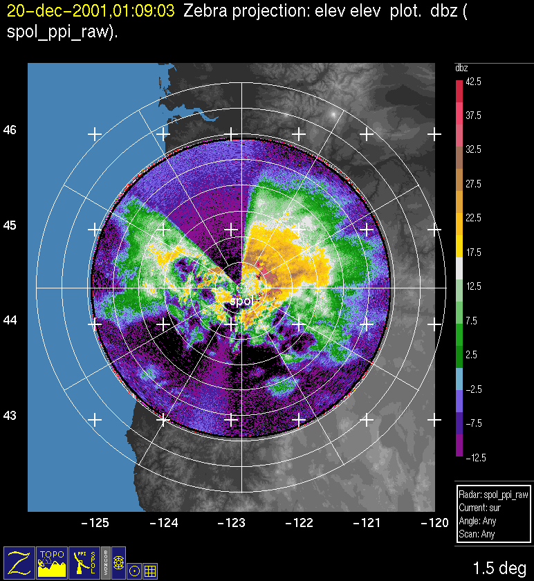
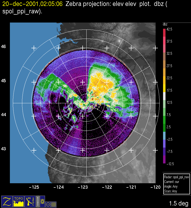
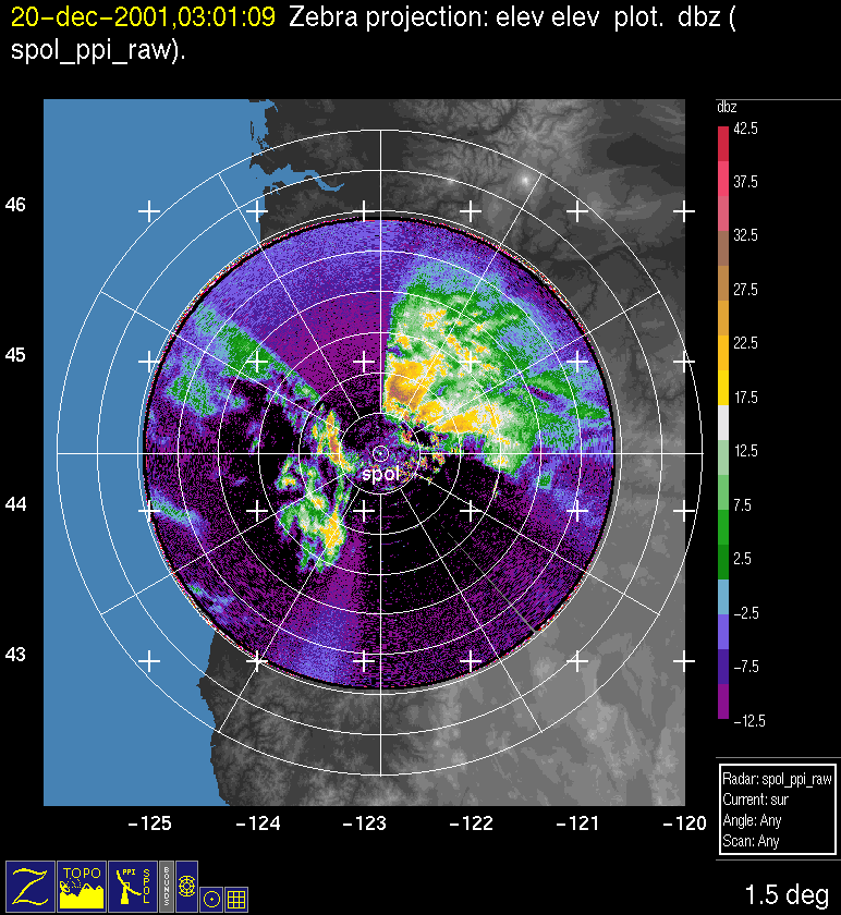
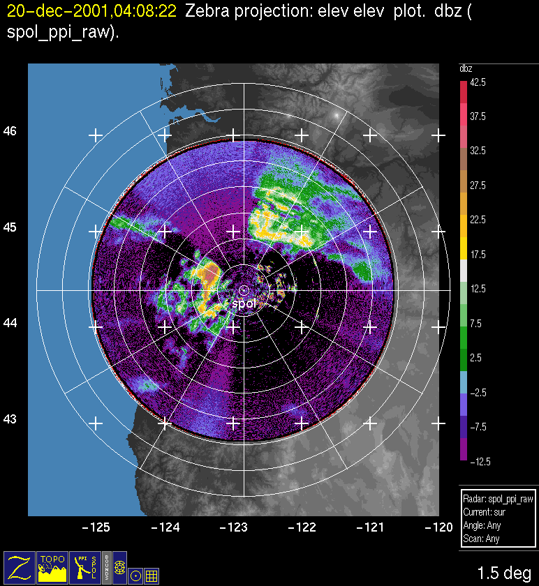
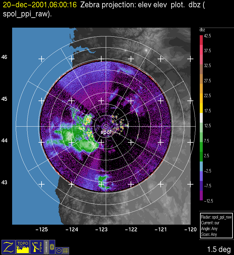
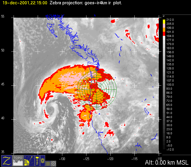
The Convair flew its first mission from 2229 UTC 19 December-0419 UTC 20 December. The infrared satellite data for 19 December 2200 UTC and 20 December 0400 UTC showed the warm-frontal clouds moving over the region during this time period (Fig. 5a, Fig. 5b, Fig. 5c, Fig. 5d). The Convair flew north-south legs both east and west of the crest of the Cascades to see the warm-frontal structure on both sides of the mountains. Before the aircraft reached the study area, the S-Pol showed a layer of precipitation aloft and gradually lowering (indicated by the shrinking circle of no echo around the radar at 1.5 deg elevation, Fig. 6a, Fig. 6b, Fig. 6c). At 2200 UTC, approximately the beginning of the Convair's first flight, the echoes reached the surface (Fig. 6d). At 2300 UTC, the echo appeared as a relatively featureless continuous layer of snow above a well defined intense bright band (at the first range ring in Fig. 6e). By 0000 UTC 20 December, the bright band was weaker and at a higher altitude, indicating general warming with the passage of the warm frontal region (Fig. 6f). By 0100 UTC, the echo was weakening and disappearing to the southwest of the radar, while the echo to the northeast was more continuous (Fig. 6g). From 0200-0300, the echo to the northeast weakened and more cellular echo appeared to the northeast (Fig. 6h, Fig. 6i), as the cold frontal part of the system approached (cf Fig. 5b).
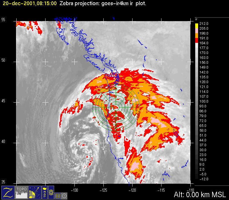
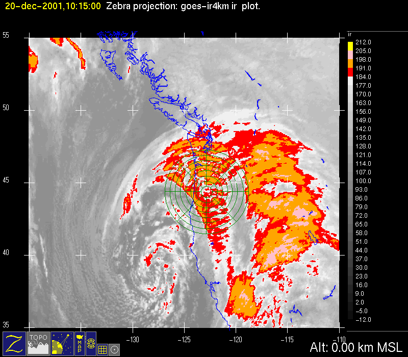
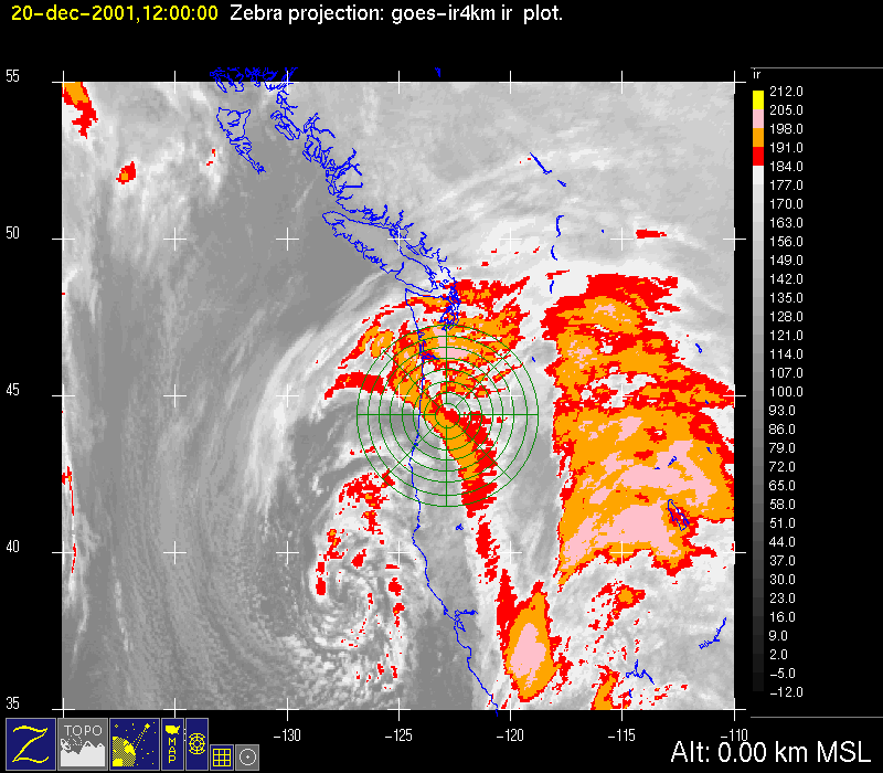
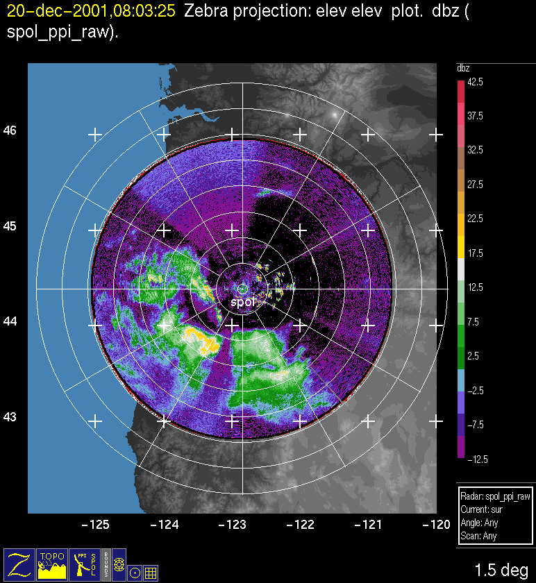
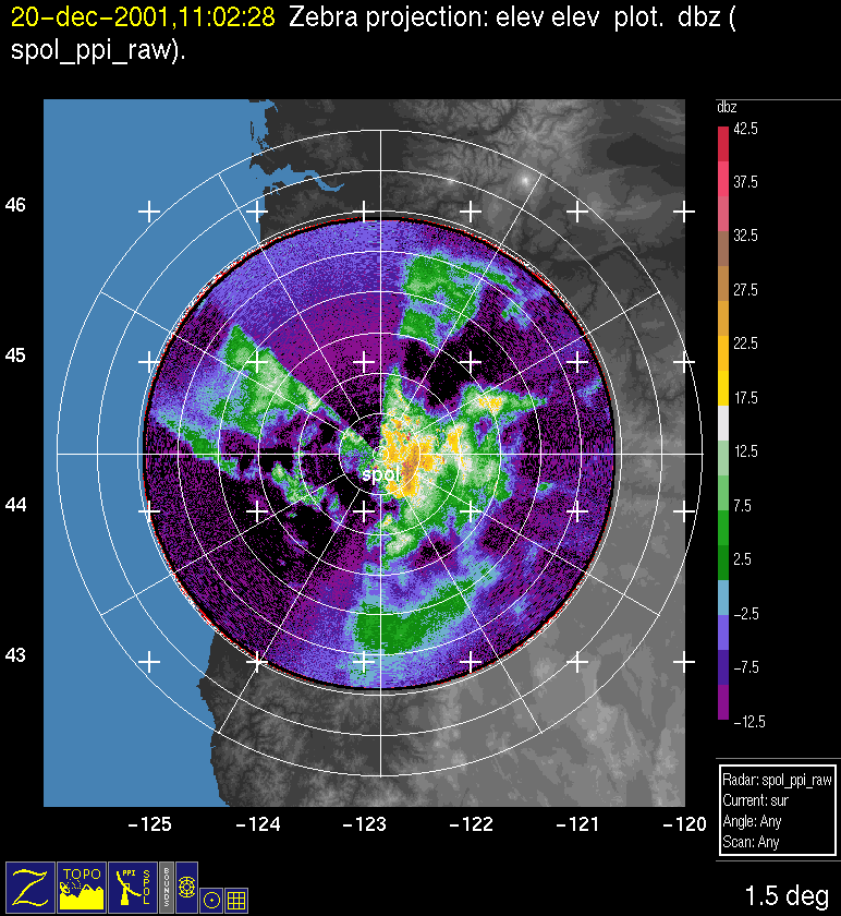
The Convair's second flight was from 0506-0609 UTC 20 December. The infrared satellite data for 0400 UTC-0600 UTC showed that the S-Pol radar was in a gap between warm-frontal clouds to the east of the mountains and cold-frontal clouds moving in from the west across the Oregon coast (Fig. 5d, Fig. 5e). At 0400 UTC, the S-Pol radar showed the warm-frontal precipitation aloft to the northeast of the radar, and convective (warm sector?) echo just west of the radar (Fig. 6j). At 0600 UTC, the warm-frontal echo to the northeast had disappeared, and a fairly continuous echo was moving in from the southwest (Fig. 6k) in association with the cold-frontal cloud band (Fig. 5e). From 0800-1200 UTC, the satellite imagery showed the cold frontal cloud band moving slowly across the radar area (Fig. 5g, Fig. 5h, Fig. 5i). The satellite images suggest that the frontal cloud band had embedded substructure in the form of transverse wavelike bands (esp. Fig. 5h), and the radar showed weak echo with embedded cellular structure (Fig. 6l, Fig. 6m).
Convair-580 Summary
UW Flight Number:
1902
Period of Flight:
2229 UTC 19 December-0419 UTC 20 December 2001
Main Accomplishment of Flight:
North-south oriented vertical profile from 18,000 to 8,000 ft west of Oregon Cascade crest. West-to-east cross-mountain track in southern edge of rainband. Truncated north-south stack in rainband east of Cascade crest. Landed in Eugene, Oregon.
Instrument Problems:
PMS 1-D cloud probe (?).
Flight Scientist:
Nick Bond
Approximate UTC Timeline (Local time= UTC-8 hours) Activity for UW Flight 1902:
2229 |
Engines on. |
2231 |
Out of blocks. |
2241 |
Takeoff. |
2253 |
No TANS/winds. |
2257 |
2-DC & HVPS working. |
2302 |
Winds now working 160˚ @ 5 m s–1 @ 576 mb. |
2322 Lat. 45˚45' |
. Winds 218˚ @ 20-25 m s–1. Possible significance of warm front aloft. |
2336 |
Decide to ascend to 18,000 ft. |
2340 |
Starting first southbound (18,000-16,000 ft). Wind 215˚ @ 22 m s-1, T ~–21˚C. Solid cloud. |
2348 |
Conversation with S-Pol radar operator indicates that legs should be shorten because of back edge of system approaching. |
0008 |
CPI not working; open ground visible below. |
0010 |
End of leg 1. |
0012 |
Start of leg 2 (north bound at 16,000 ft). |
0020 |
End of leg 2 (whole leg in precipitation). |
0023 |
Start of leg 3 (south bound 16,000-14,000 ft). Winds 205˚ @ 20 m s-1, T ~–14˚C, solid cloud. |
0027 |
End of leg 3 (steep descent). |
0029 |
Start of leg 4 (north bound @ 14,000 ft). |
0033 |
Heavier precipitation; bigger crystals. Wind 210˚ @ 22 m s-1. LWC 0.04 à 0.1 g m-3. |
0038 |
End of leg 4. |
0041 |
Start of leg 5 (south bound 14,000-12,000 ft). |
0049 |
End of leg 5. |
0050 |
Possible computer problem; displays not updating. |
0056 |
Data displays back. |
0058 |
End of leg 6. |
0100 |
Start of leg 7 (south bound 12,000 ft). |
0107 |
End of leg 7; descent at turn. |
0108 |
Start of leg 8 (north bound, 10,000 ft). Wind 212˚ @ 18 m s-1. T ~–5˚C. |
0116 |
End of leg 8. |
0120 |
Start of leg 9 (south bound 10,000-8,000 ft). |
0124 |
2-DC temp. down. |
0127 |
End of leg 9. |
0128 |
Start of leg 10 (north at 8,000 ft). Wind 185˚ @ 15 m s-1 but noisy. T ~–2˚ to –4˚C. Low LWC (0.05-0.1 g m-3). |
0132 |
Some chop |
0136 |
End of leg 10 (last north-south). Ferry to Pt. M. |
0141 |
Descending to 7,000 ft. |
0145 |
Moderate chop; near freezing level. |
0150 |
Near cloud base. |
0156 |
At Pt. M; lining up to cross mountain |
0202 |
Climb to 8,000 ft. |
0208 |
Begin climb to 10,000 ft. |
~0213 |
Turn and climb for north-south stack. |
0228 |
Start first run south bound (18,000-16,000 ft). |
0231 |
Wind 200 @ 14 m s–1. T ~–20˚C. Still in light precipitation. |
0236 |
Lighter precipitation in south end. |
0239 |
Start of second leg north (16,000 ft). Wind 210˚ @ 23 m s-1. T ~–17˚C. |
0251 |
End of second leg. |
0254 |
Start of third leg south (16,000-14,000 ft). Wind 212˚ @ 16 m s–1. |
0305 |
End of third leg. |
0307 |
Start of fourth north (14,000 ft). |
0311 |
Break in precipitation. |
0320 |
End of fourth. |
0322 |
Start of fifth south (14,000-11,000 ft). Wind 210˚ @ 17 m s–1. |
0326 |
Relatively heavy precipitation near 45˚10'. |
0332 |
End of fifth leg. |
0334 |
Heading north (descending to min ~8,000 ft). |
0340 |
Winds 125˚ @ 22 m s–1 at 8,000 ft. |
0341 |
End of descent to 8,000 ft. |
0345 |
Quasi-isothermal in climb from 8,000 to 11,000 ft; veering wind. |
0349 |
End of south bound climb. Ferry to Salem. |
0401 |
Mod. chop and precipitation. Over crest and foothills. |
0414 |
Landed at Eugene, Oregon |
0419 |
Engines off. |
UW Flight Number:
1903
Period of Flight:
0506-0609 UTC 20 December 2001
Main Accomplishment of Flight:
Transit flight from Eugene, Oregon, to Paine Field, Washington.
Instrument Problems:
PMS 1-D cloud probe (?).
Flight Scientist:
Nick Bond
Approximate UTC Timeline (Local time= UTC-8 hours) Activity for UW Flight 1903:
0506 |
Engines on. |
0514 |
Takeoff. |
0530 |
In light precipitation. |
0603 |
Landed. |
0609 |
Engines off. |
P-3 Summary
No flight
S-Pol Radar Summary
The S-Pol radar was run continuously in the same mode of operation for the entirelength of the field project.
Summary of Mobile Upstream Sonde Launches
Launch times at: Rowland, OR, Lat: 44.2800, Lon: -123.0650, Elev: 97 m
2240 UTC 19 Dec
0008 UTC 20 Dec
0306 UTC 20 Dec
0509 UTC 20 Dec
Summary of Leeside Sonde Launches
Launch times at: Black Butte Ranch, OR (a.k.a. ISS-3), Lat: 44.379, Lon: -121.679, Elev: 1027 m
2100 UTC 19 Dec
0300 UTC 20 Dec
0600 UTC 20 Dec
Summary of NWS Sonde Launches from Salem (SLE)
Launch times:
0000 UTC 20 Dec (standard)
0300 UTC 20 Dec (special)
0600 UTC 20 Dec (special)
Summary of Snow Crystal Ground Measurements
Measurement times:Every 15 minutes from
2145 UTC 19 Dec-0400 UTC 20 Dec (at Ray Benson Sno Park)
