DEEPWAVE makes use of two instrumented aircraft platforms and a range of ground-based equipment from lidars to balloon-borne instruments at six observation locations on the South Island and one on the North Island. This comprehensive suite of instruments is used in order to gather data on different types of atmospheric conditions such as wind thermodynamics, chemical processes, and air density at a range of altitudes.
DLR Falcon 20 | Mid-Altitude Aircraft
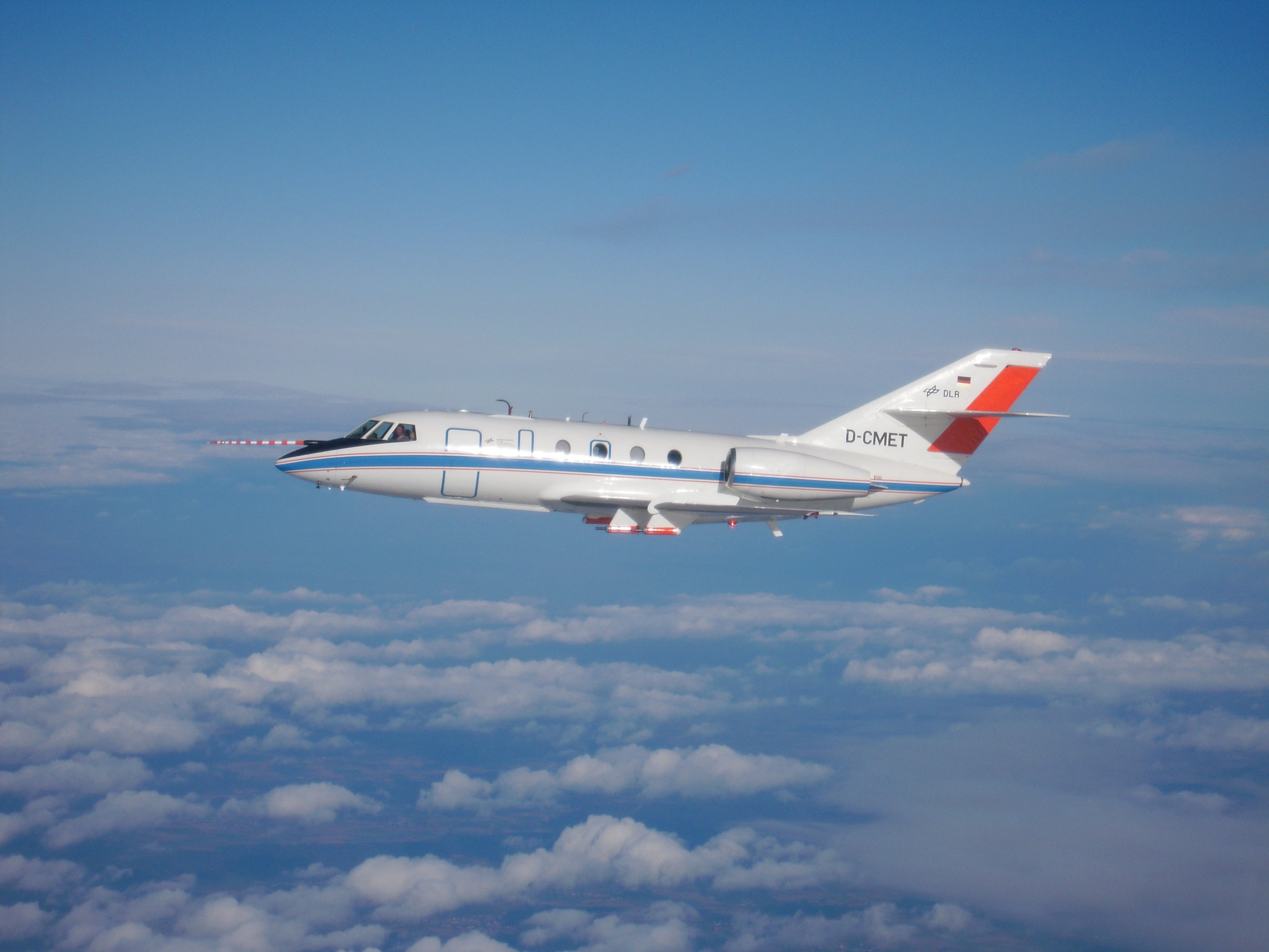 The Dassault Falcon 20, operated by DLR - the German Aerospace Center - is a very reliable and still modern aircraft. Its mechanical and aerodynamical robustness makes it an ideal research aircraft even under extreme situations like thunderstorm research or measurements in the contrail of other aircraft. Read more about the DLR Falcon-20.
| GROUND-BASED SITES |
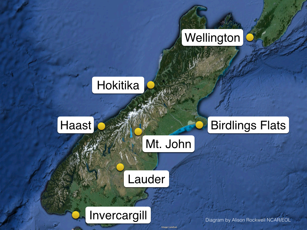 A comprehensive suite of ground-based instrumentation will be located at six sites on the South Island, and one on the North Island. Ground sites are supported by NCAR, NIWA, DLR, and the NZ Met Service. Systems include an Integrated Sounding System (ISS) measuring near-surface winds, moisture and temperature gradients; launched weather balloons measuring temperature, pressure, humidity, wind speed and wind direction; and radars and lidars measuring near surface winds.
Measurements taken at these sites are integrated with aircraft and satellite data to provide a complete vertical profile of the atmosphere from the ground up to about 100 km, ultimately providing highly detailed data for enhanced numerical model predictions.

