SOCRATES makes use of an instrumented aircraft platform as well as ship-based atmospheric profiling research instrumentation. This comprehensive suite of instruments is used in order to gather data on different types of atmospheric conditions such as cloud dynamics, aerosol size and distribution, winds, and radiation at a range of altitudes.
| RESEARCH AIRCRAFT |
NSF/NCAR HIAPER | High-Altitude Research Aircraft
 The NSF/NCAR HIAPER (High-performance Instrumented Airborne Platform for Environmental Research) is one of the most advanced aircraft for environmental research in the United States. HIAPER is owned by the National Science Foundation and operated by the National Center for Atmospheric Research (NCAR), located in Boulder, Colorado. HIAPER is a Gulfstream V business jet that has been highly modified for scientific research.
The HIAPER will be based in Hobart, Tasmania during SOCRATES and is the primary platform to characterize clouds, radiation, aerosols, and precipitation in the domain of interest south of Tasmania. For SOCRATES, HIAPER will carry a specific suite of instruments that will measure these properties. Capable of flying at altitudes as high as 51,000 feet, HIAPER can collect data at altitudes out of reach of most research aircraft. When the aircraft is flying, follow the flight track live on Google Earth.
» Read more about the NSF/NCAR HIAPER research aircraft
| SHIP-BASED FACILITIES |
Integrated Sounding System (ISS) | Atmospheric Profiling System
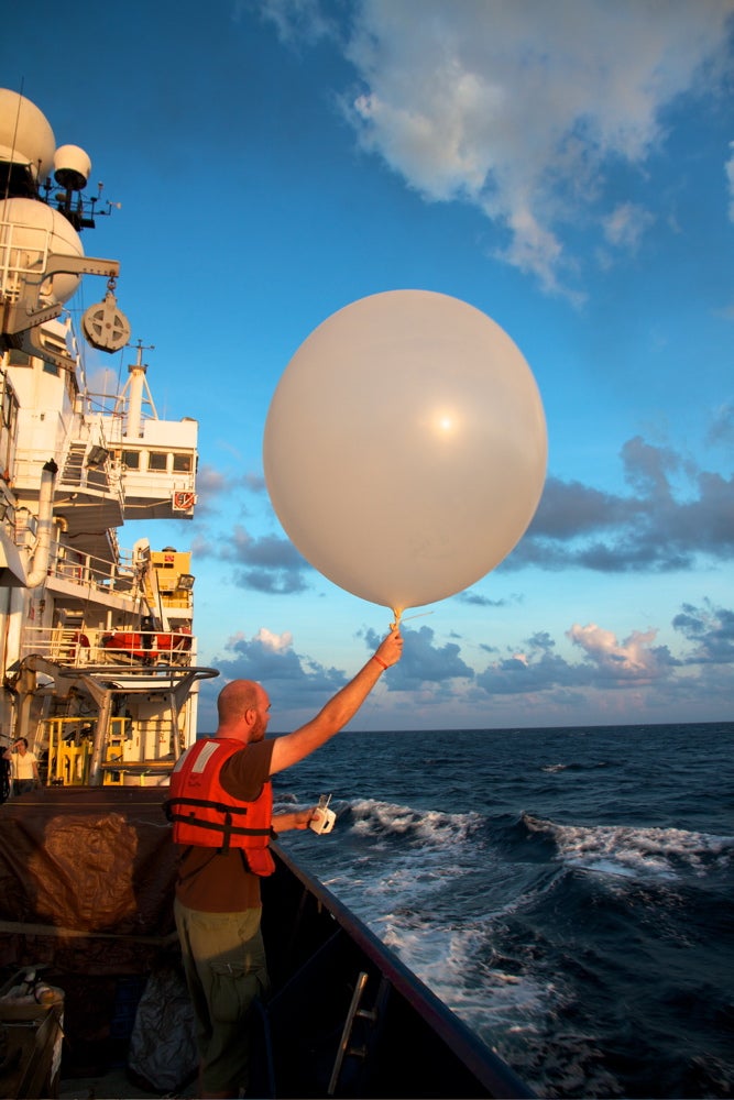 The Integrated Sounding System (ISS) will be deployed aboard the R/V Investigator for ocean-atmospheric studies. The R/V Investigator is Australia’s only blue-water research vessel operated by the Marine National Facility. The ISS will consist of a radar wind profiler, surface meteorology sensors, and our GAUS balloon-borne radiosonde sounding system. The ISS and GAUS systems have been deployed on U.S., Japanese, French, Chinese and Peruvian research vessels in conditions ranging from the calm tropics to the winter-time North Atlantic. The wind profiler is operated on a gyroscopically stabilized platform to reduce the effect of rolling. GPS and a compass are used to correct for ships motion.
Measurements taken with the ISS will be integrated with aircraft and satellite data to provide a complete vertical profile of the atmosphere from the ground up to about 100 km, ultimately providing highly detailed data for enhanced numerical model predictions.
» Read more about ISS shipboard operations