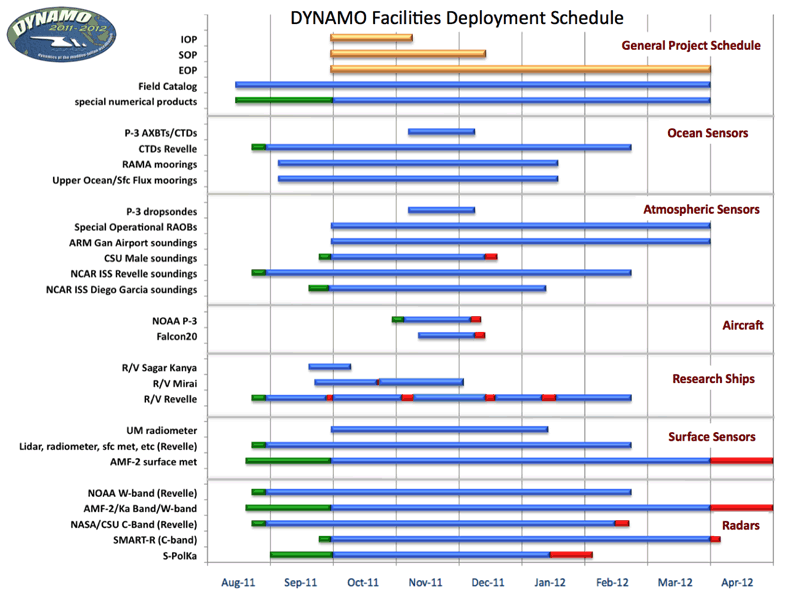
|
Radars:
7 different radar frequencies will be used during DYNAMO, which allows researchers to collect data on cloud population and evolution during the initiation phase of the MJO. Properties such as cloud configuration, microphysics, height, depth, internal wind circulation, and latent heat will be monitored.
|
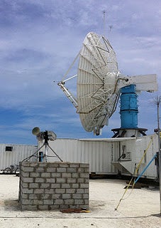
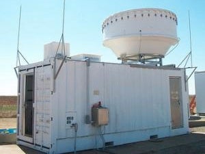
S-PolKa Radar :: S-band & Ka-band
- Agency :: NSF/NCAR
- Location :: Addu Atoll, Wharf Site
- Operational Period :: 1 October 2011 - 15 January 2012
- More information on the S-PolKa Radar
 - Image courtesy of NCAR
|
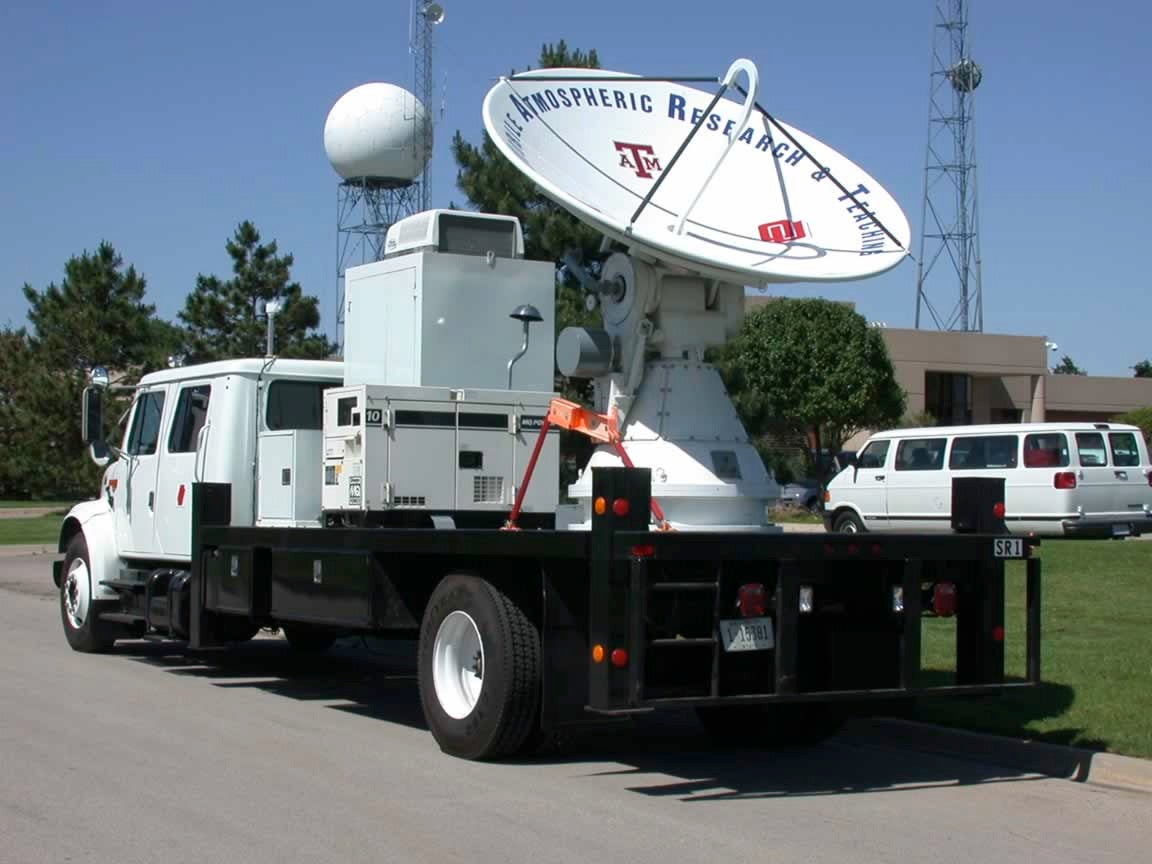
Shared Mobile Atmospheric Research & Teaching Radar (SMART-R) :: C-band
- Agencies :: The National Severe Storms Laboratory (NSSL), Texas A&M University, Texas Tech University, & The University of Oklahoma
- Location :: Addu Atoll, Spit Site
- Operational Period :: 1 October 2011 - 31 March 2012
- More information on the SMART-R
 - Image courtesy of SMART-R
|
Ka-band & X-band Radars
- Agency :: DOE/ARM Climate Research Facility
- Location :: Addu Atoll, Wharf Site & Manus Island, Papua New Guinea
- Operational Period :: 1 October 2011 - 30 March 2012
- More information on the SACR-AMF2
 - Image courtesy of DOE/ARM
|
C-band Radar
- Agency :: NASA/CSU
- Location :: R/V Revelle
- Operational Period :: 23 August 2011 - 16 February 2012
- More information on the C-band Radar
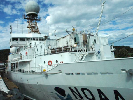 - Image courtesy of NOAA
|
W-band Radar
- Agency :: NOAA
- Location :: R/V Revelle
- Operational Period :: 23 August 2011 - 16 February 2012
|
Ka-band ARM Zenith Radar (KAZR)
- Agency :: US Department of Energy's Atmospheric Radiation Measurement (ARM)
- Location :: Addu Atoll, Gan Airport & Manus Island, Papua New Guinea
- Operational Period :: 1 October 2011 - 30 March 2012
- More information on the KAZR
 - Image courtesy of DOE/ARM
|
|
Research Ships:
Research ships play a key role in data collection for DYNAMO as they allow for measurements to be taken in remote locations. The ships are fitted with instruments that monitor both the ocean and atmosphere providing researcers with key data sets of how the air and sea interact with one another.
|
R/V Revelle
- Agency :: U.S. University-National Oceanographic Laboratory System (UNOLS)
- Location :: Indian Ocean
- Operational Period :: 23 August 2011 - 16 February 2012
- More information on the R/V Revelle
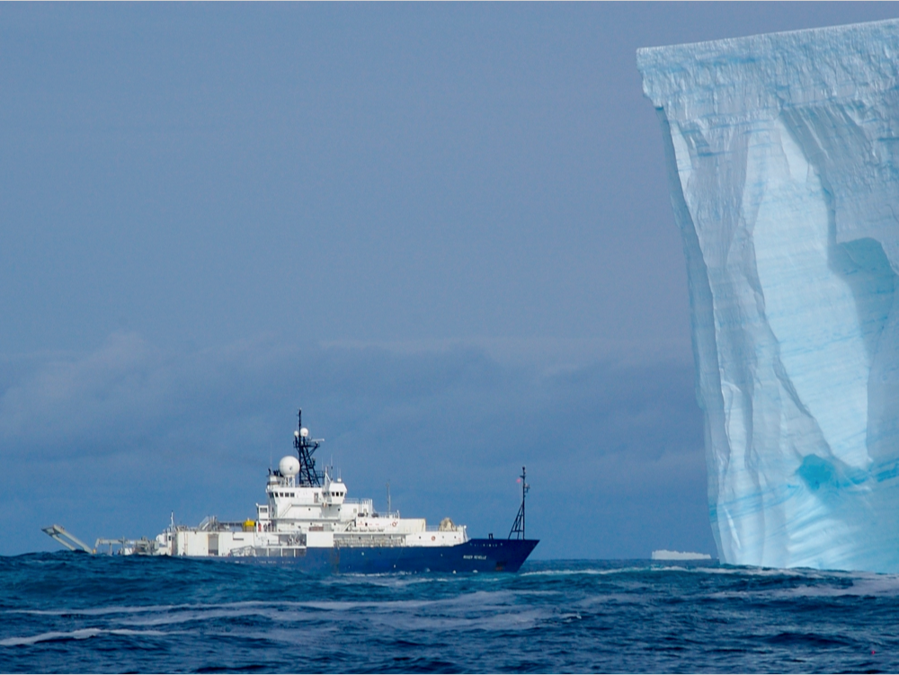 - Image courtesy of Scripps Institution of Oceanography
|
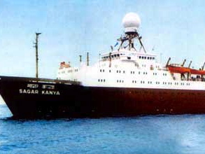
R/V Sagar Kanya
- Agency :: Indian National Centre for Antarctic & Ocean Research (NCAOR)
- Location :: Indian Ocean
- Operational Period :: 20 September - 10 October
2011
- More information on the R/V Sagar Kanya
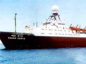 - Image courtesy of NCAOR
|
JAMSTEC R/V Mirai
- Agency :: Japan Agency for Marine-Earth Science and Technology (JAMSTEC)
- Location :: Indian Ocean
- Operational Period :: 23 September - 2 December 2011
- More information on the R/V Mirai
 - Image courtesy of JAMSTEC
|
R/V Baruna Jaya 1
- Agency :: Fugro Survey Private Limited, Singapore
- Location :: Indian Ocean
- Operational Period :: 23 September - 2 December 2011
- More information on the R/V Baruna Jaya 1
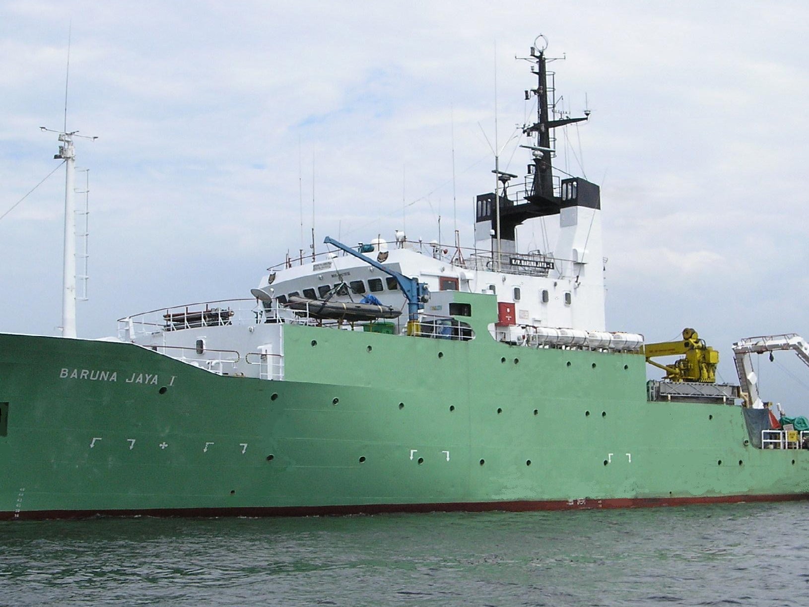 - Image courtesy of Fugro
|
|
Aircraft:
The aircraft contain a suite of instruments that collect data as it flies near targeted areas during each research flight, with some instrumentation able to collect data as far away as several kilometers from the aircraft. Research aircraft have the ability to quickly fly to remote, targeted locations that would otherwise be difficult to research by research ships.
|
Lockheed P-3 Orion
- Agency :: NOAA
- Location :: based at Diego Garcia, British Indian Ocean Territory
- Operational Period :: 8 November - 10 December
2011
- More information on theNOAA P-3
 - Image courtesy of NOAA
|
Falcon-20
- Agency :: French Service des Avions Français Instrumentés pour la Recherche en Environnement (SAFIRE)
- Location :: based at Addu Atoll, Gan Airport
- Operational Period :: 15 November - 17 December 2011
- More information on the SAFIRE Falcon-20
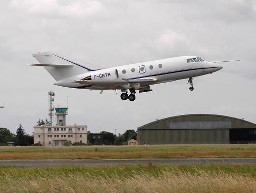 - Image courtesy of SAFIRE
|
|
Atmospheric Sensors:
Soundings collect the physical properties of a "column" of the atmosphere as the instrument ascends or descends, collecting data such as temperature, pressure, humidity, wind speed, & wind direction.
|
P-3 Dropsondes
- Agency :: NOAA
- Location :: dropped from NOAA P-3 aircraft
- Operational Period :: 8 November - 10 December 2011
- Learn more about dropsondes
 - Image courtesy of NOAA
|
CSU Soundings
- Agency :: Colorado State University (CSU)
- Location :: Hulhulé Island, Malé International Airport
- Operational Period :: 1 October 2011 - 15 January 2012
- More information on CSU Soundings
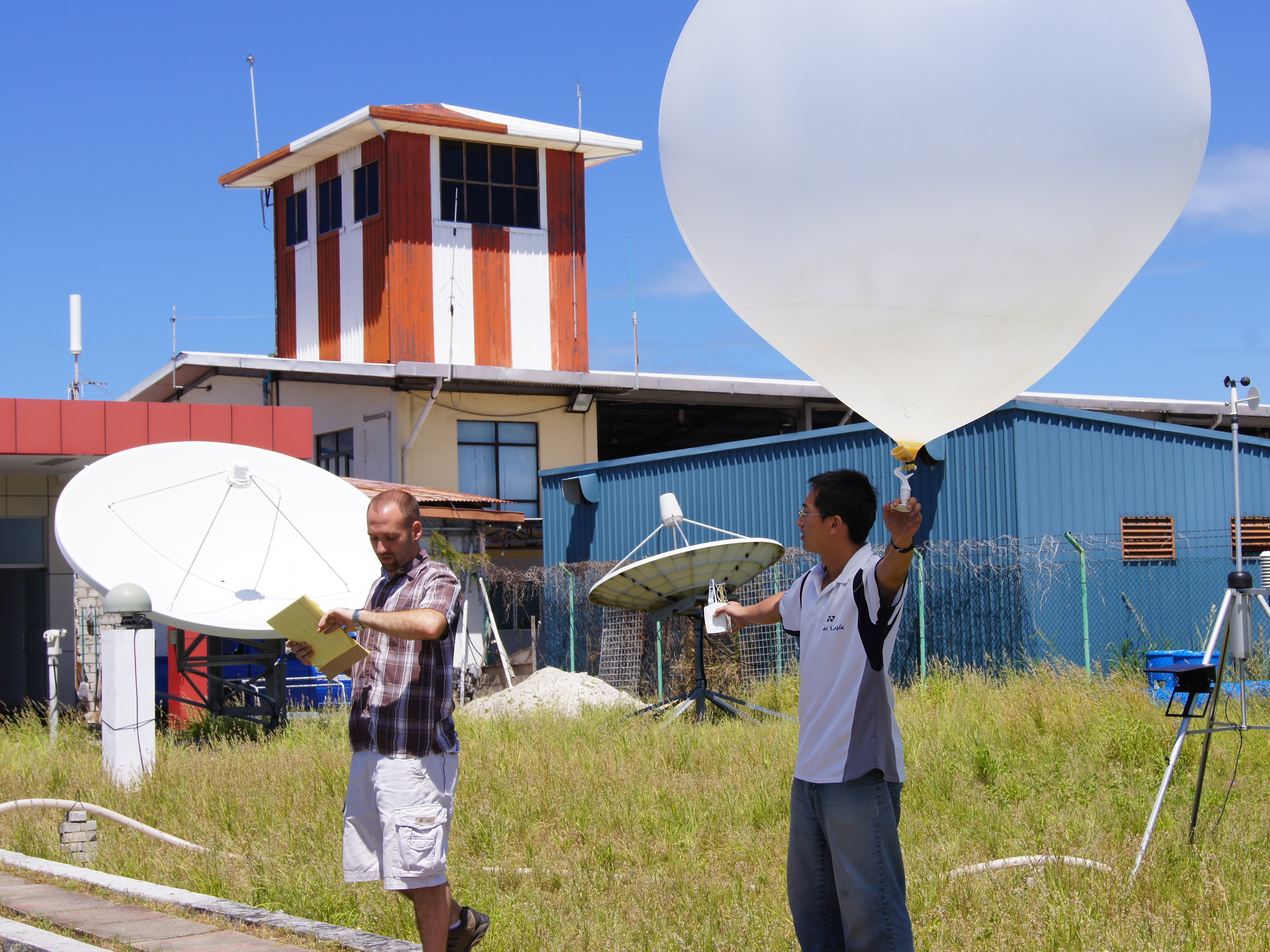
- CSU sounding launch near Malé International Airport
|
International Atmospheric Observations
- Agencies :: International collaboration
- Location :: Global
- Operational Period :: Ongoing
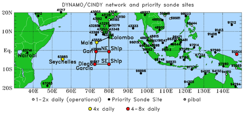 - Click to enlarge
|
Integrated Sounding System (ISS) :: Shipboard
- Agency :: National Center for Atmospheric Research (NCAR)
- Location :: based on R/V Revelle
- Operational Period :: 23 August 2011 - 16 February 2012
- More information on ISS Shipboard Operations
 - Image courtesy of NCAR
|
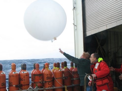
ARM Balloon Borne Sounding Systems
- Agency :: DOE/ARM Climate Research Facility
- Location :: Addu Atoll, Gan Airport & Manus Island, Papua New Guinea
- Operational Period :: 1 October 2011 - 31 March 2012
- More information on the ARM Sounding Systems
-
- ARM Sounding Preparation
|
Integrated Sounding System (ISS)
- Agency :: NCAR
- Location :: Diego Garcia, British Indian Ocean Territory (BIOT)
- Operational Period :: 1 October 2011 - 15 January 2012
- Learn more about NCAR's Integrated Sounding System
-
- ISS Site on Diego Garcia
|
|
Surface Sensors:
An array of surface sensors, both on land and ship, make measurements of the environment in the lower 30 feet of the atmosphere.
|
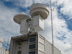
ARM Mobile Facility 2 :: Ceilometer, lidars, microwave, visible, and infrared radiometers; surface meteorology
- Agency :: US Department of Energy's Atmospheric Radiation Measurement (ARM)
- Location :: Addu Atoll, Gan Airport
- Operational Period :: 1 October 2011 - 31 March 2012
- More information on the ARM Mobile Facility 2
-
- AMF-2 Site :: Addu Atoll
|
Lidar, radiometers, surface meterology, ocean surface, chemistry
- Agency :: Several
- Location :: R/V Revelle
- Operational Period :: 23 August 2011 - 16 February 2012
|
Radiometer
- Agency :: University of Miami
- Location :: Addu Atoll, Wharf Site
- Operational Period :: 1 October 2011 - 15 January 2012
- Learn more about the Scanning Microwave Radiometer
 - Image courtesy of Paquita Zuidema
|
|
|
Ocean Sensors:
Due to a shallow thermocline in the Indian Ocean, sea surface temperatures fluctuate more easily, which in turn have a greater impact on ocean-atmosphere interactions. The physical properties of the ocean, such as temperature and salinity (conductivity) are equally important as the physical properties of the atmosphere.
|
P-3 Airborne eXpendable Conductivity, Temperature, Depths Sensor (AXCTD)
- Agency :: National Oceanographic and Atmospheric Administration (NOAA)
- Location :: dropped from NOAA P-3 aircraft
- Operational Period :: 8 November - 10 December
2011
- More Information on the Airborne eXpendable CTD (AXCTD)
 - Image courtesy of T.S.K.
|
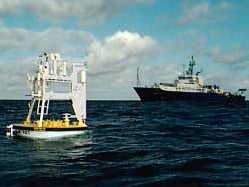
Research Moored Array for African-Asian-Australian Monsoon Analysis and Prediction (RAMA) Moorings
- Agency :: NOAA
- Location :: Moored buoys in Indian Ocean
- Operational Period :: ~5 September 2011 - 20 January 2012
- More information on RAMA Moorings
 - Image courtesy of NOAA
|
Conductivity, Temperature, & Depth (CTD)
- Agency :: NOAA
- Location :: dropped from R/V Revelle
- Operational Period :: 8 November - 10 December
2011
- More information on CTDs
-
-
|
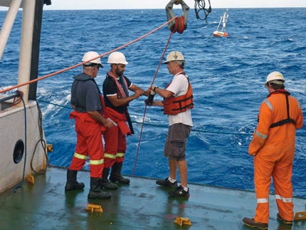
Upper Ocean/Surface Flux Moorings
- Agency :: NOAA
- Location :: Array locations in the Indian Ocean
- Operational Period :: ~5 September 2011 - 20 January 2012
- More Information on Surface Flux Moorings
 - Image courtesy of NOAA
|