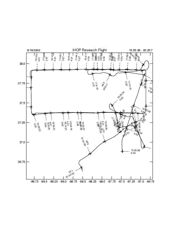
P3 Flight Log:
The P3 was requested to be part of the Boundary Layer Heterogeneity mission with LEANDRE pointing downward with a scheduled take off time of 1530 UTC. The King Air and the LearJet were also participating in the mission, but no coordination between the planes was required. We departed at 1533 UTC and headed north over the CART site at an altitude of 12,500? MSL. A flight pattern had been designed for the P3 to follow three long legs running east-west at the following latitudes: 37 degrees 00' (C-line), 37 degrees 22? (B-line) and 37 degrees 55? (G-line). The legs ran between the longitudes of 96 degrees 52? and 99 degrees 50?. The southern most leg was only to be flown if it was clear of clouds. The middle leg was over the ISFF sites in Kansas. On the way to the northern most line we had problems with both LEANDRE and ELDORA and since both groups needed some time to bring the equipment back up, a decision was made to break off and perform the Lenschow maneuvers. This had been attempted the day before, but without the proper instructions. This decision was approved by the OPS center. The calibration took just under 30 minutes, so at 1630 UTC we returned to the original track with both ELDORA and LEANDRE working. Unfortunately, ELDORA encountered some display problems and we were forced to restart the entire system. However, at this point no valuable clear air return was seen, so the loss does not appear to be great. Right about the time we were ready to return to the planned flight track, we were told that a NOTAM had not been published and that we were not allowed to operate the laser. We shut down and went into a holding pattern, while OPS attempted to fix the problem. At this point it was determined that the C-line was too cloudy and we were instructed to only fly the G-line and the B-line. At 1725 UTC we were allowed to turn LEANDRE back on, so we returned to point G8? (37 degrees 55? N, 96 degrees 32? W) and worked in a counterclockwise box pattern around the two legs. LEANDRE was seeing the depth of the boundary layer to be on the order of 1.5 km, but there was some uncertainty as to the accuracy of the measurements. LEANDRE also appeared to be getting mixing ratio values lower than what was seen by the King Air and estimated by the nowcaster in the OPS center. In an attempt to compare the measurements on board the King Air and the P3, we were given the endpoints of the King Air flight track, which was flying along the B-line. ELDORA started getting some clear air return around 1830 UTC, although the horizontal extend was limited to approximately 2 km on either side of the radar. The mission was terminated at 2017 UTC. We completed a five minute calibration leg for ELDORA before heading back to OKC, where we landed at 2054 UTC. We were held up on the runway for a while due to the air show at the airport. The equipment problems that we had had the day before had been fixed. CAPPI was working again, and I was able to once again hear communications between the planes.
Flight Track:
ELDORA Images for this Flight:
(Hit submit to view images, and allow pop-up windows to view interactive flight track.)
