IHOP_2002
International H2O Project 2002
The International H2O Project (IHOP_2002) was a field experiment that took place over the Southern Great Plains of the United States from 13 May to 25 June 2002. The chief aim of IHOP_2002 was improved characterization of the four-dimensional (4-D) distribution of water vapor and its application to improving the understanding and prediction of convection. The region was an optimal location due to existing experimental and operational facilities, strong variability in moisture, and active convection.
Research Components
- Quantitative Precipitation Forecast (QPF) - The QPF research component will primarily focus on the mesoscale distribution, evolution and spatial variation of water vapor in pre-convective and convective environments. Data assimilated from the IHOP_2002 network will be used to test the hypothesis that warm-season QFP skill can be significantly improved by better characterization of the four-dimensional water vapor field.
- Convection Initiation (CI) - The CI research component will focus on the formation and evolution of boundaries and the structure of the surrounding boundary layer to more clearly understand the processes that initiate active, deep moist convection over the Southern Great Plains (SGP).
- Atmospheric Boundary Layer (ABL) - The ABL component will examine how spatial variations in moisture depth and water vapor flux divergence within and just above the ABL have direct influence upon convection initiation and evolution, and how well these processes are simulated in mesoscale forecast models. For more information regarding ABL, please see NCAR/CU Surface, Soil, and Vegetation Observations during the International H2O Project 2002 Field Campaign (LeMone et al.)
- Water Vapor Instrumentation/Data Assimilation - The instrumentation component will focus on how to best combine diverse field measurements to obtain the optimal mix of water vapor instrumentation for future applications. The relative importance of water vapor measurements to other variables will be assessed so that better measurement strategies for operational forecasts and for meaningful data assimilation can be designed. Attention will also be paid to performance characteristics and sampling limitations of water vapor sensors.
Ground Instrumentation
IHOP_2002 ground-based instrumentation were deployed at multiple locations with both fixed and mobile platforms:
 |
- The ARM/CART site in north-central Oklahoma and south-central Kansas had an ongoing program with a variety of in-situ and remote sensing instrumentation clusters. During IHOP_2002 NOAA/ETL deployed a mini water vapor DIAL at Lamont, OK in the center of the ARM/CART site. Also, several GPS sensors were added to a network of pre-existing sensors at the Lamont site.
- The NCAR/EOL S-Pol dual polarization Doppler radar was installed in the Oklahoma panhandle about 50 miles south of Liberal, KS.
-
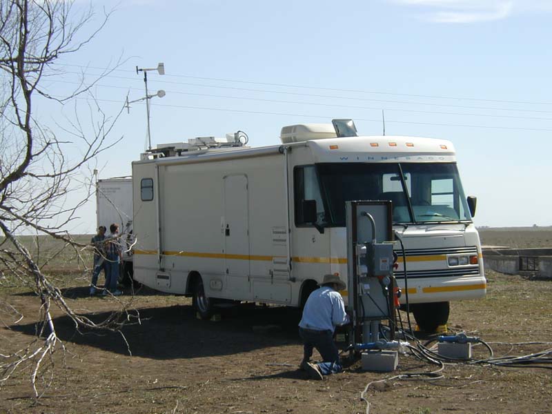
The so-called "Homestead Profiling Site" was located at an abandoned homestead about 11 miles to the east of the S-Pol site and it housed a number of special instruments including the NASA Scanning Raman Lidar (SRL) the NASA/GSFC Doppler wind lidar (GLOW) and Holographic-based backscatter lidar (HARLIE), the University of Wisconsin AERIBAGO, the NCAR Integrated Sounding System (ISS) with the Multiple Antenna Profiler (MAPR) and the University of Massachusetts FM-CW radar. The NCAR Tethered Atmospheric Observing System (TAOS) and Reference Radiosonde were located about 1 mile away from the Homestead site to avoid clutter for the profilers.
 NASA HARLIE, SRL and GLOW at Homestead. Photo Courtesy: Geary Schwemmer (NASA/GSFC). Click picture for full resolution.
 - Additionally nine NCAR Integrated Surface Flux Facility (ISFF) PAM stations were deployed in the IHOP_2002 domain along lines flown by the University of Wyoming King Air aircraft.
- Finally, special radiosonde observations were made by 10 NWS sites in the NWS Central and Southern Regions.
-
The mobile observing systems included four Doppler radars (2 Doppler on Wheels, XPOW, and SMART-R), one University of Oklahoma 3-mm W-Band radar, three mobile radiosonde systems (2 NCAR MGLASS and 1 NSSL MCLASS), two mobile radiometers (University of Alabama-Huntsville Mobile Integrated Profiling System (MIPS) and Desert Research Institute Mobile Microwave Radiometer), the University of Wisconsin AERIBAGO, and the NOAA/NSSL mobile mesonet and field coordination vehicles.
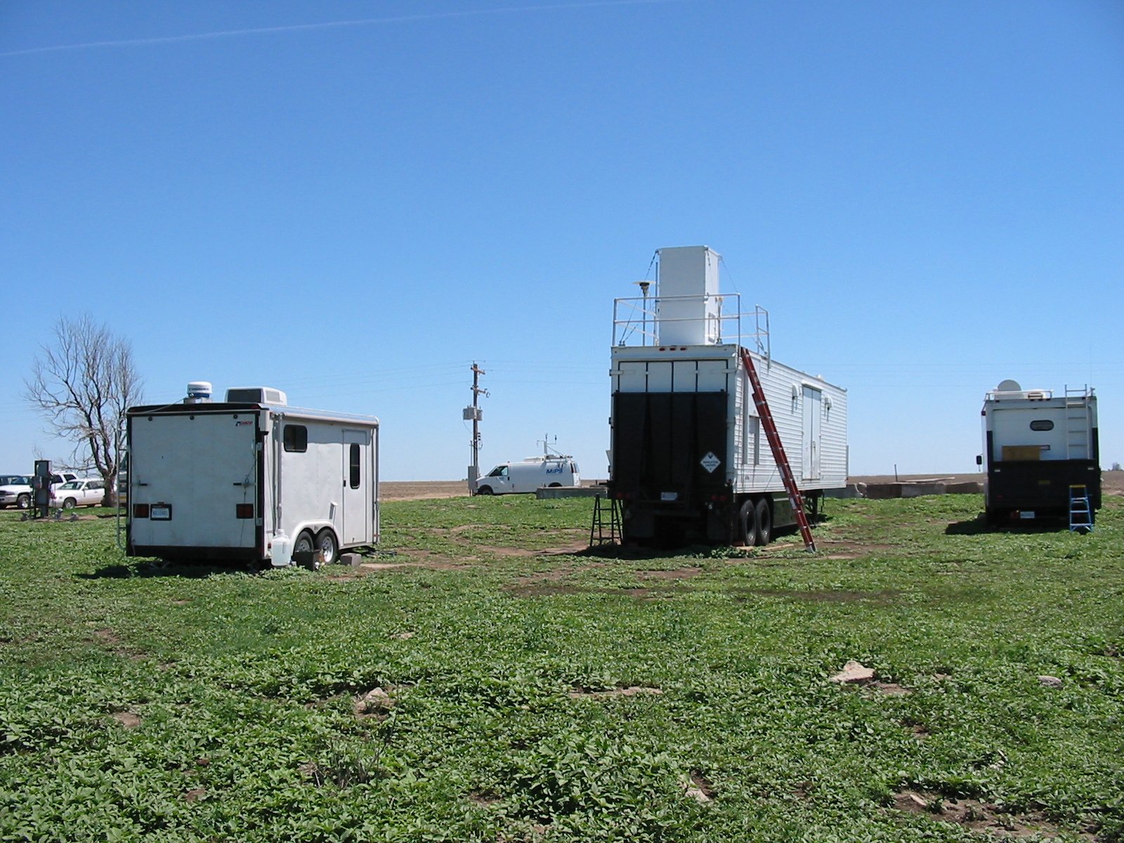
 University of Wisconsin AERIBAGO. Photo Courtesy: UW. Click picture for full resolution.

Aircraft Instrumentation
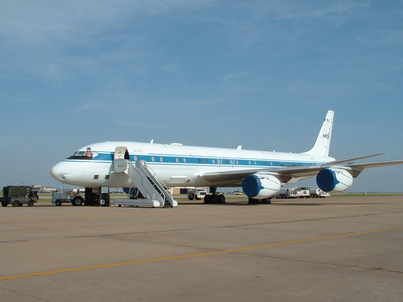
IHOP_2002 operations included a total of six research aircraft that included an unprecedented set of airborne instrumentation. All airplanes were deployed from the Will Rogers World Airport in Oklahoma City, OK.
- Naval Research Lab P-3 with ELDORA (ELectra DOppler RAdar) and Leandre II water vapor DIAL (Differential Absorption Lidar)
- University of Wyoming King Air with the Wyoming Cloud Radar
- DLR Falcon with DLR DIAL, NOAA/ETL HRDL (High Resolution Doppler Lidar) and GPS dropsondes
- Flight International Learjet with GPS dropsondes
- NASA Proteus with NAST (NPOESS Airborne Sounder Testbed)
- NASA DC-8 with LASE (Lidar Atmospheric Sensing Experiment) and S-HIS (Scanning High-resolution Interferometer Sounder)
 |
Operations Coordination and Analysis Center
IHOP_2002 operations were coordinated from the Norman Operations Center located in a trailer next to the NOAA/National Severe Storms Lab facilities on the North Campus of the University of Oklahoma. Several types of models and nowcasting systems were tested in real time.
More complete information on all of the instrumentation that participated in IHOP_2002 can be found in the IHOP_2002 Operations Plan .
For more information regarding IHOP 2002, please see An Overview of the International H2O Project (IHOP_2002) and Some Preliminary Highlights (Weckwerth et al.)
All photos copyright University Corporation for Atmospheric Research unless otherwise noted.
Principal Investigators:
- Tammy Weckwerth (NCAR/EOL/RSF)
- Dave Parsons (OU)
Data Manager:
- EOL Archive NCAR/EOL/DMS