Research Goals
 Specific scientific questions to be addressed include:
- What is the nature of the diurnal and seasonal variations in sensible and latent heat fluxes, soil moisture and atmospheric thermodynamic profiles on the two sides of the bunny fence?
- Are the variations in surface energetics and boundary layer thermodynamics responsible for the differences in cloud formation on the two sides of the bunny fence?
- Does the sharp boundary in land use along the bunny fence induce mesoscale circulations?
- What is the nature of the landscape heterogeneity induced mesoscale circulations, their structure, seasonal and diurnal variations and frequency of occurrence?
- Is the cloud formation in this region impacted by the landscape heterogeneity generated mesoscale circulations?
Objectives
We propose to use a unique combination of satellite, in situ observations and mesoscale numerical modeling experiments to answer a series of research questions related to modification of regional climate in Southwestern Australia by changes in land use. Specifically, we will focus on identifying mechanistic interaction processes between land use and climate and evaluating the impact of land use on local hydrology and associated consequences to agricultural productivity and ecosystem stability.
 We plan to use satellite and in situ measurements for two purposes. One is to characterize the differences in surface energy and moisture fluxes, atmospheric thermodynamic profiles, cloud formation, cloud microphysics and soil moisture as a function of land use. The other is to specify realistic land surface characteristics that are crucial inputs for the mesoscale model and for validating model simulations. The Colorado State University Regional Atmospheric Modeling System (CSU RAMS) will be used to understand the mechanistic interactions between land use and regional climate. The RAMS will also be used to study the impact of land use on the regional hydrology.
Specific objectives of this study include:
- 1) Use CERES data to examine differences in top-of-the-atmosphere and surface radiative fluxes over agriculture and native vegetation areas;
- 2) Characterize differences in cloud formation, cloud characteristics and precipitation as a function of land use using MODIS, TRMM and GMS5 satellite data;
- 3) Examine surface energy and moisture fluxes, soil moisture availability over agricultural and native vegetation areas using MODIS and ASTER data;
- 4) Validate satellite retrieval of moisture and energy fluxes, soil moisture using ground based measurements;
- 5) Explore the impact of land use on atmospheric thermodynamic structure using AIRS/AMSU/HSB data;
- 6) Generate land surface characteristics for current and pristine land use scenarios from MODIS data and use RAMS to simulate regional climate and cloud formation in Southwest Australia for these scenarios.
Read more about the research goals and objectives of BuFEx.
Study Area
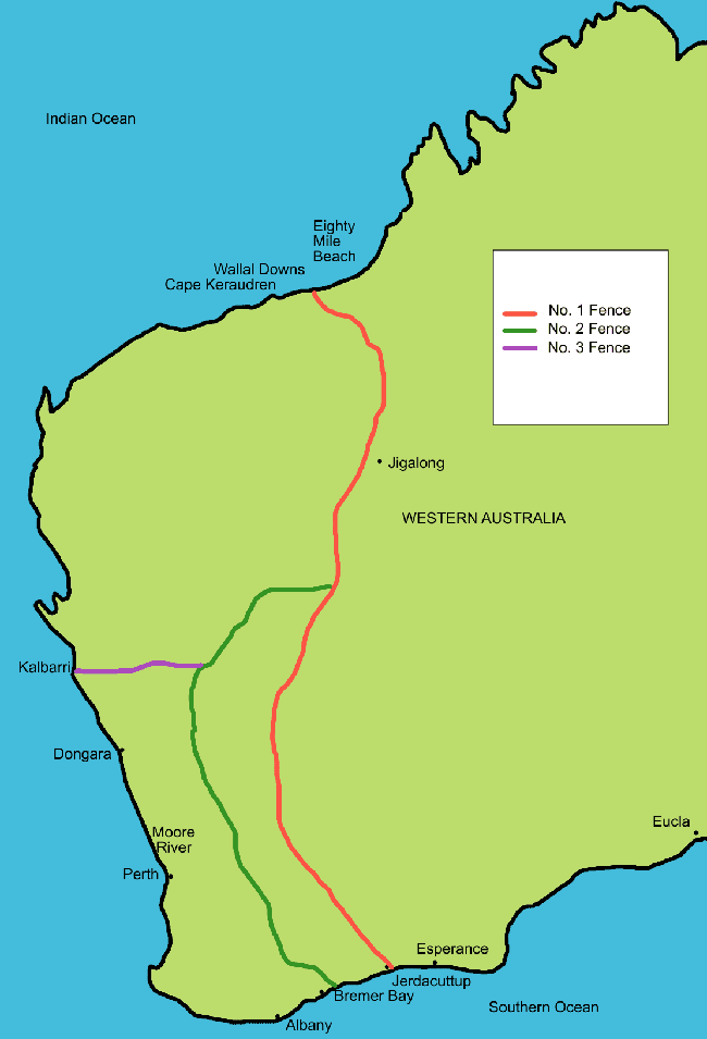
Southwest Australian region (Figure 1) has been subject to considerable land use change since late 1800s, with an estimated 13 million hectares of native vegetation removed for agricultural purposes (Lyons et. al., 1993).
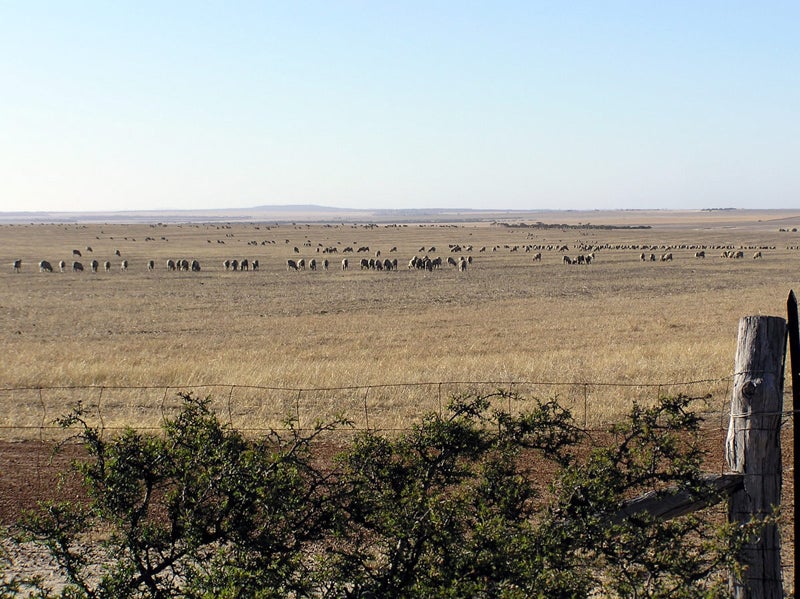
 Currently a 750 km rabbit proof fence separates the croplands along the Southwest coast from native vegetation in the continental interior. Due to the high contrast in albedo between the croplands and native vegetation, the boundary separating these areas is a prominent feature in the satellite images for this region (Figure 1b). Environmental impacts of land use change in this region include alteration of subsurface water storage, regional climate and local hydrology. Extensive removal of native vegetation with deep roots has lead to rising of the water table with the end result of increased salinity in the surface soil and associated decrease in agricultural productivity. Rising soil salinity poses a serious threat to agricultural productivity in the future and has serious economic consequences. Several studies show connections between land use change and regional climate of this region (Lyons et al., 1993, Lyons et al., 2001, Ray et al. 2003). A 20% decrease in rainfall has been reported in this area following substantial clearing of native vegetation (Lyons et al., 1993), but is not completely clear if the decrease in rainfall is linked to changes in land use.
Read more abou the BuFEx study area.


