MicroPulse DIAL Standard Products | |||
Range resolved | Temporal Resolution (profiling range) | Technique | References |
Water Vapor (Absolute Humidity) | 5-10 min (250 m to 4 km) | DIAL | |
Temperature | 30-45 min (350 m to 4 km) | DIAL | |
Quantitative Aerosol /Cloud Properties | 1 min (50 m to 10 km) | HSRL | |
MicroPulse DIAL Advanced retrievals: Water Vapor, Temperature, Aerosol Backscatter Coefficient, Relative Humidity, Virtual Potential Temperature (VPT) Surface Difference
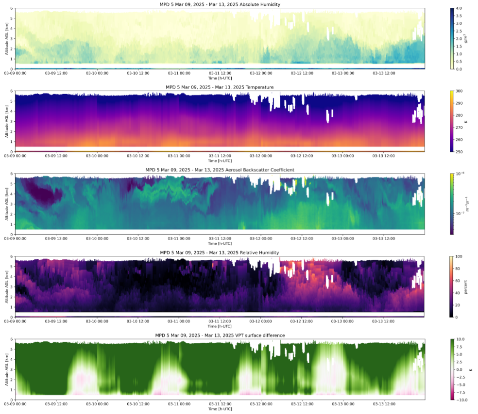
Example of advanced MicroPulse DIAL data products