KuDA
Kuwait Data Archive (KuDA)
PROJECT DATES
01/01/1991 - 12/31/1991
PROJECT DESCRIPTION
Welcome to the Kuwait Data Archive.
Sponsored by:
- Departmant of Energy (DOE)
- Defense Nuclear Agency (DNA)
- National Science Foundation (NSF)
- Enviromental Protection Agency (EPA)
- National Oceanic and Atmospheric Administration (NOAA)
This archive was created to study the effects of the Kuwait oil fires on the environment.
The data available in the archive is free to the public for the remainder of the fiscal year 1994. The data consists primarily of atmospheric measurements during 1991. The data is one of Three classes, Trackline/Point, Gridded data, Image Data.
- Trackline/Point Data: Aircraft data, land surface observation, upper air observation. For additional Aircraft Information: See Text
- Gridded Data: MRF flux fields, MRF model analysis, MRF model output, NMC.
- Image Data: 1250 images of OLS and AVHRR(LAC&GAC) Data.
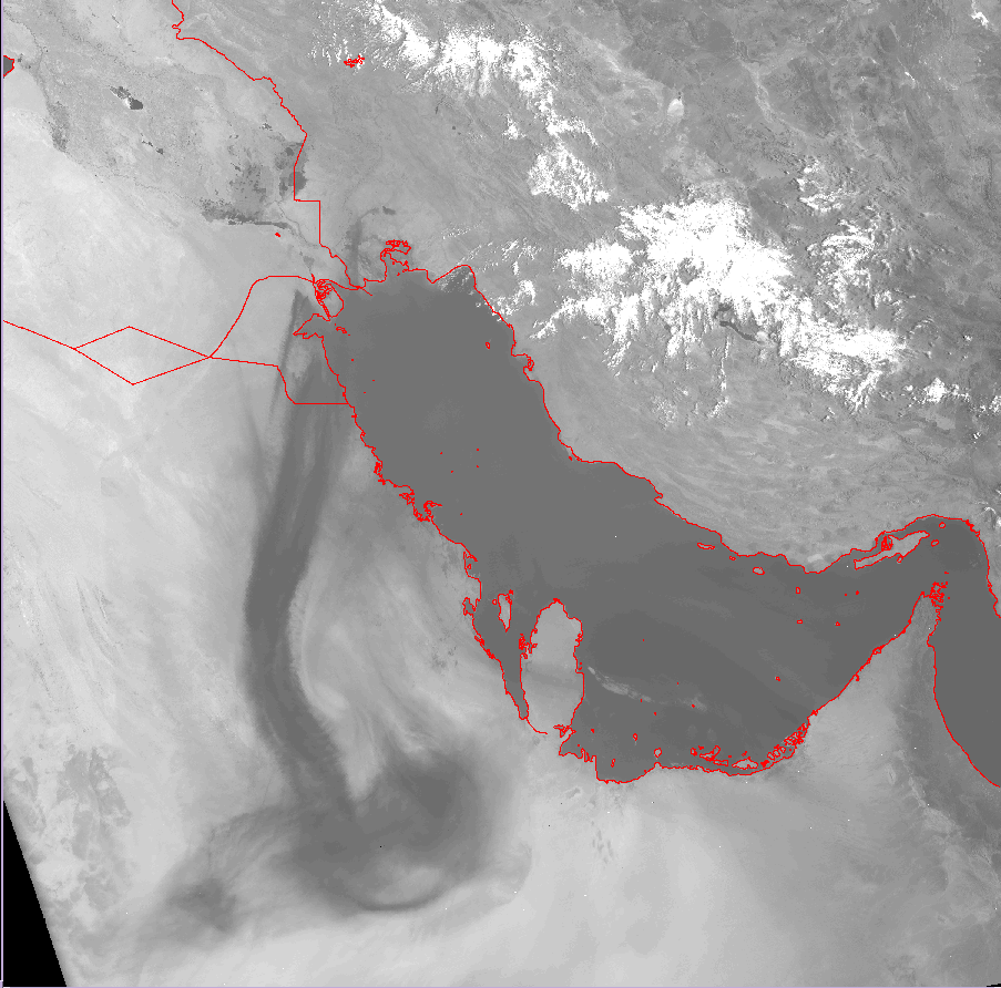 |
DMSP-F08, DMSP-F09, DMSP-F10. DMSP sample satellite image, 500m resolution, Full Size GIF(.2M) F09 20JUN91 06:44Z: |
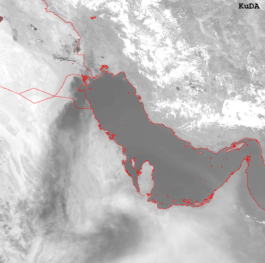 |
NOAA-09, NOAA-10, NOAA-11, NOAA-12. LAC sample satellite image, 1km resolution, Full Size GIF(.3M) N11 20JUN91 11:17Z: |
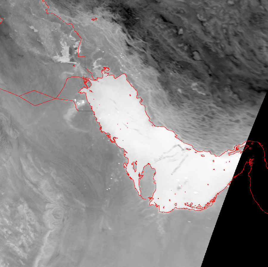 |
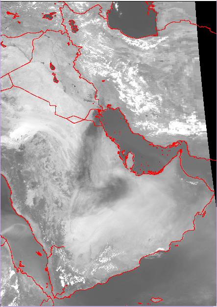
LAC near-IR sample satellite image, 1km resolution, Full Size GIF(.3M) N11 15FEB91 23:58Z: |
 |
NOAA-11, NOAA-10. GAC sample satellite image, 4km resolution, Full Size GIF(.1M) N11 20JUN91 11:14Z: |
Satellite inventory See Text
Satellite images can be viewed at a lower resolution within the Archive.
See Plotted Smoke contours for the entire year.
The archive, at one time, had an online meta-data browser. It is no longer active, since funds no longer exist to support it.
For additional information contact RAF.