NDTP
North Dakota Thunderstorm Project
The North Dakota Thunderstorm Project (NDTP) was a multi-agency cooperative research program designed to enhance operational cloud seeding studies and examine a number of facets of cloud characteristics and evolution in the northern high plains. The nucleus of the NDTP was funded by NOAA and the State of North Dakota through the Federal-State Cooperative Program in Atmospheric Modification Research (NOAA/AMP). Additional investigations were funded by the National Science Foundation (NSF), NCAR, North Dakota Atmospheric Research Board (NDARB), and the Bureau of Reclamation (BuREC). Various participating Universities included the South Dakota School of Mines and Technology (SDSM&T), University of Maryland (UM), State University of New York at Albany (SUNY), Desert Research Institute (DRI), University of Wyoming (UW), and the University of North Dakota (UND). Other private entities included the North American Weather Consultants (NAWC), and Weather Modification Inc. (WMI). The core program for the NTP included one (1) aircraft for the release of tracer and seeding agents, five (5) other aircraft for cloud physics/tracer-detection, four (4) radars, as well as special and routine upper-air/surface observations.
EXPERIMENTAL GOALS
A number of objectives for the NDTP were determined through extensive evaluation of North Dakota’s long-term operational hail suppression cloud seeding program. The long-range goals of this program were to: (1) determine the conditions (if any) under which convective rainfall can be enhanced by cloud seeding; (2) assess the feasibility of reducing hail damage through cloud seeding; and (3) improve the understanding of the atmospheric water processes and hazards in northern Great Plains thunderstorms. Investigators from various Institutions involved with the NDTP formulated specific experiments to research a wide range of processes within convective clouds including cloud microphysics, lightning, trace gases, storm development/motion/evolution, and verification and improvement of numerical cloud models. In addition, the NDTP included student participation in the field (10 university students) through a grant with the NSF’s Research Experience for Undergraduates (REU).
PROJECT OPERATIONS
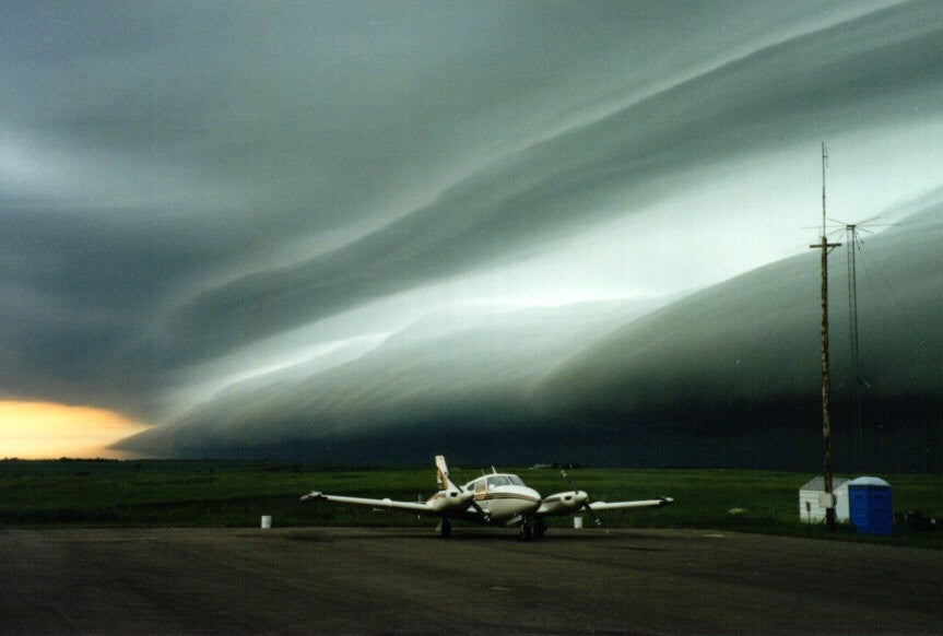
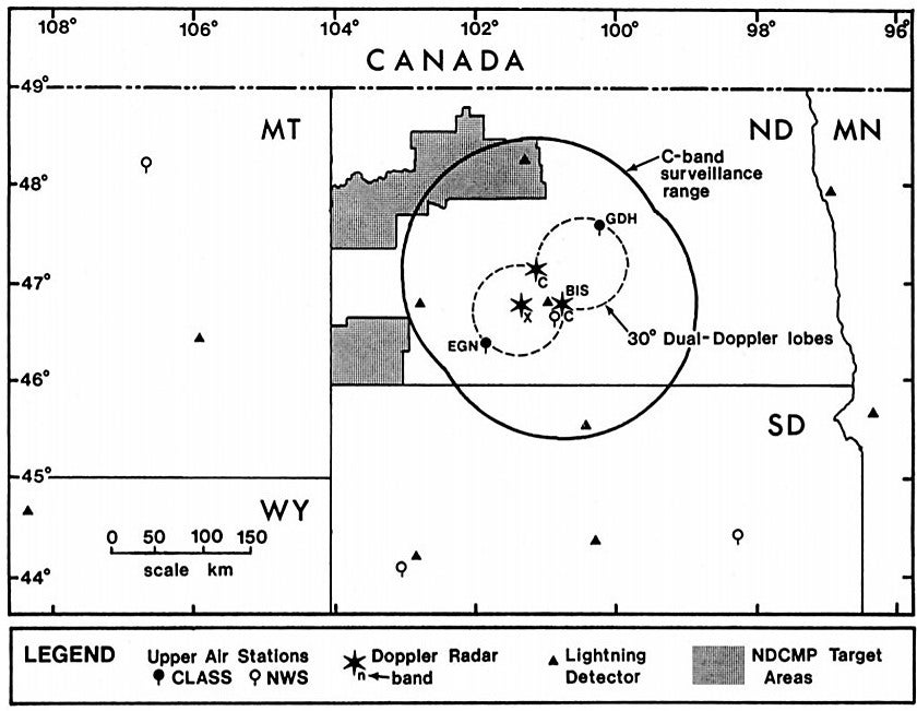
Thirty scientists from fifteen (15) institutions participated in the NDTP with the project headquarters and operations center in Bismark, ND (see map). The project combined the instrumented aircraft with the Doppler radar network and other supporting instrumentation in coordinated studies of meteorological processes. The primary research area was central North Dakota, separate from the operational cloud-seeding program in the western end of the state, thus avoiding potential airspace conflicts. This separation also greatly increased the number of untreated clouds that passed through the Doppler radar network, which enabled all multiple-aircraft case studies to be conducted within the airspace controlled by a single Air Route Traffic Control Center (ARTCC). All six (6) project aircraft were based at the Bismark airport which optimized communications and aircraft coordination from the NCAR transportable Mobile Operations Center for Control and Analysis (MOCCA) two (2) linked trailers. There were nineteen (19) different experiments attempted in the NDTP with at least one attempt made for every experiment (totaling 129 experiments) over the NDTP period.
 |
 |
|
NDTP Cloud Seeding Aircraft
(Photo courtesy of North Dakota State Water Commission) |
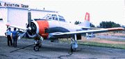
The SDSM&T T-28 Aircraft
(Photo courtesy of North Dakota
State Water Commission)
|
In a typical NDTP aircraft operation, the WMI Beechcraft Duke aircraft released sulfur hexafluoride (SF6) tracer gas [often with Silver Iodide (AgI) and radar detectable metal chaff] below, above, or to the side of a developing cumulus cloud. The data-collection aircraft then flew around or through the cloud at preplanned altitudes and positions to measure SF6, and, when AgI was released, ice crystal concentrations. The researchers took these measurements to investigate how clouds mix with surrounding air (a fundamental problem in understanding cloud behavior) and to measure the transport, dispersion, and activity of cloud seeding agents.
OBSERVATIONS/DATA
| Aircraft | UND Citation, WMI Beachcraft Duke, SDSM&T T-28, UW King Air, NOAA WP-3D, NCAR Sabreliner |
|---|---|
| Lightning | SUNY cloud-to-ground lightning detection network |
| Model | SDSM&T two-dimensional cloud model daily runs (200-m resolution, 20 x 20 km) |
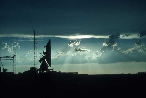
| Radar | NCAR CP-3 and CP-4 Doppler C-band radars |
| Radar | NOAA-C X-band circularly polarized Doppler radar |
| Radar | NOAA WP-3D airborne X-band Doppler radar housed in the NOAA/OAO P-3 aircraft |
| Photography | NCAR ground 35mm and 16mm time lapse film |
| Photography | NWS video recordings of WSR-74C radar |
| Satellite | GOES Vis and IR imagery (including RISOP on selected days) |
| Surface | Two (2) NCAR PAM II stations collocated with the NCAR CLASS sounding systems |
| Upper Air | Two (2) NCAR LORAN CLASS rawinsonde system sites near Elgin and Goodrich, ND |
| Upper Air | NWS routine and special soundings at the Bismark (BIS) airport site |
| Upper Air | BuREC Doppler Acoustic Sounder |
NETWORK MAP
 |