Lake-ICE
Lake-Induced Convection Experiment
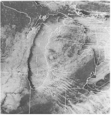
The Lake-Induced Convection Experiment (Lake-ICE) and the Snowband Dynamics Project (SNOWBAND) were conducted during December 1997 and January 1998 over the Great Lakes region with a particular concentration over Lake Michigan. They were designed to develop comprehensive data sets on the processes involved in lake-effect snowstorms and snowbands associated with cyclones.
(Click Image for Full Resolution)
Scientific Objectives
The overall goals of of Lake-ICE were to develop a better understanding of meso-α-scale aggregate vorticies, meso-γ-scale boundary layer circulations, and interactions between mesoscale circulations and turbulent micro-γ-scale mixing processes throughout the convective boundary layer in lake-effect snow events.
SNOWBAND sought to develop a better understanding of bands of heavy precipitation in the northwest quadrant of cyclones and of enhancement of precipitation associated with cyclonges over the Great Lakes.
(Click Image for Full Resolution)
Instrumentation
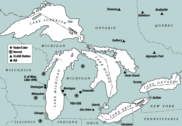
Lake-ICE and SNOWBAND incorporated a variety of airborne and ground-based sensor systems to examine wintertime snow-producing phenomena. Data collected by the research platforms during a number of Intensive Operations Periods (IOPs), in combination with operational datasets, allowed for detailed investigations of lake-effect, boundary layer convective structures, turbulence, and cloud and precipitation microphysical characteristics, as well as mesoscale precipitation and thermodynamic characteristics of cyclones. There were three major regions of focus in the field experiments: 1) surface, airborne, and remote sensing observations over and near Lake Michigan; 2) sounding observations in southeastern Canada; and 3) airborne and sounding observations across the northwest regions of cyclones.
Platforms deployed over the Lake Michigan region included the NCAR Electra and University of Wyoming King Air aircraft, three NCAR Integrated Sounding Systems (ISS), the Pennsylvania State University Cloud Observing System (PSU COS), and the University of Wisconsin Volume Imaging Lidar (VIL).
In the sourtheastern Canada region five NCAR CLASS and one NSSL mobile CLASS radiosonde systems were deployed to fill gaps in the operational sounding network.
The SNOWBAND observational strategy included the use of the ELDORA radar aboard the Electra, dropsonde measurements, and the standard wind, thermodynamic, and microphysical instrumentation aboard the NCAR Electra aircraft.
Supporting Datasets
In addition to the datasets derived from the special instrumentation in place for Lake-ICE and SNOWBAND a number of supporting data sets were collected over the region. These included:
- National Weather Service high resolution radiosonde data over the US
- NOAA Profiler Network data
- ACARS observations
- Composite surface meteorological data sets at 5/20/60 minute resolution
- WSR-88D Level II
- WSR-88D Level III
- GOES-8 imager
Further information on Lake-ICE and SNOWBAND is available in the overview article published in BAMS.
|
|
|
|
|
|
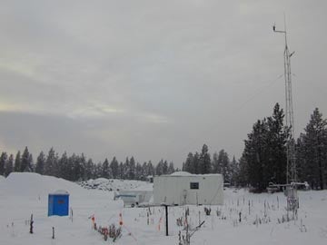
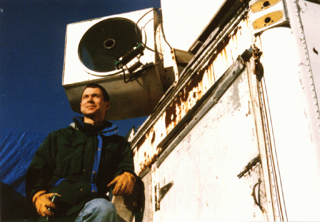
The NCAR ISS.
|
Photo from the VIL site in Sheboygan, WI (courtesy: UW Lidar)
|
University of Wisconsin Volume Imaging Lidar (courtesy: UW Lidar)
|
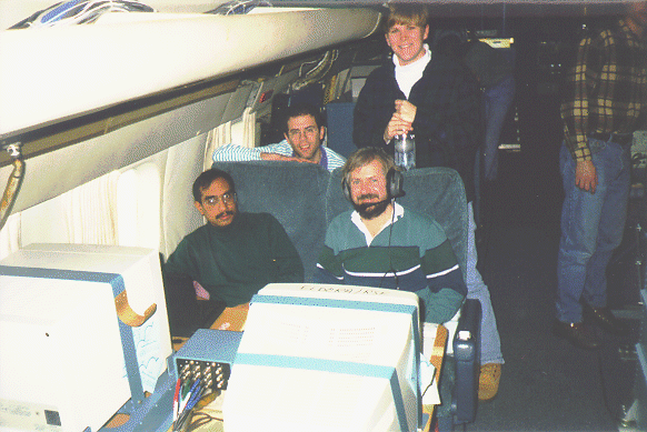
Bob Rauber, Mohan Ramamurthy, John Martin and Maria King on the NCAR Electra during SNOWBAND. (courtesy: UIUC)
|
All photos copyright University Corporation for Atmospheric Research unless otherwise noted.
Principal Investigators:
- Donald Lenschow NCAR
Project Manager:
Data Manager:
- EOL Archive NCAR/EOL/DMS