JOINT-II
JOINT-II
During March through May of 1976, the Coastal Upwelling Ecosystem Analysis (CUEA) program of the International Decade for Ocean Exploration (IDOE) of the National Science Foundation (NSF) and the Peruvian Government conducted an international multi-disciplinary study of coastal upwelling along the nutrient rich water along Peruvian coast (100 square km from Pisco to San Juan, Peru). This experiment was called JOINT-II and observations continued for a second campaign in March through May 1977. The JOINT-II Operations Center was at Pisco, Peru. Project facilities included research aircraft, ship research vessels, rawinsonde and PIBAL upper air stations, and numerous coastal and meteorological stations. The overall scientific goal was to understand upwelling ecosystems well enough to predict variations, thereby optimizing the use of the fisheries and helping to ensure their long-term productivity.
The specific objectives of the aircraft program were: (1) Map the Sea Surface Temperature (SST) field over the JOINT-II Region; (2) Document the wind field at low levels (500 ft) and its variation with height; and (3) Document the general structure and variation of the atmosphere over the upwelling region (temperature, relative humidity, moisture, clouds, and winds from the surface to 5000 ft.). The NCAR Queen Air aircraft flew 22 flights with 120 research hours for the 1976 campaign. The Queen Air flew 46 flights with 184 flight hours during 8 weeks in the April-May 1977 campaign.
OBSERVATIONS (1976)
| Aircraft | NCAR Queen Air |
|---|---|
| Oceanographic | Meteorological buoy |
| Ship | R/V Thompson (US), R/V Alpha Helix (US), TAREQ-II (Peru) |
| Surface | Coastal Stations (6) and other area synoptic weather stations |
| Upper Air | Rawinsonde station at Lima; PIBAL station at Pisco |
In the 1977 campaign, there were also 4 U.S. Research Vessels along with twelve coastal stations installed and operated by NCAR. JOINT II (1977) was the last of the Coastal Upwelling Studies coordinated by IDOE and CUEA.
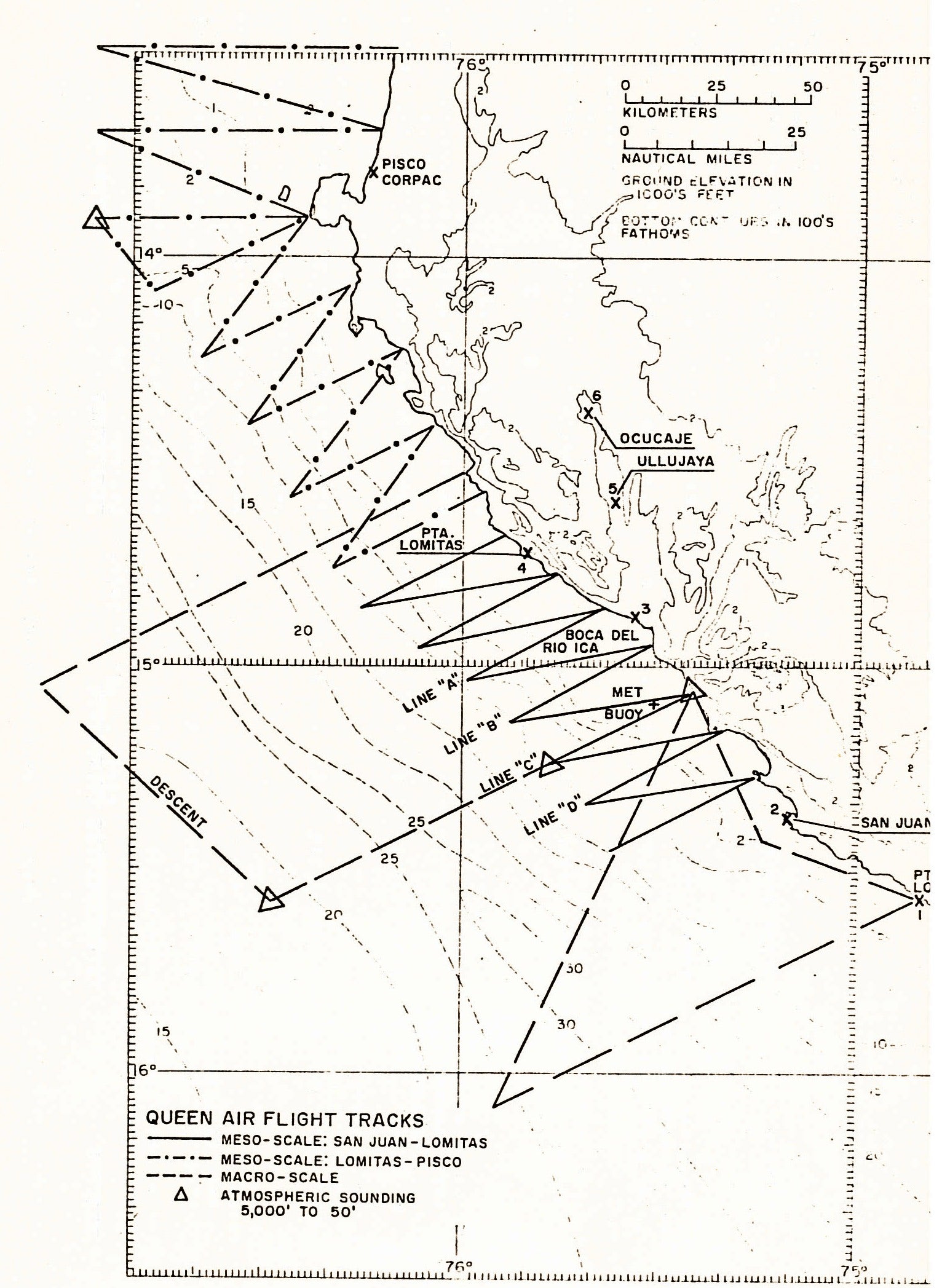
NETWORK MAP
 |
|
Figure 1 (above) shows the 1976 JOINT-II
deployment network along with the Queen Air flight tracks.
|
- EOL Archive NCAR/EOL/DMS