BeringSea
The Bering Sea Project: BEST/BSIERP
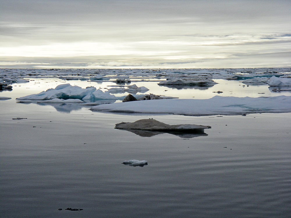
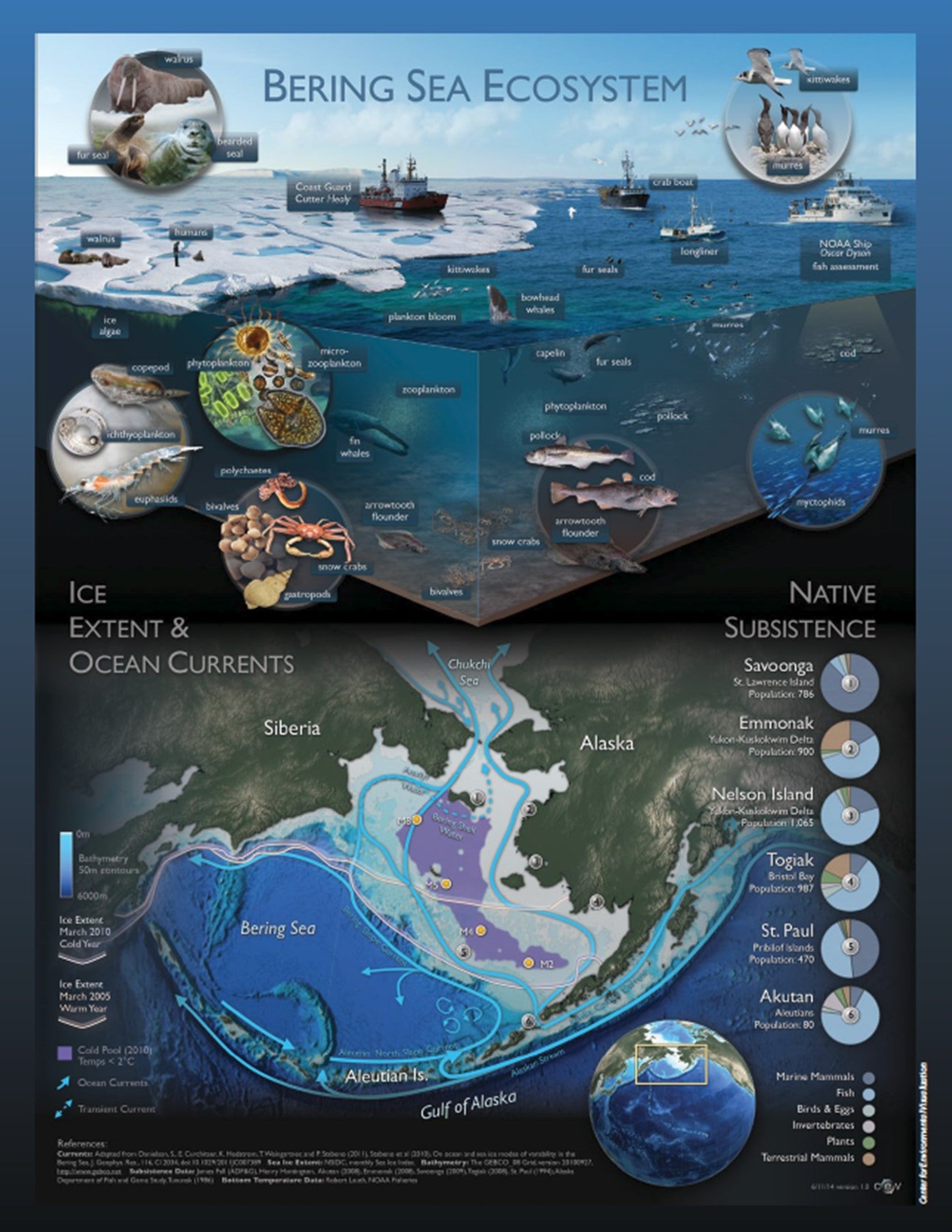
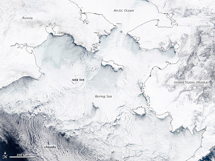
The Bering Sea Project was a multiagency, integrated ecosystem study, aimed at delivering new knowledge and understanding of how climate change and changing sea ice cover would affect the eastern Bering Sea marine ecosystem. The project linked research on climate, physical and biological oceanography, phytoplankton, zooplankton, fishes, seabirds, marine mammals, humans, traditional knowledge, and economic outcomes to investigate the mechanisms that sustain this highly productive region. A major scientific effort was required to work at the scale of the entire ecosystem in this vast and complex region. The continental shelf area of the eastern Bering Sea is over 1,200 kilometers in length and 500 kilometers in width—roughly the size of California, and close to half of the overall Bering Sea extent of ~2.3 million square kilometers.
To meet the need of major resource investment, the National Science Foundation (NSF) Office of Polar Programs (OPP) collaborated with the North Pacific Research Board (NPRB). Additionally, there were significant in-kind contributions from the National Oceanic and Atmospheric Administration’s (NOAA) Alaska Fisheries Science Center and NOAA Pacific Marine Environmental Laboratory (PMEL), and from the U.S. Fish & Wildlife Service. The Bering Sea Project assembled monetary and ship resources that would have been beyond the reach of any one agency or organization, and supported 43 collaborative research projects, nearly 100 principal investigators, and a small army of postdoctoral scholars, graduate students, technicians, and vessel crews.
In 2004, the NSF supported the Bering Sea Ecosystem Study (BEST) project which was a multi-year, interdisciplinary program to develop an end-to-end mechanistic understanding of how climate change and changing sea ice cover affected the marine ecosystems of the eastern Bering Sea, the continued use of their resources, and the social, economic and cultural sustainability of the people who depend on them. In 2007, the NPRB was consequently poised to launch its first Integrated Ecosystem Research Program (IERP) in the Bering Sea (named the “Bering Sea IERP”, or “BSIERP”) which emphasized the importance of large-scale integrated studies of the marine ecosystems of the eastern North Pacific. BSIERP focused on understanding trophic interactions among colony-based foragers, hot spot foragers, pelagic forage species, pelagic predators and benthic predators. Hypotheses were tested in a linked set of spatially explicit, competing models that connected climate scenarios, physical and biological oceanographic models, a lower and upper trophic level ecosystem model and economic and management models. Because of synergistic scientific objectives, the NSF and NPRB then agreed to collaborate in bringing the BEST and BSIERP programs together to form a unified project over a 7-year period. Data Management for these complex combined projects was performed by the National Center for Atmospheric Research (NCAR)’s Earth Observing Laboratory (EOL).
Scientific Objectives:
During the planning phase of the Bering Sea Project, researchers from many disciplines came together with people from Bering Sea communities—ranging from ice-free communities in the Aleutians to the seasonally ice-covered waters of St. Lawrence Island. Over the course of many months, they conceived a program of research that would become 43 linked components focused on key species, processes, and selected coastal communities, forming a highly integrated program structured around a five core hypotheses:
A. Climate-driven changes in the physical components that control the Bering Sea (e.g., temperature, wind, sea-ice, and currents) modify the availability and allocation of food for all species.
B. Climate and ocean conditions influencing water temperature, ocean currents, and ecological boundaries impact fish reproduction, survival, and distribution, the intensity of predator-prey relationships, and the location of zoogeographic provinces.
C. Warming temperatures and subsequent earlier spring sea-ice retreat result in later spring phytoplankton blooms, thereby leading to increased abundance of piscivorous fish (e.g., walleye pollock, Pacific cod, and arrowtooth flounder) and a food web controlled by predators.
D. Climate and ocean conditions influencing water temperature, ocean currents, and ecological boundaries affect the distribution, frequency, and persistence of oceanographic fronts and other prey-concentrating features, and thus control the foraging success of marine birds and mammals.
E. Changes in climate and ocean conditions will affect the abundance and distribution of commercial fisheries and subsistence harvests.
Project Operations:
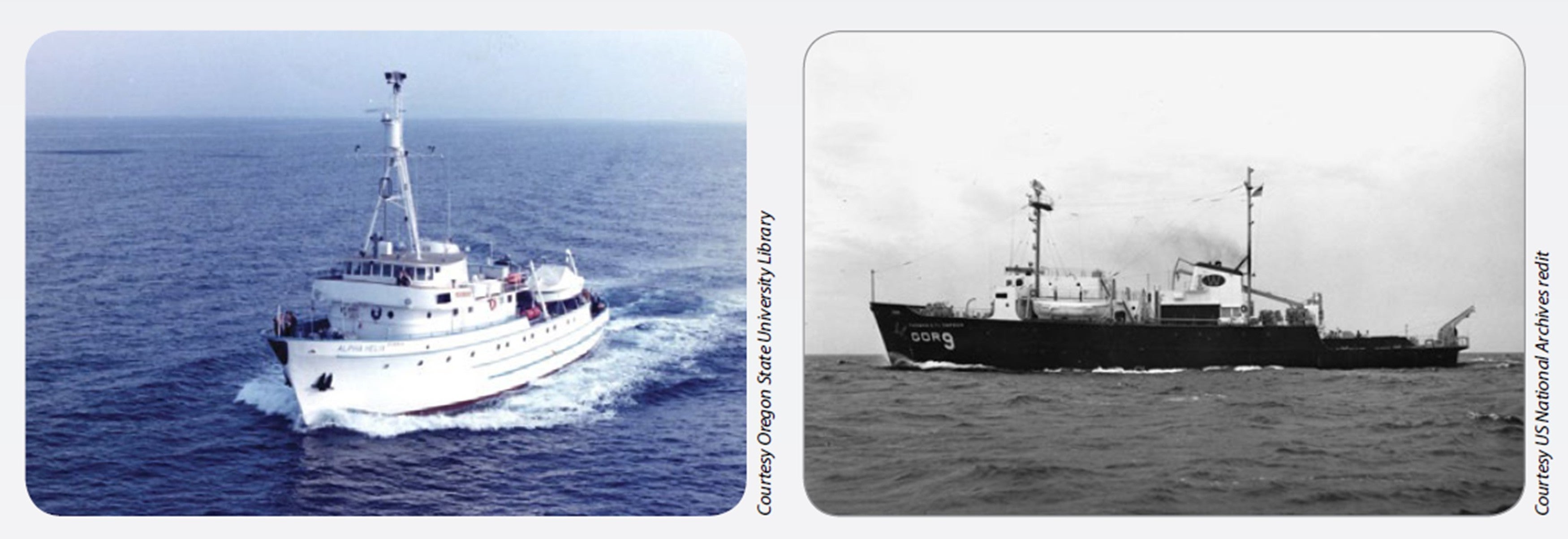
Initial combined Bering Sea Project fieldwork began in 2007 with a limited subset of the participating teams, and by 2008 the Bering Sea Project was fully in motion with the first of three comprehensive field seasons. In a concerted push of major new research activity, field scientists sampled the eastern Bering Sea in every month of the year (except December). The skilled crews of icebreakers operated by the US Coast Guard and UNOLS (University-National Oceanographic Laboratory System) vessels gave researchers access to the region around St. Lawrence Island and the northern shelf, powering through the ice-choked waters of late winter and spring. Enhanced sampling by NOAA survey ships in the April through October period further contributed to a far more detailed view of the ecosystem than was previously available.
Data Management:
The comprehensive data management support strategy for the Bering Sea Project involved engaging with the science team early on to determine their requirements and establish priorities based on available resources. It also included implementation of a Project Field Catalog for use aboard the research cruises, and allowed the science teams to upload real-time documentation of data collection. This gave researchers on those vessels real-time displays of current ship track and position, and all ship-based sampling stations for the current and previous cruises, critical in the repeat location sampling strategy used during the project. They also had access to any operational products, such as satellite sea-ice data, used for real-time cruise track selection. EOL also worked closely with Local and Traditional Knowledge (LTK) investigators to develop a Geographic Information System (GIS) tool (i.e. LTK Mapserver), for displaying detailed data and information collected during the Nelson Island Project connecting place names to stories and photos.
Project Outcome:
After multiple years of planning, from 2002-2006, followed by four field years of sampling, from 2007-2010, and several years of data analysis, synthesis, laboratory studies and extensive modeling work, the Bering Sea Project drew to a close in 2015. As a one-stop shopping, integrated mechanism for communicating Bering Sea Project results, three ‘special issues’ of Deep-Sea Research Part II, a peer-reviewed scientific journal, were published. Many other papers, book chapters, theses, and dissertations have stemmed from the project— a total of over 600 peer-reviewed publications have been published, complemented by hundreds of conference presentations and other avenues of communication. Further analyses and syntheses of the information and insights gathered during the Bering Sea Project will produce results and influence further research and policy for years to come.
Further information and details on the Bering Sea Project can be found at:
Van Pelt, T.I. (Ed.), 2015. The Bering Sea Project: Understanding ecosystem processes in the Bering Sea. Anchorage, AK: North Pacific Research Board. ISBN 978-0-692-54864-6.
Project Managers:
- William J. Wiseman, Jr. NSF
- Tom Van Pelt NPRB
Data Manager:
- EOL Archive, NCAR/EOL/DMS