ACE-1
Southern Hemisphere Marine Aerosol Characterization Experiment
The Aerosol Characterization Experiments were a series of experiments planned by the International Global Atmospheric Chemistry Program (IGAC) to better understand the chemical, physical, and radiative properties of atmospheric aerosols and the processes which control these properties. The overall goal of these projects was to provide the necessary data to incorporate aerosol particles into global climate models and to reduce the overall uncertainty in calculating the climatic effect of aerosols.
The first of these experiments, ACE-1, took place from 15 November to 14 December 1995 in the minimally polluted marine atmosphere south of Australia. This marine environment also afforded an opportunity to study the properties of natural aerosols and thus provides a background from which to compare and quantify any human induced changes. ACE-1 had its operations center in Hobart at the Tasmania International Airport and involved scientists from 44 research institutions in 11 countries.
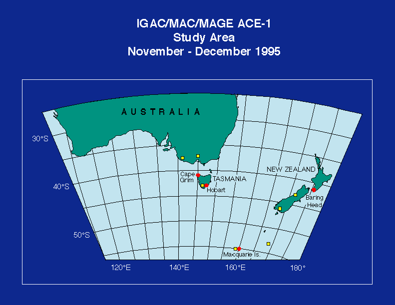
The ACE-1 study area.
(Click Image for Full Resolution)
Scientific Objectives
The ACE-1 Science Team defined three specific objectives:
1) Document the chemical, physical, and radiative characteristics of remote marine aerosols and investigate the relationships between these aerosol properties.
2) Determine the key physical and chemical processes controlling the formation and fate of aerosols and how these processes affect the number size distribution, the chemical compos-ition, and the radiative and cloud nucleating properties of the particles.
3) Assess the climatic importance of remote marine aerosols.
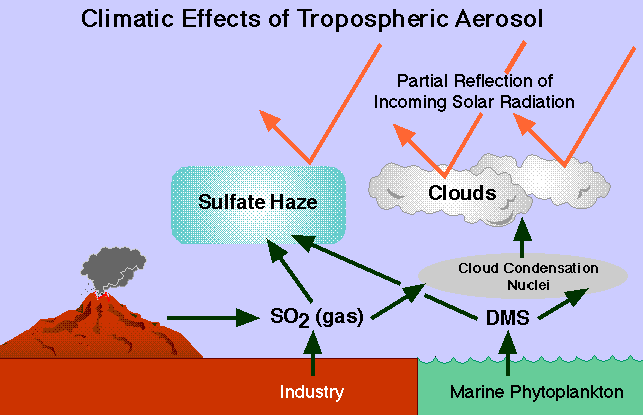
Climatic effects of tropospheric aerosol.
(Click Image for Full Resolution)
Instrumentation
ACE-1 conducted measurements using two ship platforms. The NOAA R/V Discoverer was used for: 1) a survey of DMS emissions; 2) chemical, physical, and radiative measurements of atmospheric aerosol; and 3) to provide surface support for aircraft Lagrangian and column closure experiments. The CSIRO R/V Southern Surveyor was used to provide additional measurements of DMS and size-segregated aerosol composition.
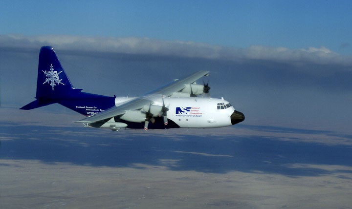
ACE-1 also utilized the NSF/NCAR C-130 aircraft. It was equipped with the capability to make measurements of boundary layer structure and fluxes; aerosol microphysical and chemical properties; cloud properties; radiation; and the concentration of gas phase aerosol precursors and tracers including oxidants, sulfur and nitrogen gases, hydrocarbons, and halocarbons. The C-130 conducted 33 total flights for ACE-1, 18 of the flights were out of Hobart and the other 15 were during the ferry from Broomfield, CO to Hobart and had a significant research component.
ACE-1 also conducted land-based measurements at regional base-line stations. The long-term records at these stations provided a means by which the intensive experiment could be placed into a broader climatological context. The measurements at the sites provided an opportunity to conduct closure experiments over a range of conditions and for extended periods and also to provide a ground base for column closure experiments made in conjunction with the aircraft. The locations for these measurements were at Cape Grim, Macquarie Island, and Baring Head (see Study Area map above). Cape Grim included a large observatory with an on-going observational program of aerosol, trace gas, passive radiation, and meteorological measurements which was enhanced during ACE-1 with an NCAR Integrated Sounding System. Macquarie Island had a small clean air laboratory at which a limited aerosol observation program has carried out since 1986. The station was enhanced during ACE-1 with a 20 m tower. The Baring Head research station at the south end of the North Island of New Zealand provided regional background measurements and facilities included a 10 m tower and three small laboratory buildings with an ongoing measurement program.
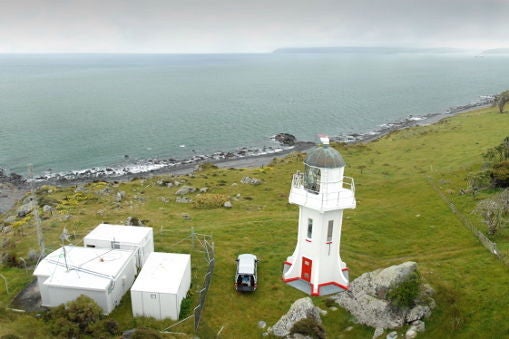
Baring Head Research Station.
(Click Image for Full Resolution)
Satellite Measurements
Observations from satellite platforms provided valuable to mission planning and post-experiment analysis. NOAA AVHRR measurements provided estimates of aerosol optical depth, aerosol size characteristics, cloud reflectance, cloud amount, cloud top temperature, and sea surface temperature. The GMS satellite provided important temporal information about cloud motion and synoptic systems for forecasting and mission planning. The ERS-2 ATSR instrument provided a well-calibrated, multi-wavelength view of aerosol optical depth and cloud coverage over the ACE-1 study area.
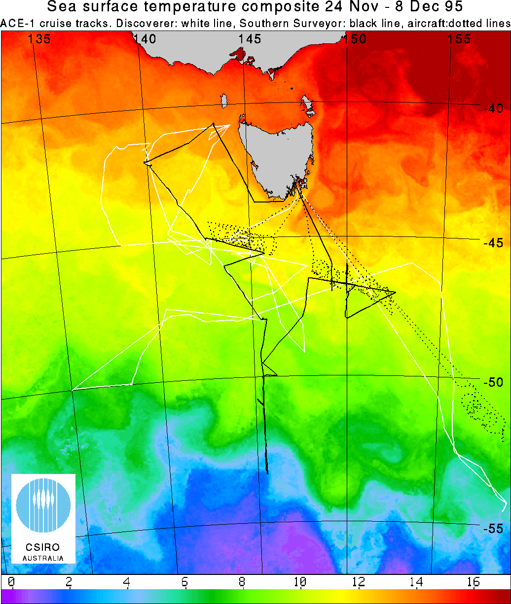
ACE-1 Composite SST with ship and aircraft tracks.
(Click Image for Full Resolution)
Further information on ACE-1 is available in the overview article published in the ACE-1 special issue of the Journal of Geophysical Research.
|
|
|
|
|
|
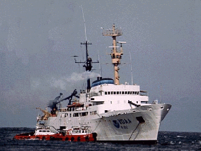
NOAA R/V Discoverer
|
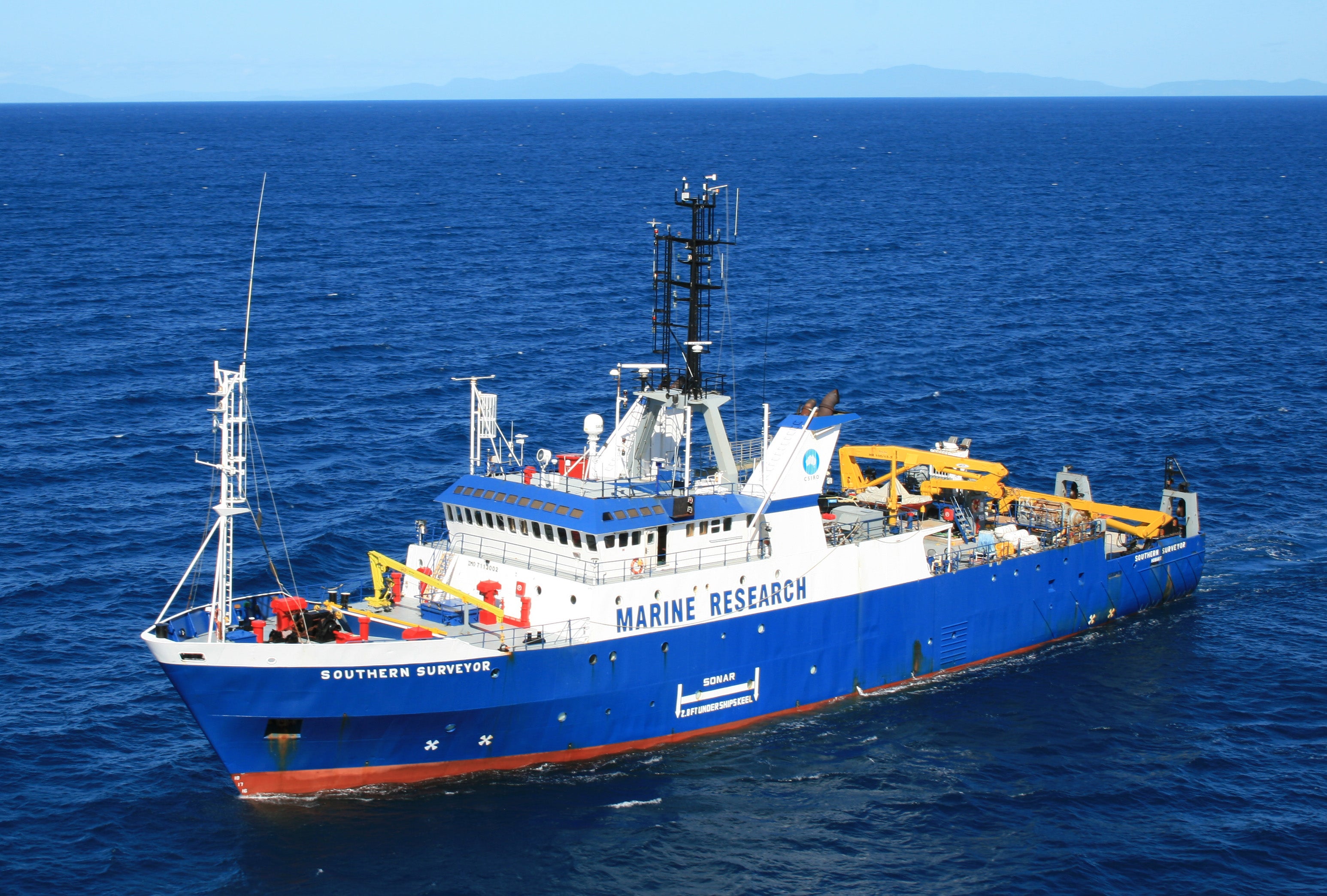
CSIRO R/V Southern Surveyor
|
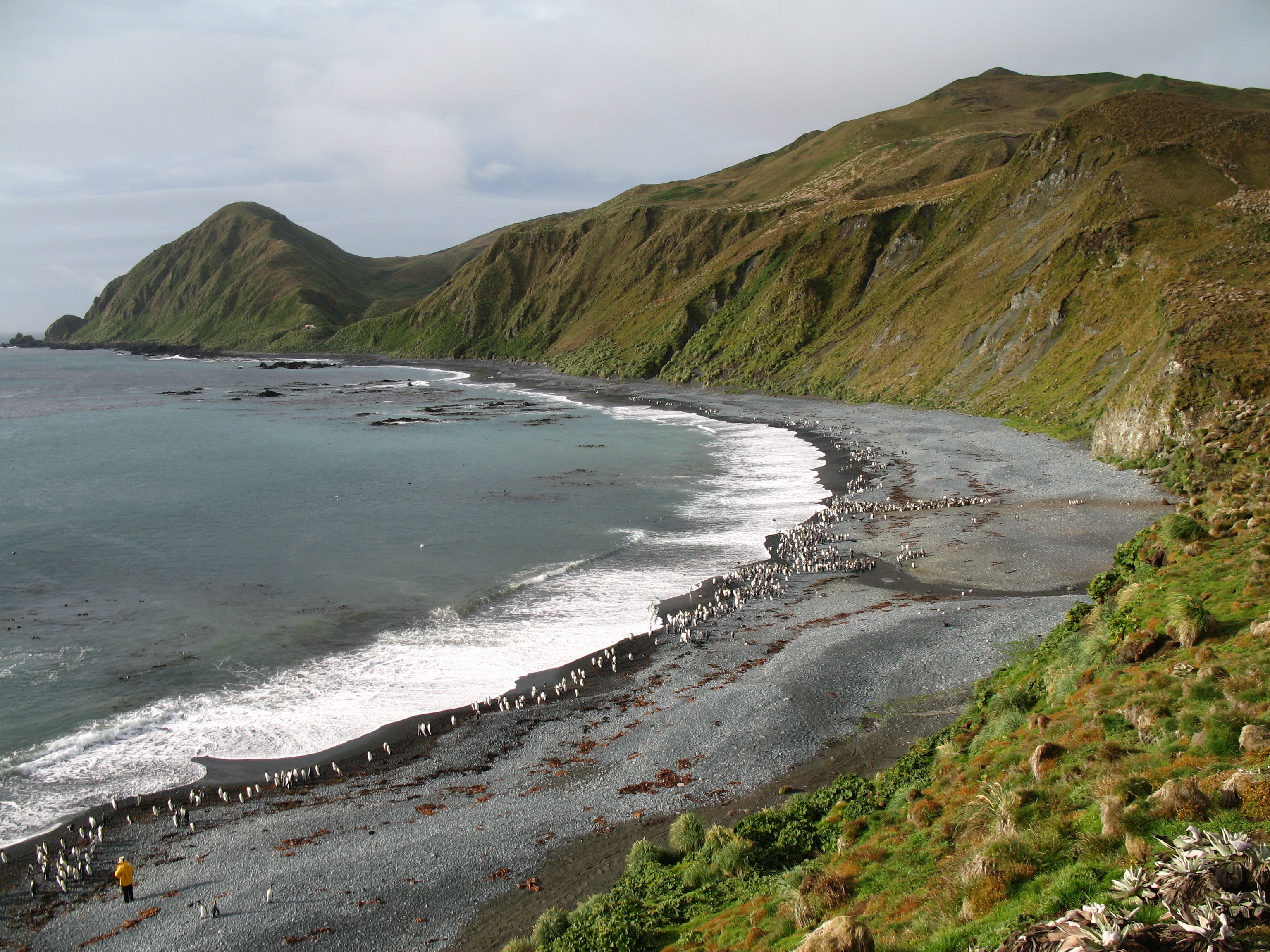
A view over the Macquarie Island bluffs (Courtesy M. Murphy)
|
Cape Grim Baseline Air Pollution Station (courtesy: BoM)
|
|
|
|
||
|
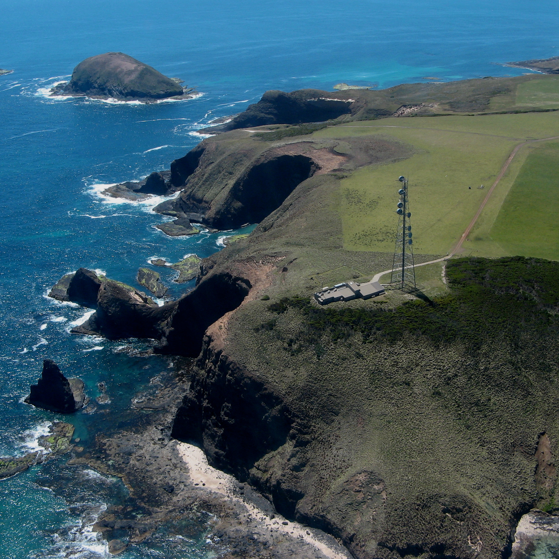
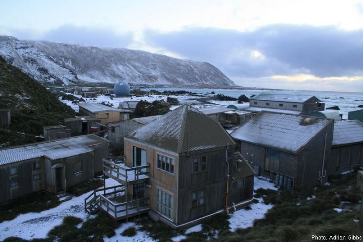
Macquarie Island Station (Courtesy Adrian Gibbs)
|
NSF/NCAR C-130 Aircraft
|
All photos copyright University Corporation for Atmospheric Research unless otherwise noted.
Principal Investigators:
- Barry J. Huebert, et al.
Project Manager:
- Al Schanot NCAR/EOL/RAF
- Dick Friesen NCAR/EOL
Data Manager:
- EOL Archive NCAR/EOL/DMS