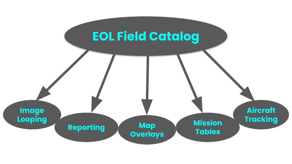
The EOL Field Catalog (DMS)
Each EOL Field Catalog is customized as needed for each campaign and continues to be available online long after the field campaign has ended so they can be used for post-project analysis. Every Field Catalog produced continues to be online at http://catalog.eol.ucar.edu.
To learn more about the Field Catalog capabilities check out the YouTube trainings located in the sidebar.
| Decision Making Tools | Real-time Tracking and Observations | Playback Intensive Operating Periods |
|---|---|---|
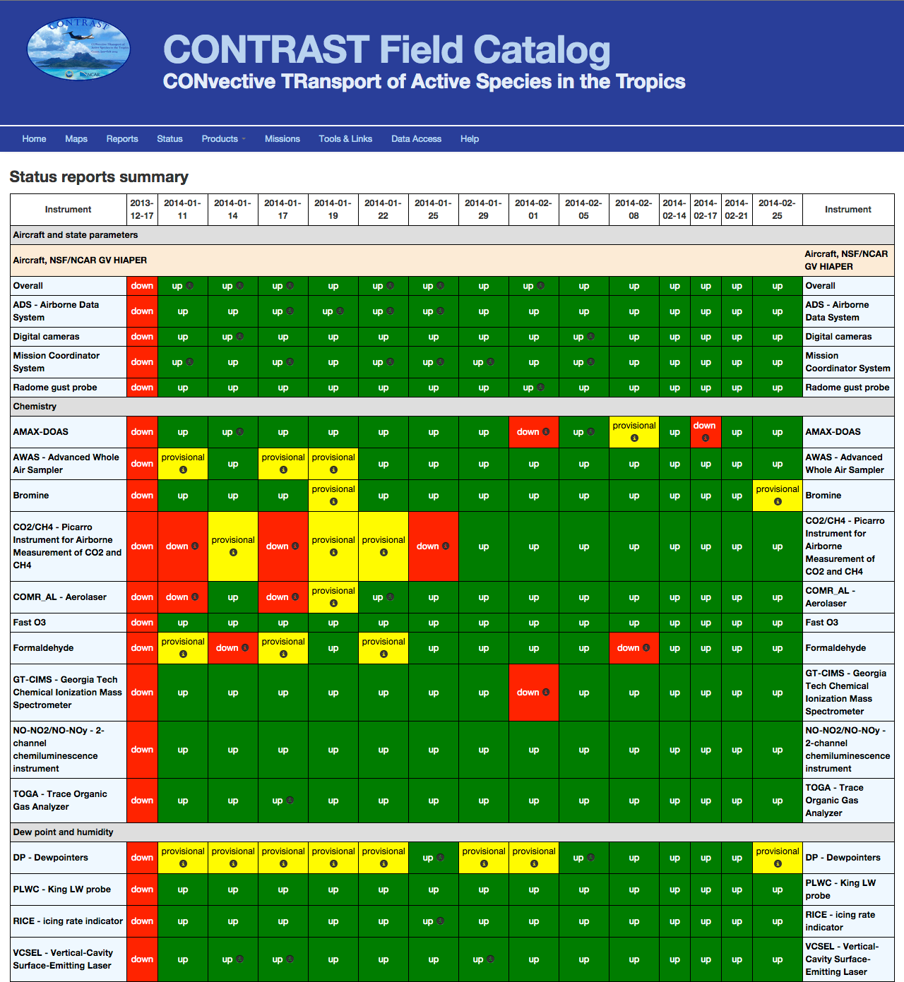
|
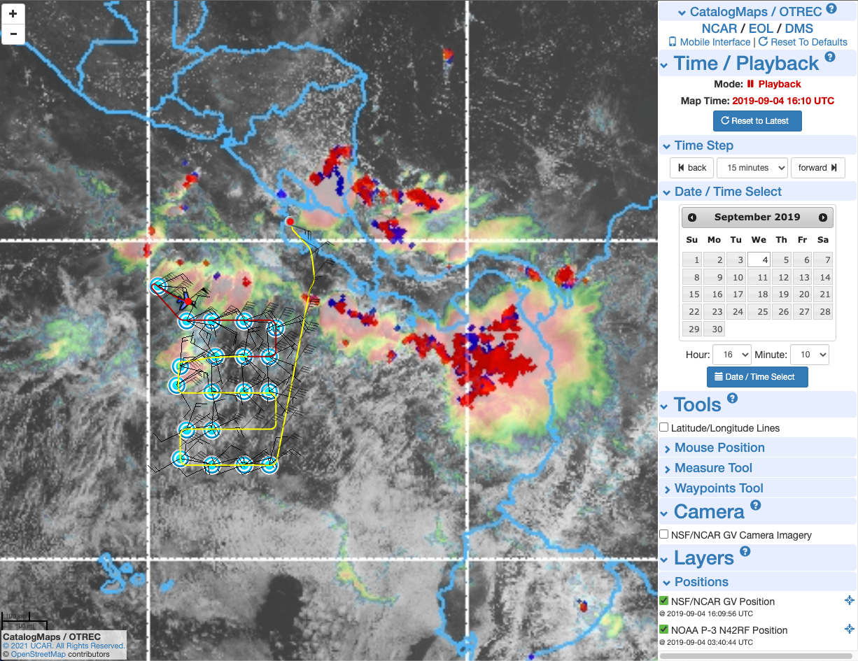
|
|
Citation
NSF NCAR - Earth Observing Laboratory, 1995-present. EOL Field Catalog. https://doi.org/10.5065/D6SQ8XFB
Request us!
|
Note that EOL Data Services can be requested on its own. They do not have to be tied to an EOL instrument/platform request.
Please contact the DMS Facility manager with any questions. |