Overview
This document describes TRAM components and usage. I'll start with a bit of history.
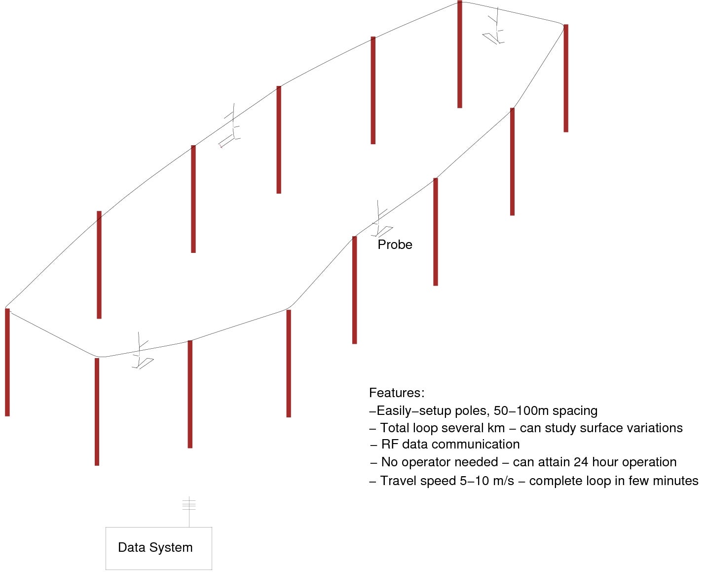
I developed the TRAM concept while at the AMS/BLT Symposium in Denmark in 1990. I heard several talks in which the location of micrometeorological phenomena (such as the top of an internal boundary layer associated with Arctic leads) was not known and could vary with time. I thought it would be useful to have a system that would sample like an aircraft close to the surface repetitively for long periods of time. I sketched the following immediately after this meeting:
As I originally envisioned it, the cable would move making easy to attach several probes to it (just like a ski lift). For several years, I played with this idea, but also considered using UAVs to make the same measurements. Although UAV set-up is potentially much simpler (if you don't count the effort to apply for a COA), routine 24-hour operation is still problematic (especially with high winds) and not yet possible within the forest canopies in which TRAM has been used.
In 2002 (12 years later), we received NCAR/Biogeosciences funds to construct a prototype system to be used to study carbon exchange in forests. At that time, EOL/DFS staff pointed out that a moving cable would have a lot of moving parts scattered throughout the wilderness that could be hard to service. In addition, they noted that ski lifts are always arranged on a line to avoid lateral stresses. They advocated changing to a fixed cable/moving trolley system. The first system was completed in the fall of 2002, unfortunately a bit late to be included in the NIWOT02 field study. In the following years, we made incremental improvements and deployed it as opportunities arose. The original intent to study CO2 transport in forests was accomplished in 2007 (NIWOT07, crossing Como Creek) and published in 2009. A smaller study to investigate spatial variability of CO2 fluxes required moving the track to between the Univ. Colo. and USGS flux towers was operated in 2009 (NIWOT09). At the end of 2009, the TRAM track was removed from Niwot Ridge.
In 2012, we had an opportunity to participate in a study measuring the spatial variability of turbulence, with a mini-experiment colocating TRAM with a set of fixed towers, an angle-of-arrival optical scintillometer (both from Northwest Research Associates in Boulder), and an accoustic tomography array (Univ. Colo./NOAA). We built a 200m track along one site of the tomography array at NOAA's Boulder Atmospheric Observatory (BAO). All systems operated together for only 1 evening, though the track was left in place to enable a repeat. (Data from the 1 evening showed a problem deriving vertical velocity that has not yet been resolved.) In 2016, NOAA vacated the BAO property, so the track was removed, having never had the opportunity to have a repeat.
TRAM is now in storage, with no staff or funds to support it. A new IMU sensor was added in 2014/15 to the trolley to improve wind calculations, but has not been tested. A short test track at NCAR still exists.


