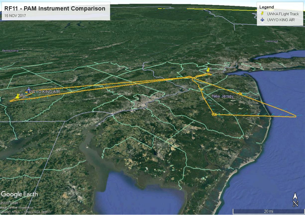
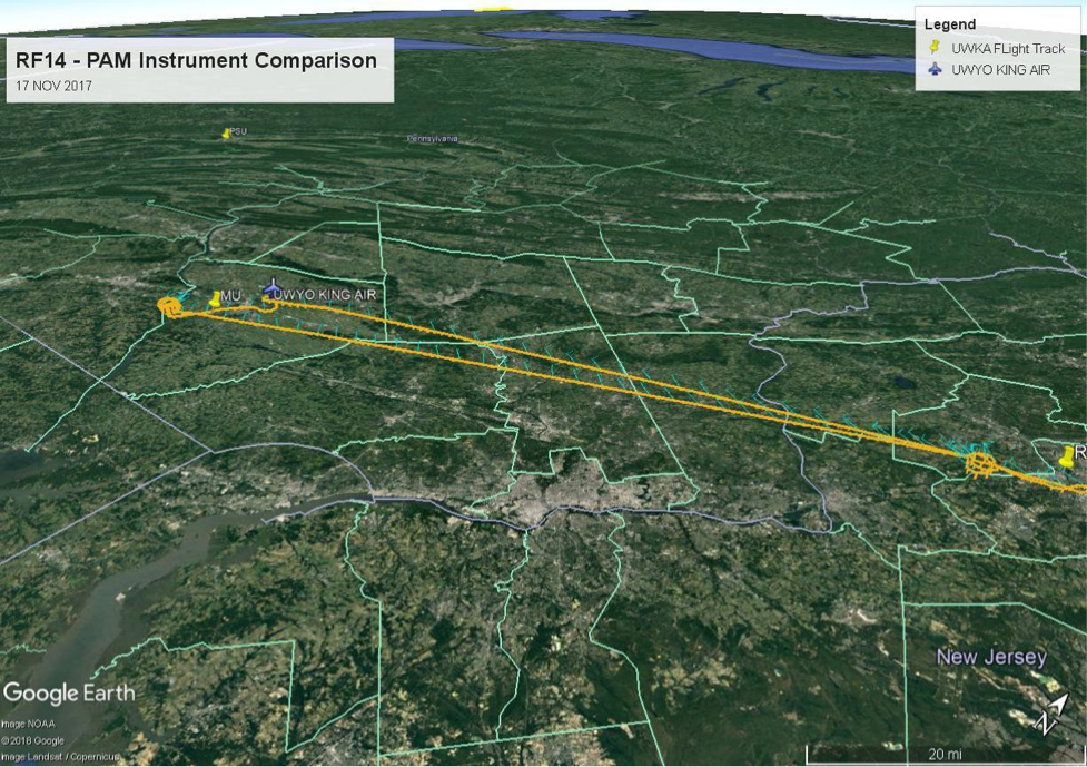
Rutgers’ involvement with the SEAR-MAR aircraft research dealt primarily with gathering information to verify the accuracy of ground-based measurements of the lower atmosphere. Specifically, the wind speed and direction measurements from a 915 MHz Wind Profiler located on Rutgers Horticulture Research Farm 3 in East Brunswick, NJ. The instrument measures wind speed/direction and virtual temperature up to about 5,000 and 1,200 meters above ground level, respectively. The research aircraft made trips to the site on two different days and provided our first ever glimpse into just how well the ground-based instrument is performing. Figure 26 shows the flight track on 15 NOV 2017, RF11, and two days later on 17 NOV 2017, RF14 was used to perform a second aircraft pass over the PAM site and the Millersville MARAF site for instrument comparison as the final flight hours were expended (Figure 27).
It is important that this instrument, first installed in 1993, is still working accurately, as the data from this profiler will not only be used in my master’s thesis which will be analyzing the longer- term trends at the site, but also because it is part of an official PAMS (Photochemical Assessment Monitoring Station) for the state of New Jersey. The profiler’s data is used by the New Jersey Department of Environmental Protection’s Air Monitoring Group to make crucial decisions about issuing air quality alerts and determining the causes of unexpected poor air quality events, so it must be accurate. As the site is situated over ‘final approach’ for Newark Liberty International Airport, launching radiosondes at the site is understandably impractical due to FAA regulations, so the aircraft flyovers were an excellent solution.
The other part of the PAMS aircraft flights were related to assessing boundary layer development over the state of New Jersey, both overland and just off the coast. The plane flew in a spiral over some set locations taking measurements to determine the boundary layer depth and dynamics.
Boundary layer measurements are an important component of many plume dispersion and behavior models, and therefore also play an important role in understanding and predicting air quality in the state. Not only that, but the comparison of the boundary layer development on land versus offshore is a valuable data set to have for future student projects.
It was also a very helpful and interesting learning experience to see and participate in the logistics behind how field campaigns operate. It’s something I don’t think very many people know about unless they’re directly involved with it. Working in the meteorology and atmospheric science field, this may not be the last field campaign I will be a part of. This campaign serving primarily as an educational and teaching deployment was a unique opportunity I feel fortunate to have been a part of. It will hopefully prepare me for future campaigns where a more basic understanding of the logistics might be assumed of the participants.