After the passage of a cold front, the Appalachians often experience an extended period of strong flow with a westerly and/or northerly component. In cooler, more stable air this results in the formation of trapped lee waves with trains that may propagate across the mid-Atlantic Piedmont and through the SEAR-MAR domain. Since the mountains have a sharp clockwise bend in the study area, both eastward and southward traveling waves can be triggered, and there is a possibility of interference between the two.
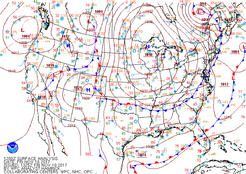
Forecast teams identified 10 Nov, after an overnight cold front passage and ahead of an advancing 1040 hPa high pressure system (Fig. 14), as an ideal mountain wave day. Short-term model guidance suggested a midday transition from wave trains to convective cloud streets, so takeoff was scheduled for 1430 UTC.
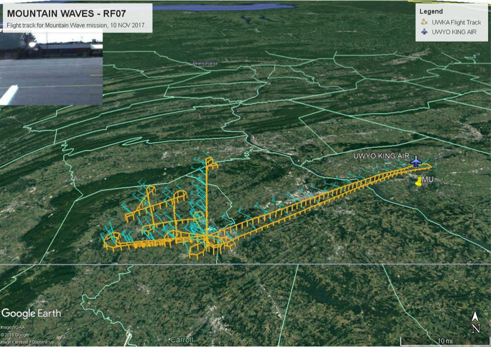
To study this phenomenon, a flight path was developed that included four vertically-stacked levels in both an N-S direction and an E-W direction (Fig. 15). Between these two stacks, in the area NE of Gettysburg, PA, a sequence of ascending legs crisscrossing the line of inflection through the Appalachians was planned, followed by a set of similar descending legs.
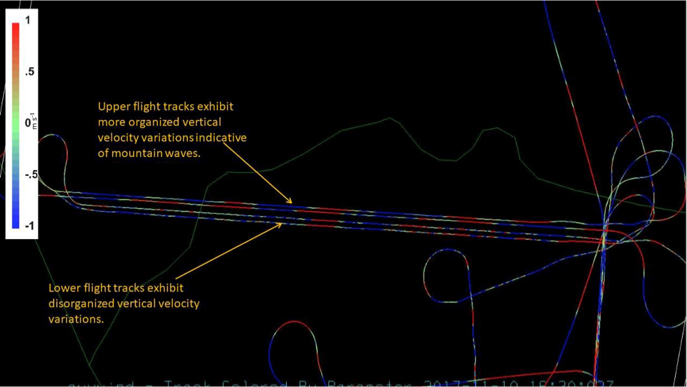
The N-S stacks had a well-defined wave structure at 6250’ AGL, but the lower three legs were found to all be within the turbulent boundary layer. For this reason, the flight plan was changed so that after the ascending zigzag, the return pattern was made at a constant 6250’ elevation. Then, one of the lower E-W legs was replaced by a higher one at 7750’ resulting in additional mountain wave transits.
Figure 16 is from a student presentation showing the inflight vertical velocities for the entire track. There are obvious differences between the irregular fluctuations in the lower transects and the smoother, periodic undulations along the transects at higher altitudes where the mountain waves reside.