VORTEX
Verification of the Origins of Rotation in Tornadoes Experiment 94
The Verification of the Origins of Rotation in Tornadoes EXperiment (VORTEX1) project was designed to address research questions relating to tornadogenesis and tornado dynamics.
VORTEX1 took place from 1 April to 15 June in 1994 (VORTEX-94) and 1995 (VORTEX-95). Spreading the operations over two years increased the size of the sample of tornadic storms and allowed for the improvement of technologies and strategies by analyzing the first year data during the off-season. The experiment was held in the southern and central plains states, a region ideal for observing tornadoes and tornadic storms because of the relative frequency, the relative flatness of the terrain, a good road network, and generally good visibility.
(Click Image for Full Resolution)
Scientific Objectives
The objectives of VORTEX were stated in terms of testable, refutable hypotheses. There were four broad areas covered by the hypotheses
- Hypotheses relating to the role of the storm environment in governing or modulating the structure and evolution of tornadic storms. These related to looking at the imporatance of horizontal inhomogeneities, helicity time tendency, vertical distributions of convective available potential energy (CAPE) and several other issues.
- Hypotheses relating to tornadogenesis. The issues examined here included the importance of vorticity intensification through stretching and/or tilting and several other issues.
- Hypotheses pertaining to tornado dynamics. There were several issues to be examined here including determining if the flow near the tornado is axisymmetric, whether the vertical vorticity is strongly concentrated within the tornadic core, whether the funnel cloud is a constant pressure surface, whether maximum velocities occur within 50 m of the surface and so on.servations were used to constraints on what model output could or could not be considered realistic.
- Hypotheses pertaining to tornado debris deposition. These aimed to determine whether the debris generated by a tornado and lofted high into a storm returns to earth in a repeatable patter and whether the pattern of return of debris to the surface can be predicted using knowledge of vortex/storm dynamics and meso- and cloud-scale wind fields.
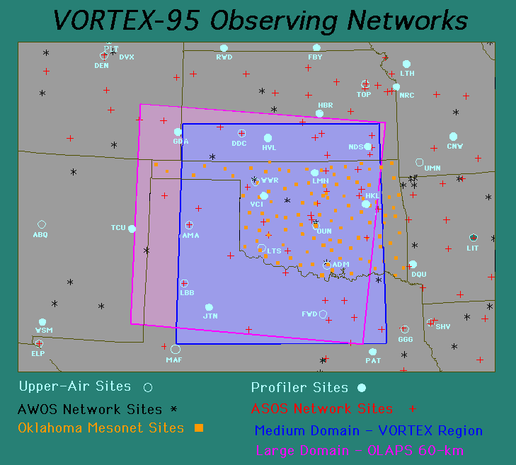
Instrumentation
 |
|
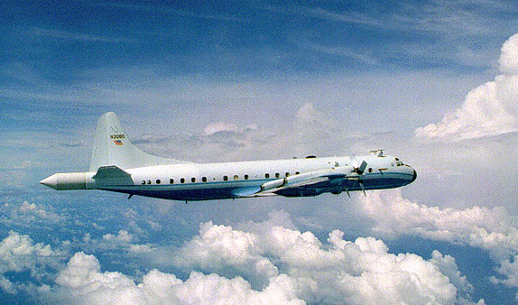
The NCAR Electra aircraft in flight. The ELDORA radar is in the tail.
(Click Image for Full Resolution) |
VORTEX1 utilized a suite of aircraft and fixed and mobile ground facilities to support its operations.
The NOAA P-3 aircraft took part in both the 1994 (10 flights) and 1995 (26 flights) field seasons. It was equipped with a Doppler radar, a variety of cloud physics instrumentation, and a NOAA/ETL radiometer.
The NCAR Electra aircraft took part only in the 1995 (15 flights) field season. It was equipped with the ELDORA Doppler radar.
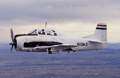
The T-28 armoured aircraft took part in both the 1994 (5 flights) and 1995 (5 flights). Its mission was to penetrate convective clouds and provide in-situ observations of the precipitation particle population in regions simultaneously being scanned by multi-parameter radar. The operations were in loose coordination with VORTEX, but its activities were restricted to within 50 miles of the Cimarron, OK radar. It carried an instrument package to measure temperature, vertical winds, electric fields, water content, etc. It also carried a PMS 2D-P optical probe.
 |
|
The T-28 aircraft in flight.
(Click Image for Full Resolution) |
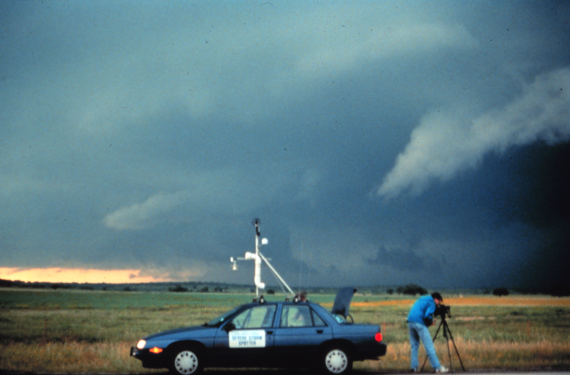
On the ground VORTEX1 had a compliment of mobile radars, mobile mesonets and mobile sounding systems all coordinated by an in field coordination vehicle. The sounding systems were operated by the National Severe Storms Laboratory (NSSL) and the National Center for Amtospheric Research (NCAR). The mobile mesonet was comprised of cars outfitted with an instrument package collecting location, velocity and meteorological parameters every five seconds. They were deployed in strategic locations around the storms to provide storm-scale surface data.
(Click Image for Full Resolution)
Further information on VORTEX is available in the overview article published in the Bulletin of the American Meteorological Society.
|
|
|
|
|
|
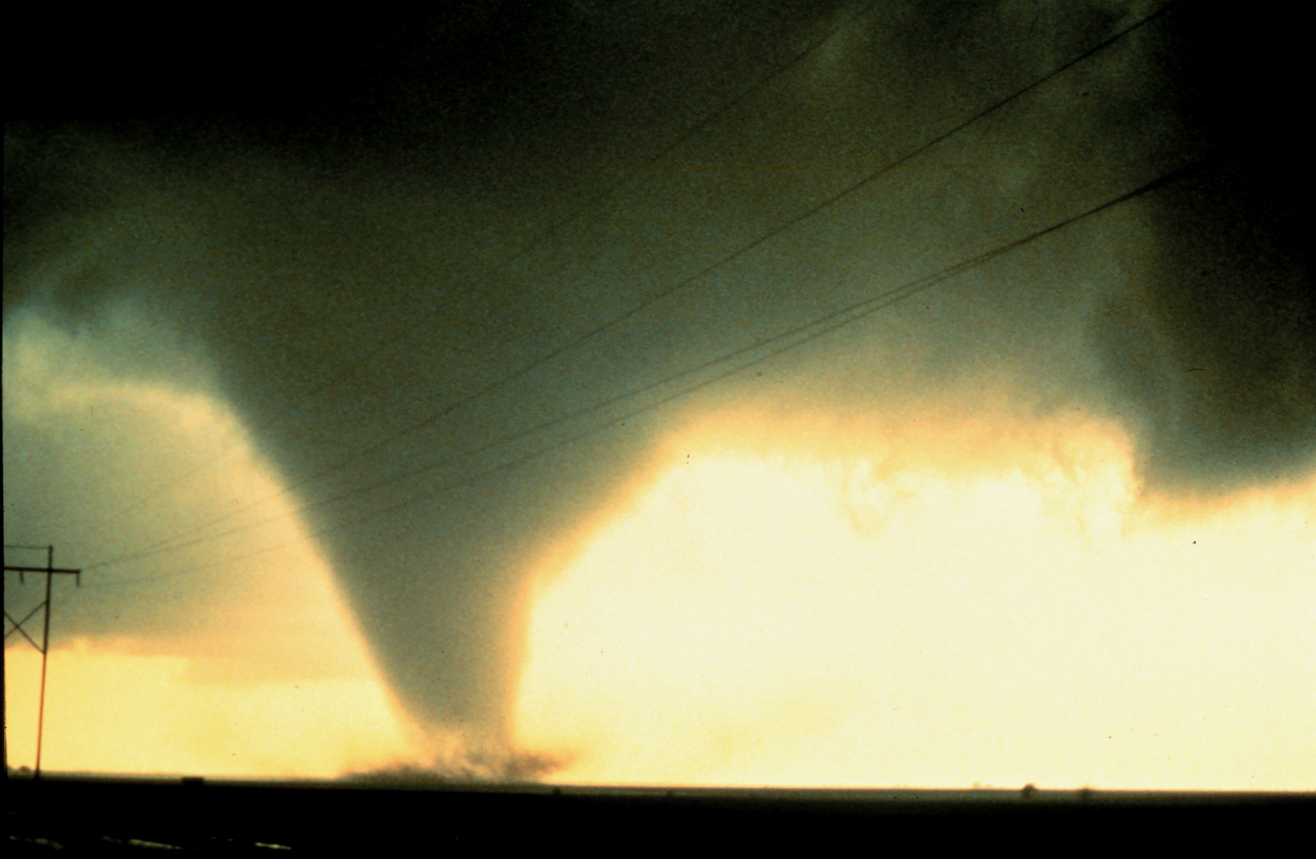
The Dimmitt, TX tornado of 2 June 1995. Courtesy NOAA Photo Library.
|
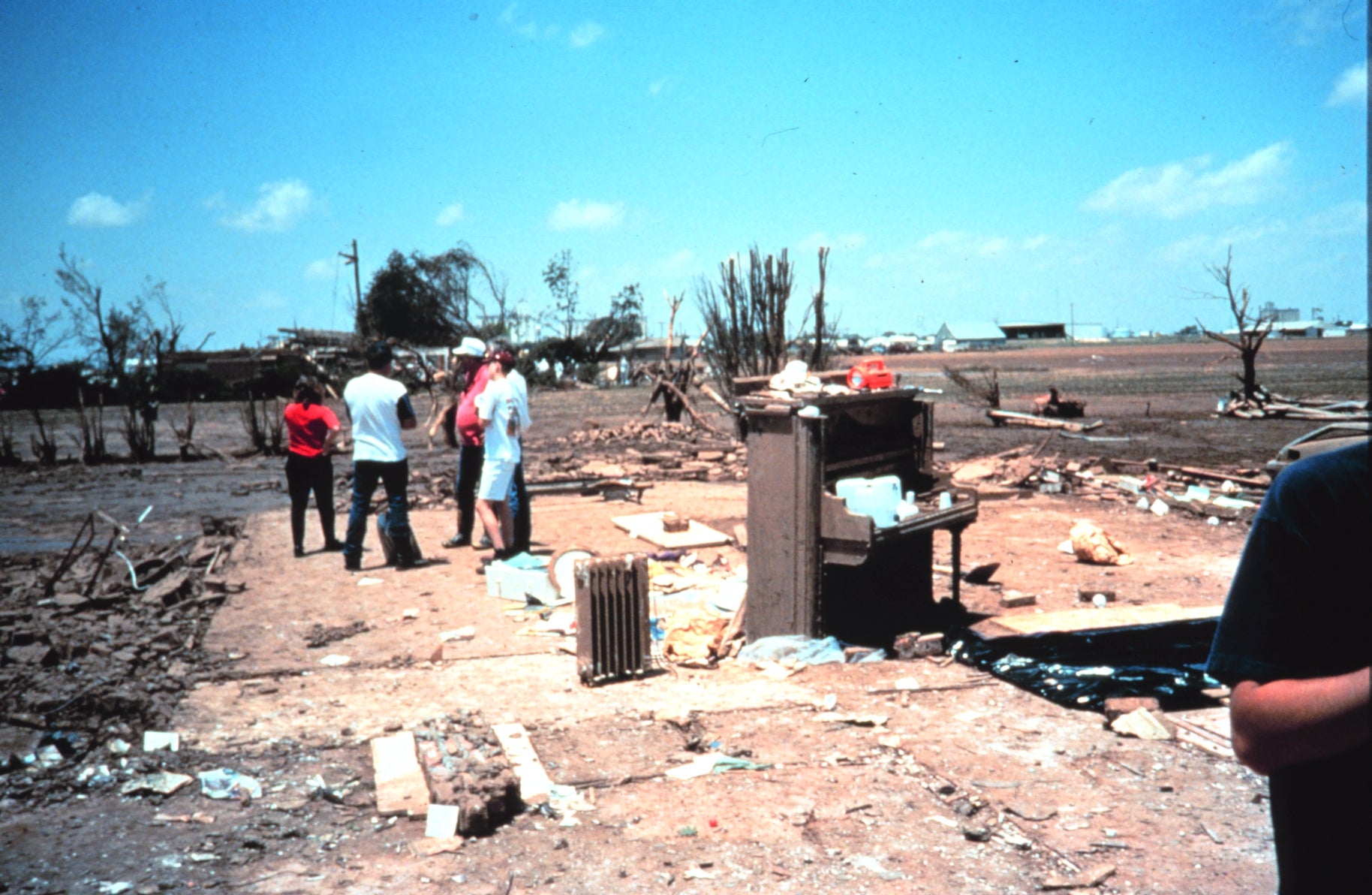
Damage from the 2 June 1995 Friona, TX tornado. Courtesy NOAA Photo Library.
|
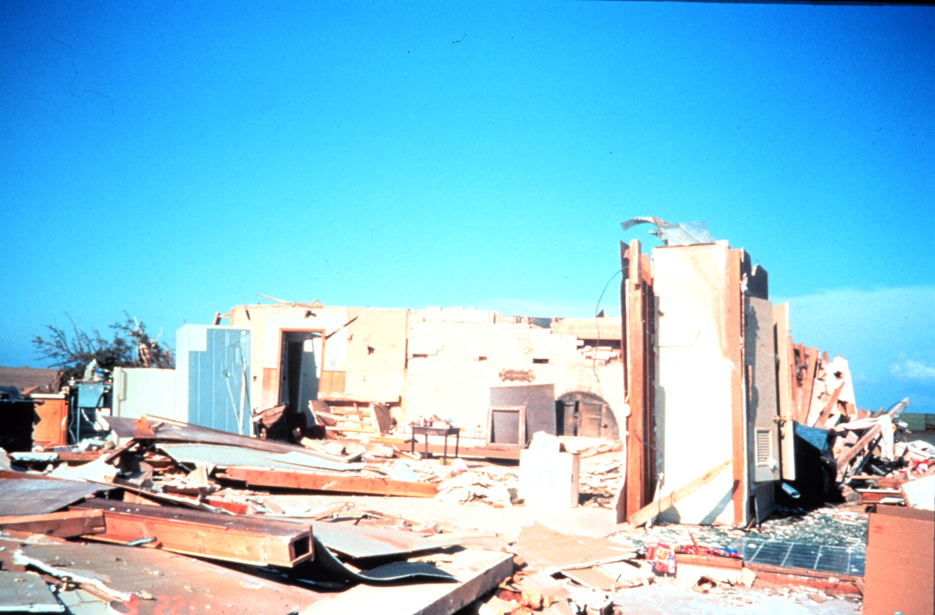
Damage from the 8 June 1995 Allison, TX tornado. Courtesy NOAA Photo Library.
|
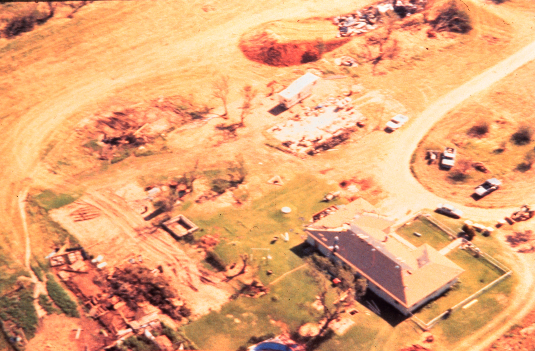
Damage from the 8 June 1995 Kellervlle, TX tornado. Courtesy NOAA Photo Library.
|
|
|
|
|
|
|
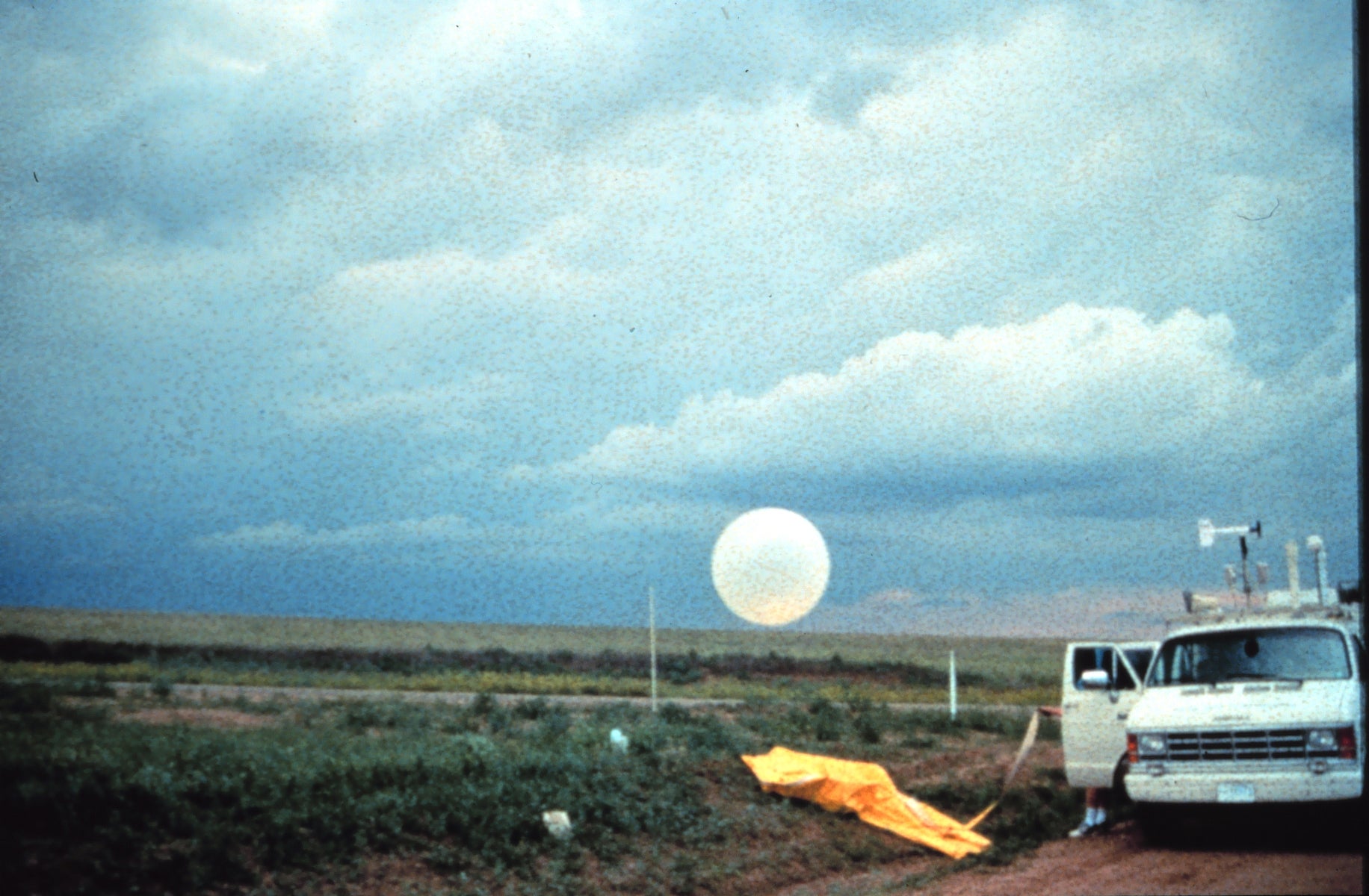
One of the mobile soundings systems in Lubbock, TX on 26 May 1994. (Courtesy NOAA Photo Library)
|
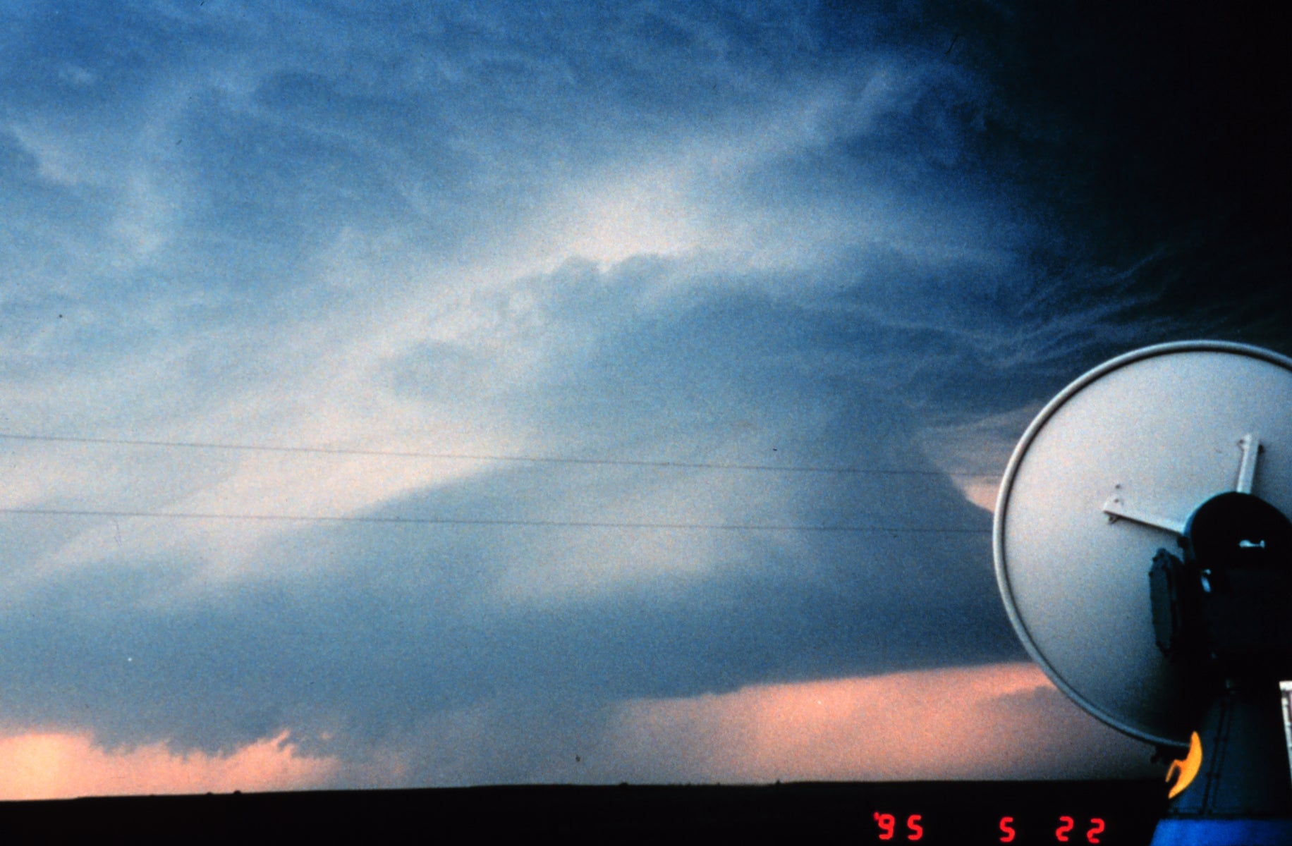
One of the mobile radars in Northern Texas on 22 May 2995. (Courtesy NOAA Photo Library)
|
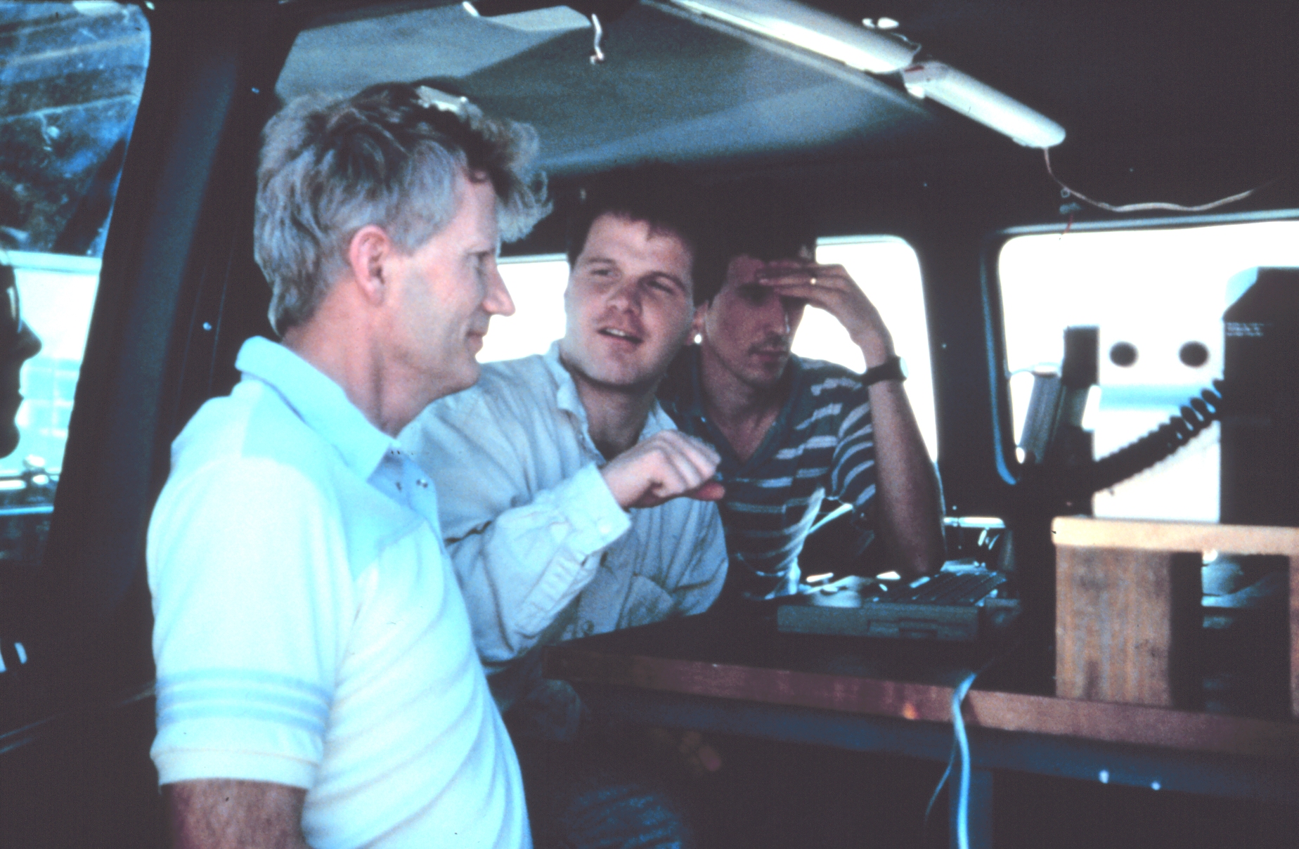
VORTEX Investigators Bob Davies-Jones, Jerry Straka, and Eric Rasmussen in the VORTEX Field Coordination vehicle.
|
All photos copyright University Corporation for Atmospheric Research unless otherwise noted.
Principal Investigators:
- Morris Weisman (NCAR)
- Jim Wilson (NCAR)
- Roger Wakimoto (UCLA)
Project Manager:
- Bruce Morley NCAR/EOL
- Dick Friesen NCAR/EOL
Data Manager:
- EOL Archive NCAR/EOL