ICECHIP
In-situ Collaborative Experiment for the Collection of Hail In the Plains
Why It Matters - Hailstorms cause billions in damage and pose risks to life and property. ICECHIP data will improve hail detection, forecasting, and warnings to protect communities.
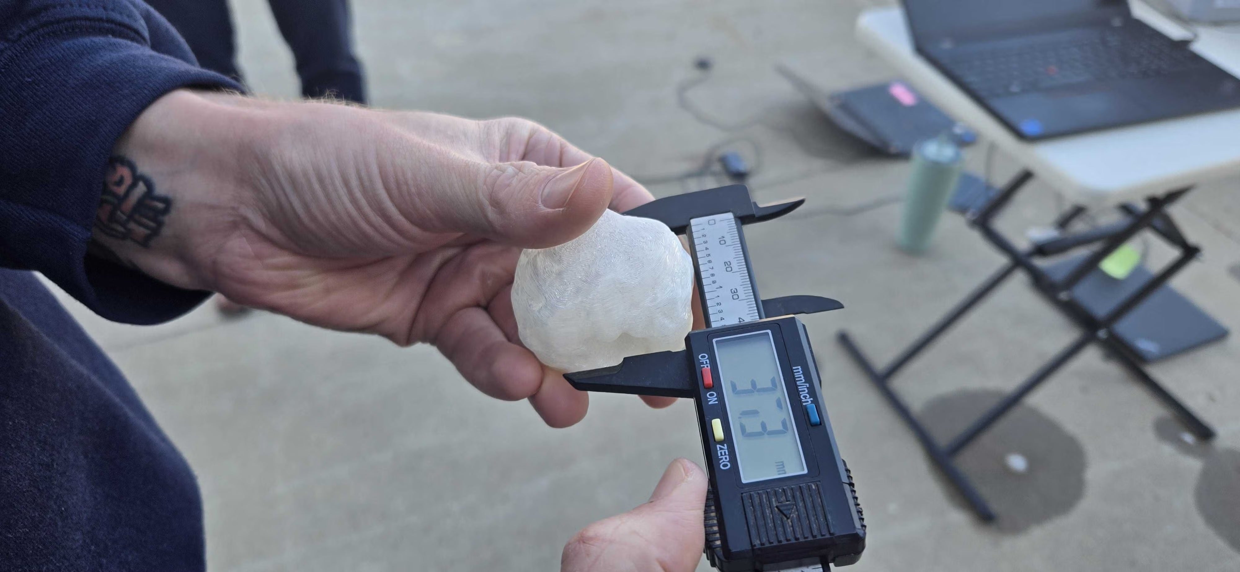
Funded by the National Science Foundation (NSF), ICECHIP was the first U.S. hail-focused field campaign in over 40 years. Using modern instrumentation and advanced numerical models, researchers from 15 institutions and 3 international partners deployed a fully mobile network for ~6 weeks across the U.S. Front Range and Central Plains, capturing observations from a wide variety of hailstorms and hail types. This first-of-its-kind dataset will drive improvements in radar-based hail detection, hail modeling forecasting, and warning systems.
ICECHIP addresses five key hail science themes:
Theme 1: Study hailstone growth and fall behavior to improve microphysical models.
Theme 2: Validate hail trajectory models and link updrafts to surface hail production.
Theme 3: Assess environmental impacts on hail forecasting skill.
Theme 4: Connect hailstone properties to damage potential on materials and structures.
Theme 5: Enhance radar-based hail detection and link updrafts to hail mass and damage.
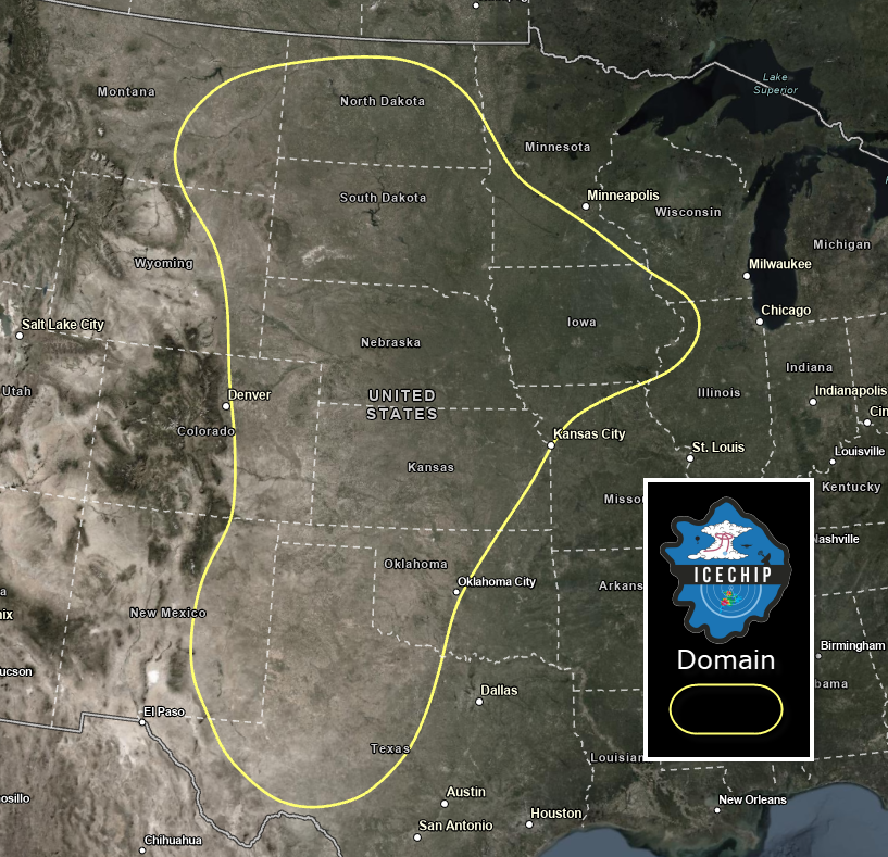
ICECHIP observations focued on the U.S. Central Plains and Front Range of the Rocky Mountains including Montana, Wyoming, Colorado, the Dakotas, Nebraska, Kansas, Oklahoma, New Mexico and Texas.
Victor Gensini
ICECHIP Field Project Logo
Becky Adams-Selin
Principal Investigators
- Rebecca Adams-Selin Atmospheric and Environmental Research (Lead PI)
- John Allen Central Michigan University
- Victor Gensini Northern Illinois University
- Andrew Heymsfield National Center for Atmospheric Research
Steering Committee
- Brian Argrow Univ. Colorado Boulder
- Ian Giammanco Insurace Institute for Business & Home Safety
- Karen Kosiba Univ. Alabama Huntsville
- Matthew Kumjian Pennsylvania State Univ.
- Joshua Wurman Univ. Alabama Huntsville
Additional Science PIs
- V. Chandrasekar Colorado State Univ.
- Xingchao Chen Pennsylvania State Univ.
- Daniel Dawson Purdue Univ.
- Justin Dodd Northern Illinois Univ.
- Katja Friedrich Univ. Colorado Boulder
- Yongli Gao Univ. Texas San Antonio
- Cameron Homeyer Oklahoma Univ.
- Jason Keeler Central Michigan Univ.
- Zachary Lebo Oklahoma Univ.
- Kelly Lombardo Pennsylvania State Univ.
- Ted Mansell NOAA/National Severe Storms Laboratory
- Russ Schumacher Colorado State Univ.
- Hannah Vagasky Atmospheric and Environmental Research
- Loren White Jackson State University
- Yunji Zhang Pennsylvania State Univ.
- Conrad Ziegler NOAA/National Severe Storms Laboratory
Collaborators/Partners
- Australian Bureau of Meteorology (Joshua Soderholm, Alain Protait)
- Insurance Institute for Business and Home Safety (Ian Giammanco)
- Northern Hail Project (Julian Brimelow)
- Universität Bern (Olivia Romppainen-Martius)
Data Manager
- EOL Archive NCAR/EOL/DMS