Worldwide Radiosonde Launch Sites Notes
MJ Mahoney
Last Revision: June 19, 2008
Since radiosondes play a key role in MTP data analysis, it is important
to have a comprehensive list of launch sites worldwide, so that
appropriate soundings can be downloaded wherever and whenever a field
campaign occurs. Initially we used WMO Publication No. 9 Volume A - Observing
Stations
-- called a flatfile -- since it is the most authorative source.
Documentation on the format of these more than 11,600 surface and
upper-air stations can be found here.
A subroutine named UAfromFlatfile was
written more than a decade ago to read this flatfile and extract
relevant information such as launch site WMO station number, latitude,
longitude and geopotential height. However, the WMO flatfile did not
provide the ICAO
name for a site (if there was one).
Since it is easier to remember ICAO names than it is to remember WMO
(station) numbers, I stopped using the WMO flatfile and migrated to
using a
GEMPAK
listing of radiosonde launch sites, which does include both the
ICAO name and WMO number. When I started this many years ago, you could
download a file named station-query.html
which contained all the
launch sites worldwide. UAfromFlatfile
was modified to convert the
sites in station-query.html
into binary records in a file named
UA_MTP.BIN with the following
data structure found in the
RAOBcommon.BAS module:
'GEMPAK Station List
'http://www.unidata.ucar.edu/software/gempak/tutorial/station_tables.html
'Station tables should use the following format:
'(A8,1X,I6,1X,A32,1X,A2,1X,A2,1X,I5,1X,I6,1X,I5)
' ^     ^     ^      ^     ^     ^     ^     ^
' |     |     |      |     |     |     |     |
' |     |     |      |     |     |     |     --- Elevation (meters)
' |     |     |      |     |     |     --- Longitude (west = negative)
' |     |     |      |     |     --- Latitude (south = negative)
' |     |     |      |     --- Country
' |     |     |      --- State
' |     |     --- Station Name
' |     --- Station Number
' --- Station ID
'Note that Latitude and Longitude are expressed in hundredths of decimal degrees (not DMS!).
'0        1         2         3         4         5         6         7
'1234567890123456789012345678901234567890123456789012345678901234567890123
'$$$$$$$$ %%%%%% $$$$$$$$$$$$$$$$$$$$$$$$$$$$$$$$ $$ $$ %%%%% %%%%%% %%%%%
'VBCI      48109 COCO ISLAND                      -- BM  1412   9337     3
'VBG       72393 VANDENBERG AFB                   CA US  3465 -12057   112

Type GPrecord
  GPcards As Long               ' CARDS number = WMO*10
  GPicao As String * 8          ' Alpha name
  GPlatitude As Single          '
  GPlongitude As Single         '
  GPaltitude As Integer         ' meters MSL
  GPregion As Integer           ' WMO region
  GPcountry As String * 2       ' FIPS PUB 10-4 Country Code
  GPstate As String * 2         '
  GPstation As String * 32      '
  GPspare As Integer            ' Spare
End Type
Unfortunately, the complete station-query.html
file does not seem to be available. To overcome this short-coming,
there where options on the RAOBsites
form (under the RAOBman Export tab) that allowed sites to
be added, removed, or editted in MTP_UA.BIN.
I decided to see if I could find a some other current source of
worldwide launch sites, and was successful. The NOAA Earth System
Research Laboratory (ESRL) Global Systems Division (GSD, formerly FSL)
does provide current radiosonde launch site documentation because (in
their own words):
The station history is an integral part of the radiosonde
archive. Information contained in the station history are
required
for output of data. As a result, a sounding will not be output
unless
a corresponding entry exists in the station history file. We
strive
to maintain an updated station history tracking changes of location,
station
identifiers and dates station moves as they occur. You are
encouraged
to update your copy of this station history frequently.
Additionally,
we value your feedback on
possible
corrections to this file when a station moves or our information is
incorrect.
This is exactly what is needed! So the
Add, Remove, and Edit buttons were removed from the RAOBsites form shown in Figure 1.
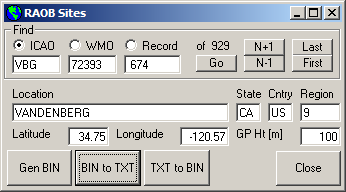
Figure 1. The RAOBsites
form.
The procedure now for updating the MTP_UA.BIN
file is as follows:
1) Go to the NOAA
ESRL GSD Station History documentation and download the intl2000.wmo
text file file to the C:/MTP/RAOB/BIN/
folder (or just right click on the last link and select the Save Link As menu option).
2) Run the CRLF.exe program to
add a carriage return to each line of the intl2000.wmo file.
3) Select the Export tab in
the RAOBman.exe program, and
then depress the Show RAOB Details
button near the bottom of the form bring up the RAOBsites form shown in Figure 1.
4) Finally, depress the Gen BIN button on the buttom left of the
RAOBsites form to create a new version of the C:\MTP\RAOB\BIN\MTP_UA.BIN file.
This is the only RAOB file now read by MTP data analysis programs that
need radiosonde location information.
More documenation on the RAOBsites
form is available here.