The EOL Field Catalog is one of the most heavily used services that EOL provides to the scientific community. A majority of the facility requests EOL receives each year include a petition for field catalog support. The major strengths of the field catalog have been its comprehensive collection of field project related documents and images, ease of use and adaptability.
The EOL Field Catalog is a suite of tools that provide support for the documentation of observational field project operations, mission planning, cross-project collaboration, real-time situational awareness, communication with and direction of remote instrument platforms and post operations product review and playback, and is developed and maintained by EOL's Data Management & Services Facility.
The field catalog is identified as https://doi.org/10.5065/D6SQ8XFB. See the citation recommendation below for more information.
 |
 |
 |
Capabilities
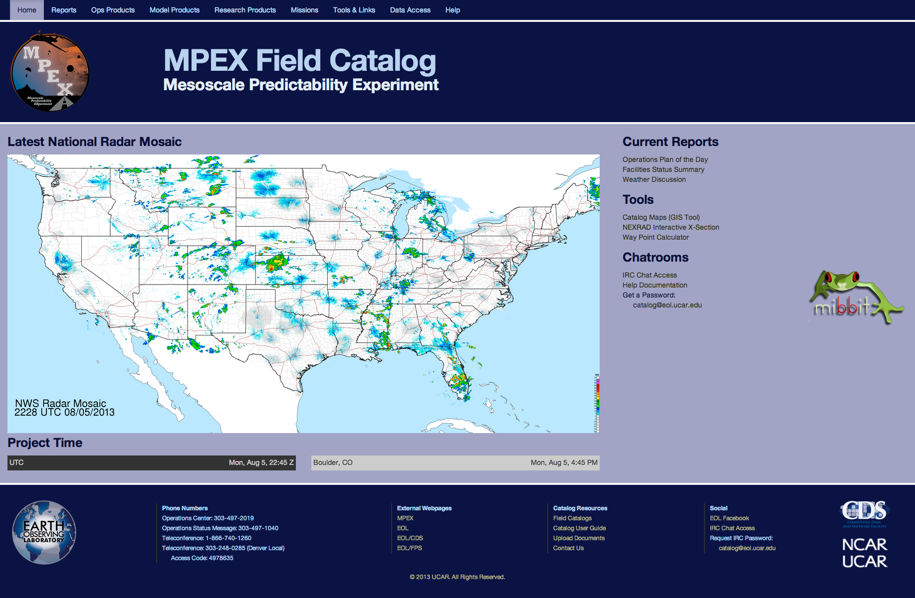
Each EOL Field Catalog is customized as needed for each campaign, and continues to be available on-line long after the field campaign has ended so they can be used for post-project analysis. Every Field Catalog produced continues to be on-line and can be found at: http://catalog.eol.ucar.edu
Project Documentation
The EOL Field Catalog provides reporting tools for documenting project operations. These tools allow the user to write reports in their web browser and include special formatting, in-line images, URLs, instrument status, and event-specific information. These reports can be generated as frequently as necessary and are editable to correct errors or include additional information. The report forms can be customized to meet the users' needs and be password-protected to limit their distribution only to the project team. If users prefer to write and format reports in their style, they can also upload their reports to the Field Catalog in pdf form. A Mission Table summarizes all of the significant events and operations that occurred during the field campaign.
Supporting Products
The EOL Data Management Team works with the project PIs to determine beforehand a list of necessary products that should be collected and available in real-time for the field campaign. This list includes necessary information for real-time decision-making as well as for documentation of conditions in which the research data was collected.
EOL welcomes any and all research products generated in the field that the project participants might be willing to provide. These also can be password-protected to limit their distribution.
Mission Planning
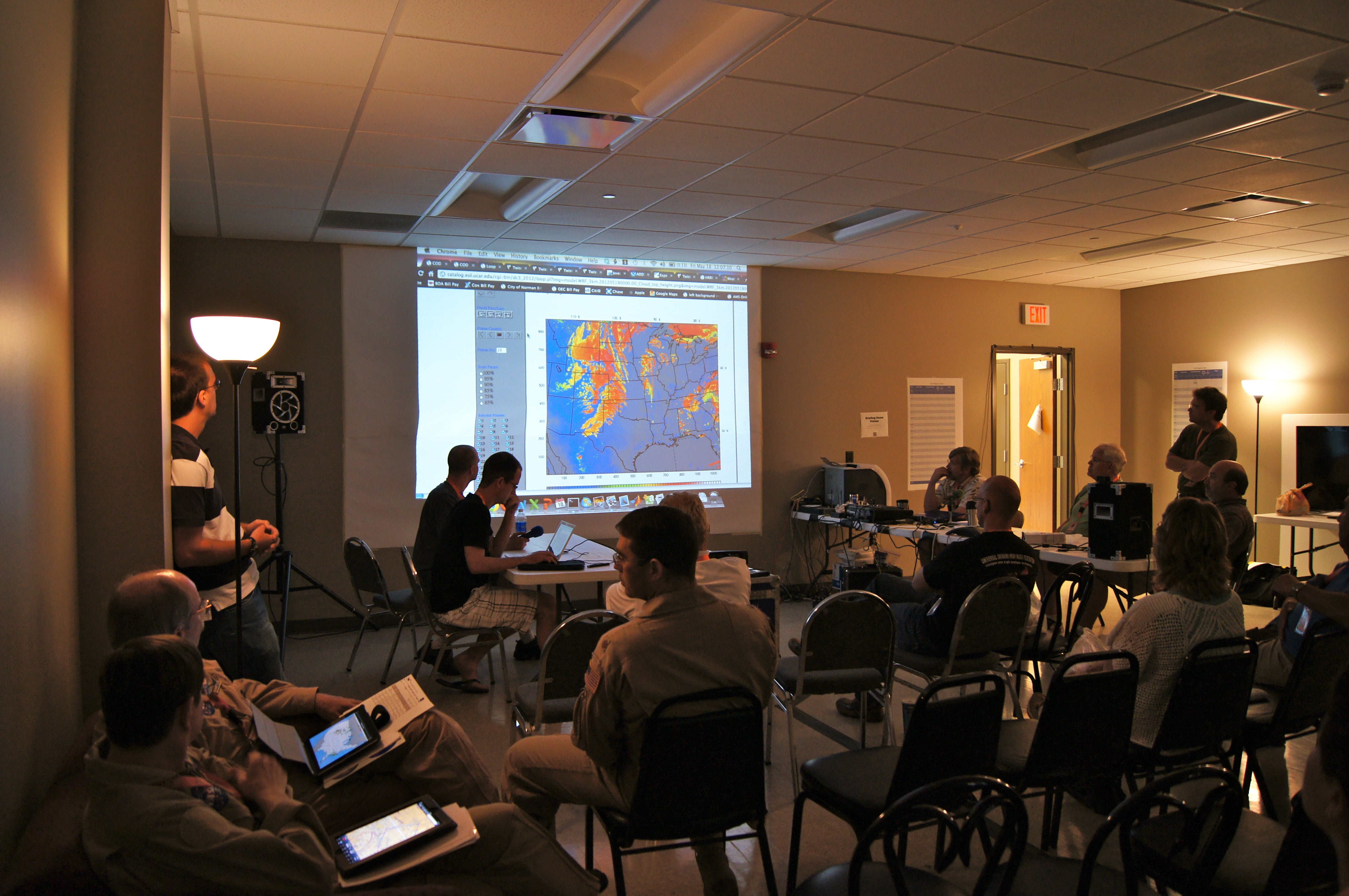
The EOL Field Catalog provides a number of features to assist in mission planning. First, we encourage the use of a Forecast Report to include all of the information for the daily briefing. This allows others who may only have a voice connection to follow along with the forecast briefing and allows those not present to browse it later. After a meeting where decisions are made regarding project operations, the Project Operations Director or Chief Scientist will fill out or update the Ops Plan of the Day report. This report can be automatically emailed to the project mailing list if the author chooses and the specific operations schedule included in this report is automatically published to the Field Catalog front page. An instrument status report is also usually a part of every EOL Field Catalog. This report allows each instrument operator or platform manager to report the status of their instruments in a simple color-coded manner and include some optional text to give further information when necessary.
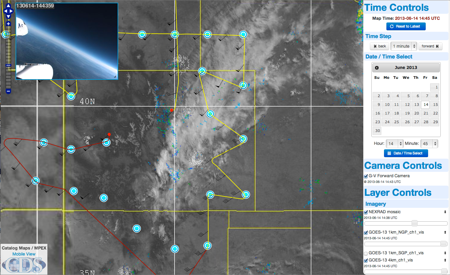
Catalog Maps
The EOL Field Catalog contains a GIS-based tool called Catalog Maps, which allows any user to overlay various products such as instrument locations or flight plans for situational awareness and real-time decision-making. This tool provides excellent situational awareness and is also available on NSF/NCAR Aircraft.
Catalog Maps provides rapid updating of instrument locations, for NCAR aircraft, this update rate is currently at 5 seconds. It can show mobile vehicle locations, dropsonde locations, aircraft tracks, satellite radar and lightning imagery, model forecast and other graphics.
Real-Time Communications
EOL routinely provides IRC Chat support for field campaigns. This service allows users to communicate between various ground-based and airborne locations in real time with instant messaging.
In-Field Data Sharing
EOL sets up a preliminary data sharing for use by project participants when needed. This site can be anonymous or password-protected and is for the sharing of preliminary data collected during the campaign. Assuming there is sufficient bandwidth during the campaign, these data are mirrored back to Boulder and security is maintained so off-field-site users can access the data.
Post-Mission and Post-Campaign Review
The EOL Field Catalog remains online prior to, during and long after the field campaign ends. Products, reports and instruments status can be viewed for any date/time. The Catalog Maps tool likewise allows any user to playback and manipulate layers from any date/time during the project. As mentioned above, the Mission Table is a good place to start for post campaign review.
Citation
When referencing the EOL field catalog in publications or proposals, please use the identifier link https://doi.org/10.5065/D6SQ8XFB . For example as a citation:
UCAR/NCAR - Earth Observing Laboratory, 1995-present. EOL Field Catalog. https://doi.org/10.5065/D6SQ8XFB
or as a footnote:
UCAR/NCAR - Earth Observing Laboratory Field Catalog, https://doi.org/10.5065/D6SQ8XFB
Please be careful of line breaks and punctuation when cutting and pasting the above text, and feel free to reformat to fit your document. Additional example citation styles are available at ReFindit. The identifier and citation above apply to the field catalog software system as a whole. If you would like to additionally cite aa specific catalog "product", please contact us for the details.


