
|
|
Project ispa2007 plot images for 20070117 |
Previous day: 20070116
Next day: 20070118
Click on the thumbnail image to view the full-size image.
ISS_MAPR_Profiler.200701170600.RASS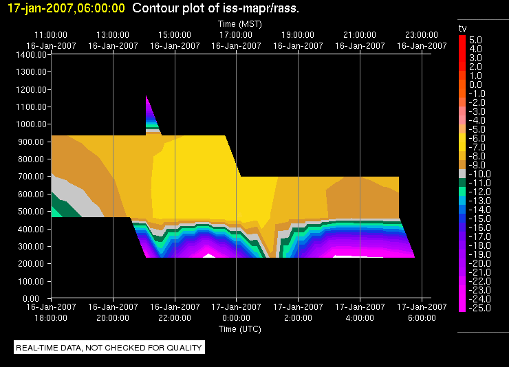
|
ISS_MAPR_Profiler.200701170600.Wind_Profile_High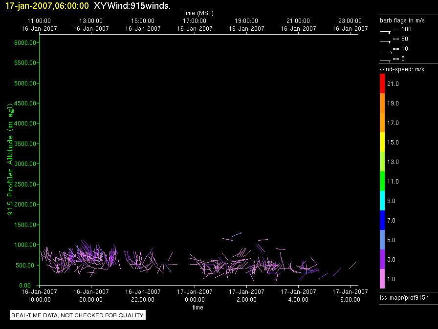
|
ISS_MAPR_Profiler.200701170600.Wind_Profile_Low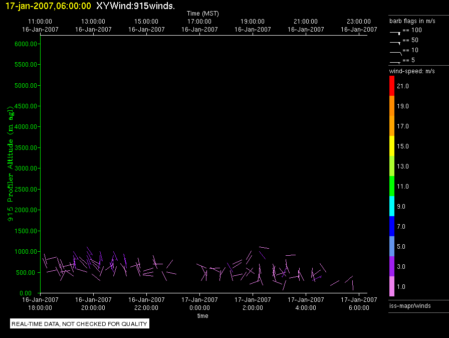
|
ISS_MAPR_Profiler.200701171800.RASS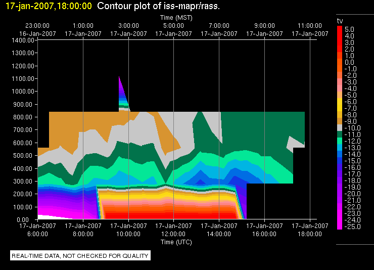
|
ISS_MAPR_Profiler.200701171800.Wind_Profile_High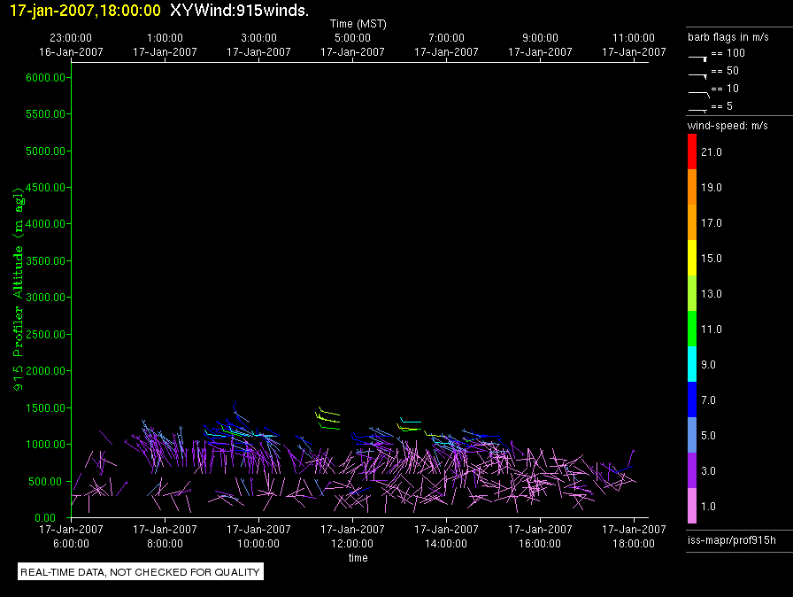
|
ISS_MAPR_Profiler.200701171800.Wind_Profile_Low
|
ISS_MAPR_Surface.200701170600.Diagnostics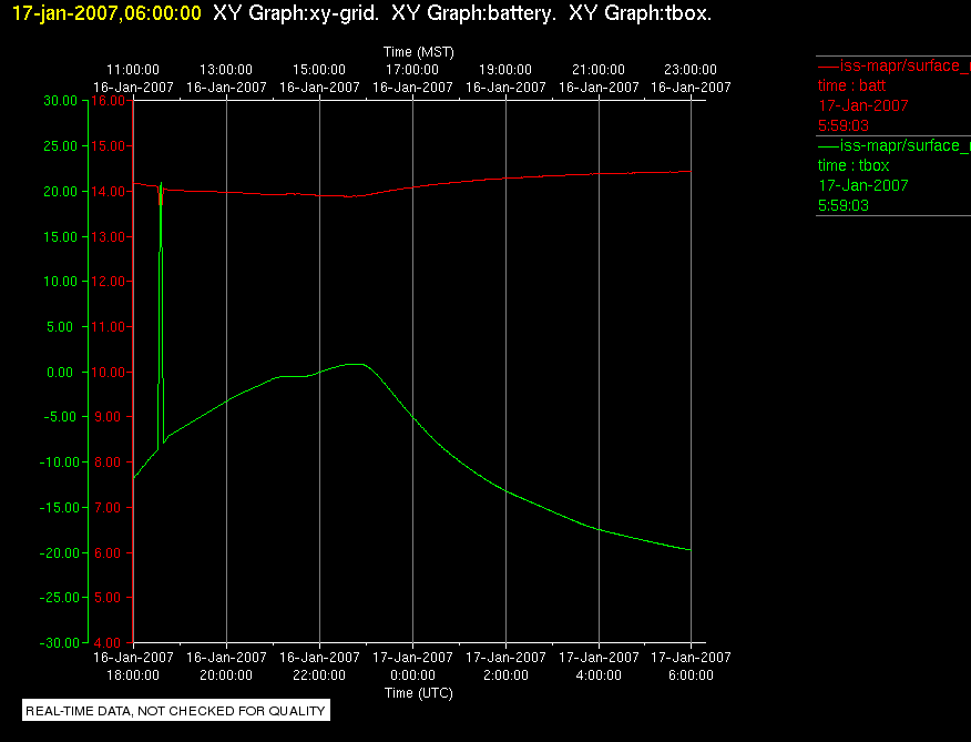
|
ISS_MAPR_Surface.200701170600.Diagnostics2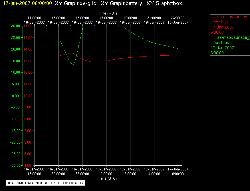
|
ISS_MAPR_Surface.200701170600.Surface_Met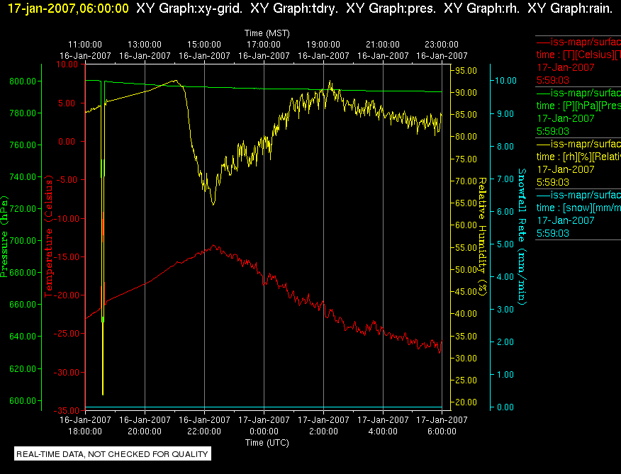
|
ISS_MAPR_Surface.200701170600.Surface_Rad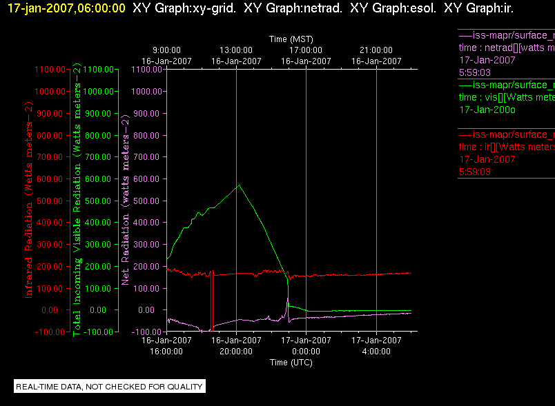
|
ISS_MAPR_Surface.200701170600.Surface_Snow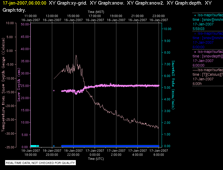
|
ISS_MAPR_Surface.200701170600.Surface_Wind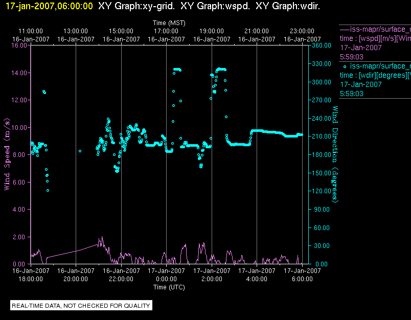
|
ISS_MAPR_Surface.200701171800.Diagnostics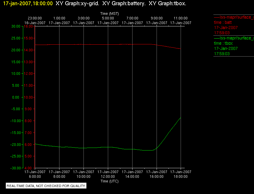
|
ISS_MAPR_Surface.200701171800.Diagnostics2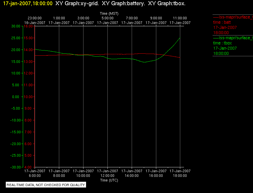
|
ISS_MAPR_Surface.200701171800.Surface_Met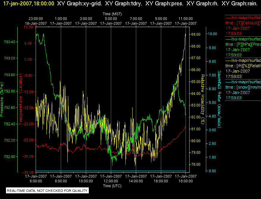
|
ISS_MAPR_Surface.200701171800.Surface_Rad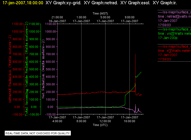
|
ISS_MAPR_Surface.200701171800.Surface_Snow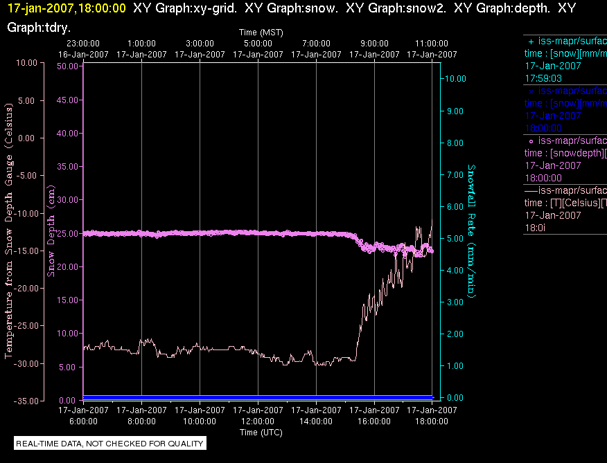
|
ISS_MAPR_Surface.200701171800.Surface_Wind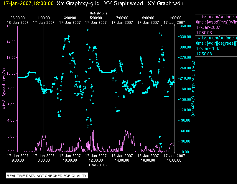
|
Created Thu Jan 18 22:42:28 MST 2007