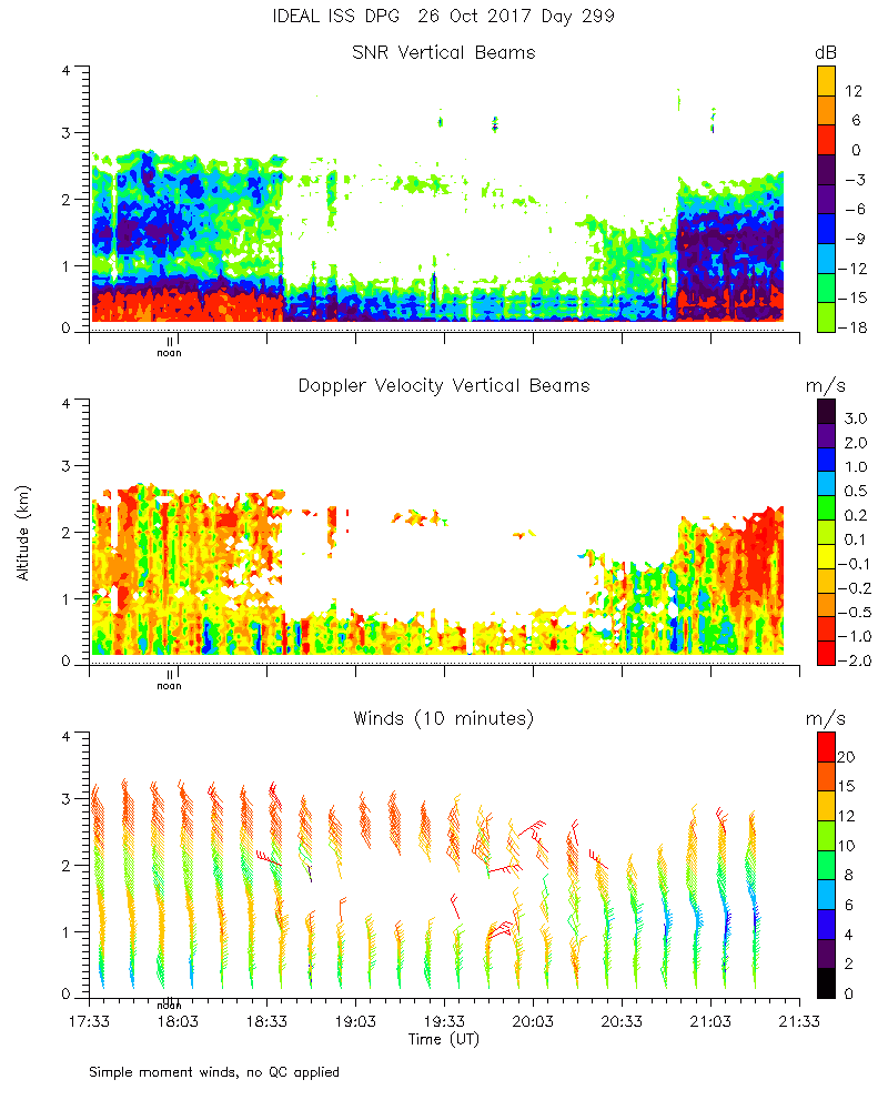
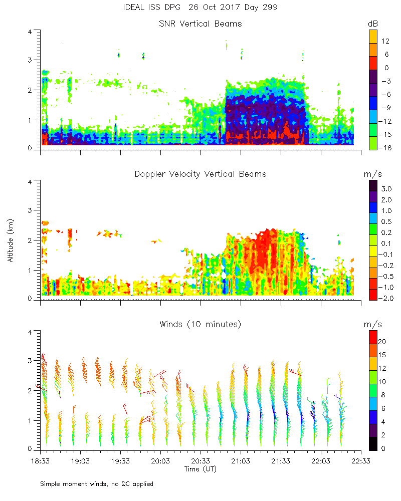
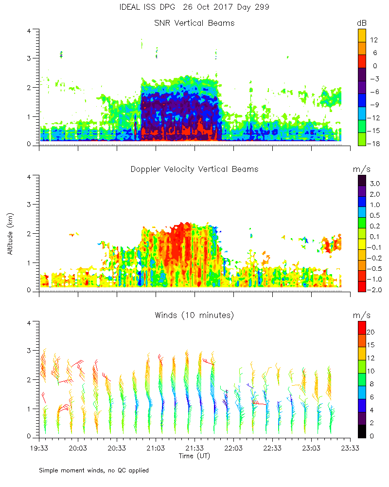
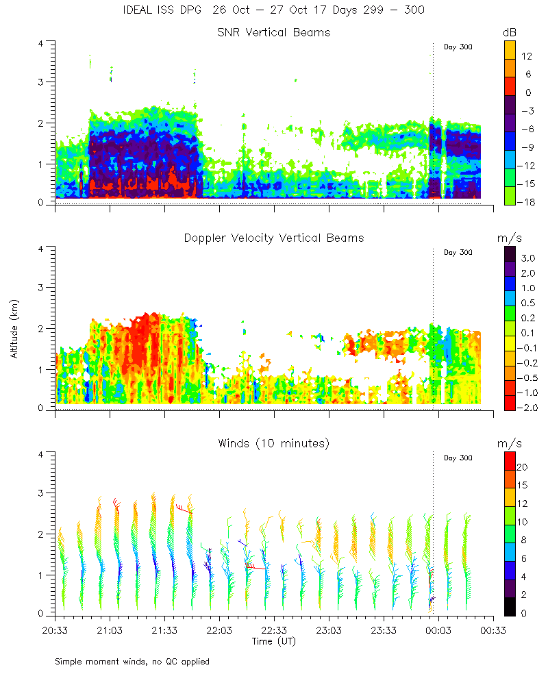
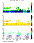
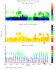
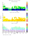
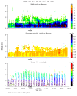
Click on the thumbnail image to view the full-size image.
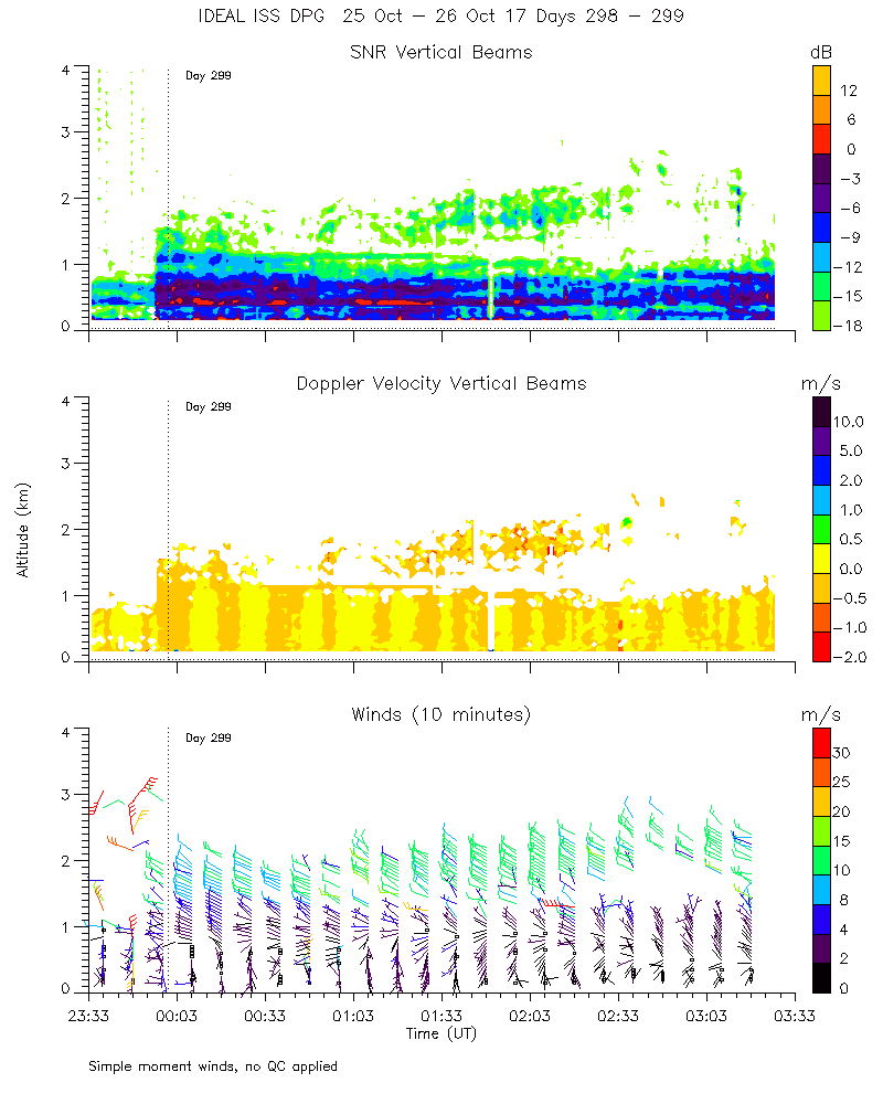
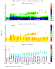
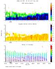
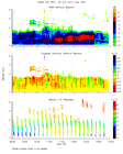
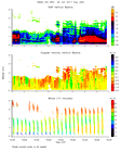
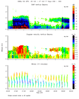
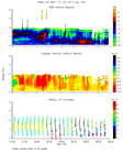
ISS2_Profiler.201710260000.mome...
|
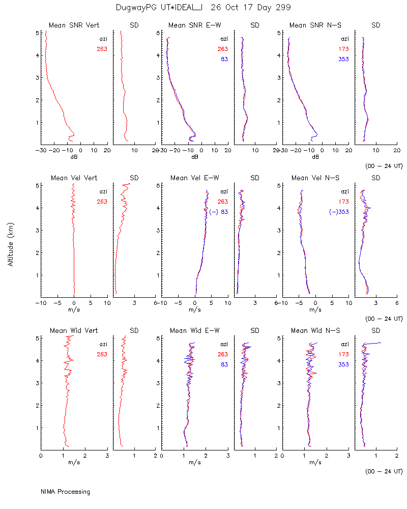
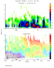
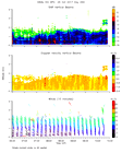
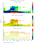
ISS2_Profiler.201710260000.nima...

|
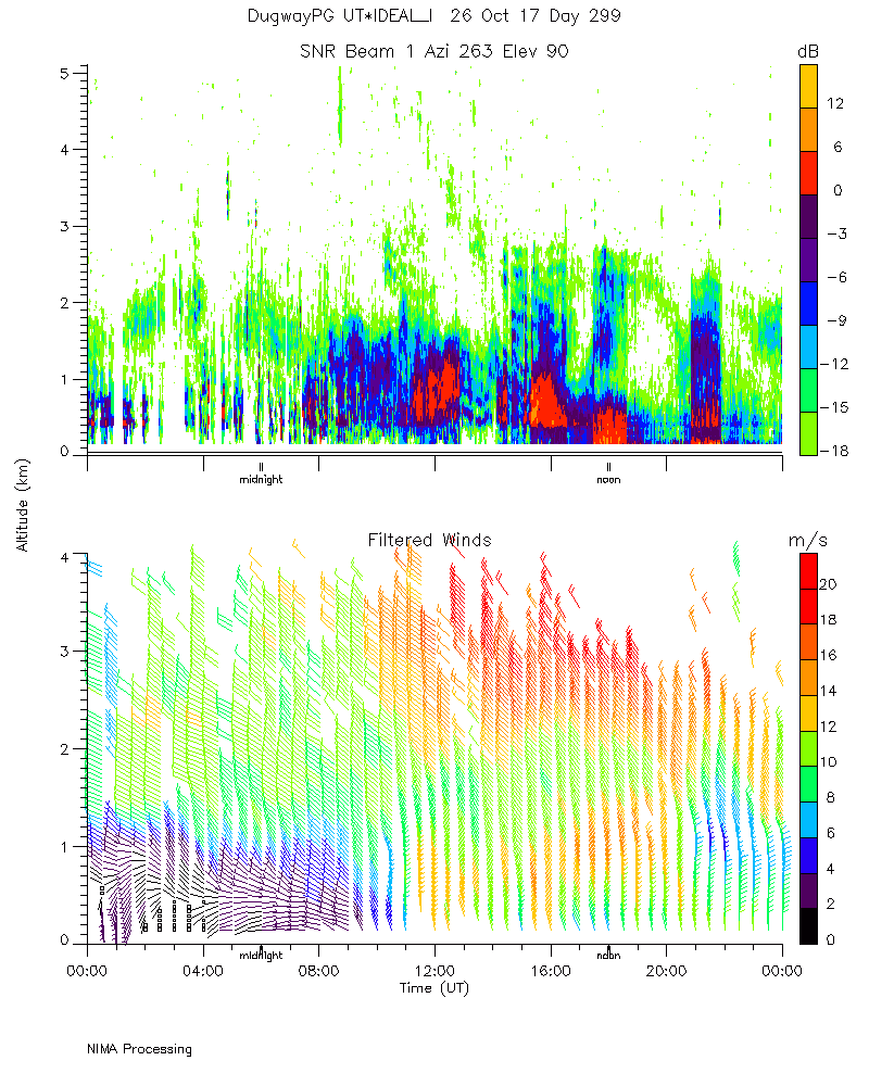
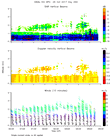
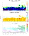
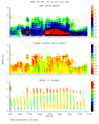
ISS2_Profiler.201710260000.nima...

|
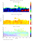
ISS2_Profiler.201710260000.nima...

|
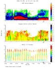
ISS2_Profiler.201710260000.nima...
|
ISS2_Profiler.201710260000.snr_...
|
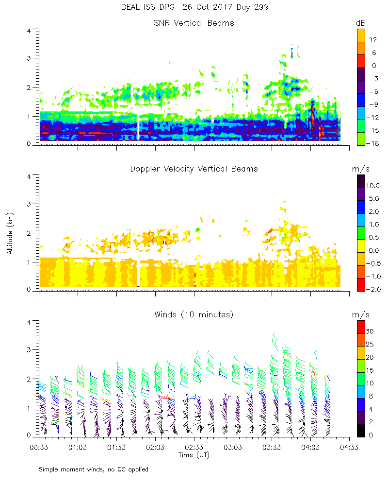
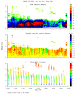
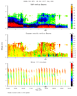
ISS2_Profiler.201710260100.mome...
|
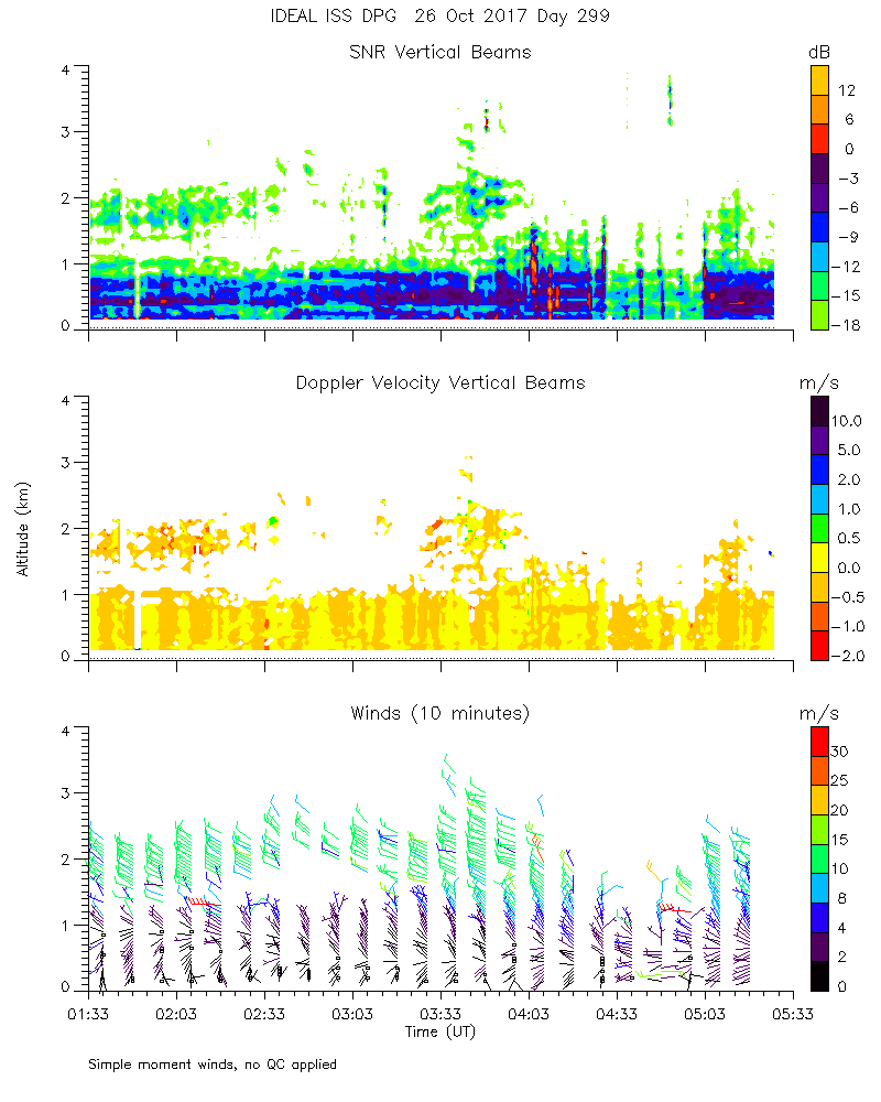
ISS2_Profiler.201710260200.mome...
|
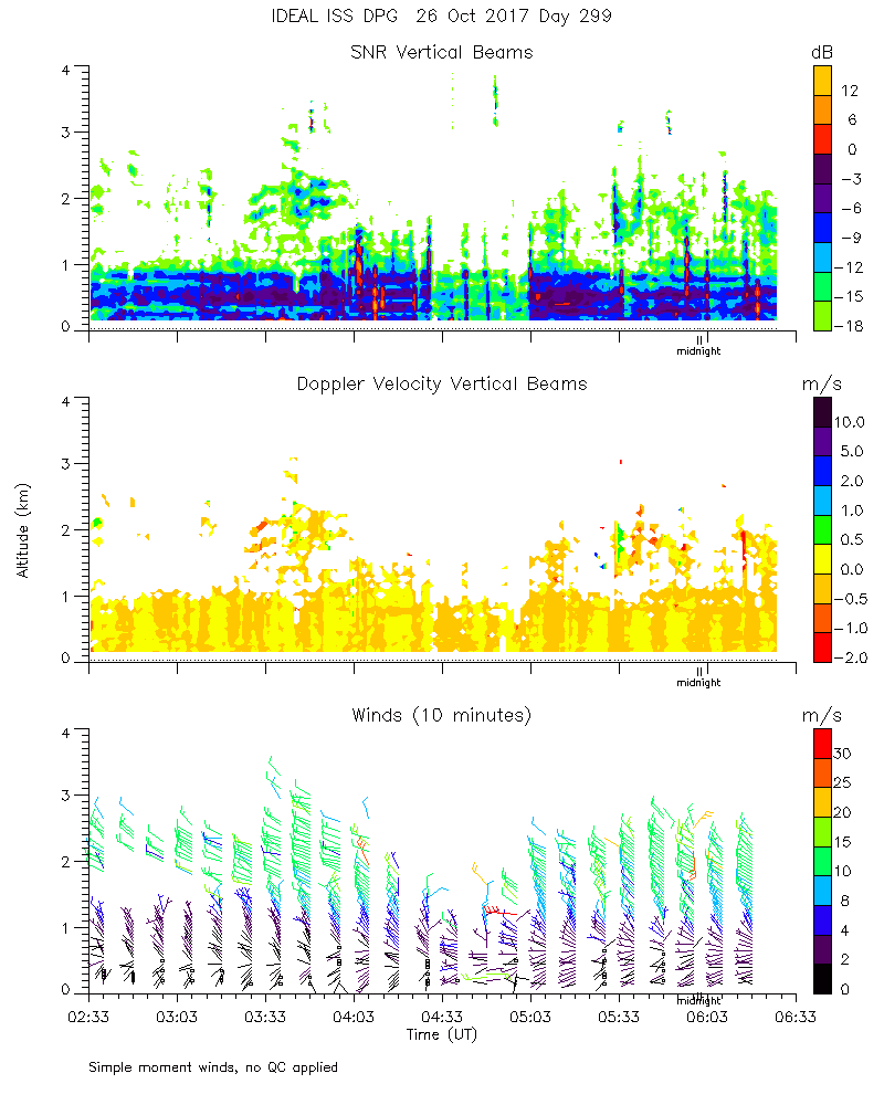
ISS2_Profiler.201710260300.mome...
|
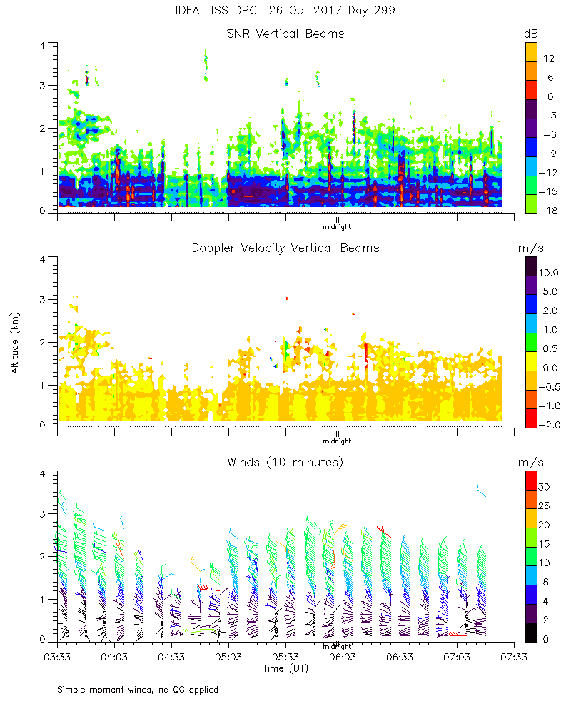
ISS2_Profiler.201710260400.mome...
|
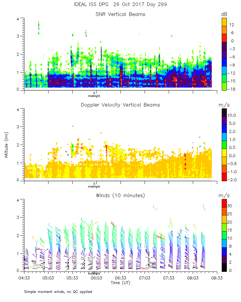
ISS2_Profiler.201710260500.mome...
|
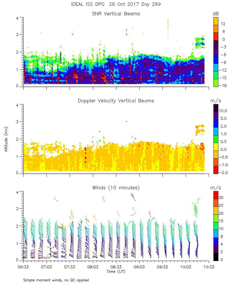
ISS2_Profiler.201710260600.mome...
|
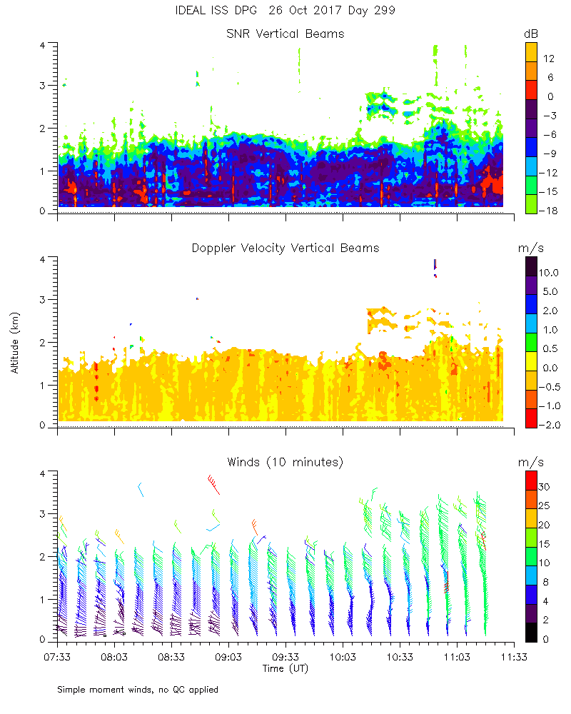
ISS2_Profiler.201710260700.mome...
|
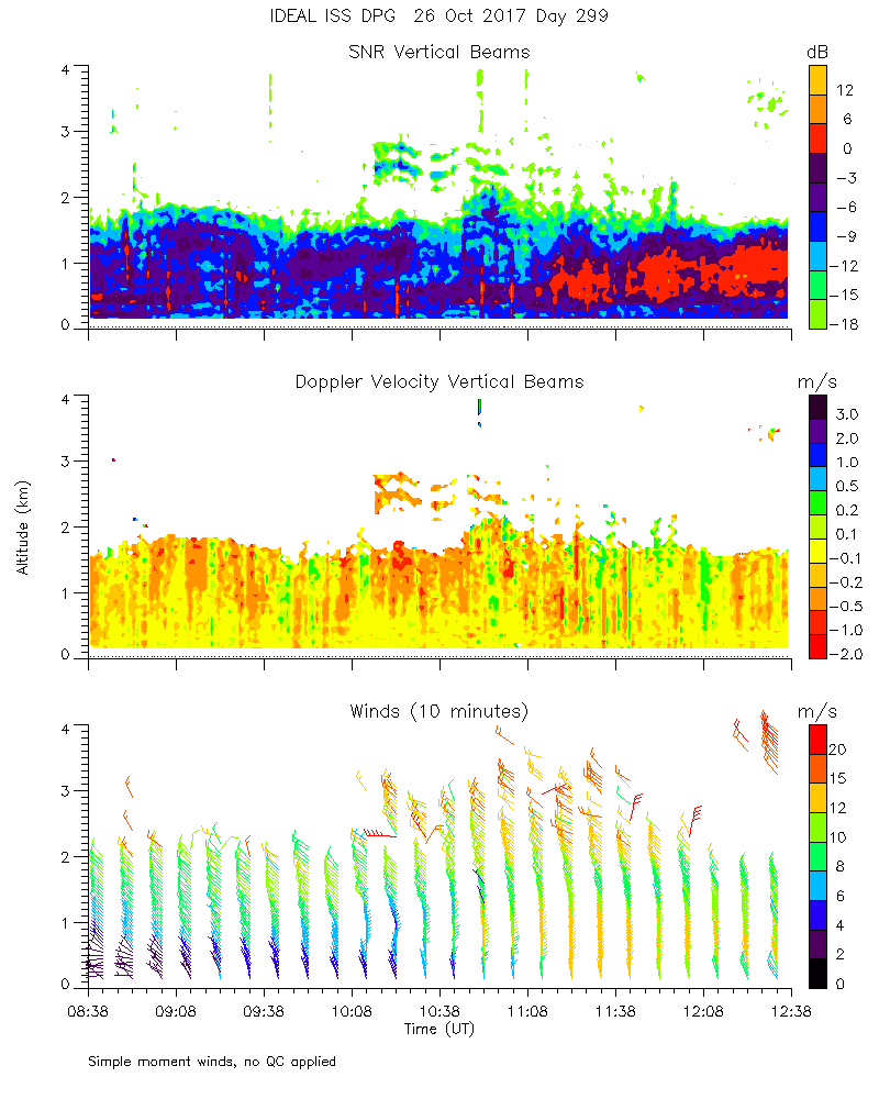
ISS2_Profiler.201710260800.mome...
|
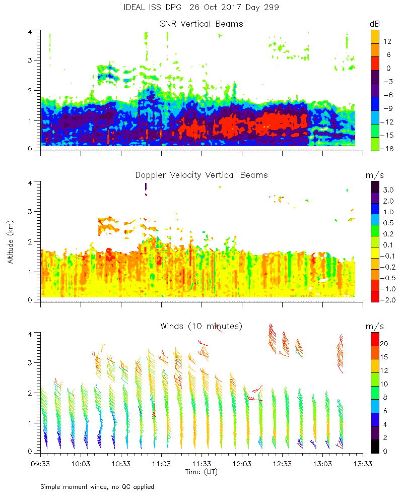
ISS2_Profiler.201710260900.mome...
|
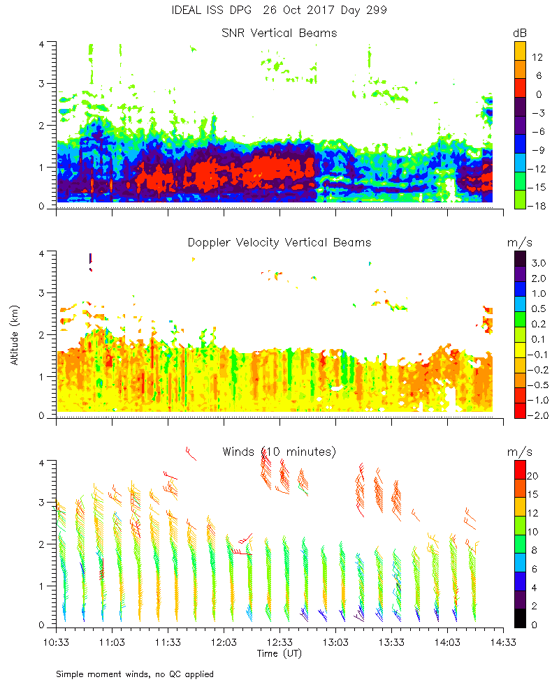
ISS2_Profiler.201710261000.mome...
|
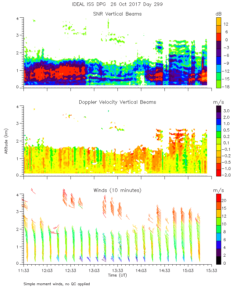
ISS2_Profiler.201710261100.mome...
|
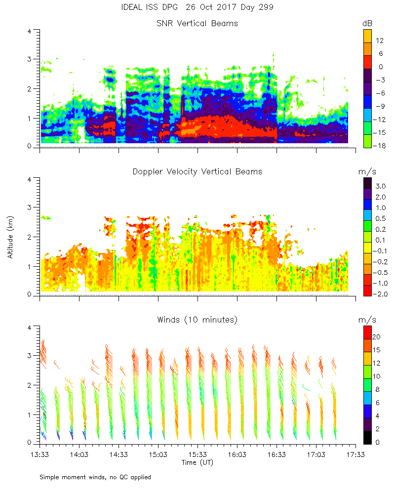
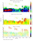
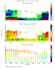
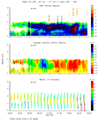
ISS2_Profiler.201710261200.mome...
|
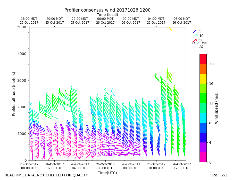
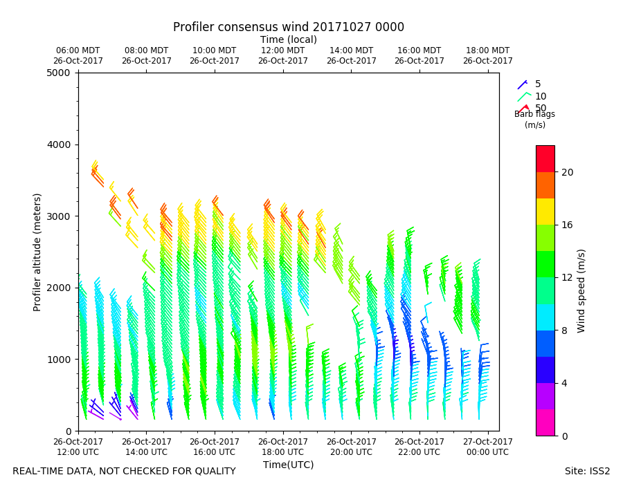
ISS2_Profiler.201710261200.wind...
|
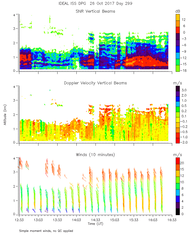
ISS2_Profiler.201710261300.mome...
|
ISS2_Profiler.201710261400.mome...
|
ISS2_Profiler.201710261500.mome...
|
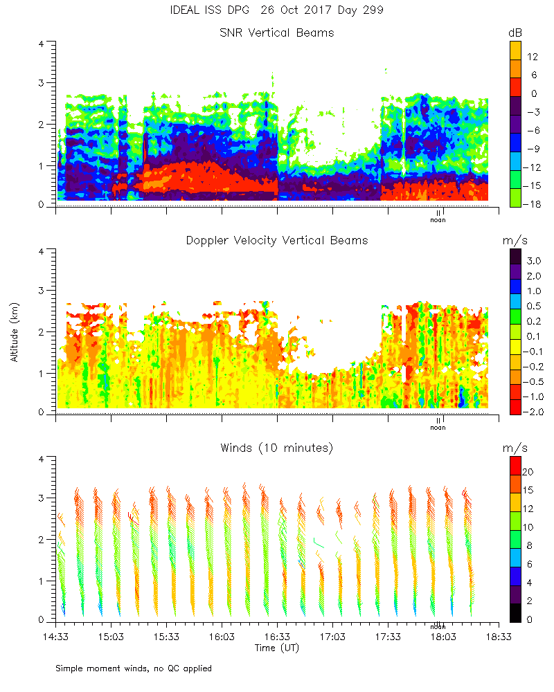
ISS2_Profiler.201710261600.mome...
|
ISS2_Profiler.201710261700.mome...
|
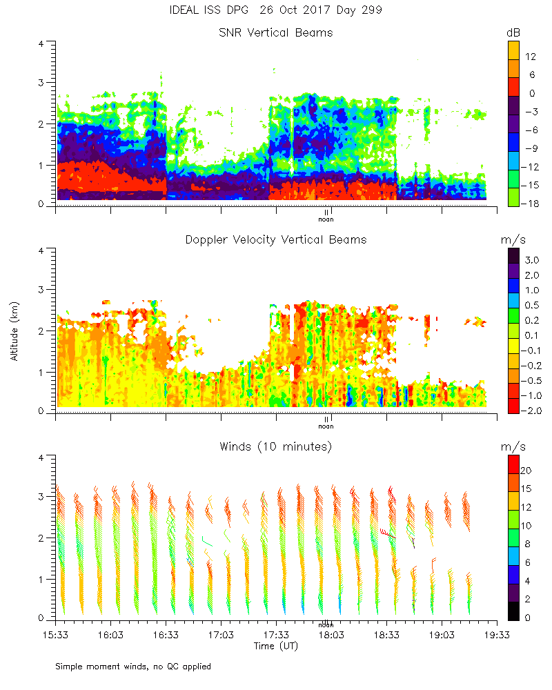
ISS2_Profiler.201710261800.mome...
|
ISS2_Profiler.201710261900.mome...
|
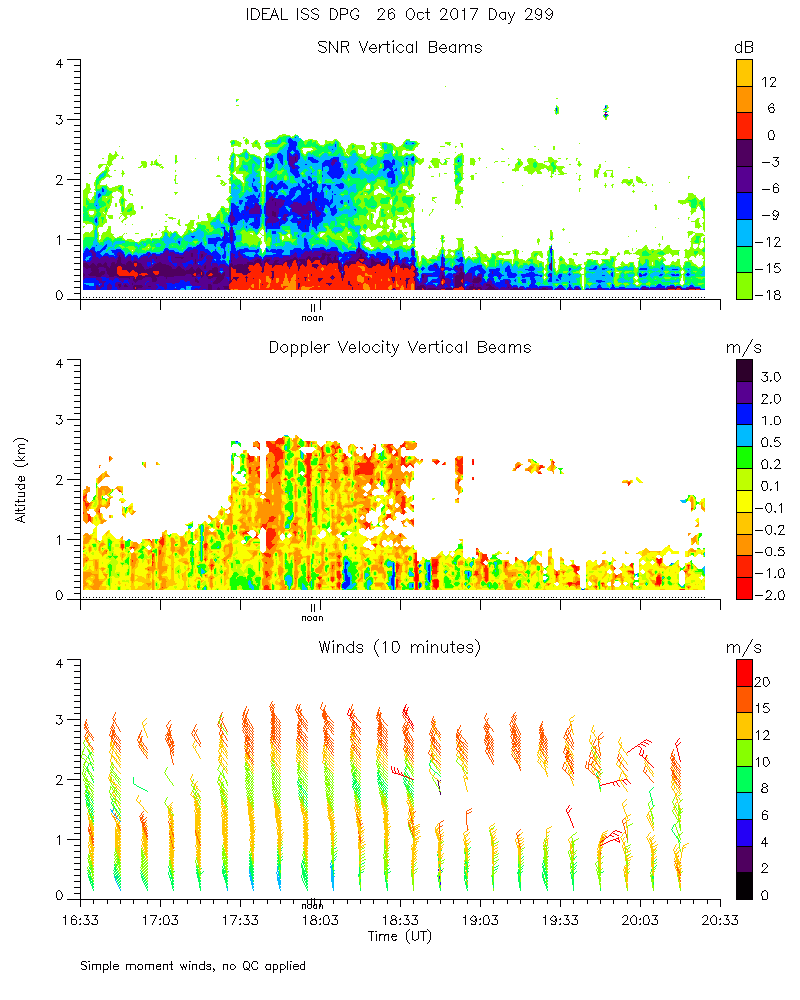
ISS2_Profiler.201710262000.mome...
|
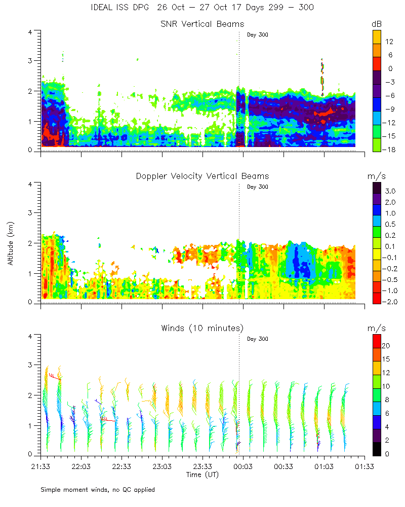
ISS2_Profiler.201710262100.mome...
|
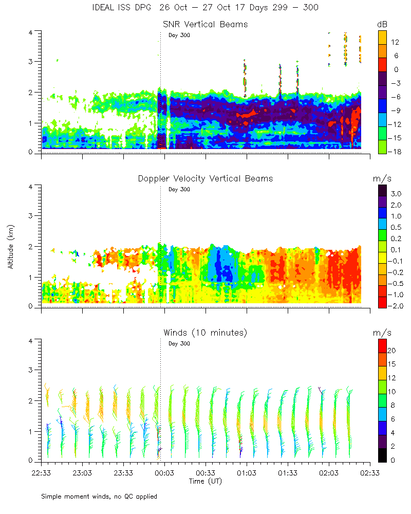
ISS2_Profiler.201710262200.mome...

|
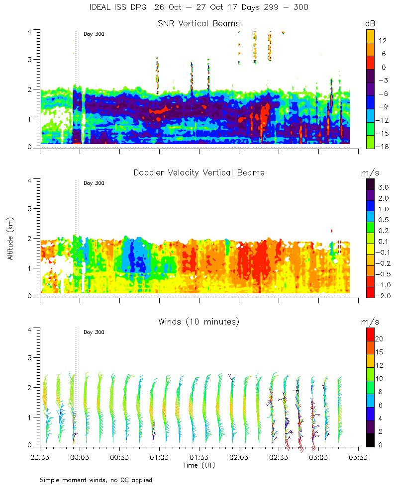
ISS2_Profiler.201710262300.mome...

|
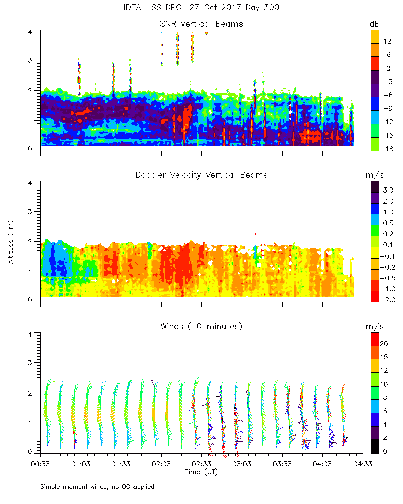
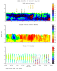
ISS2_Profiler.201710270000.mome...
|
ISS2_Profiler.201710270000.wind...
|
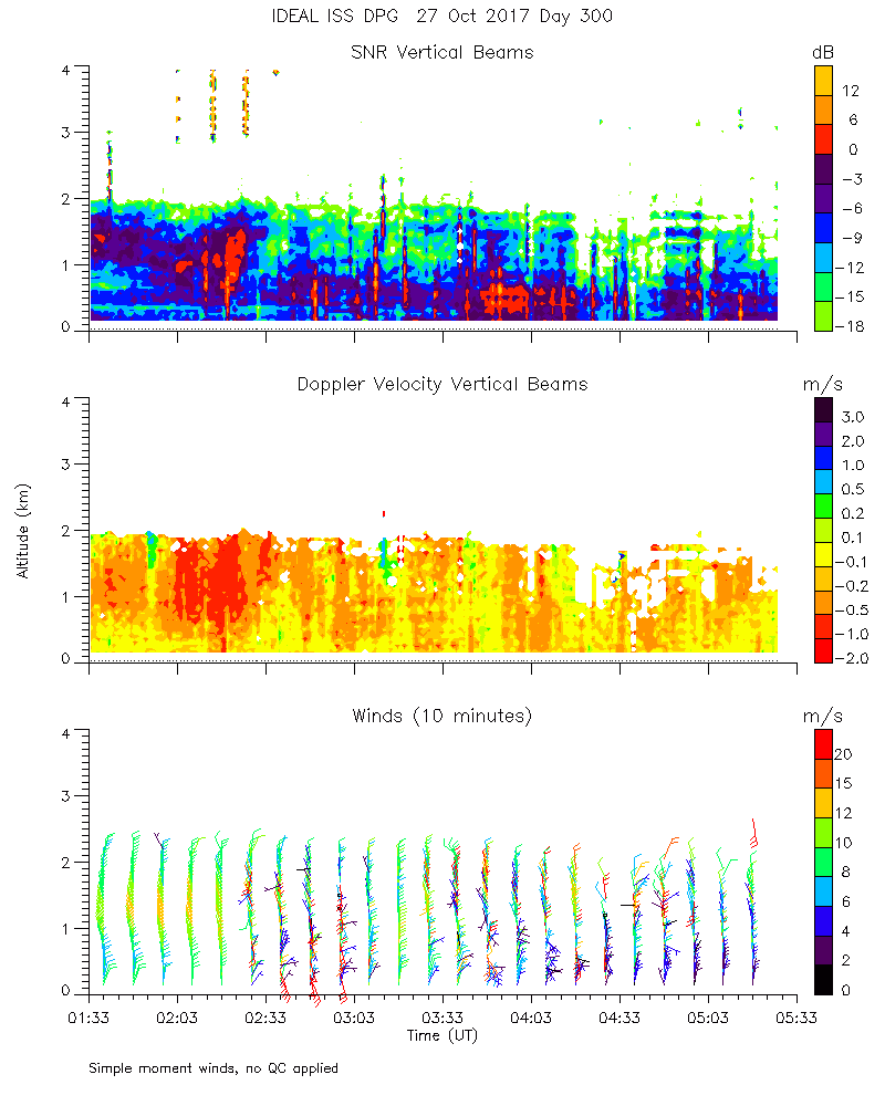
ISS2_Profiler.201710270100.mome...
|
ISS2_Profiler.201710270200.mome...
|
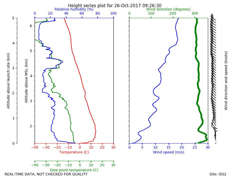
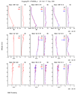
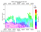
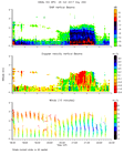
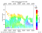
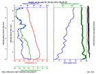
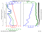
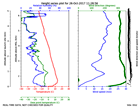
ISS2_Sonde.201710260926.height_...
|
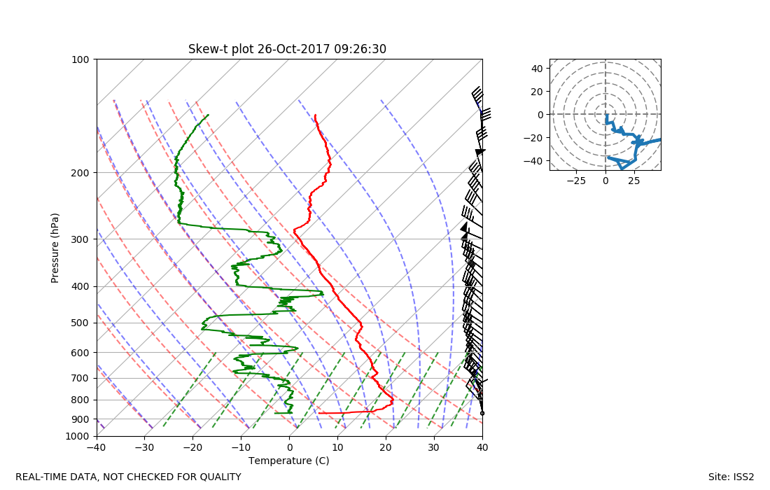
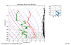
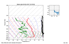
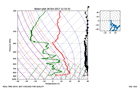
ISS2_Sonde.201710260926.skewT
|
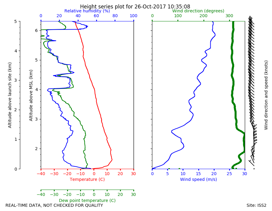
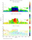
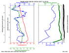
ISS2_Sonde.201710261035.height_...
|
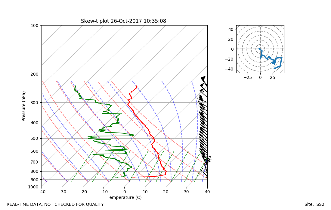
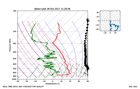
ISS2_Sonde.201710261035.skewT
|
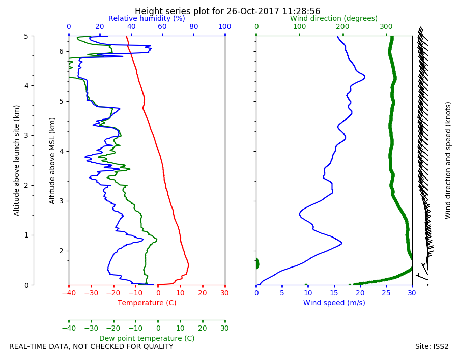
ISS2_Sonde.201710261128.height_...
|
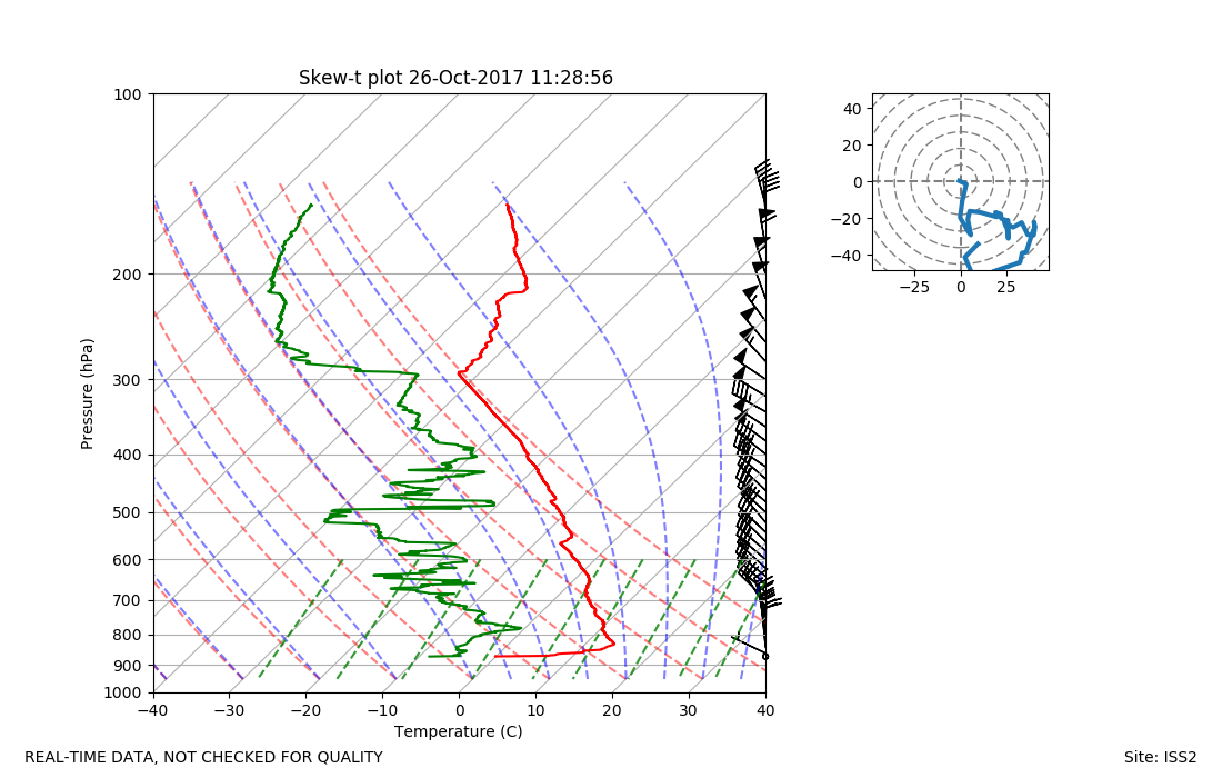
ISS2_Sonde.201710261128.skewT
|
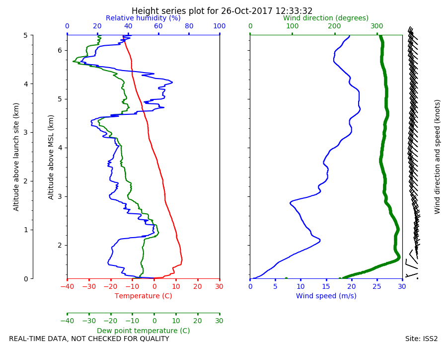
ISS2_Sonde.201710261233.height_...
|
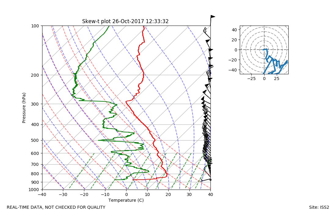
ISS2_Sonde.201710261233.skewT
|
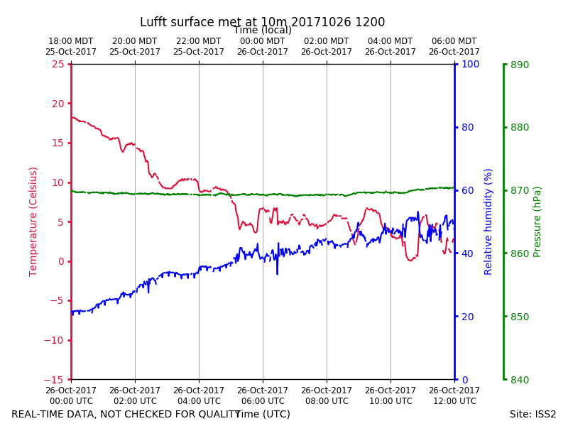
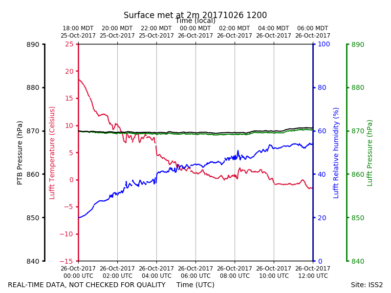
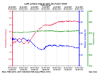
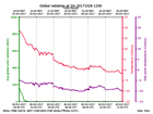
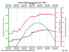
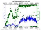
ISS2_Surface10m.201710261200.pt...
|
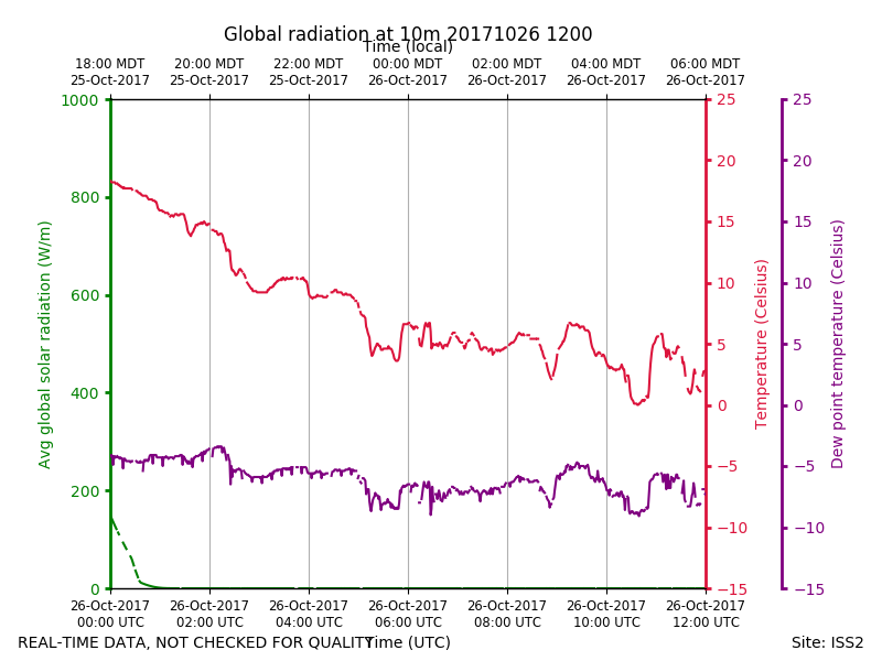
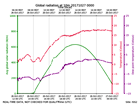
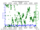
ISS2_Surface10m.201710261200.ra...
|
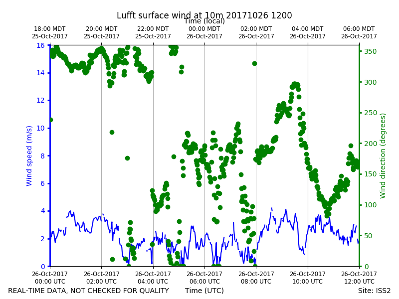
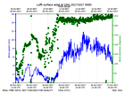
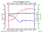
ISS2_Surface10m.201710261200.wi...
|
ISS2_Surface10m.201710270000.pt...
|
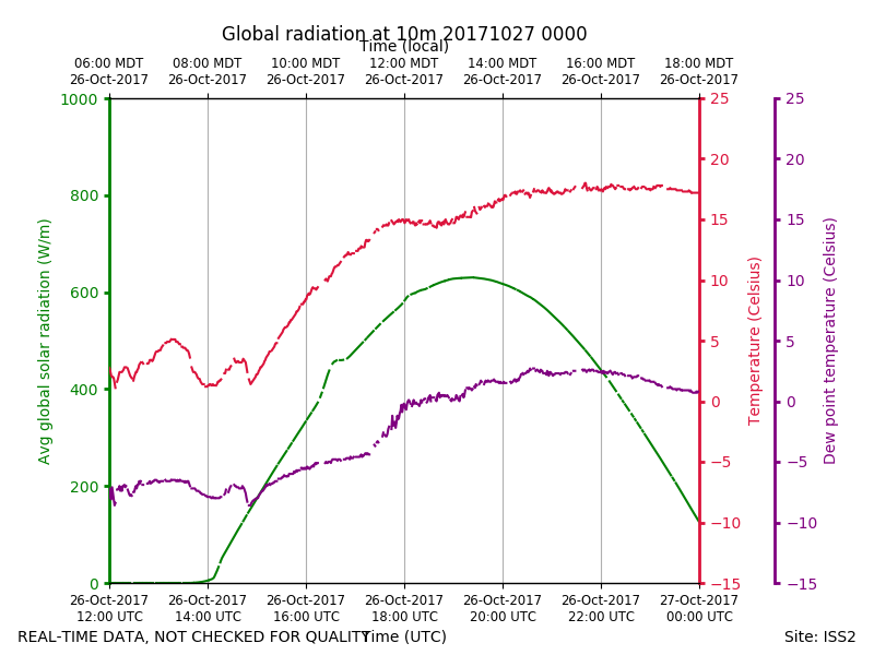
ISS2_Surface10m.201710270000.ra...
|
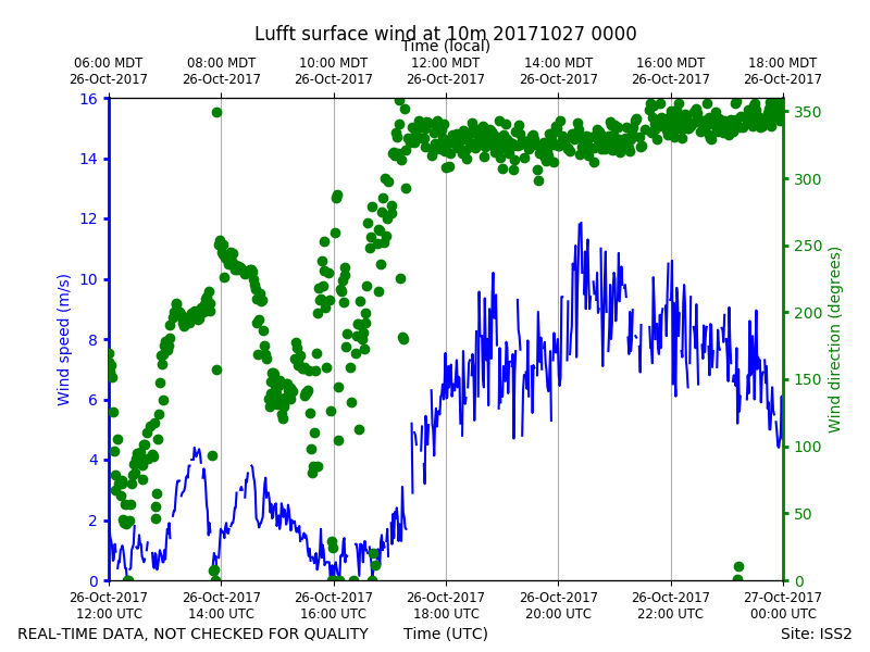
ISS2_Surface10m.201710270000.wi...
|
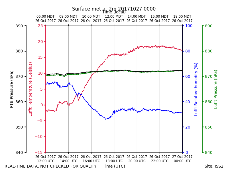
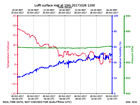
ISS2_Surface2m.201710261200.pth
|
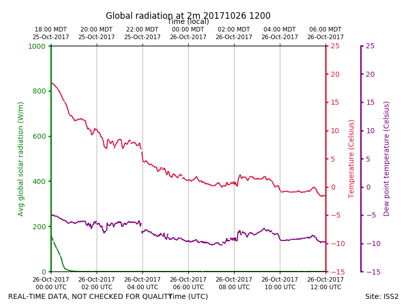
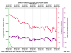
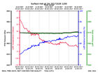
ISS2_Surface2m.201710261200.rad...
|
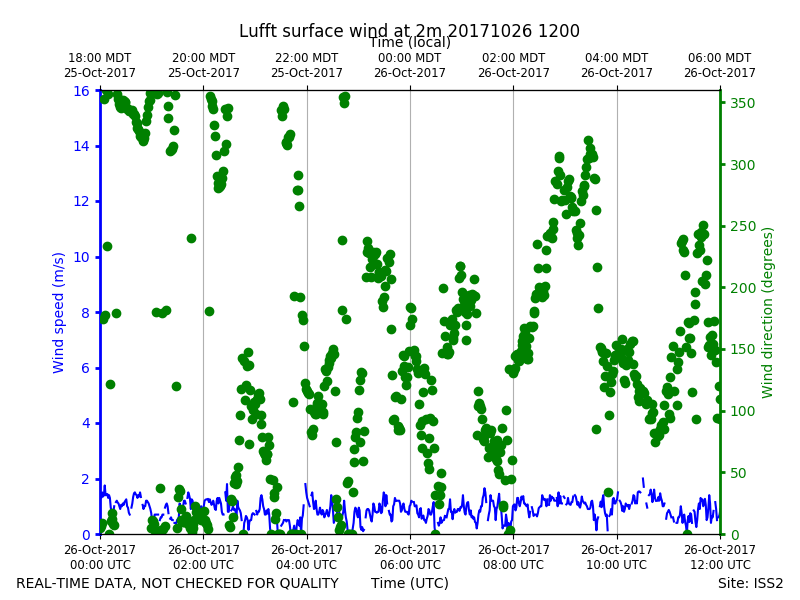
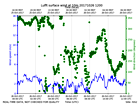
ISS2_Surface2m.201710261200.win...
|
ISS2_Surface2m.201710270000.pth
|
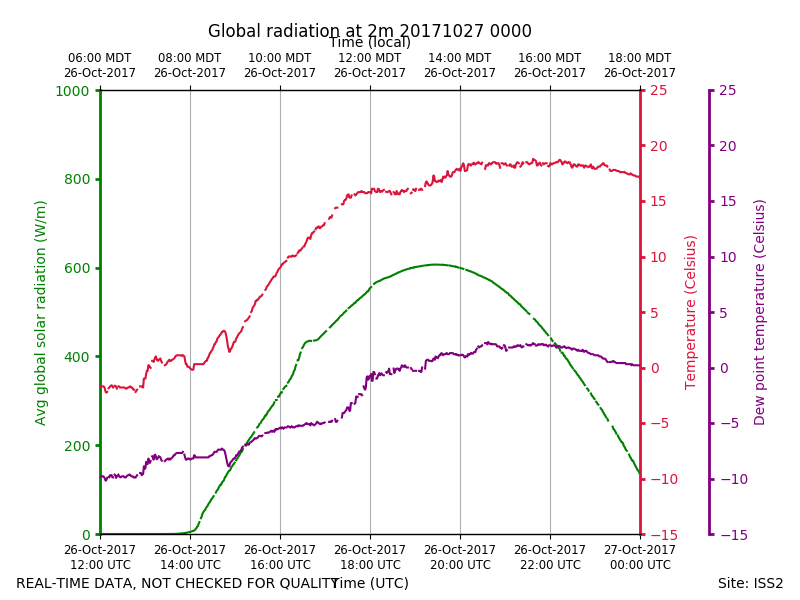
ISS2_Surface2m.201710270000.rad...
|
ISS2_Surface2m.201710270000.win...
|