

Data Access
The NCAR data for TBLMTN will be available in only 1 form:
The NetCDF statistics are available online here, after the data processing steps noted below. Please contact The ATD Data Manager if you plan to work with these data, so that we can inform you of any updates to this data set.
A complete list of variables is available. This list shows the NetCDF variable name, dimensions, descriptive variable name, units, and additional comments, if available. Each file contains all the statistics for one day, beginning at 00:00:00 UTC. All variables are dimensioned (time), where time is in 5 minute increments (288 per day).
Most descriptive variable names hopefully are self-explanatory. Those beginning with Capital letters came from slow response sensors and those with lower cases letters from fast response sensors. Higher order statistics are indicated by products of variables. For example, w'tc' is the covariance between vertical velocity and sonic virtual temperature and h2o'h2o'h2o'h2o' is the fourth order moment of water vapor mixing density.
Location
The PAM station was deployed near the center of Table Mountain, about 6 miles
north of Boulder. The boom for the sonic anemometer was oriented nearly West
with the solar panels to the ENE of the tower tripod, about 9m away. The
rain gauge was about 2m to the NW of the solar panels. The Licor radiometer
was on one of the supports for the rain gauge wind screen.
Photographs will be taken at a later date.
Sensors
The NCAR sensors are mostly described in the
ASTER Facility Description.
Data Usage/Processing Notes
To be completed later.
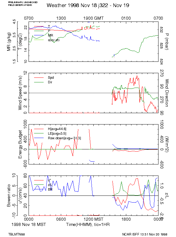
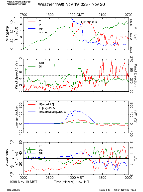
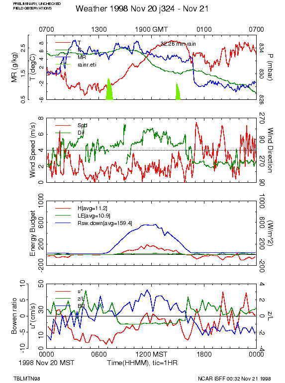
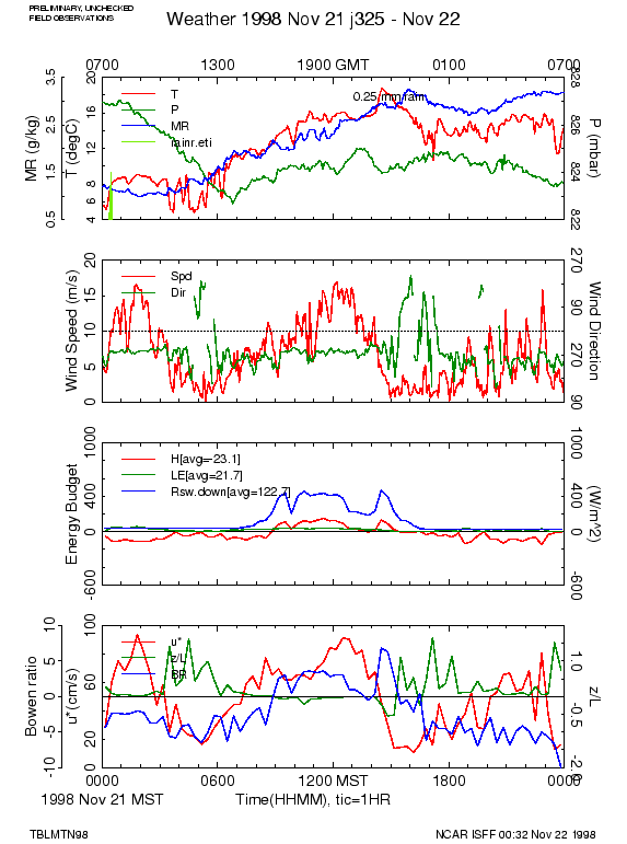
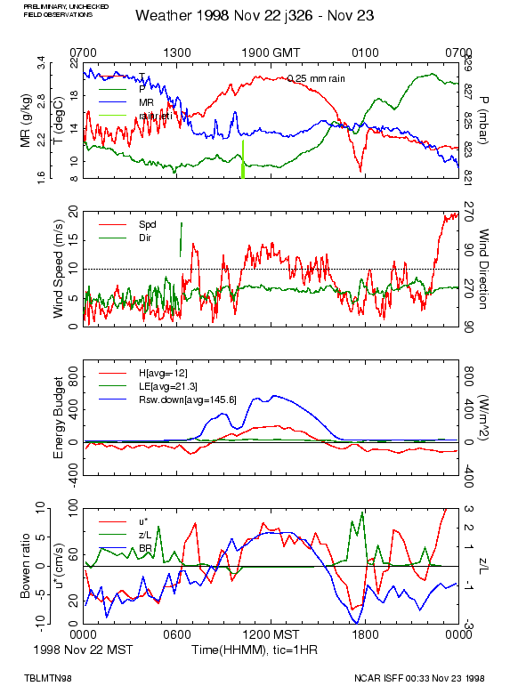
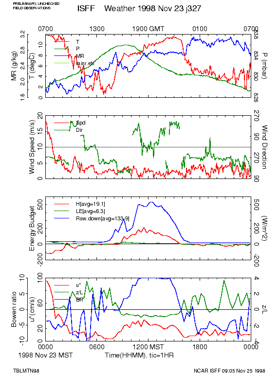
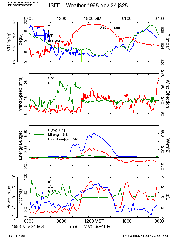
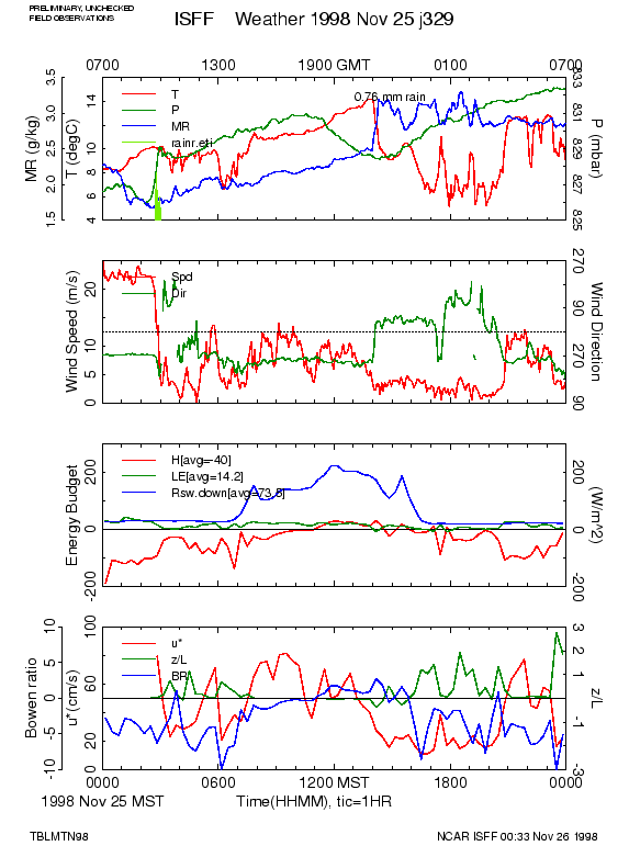
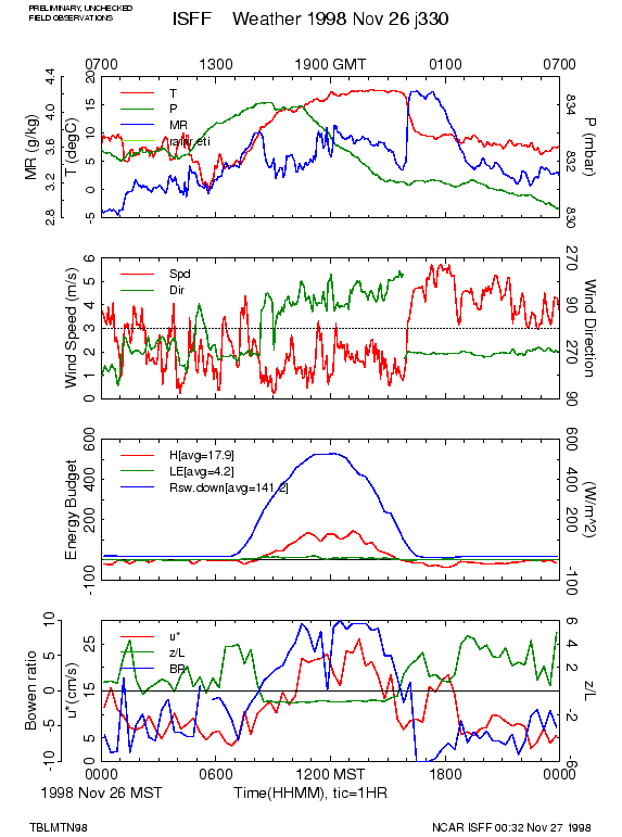
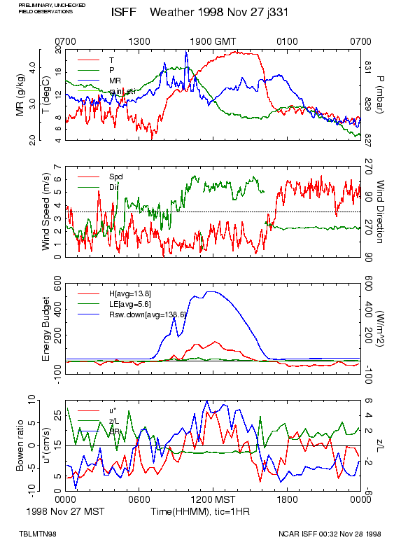
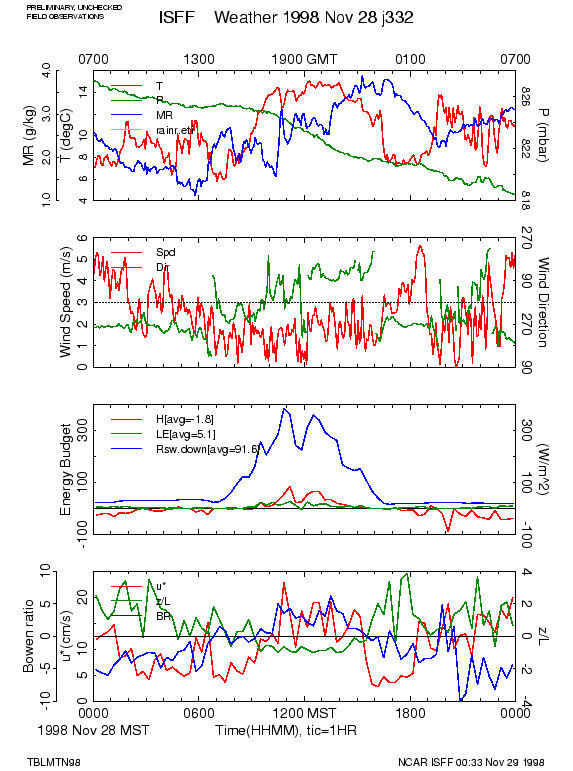
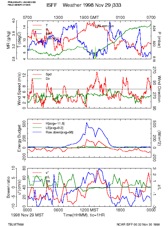
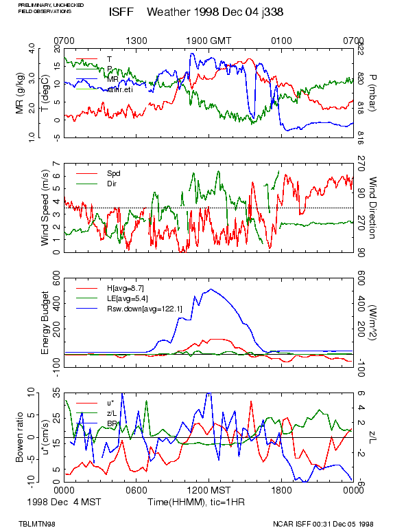
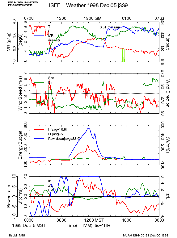
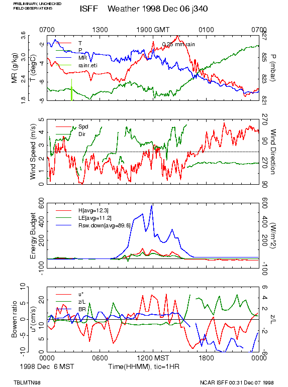
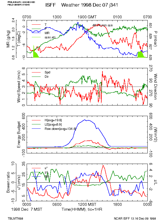
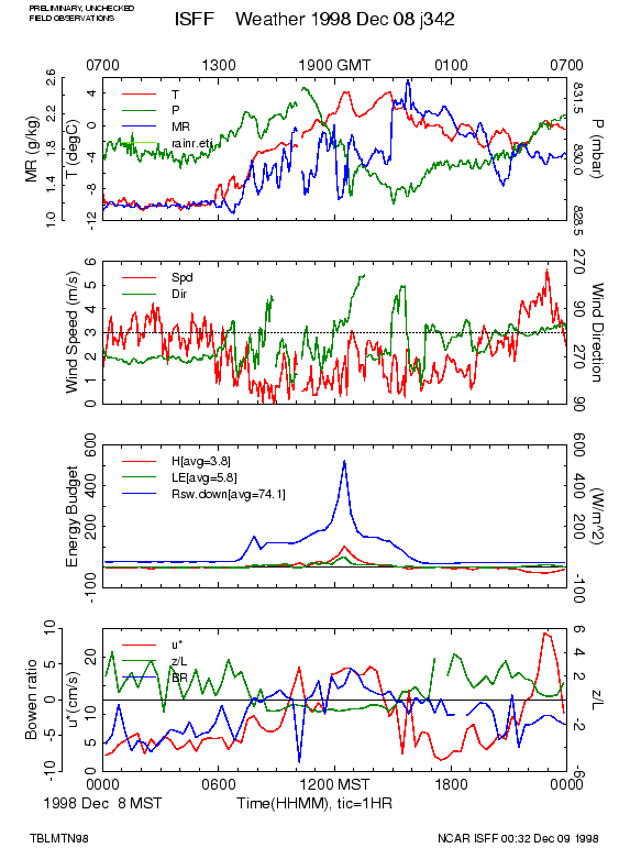
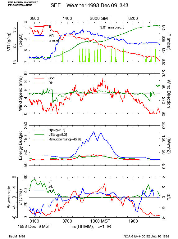
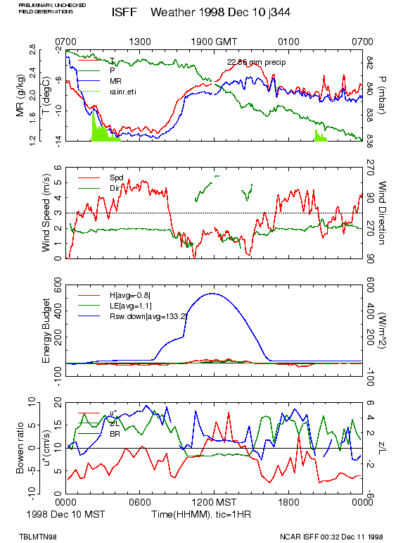
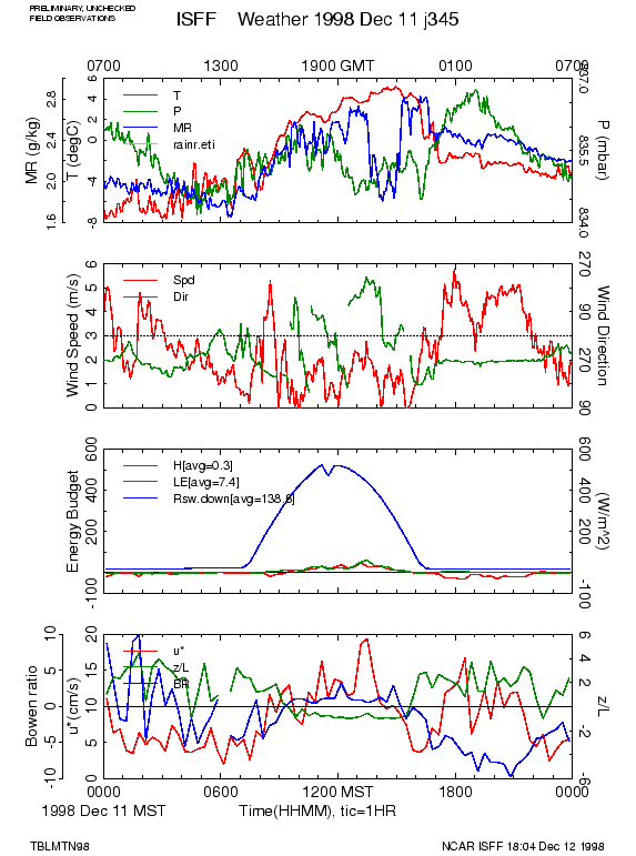
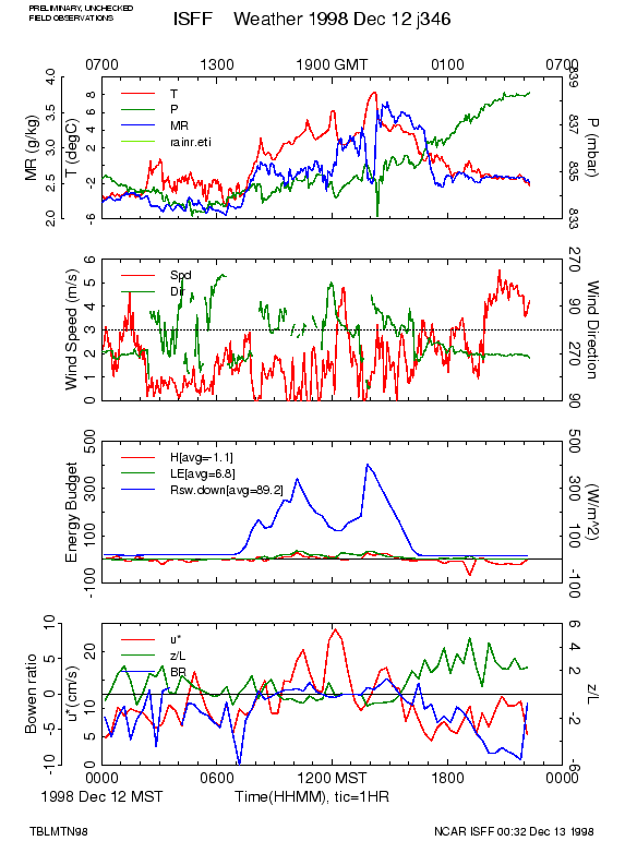
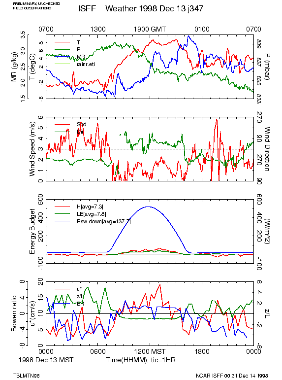
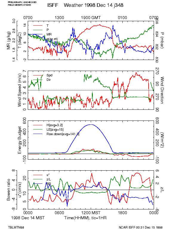
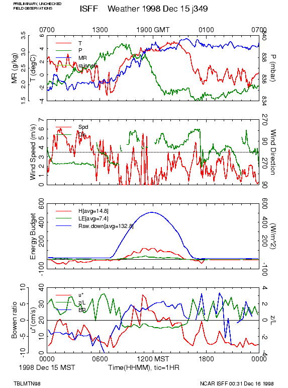
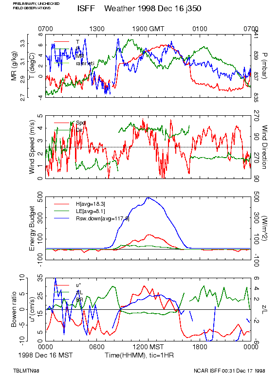
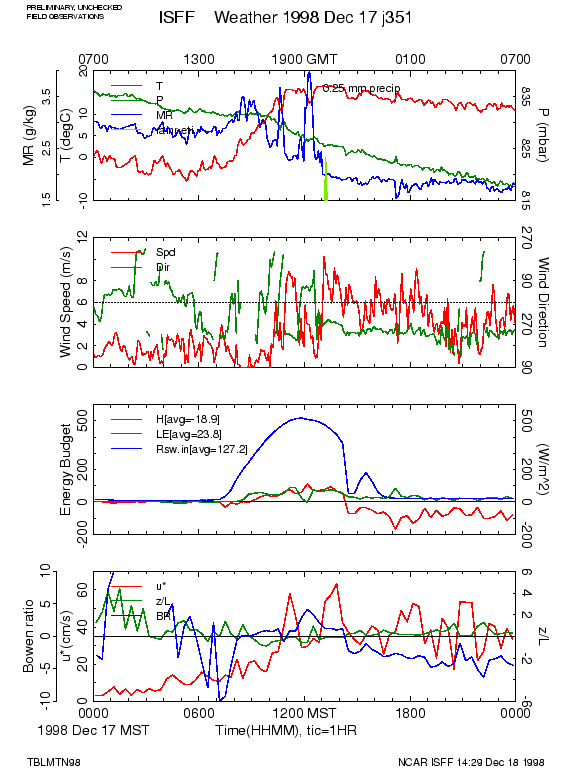
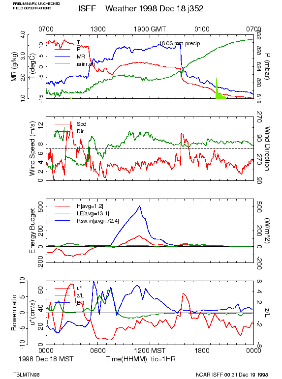
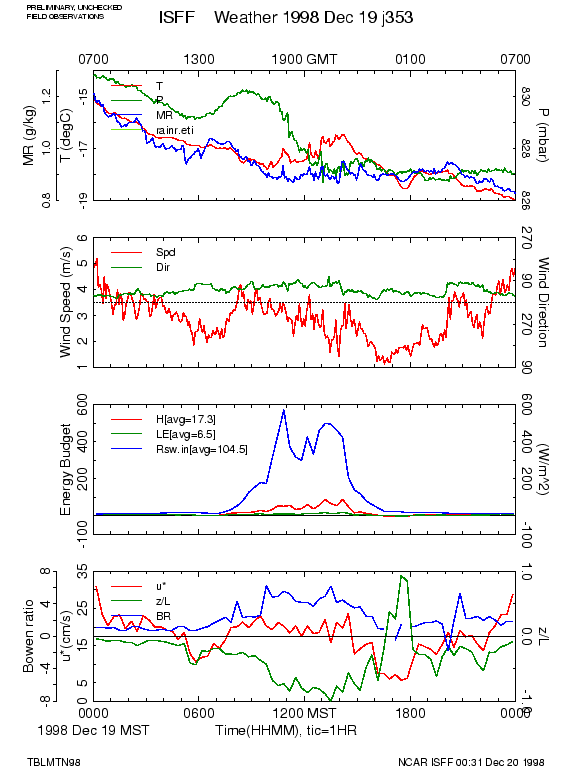
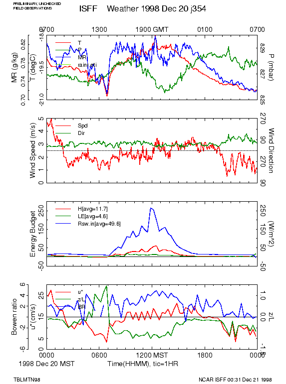
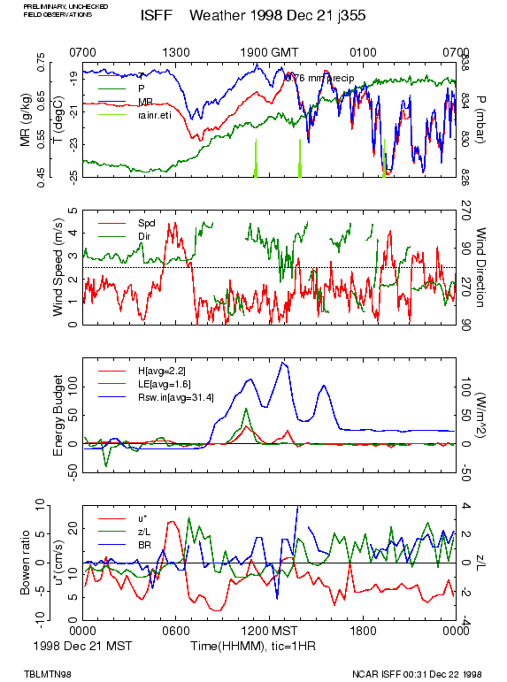
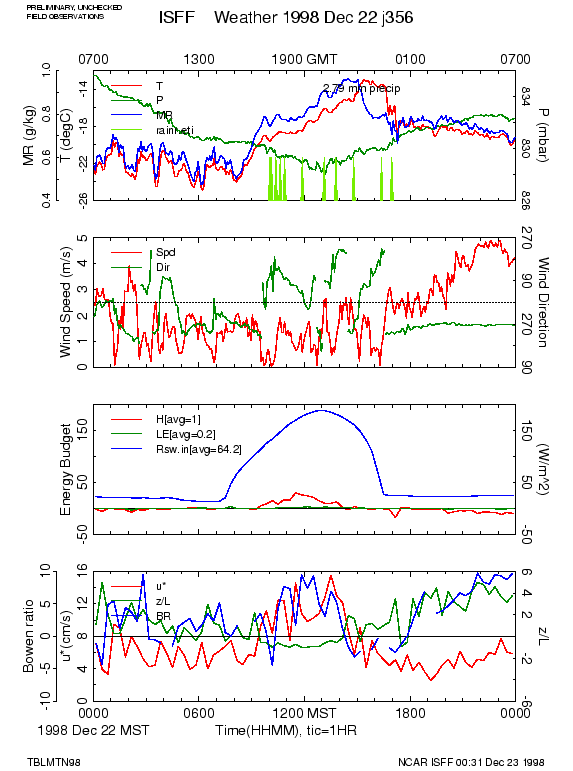
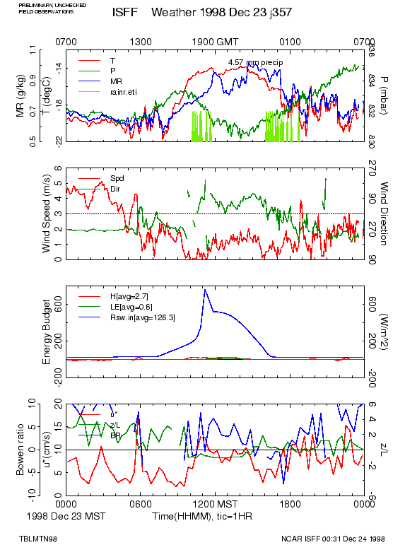
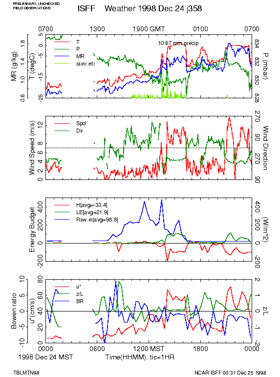
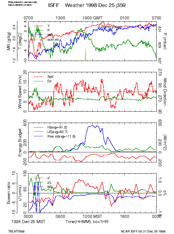
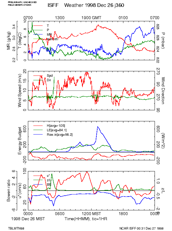
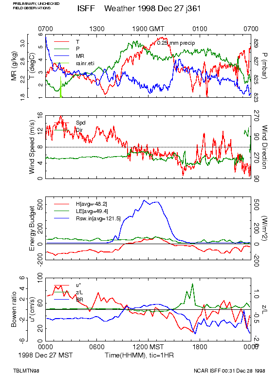
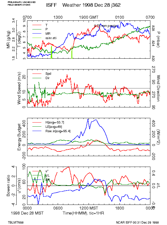
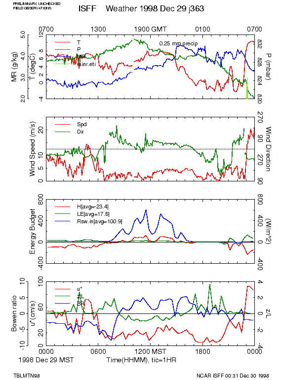
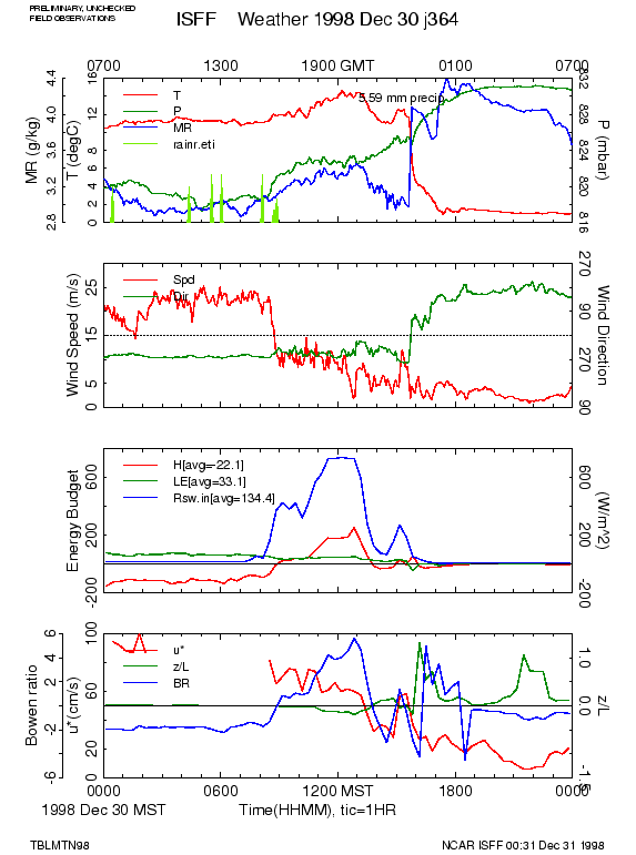
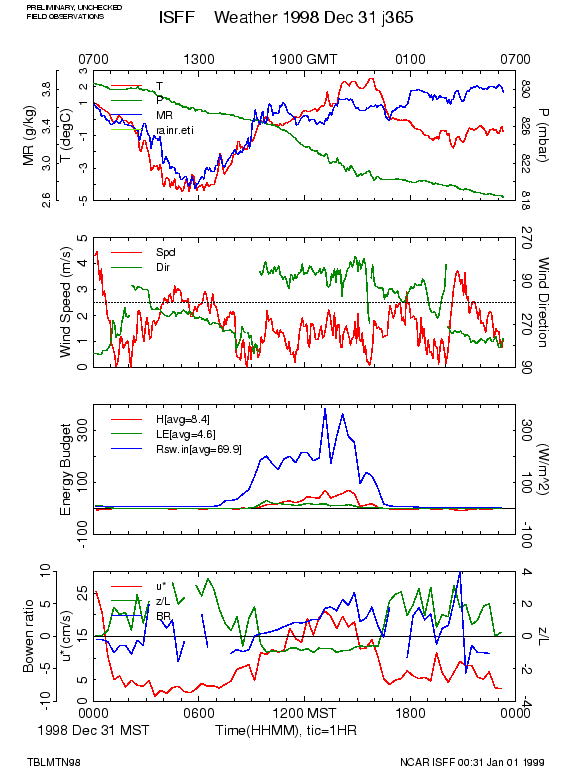
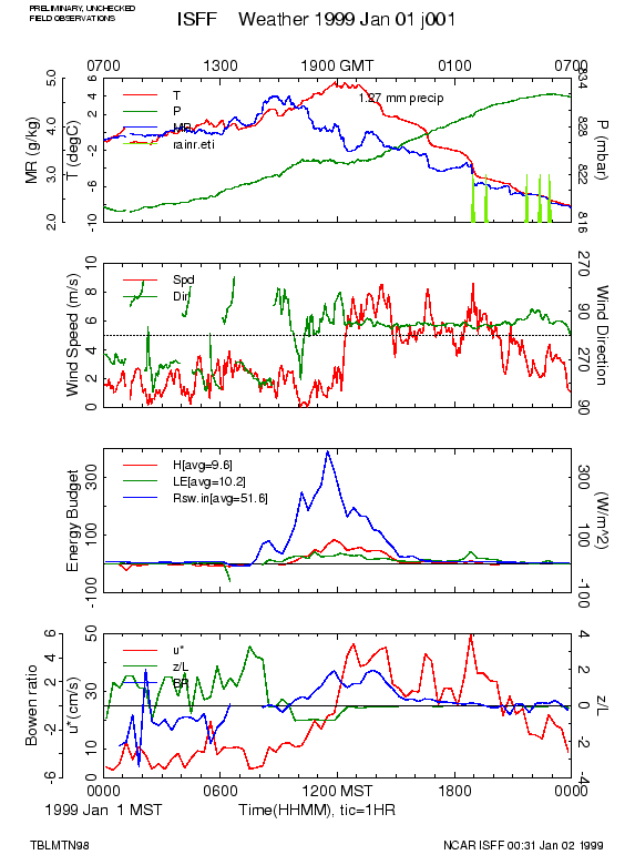
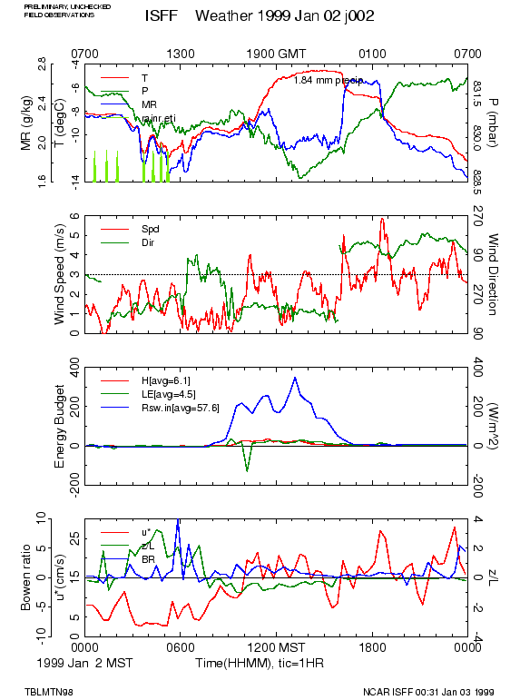
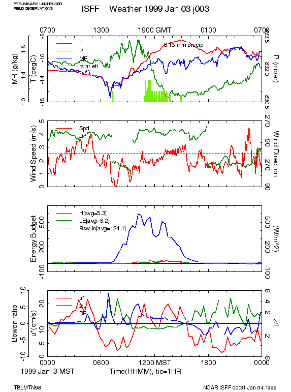
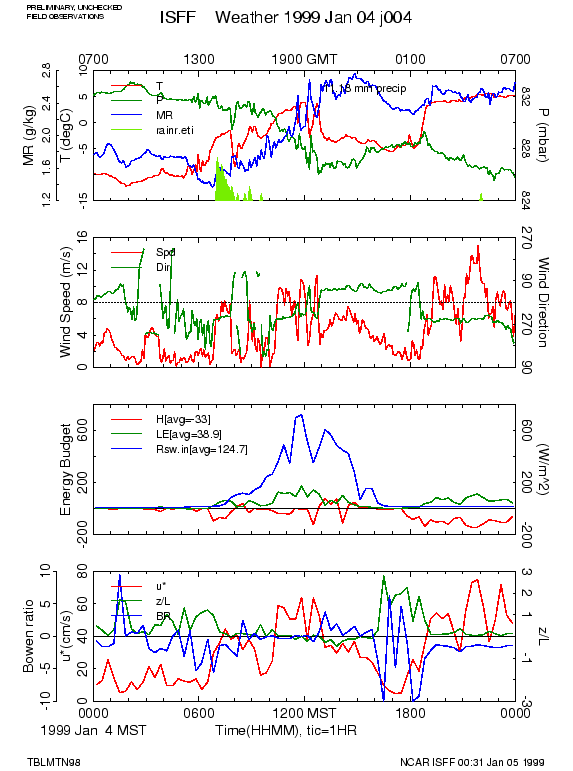
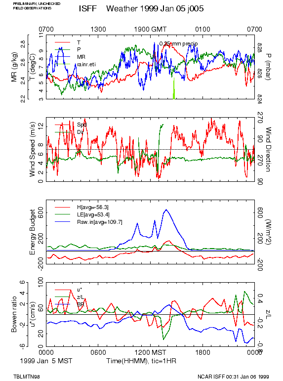
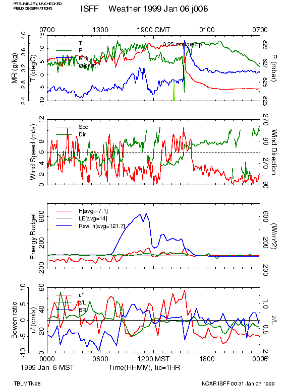
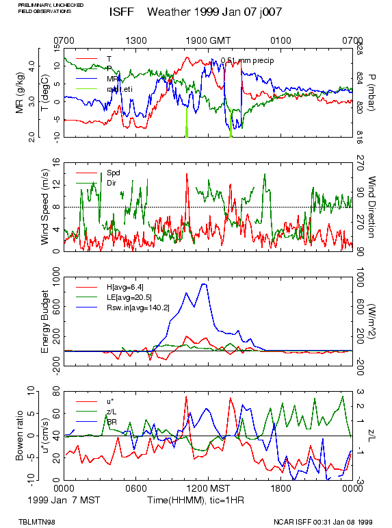
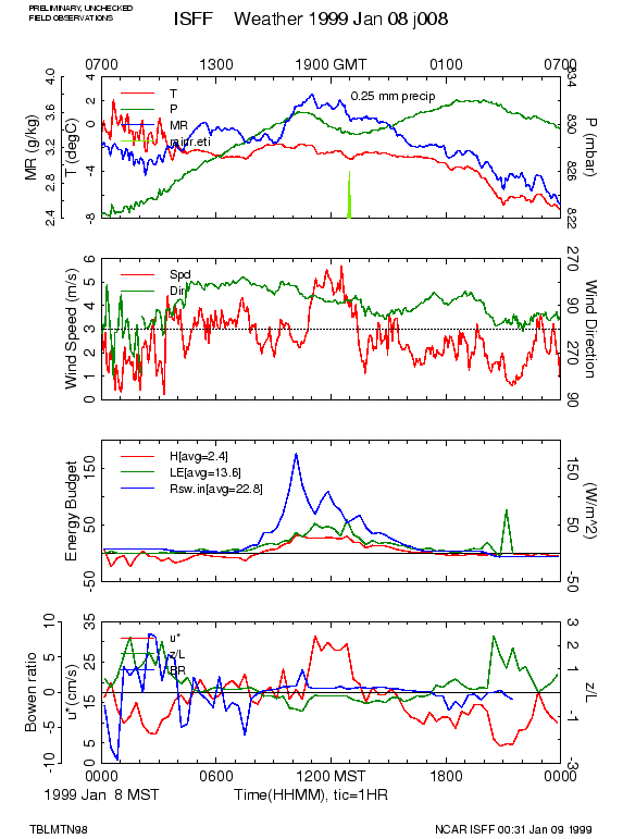
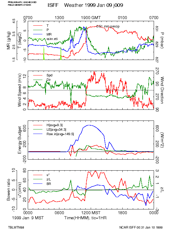
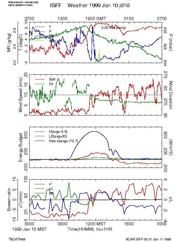
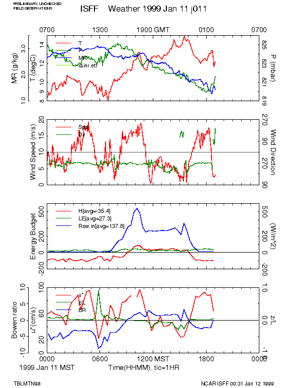
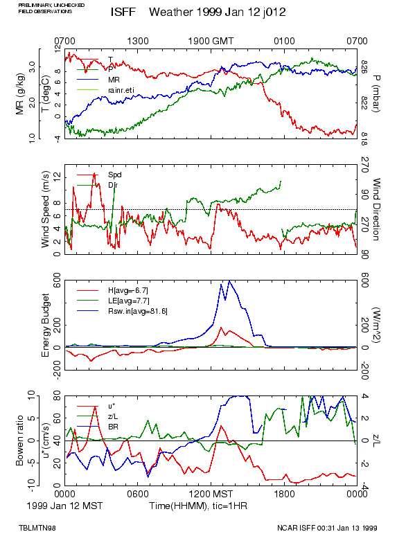
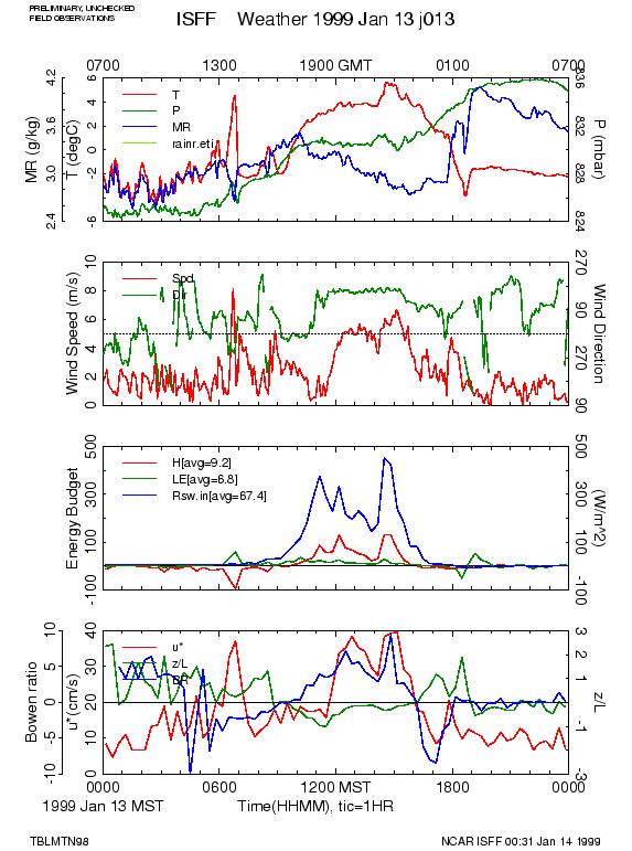
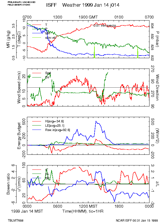
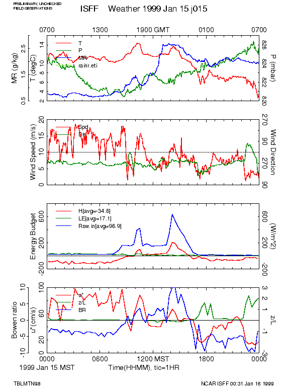
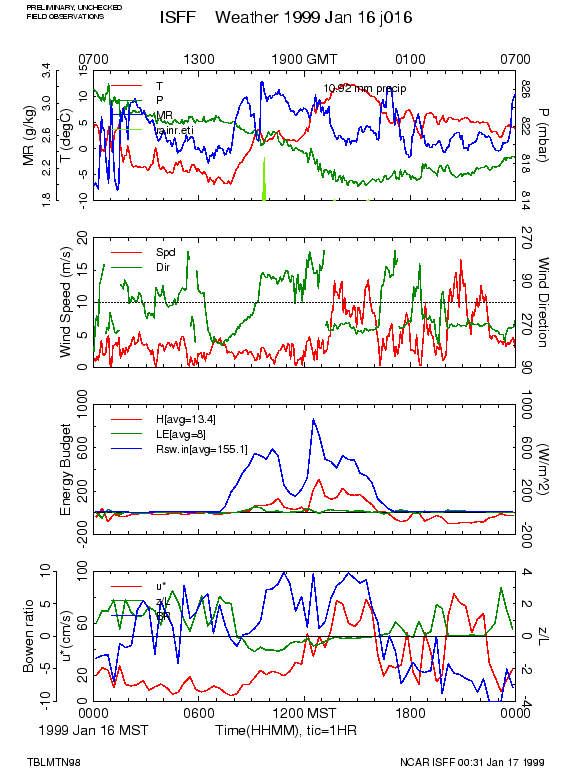
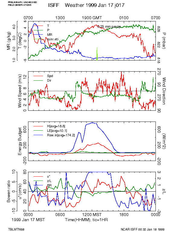
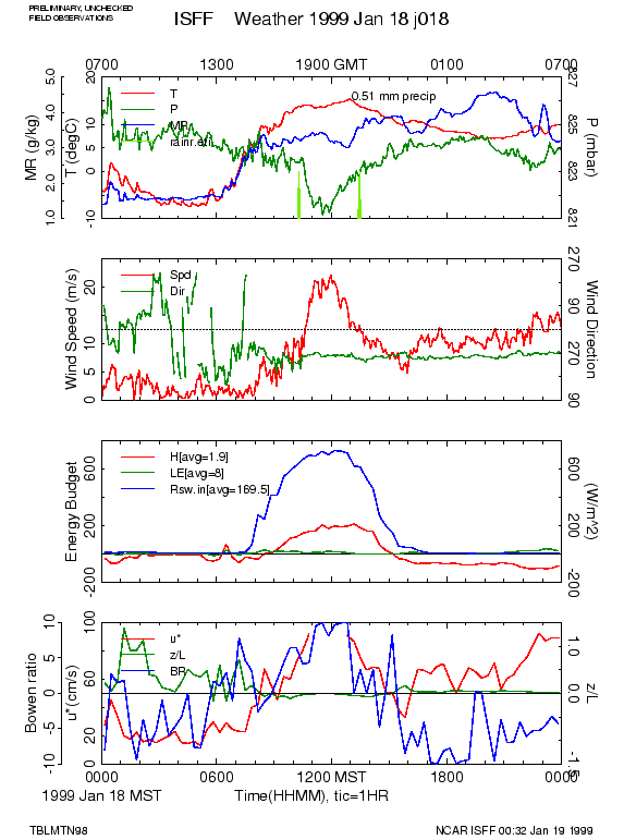
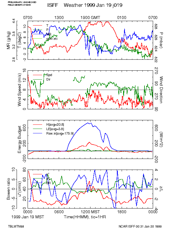
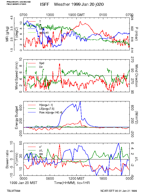
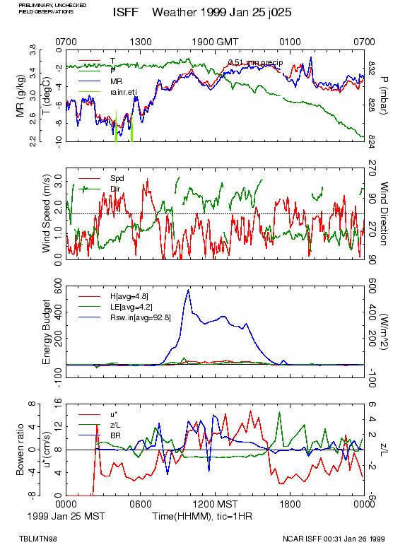
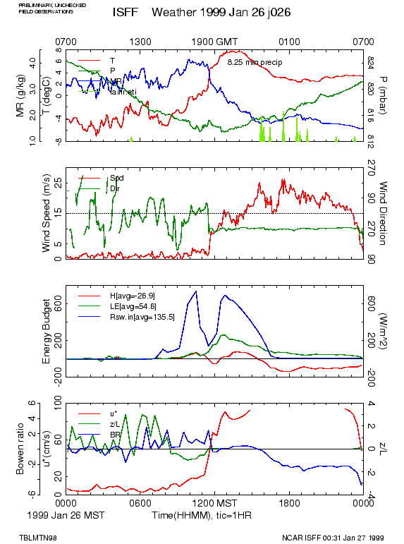
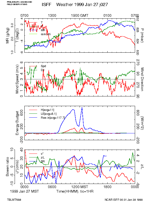
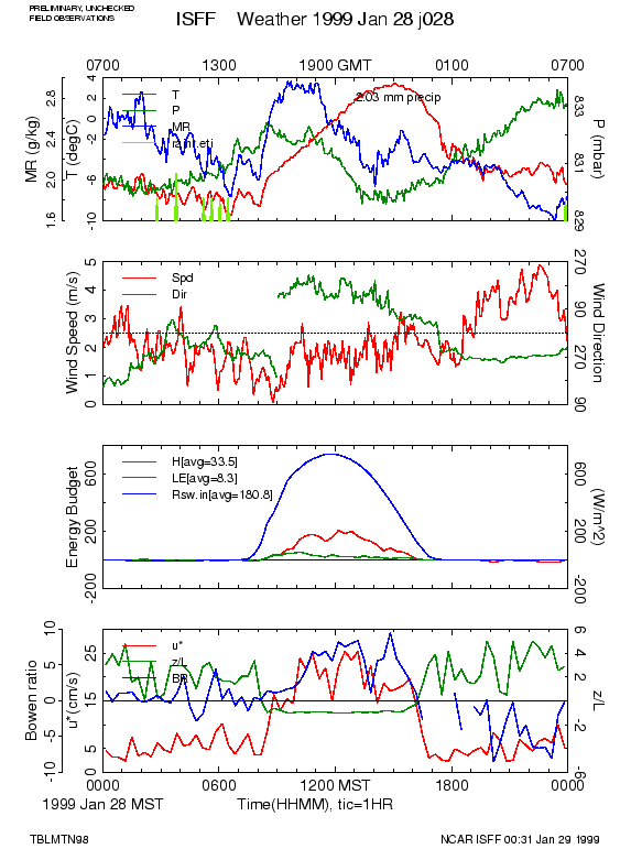
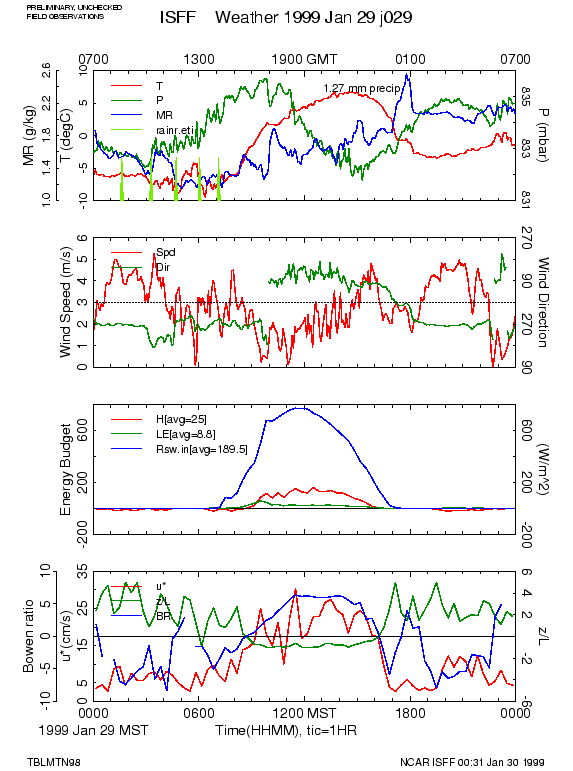
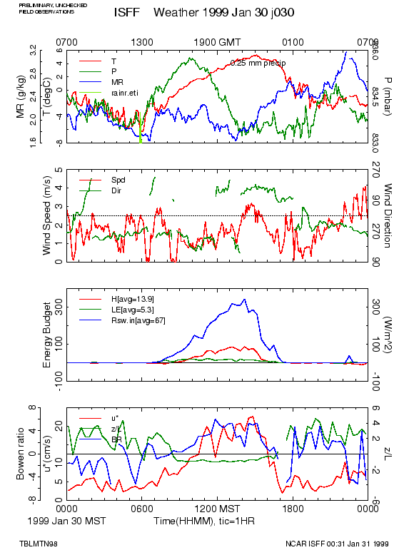
Daily Weather Plots
The following plots summarize conditions measured by the NCAR sensors for each
day of the project.
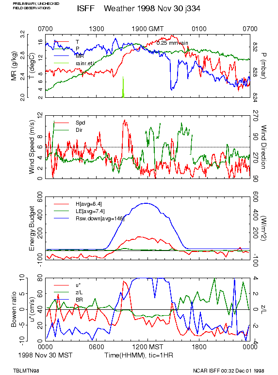
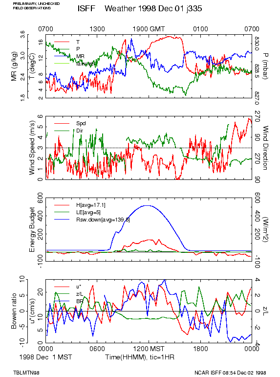
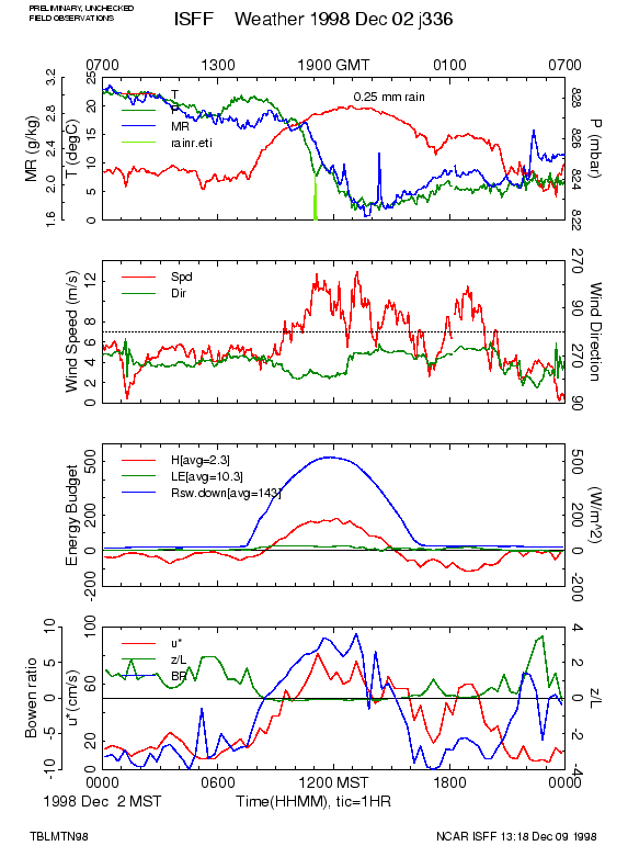
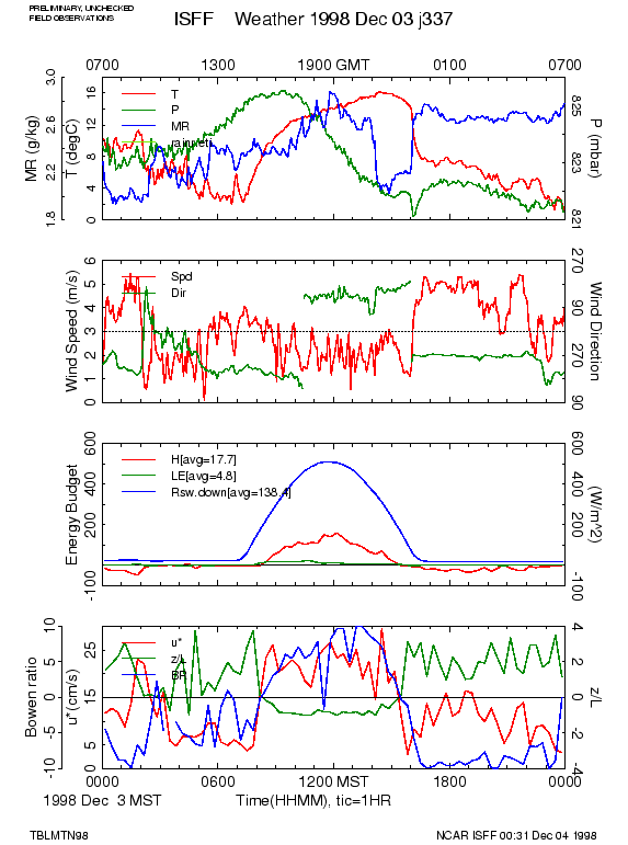
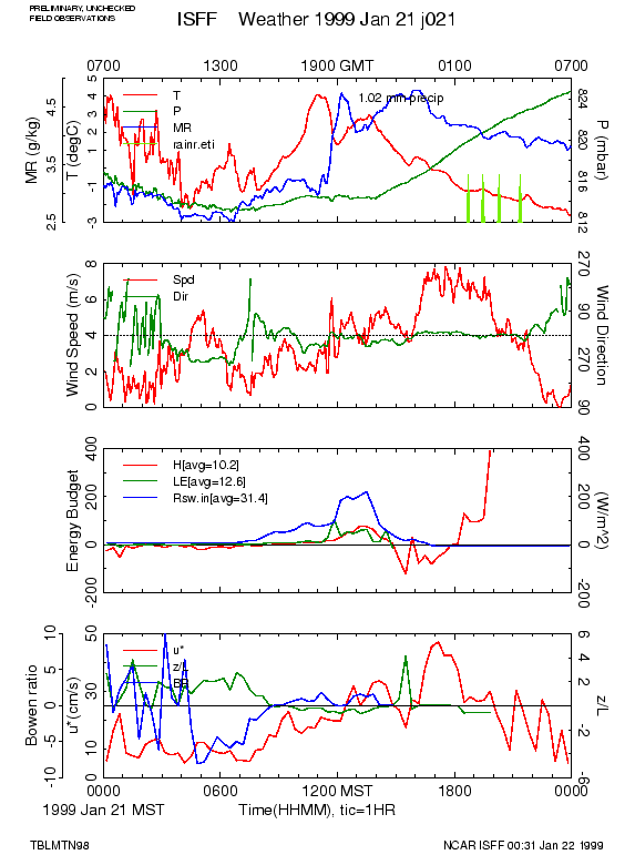
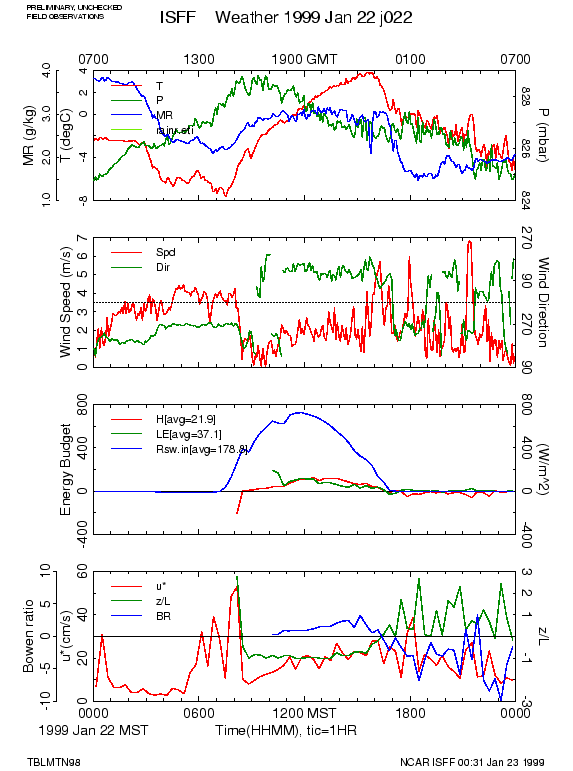
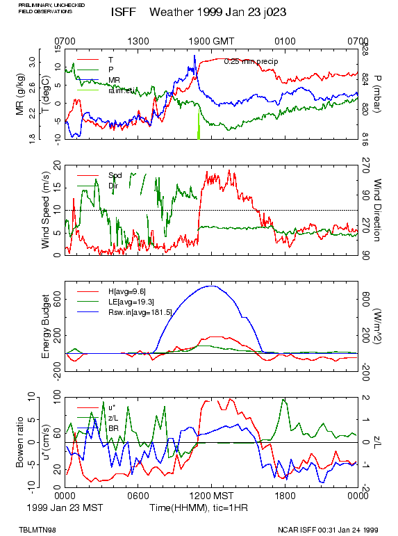
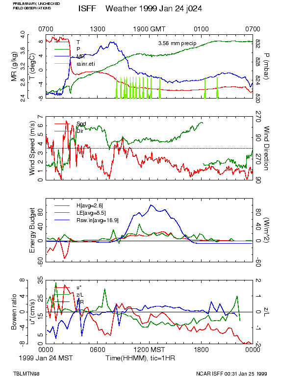
Each plot covers one days (00-23 CDT) and is labeled with time
in GMT at the bottom and local time (CDT) at the top. The top panel
displays temperature and specific humidity measured at 2m,
pressure, and precipitation rates (if present). Below that is a plot of
wind speed and direction measured at 10m, with a dotted line showing the
direction of the best fetch (West). The next panel shows solar radiation,
sensible and latent heat flux. The bottom panel shows
the Monin-Obukhov stability parameter, z/L, the friction velocity, u*, and
the Bowen ratio calculated from the flux data.
Since these fluxes and derived parameters are based on smoothed, 5-minute
average statistics, they should not be used quantitatively and are only
shown for guidance in selecting periods to analyze further.
| 18 | 19 | 20 | 21 | |||
| 22 | 23 | 24 | 25 | 26 | 27 | 28 |
| 29 | 30 | . | . | . | . | . |
| 1 | 2 | 3 | 4 | 5 | ||
| 6 | 7 | 8 | 9 | 10 | 11 | 12 |
| 13 | 14 | 15 | 16 | 17 | 18 | 19 |
| 20 | 21 | 22 | 23 | 24 | 25 | 26 |
| 27 | 28 | 29 | 30 | 31 | . | . |
| 1 | 2 | |||||
| 3 | 4 | 5 | 6 | 7 | 8 | 9 |
| 10 | 11 | 12 | 13 | 14 | 15 | 16 |
| 17 | 18 | 19 | 20 | 21 | 22 | 23 |
| 24 | 25 | 26 | 27 | 28 | 29 | 30 |
| 31 | . | . | . | . | . | . |