This site survey is for a multiple instrument site in the Oklahoma panhandle, where the following instruments will be sited (with contact people):
Bill Brown and Mike Susedik conducted a site survey on 11 and 12 Feb 02, this report is a product of that survey.
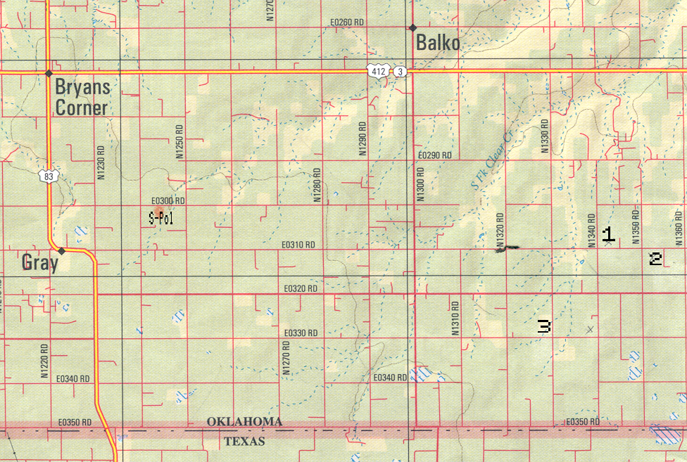
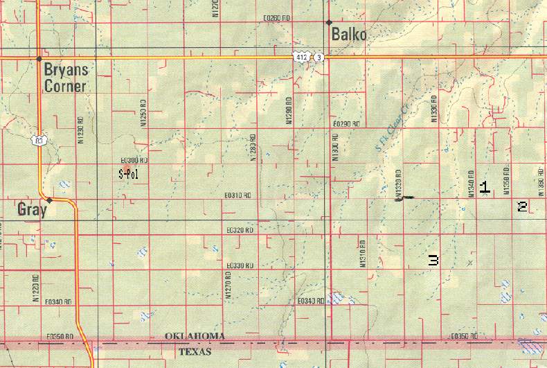
These requirements concentrated the search to a region about 15 - 20 km east of S-Pol; further east and the region west of S-Pol had more uneven terrain. One road in particular, marked as E0310 Rd on DeLorme Oklahoma Gazetteer (although such designations were unfamiliar to the locals) was the most fruitful. This dirt road had a multiple phone line cable and 3 phase power; other nearby roads lacked one or other, were along varying terrain, or some other requirement wasn't met. 3 sites were selected.
A map of the area near the site: high resoln (1.9M), low resoln (83k). The area shown measures 15.6 x 10.6 miles (24.9 x 16.9 km). The site numbers (towards the eastern edge of the map), refer to the numbers below. Most of the area has roads every mile, the lot numbers below refer to the county's designation for the square mile blocks.
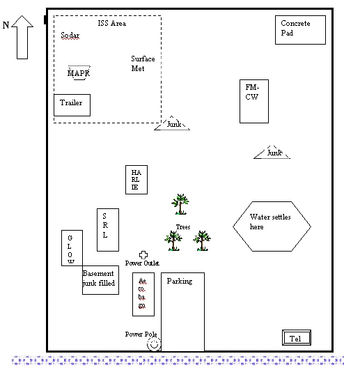
We intend to use this site for all of the above instruments, except TAOS. Click here for a preliminary layout plan for the site.
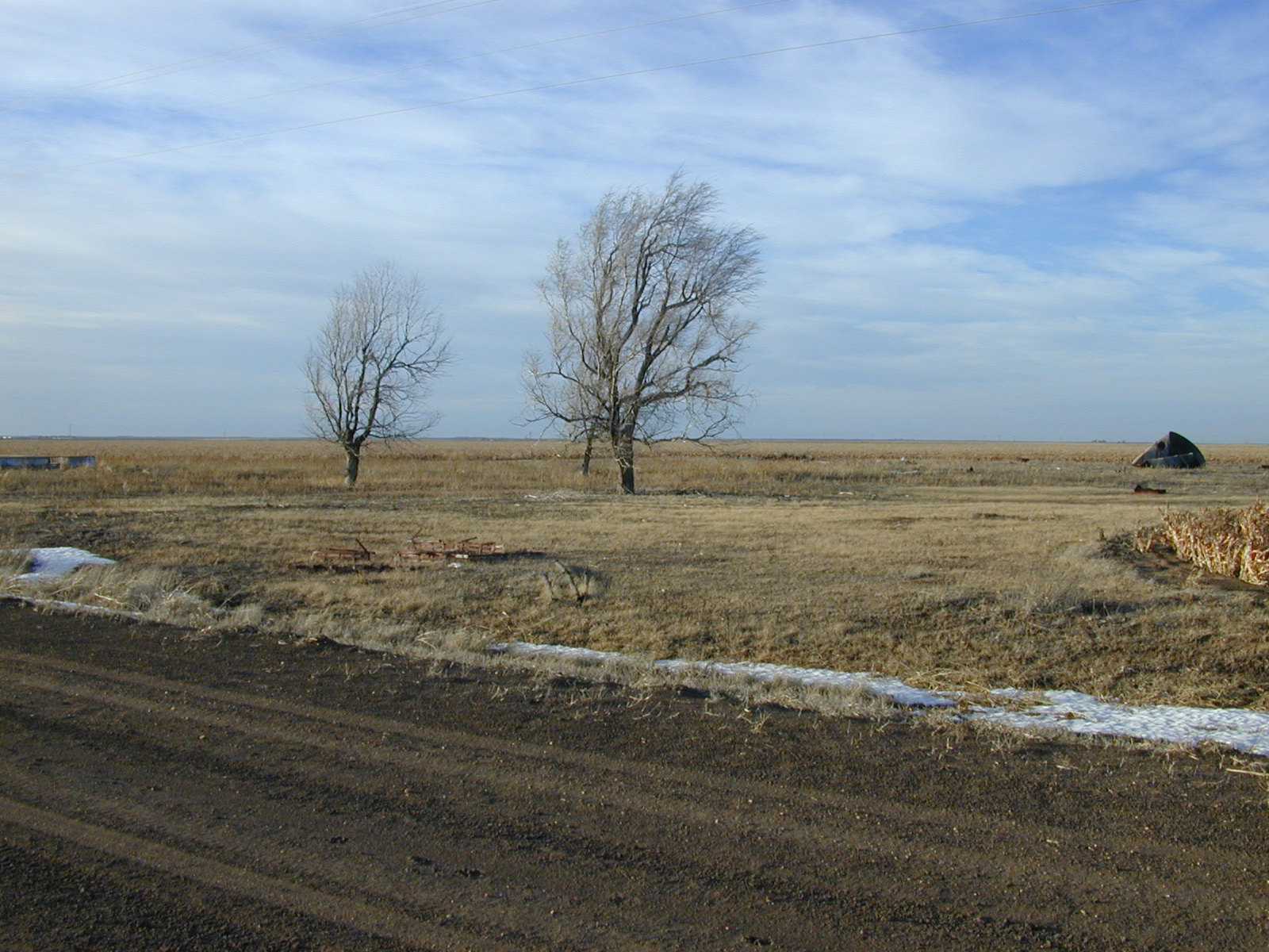
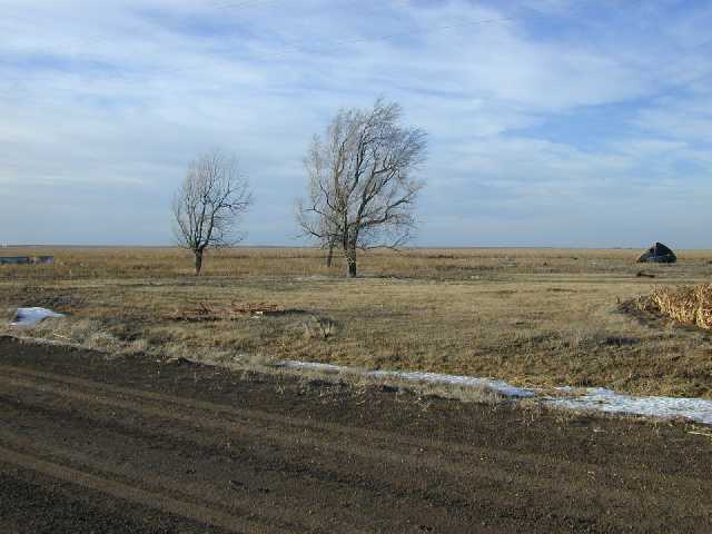
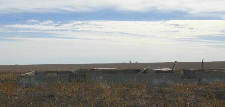
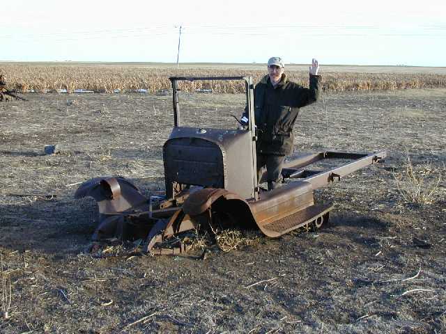
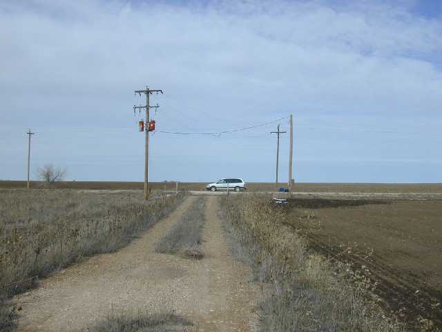
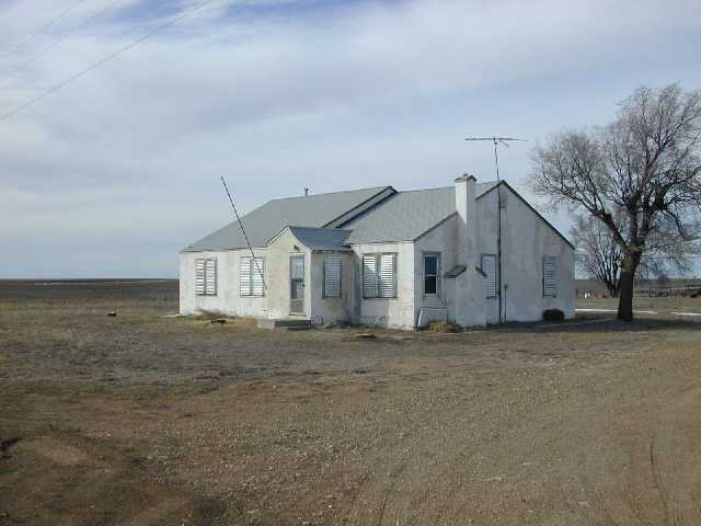
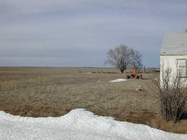
The site is an abandoned homestead of about two acres. The ground was mostly firm and grassed over. There are some debris and old machinery littered around the site, and there are also foundations for the demolished buildings, however most of the site is clear. The basement of the old house is near the front of the site and is filled with debris. A 3-phase power line runs next to the site, and an underground phone cable with junction box is just across the road. The site measures approx 120 by 100 meters, the surrounding land is farmed and the farmer would prefer we kept off it.
We intend to operate TAOS at this site.
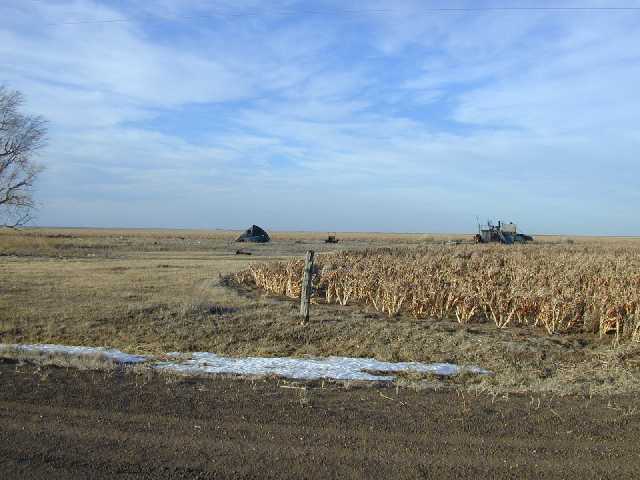
This grassy field is about a mile east of the above site on the same road. There are two abandoned oil wells here about 200 - 300 meters from the road. One is in the centre of the field with just a couple of pipes sticking up; the other is on the eastern edge of the field in a different property and has a large pump and oil tank battery. Both have rough access roads, although to use both roads we would need to pay two landowners. The ground in the field and on the access roads seem firm. Vehicles should have no problems pulling off the access roads onto the field and any trailers requiring very firm ground could remain on the access roads. The farmer has no plans to plough the area and may make hay from it in late summer.
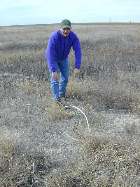
There is a phone junction box on the same side of the road. A 3-phase power line runs across the road from the site and there are disconnected underground 3 phase power cables that run to the wells. There are disconnected transformers on a power pole that may be serviceable.
We do not plan to use this site, however it might be useful as a backup site.
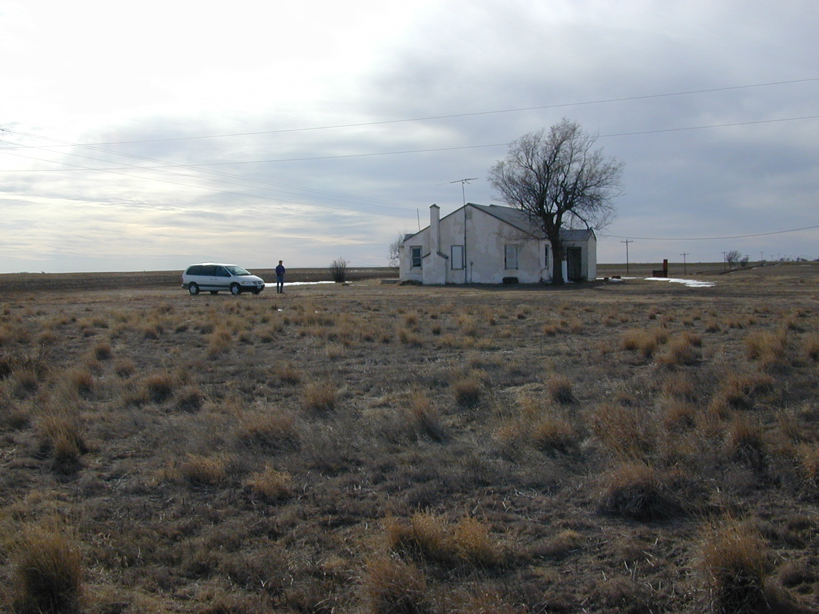
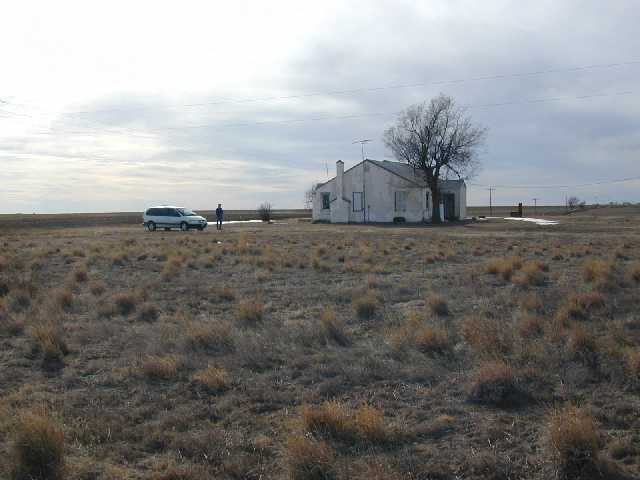
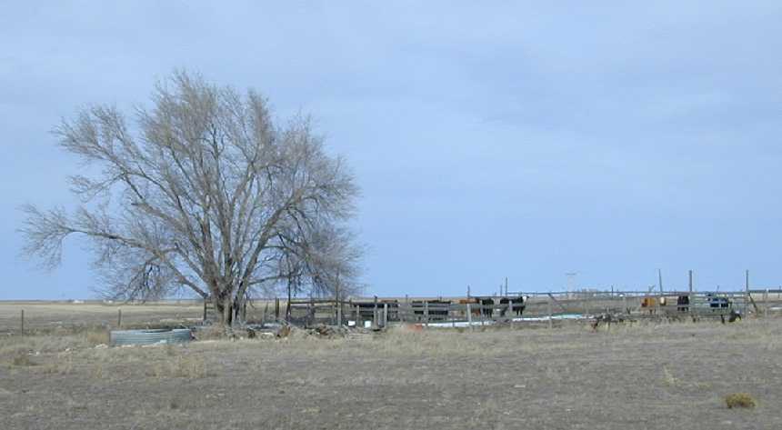
The site is 2 - 3 miles south west of the above sites. There is a farm house that hasn't been lived in for a few years on a grassy lot of about an acre (about 60 by 200 meters). The house is boarded up, but seems sound and may be useful for storage. The farmer operates a cattle yard and farm shed right next to the site, (access is through the site) and we would need to ensure we don't disturb this activity. There is 3 phase power and a phone line running to the house (probably disconnected), and a phone junction box nearby. The ground seems firm and just away from the site to the north and west, the land slopes down 2 or 3 meters. The dirt road running past this site can apparently get very muddy in wet weather.
The local phone company is the Panhandle Telephone Coop Inc PTCI, based in Guymon. Useful phones books for the whole area are available from Feist or online at www.feist.com.
The site is in line of sight to S-Pol, so it might be possible to run a radio-based data link to S-Pol where there will be a T1 link. The T1 link will be busy transferring S-Pol images to the Norman ops center, and there will be some capacity for transfers from our site. The University of Massachusetts group have offered the use of a wavelan radio link, and we would need to run fiber optics cables to each trailer from that.
We were able to use Nextel cell phones from the sites, however coverage was mainly analogue and somewhat spotty with static. The signal level meter on the phone was typically at level 2 out of 3. External elevated antennas would probably help.
Other towns are Guymon OK (pop 10,000) about 60 miles to the west, Beaver OK (hosts the World Cow Chip Throwing Championship, pop 1600) about 20 miles north, Perryton TX ("Wheatheart of the Nation", pop 8000) about 25 miles drive SW, and Booker TX (pop 1200) about 10 miles drive to the south. Beaver houses the offices for Beaver county.
From the east,
driving along Route 412, at Elmwood head south on Route 23 for 4 miles,
then drive east 4.75 miles to the site.